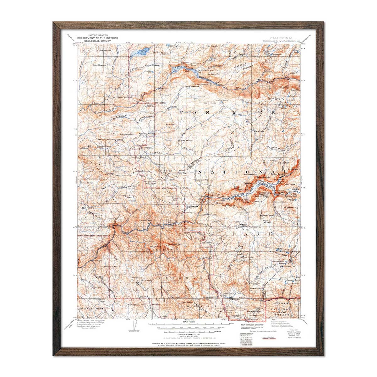
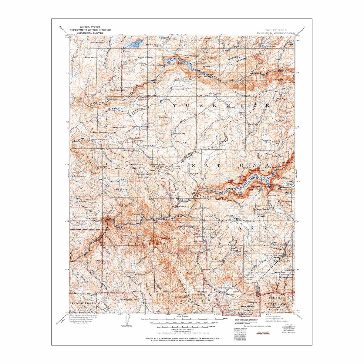
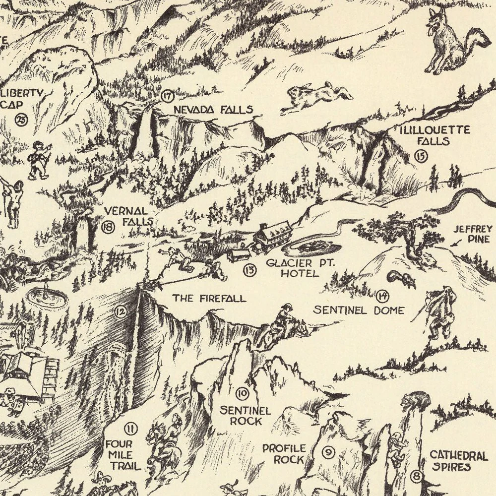
Yosemite Valley Whimsical 1946 Map
Created by Willy Nilly in 1946, this whimsical map of Yosemite Valley was originally meant to be folded and sent through the mail. The reverse side was printed with a Boasting Chart of 47 places and things to do with the corresponding numbers on the map. It includes Half Dome, Camp Curry, Clouds Rest, Little Yosemite, Indian Village, wildlife, recreational facilities, roads and trails.
This reproduction print was carefully remastered from a digital scan of the original map.
Product Information
Product Information
Shipping & Returns
Shipping & Returns


Yosemite Valley Whimsical 1946 Map
Yosemite Valley Whimsical 1946 Map
Created by Willy Nilly in 1946, this whimsical map of Yosemite Valley was originally meant to be folded and sent through the mail. The reverse side was printed with a Boasting Chart of 47 places and things to do with the corresponding numbers on the map. It includes Half Dome, Camp Curry, Clouds Rest, Little Yosemite, Indian Village, wildlife, recreational facilities, roads and trails.
This reproduction print was carefully remastered from a digital scan of the original map.
Original: $70.95
-70%$70.95
$21.29Product Information
Product Information
Shipping & Returns
Shipping & Returns
Description
Created by Willy Nilly in 1946, this whimsical map of Yosemite Valley was originally meant to be folded and sent through the mail. The reverse side was printed with a Boasting Chart of 47 places and things to do with the corresponding numbers on the map. It includes Half Dome, Camp Curry, Clouds Rest, Little Yosemite, Indian Village, wildlife, recreational facilities, roads and trails.
This reproduction print was carefully remastered from a digital scan of the original map.