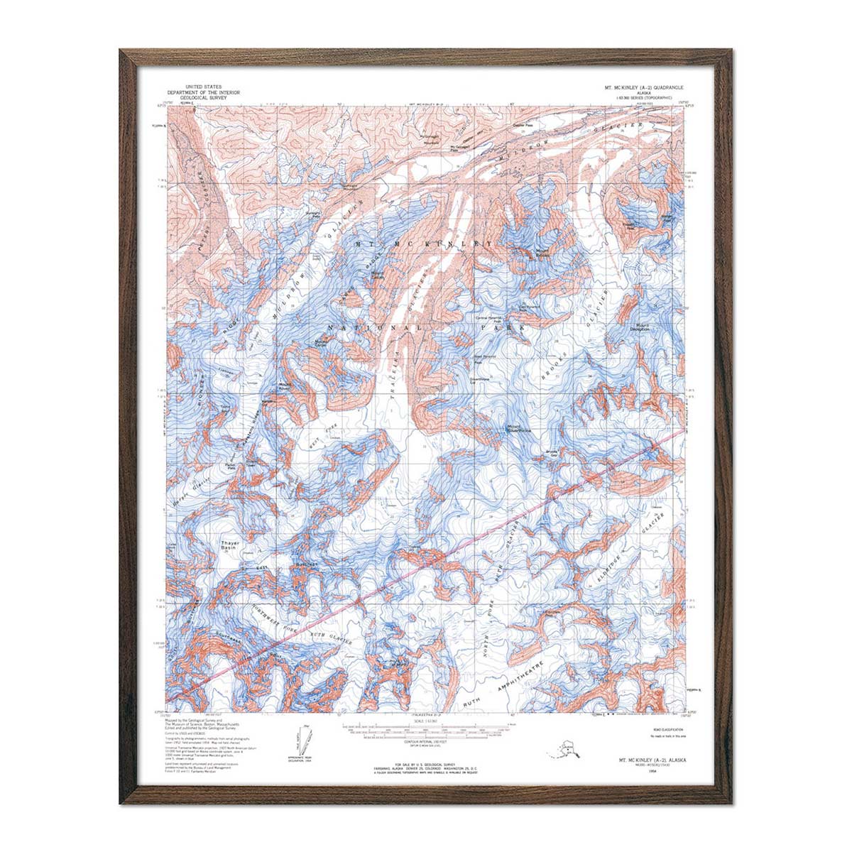
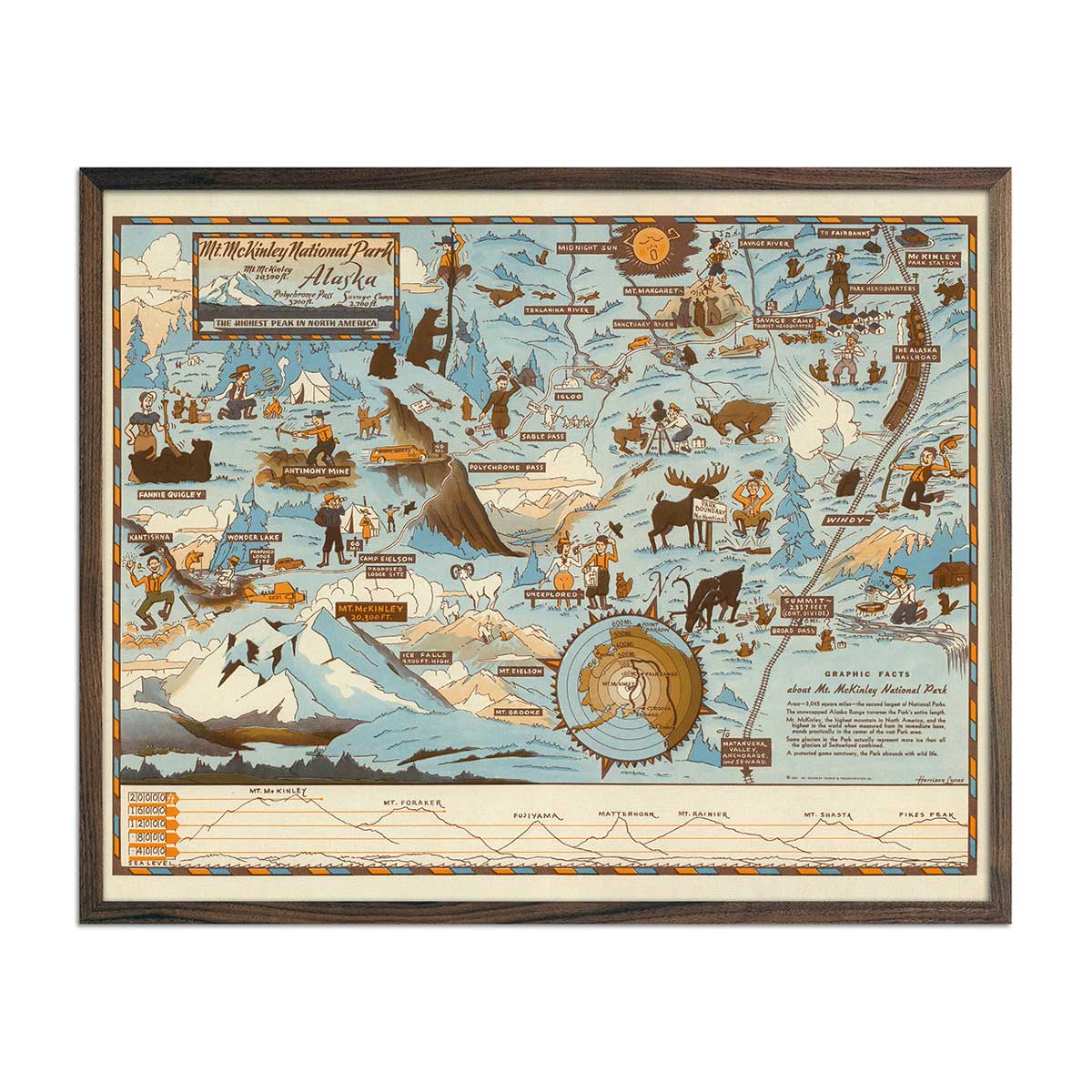
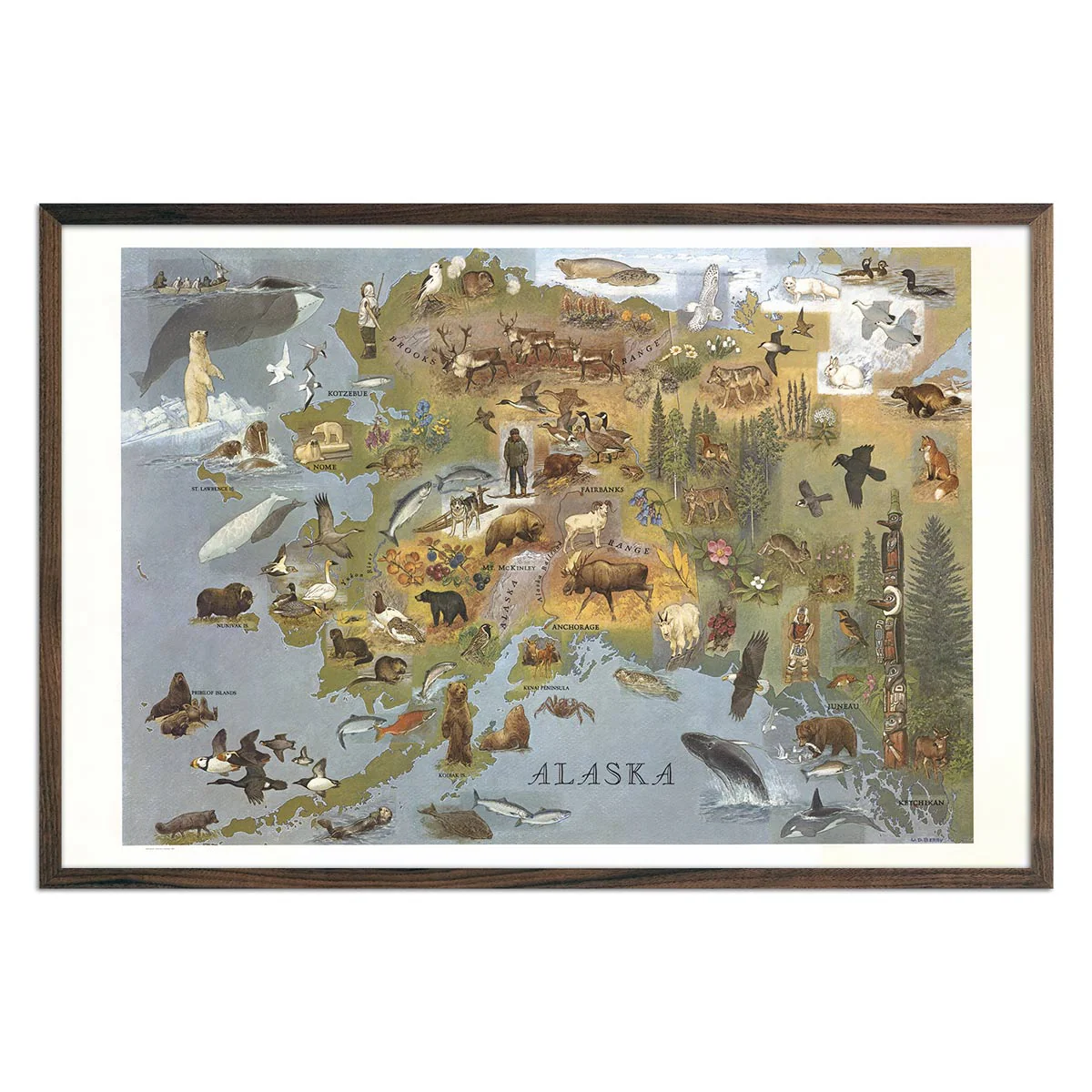
Alaska 1967 Pictorial Map
W.D. Berry created this pictorial map of Alaska in 1967 showing its islands, cities and towns, rivers, peninsulas, and mountain ranges. More importantly, were his illustrations of wildlife, fisheries, landmarks, and Inuit hunters. We carefully restored the map from a digital scan to make this reproduction print.
Product Information
Product Information
Shipping & Returns
Shipping & Returns


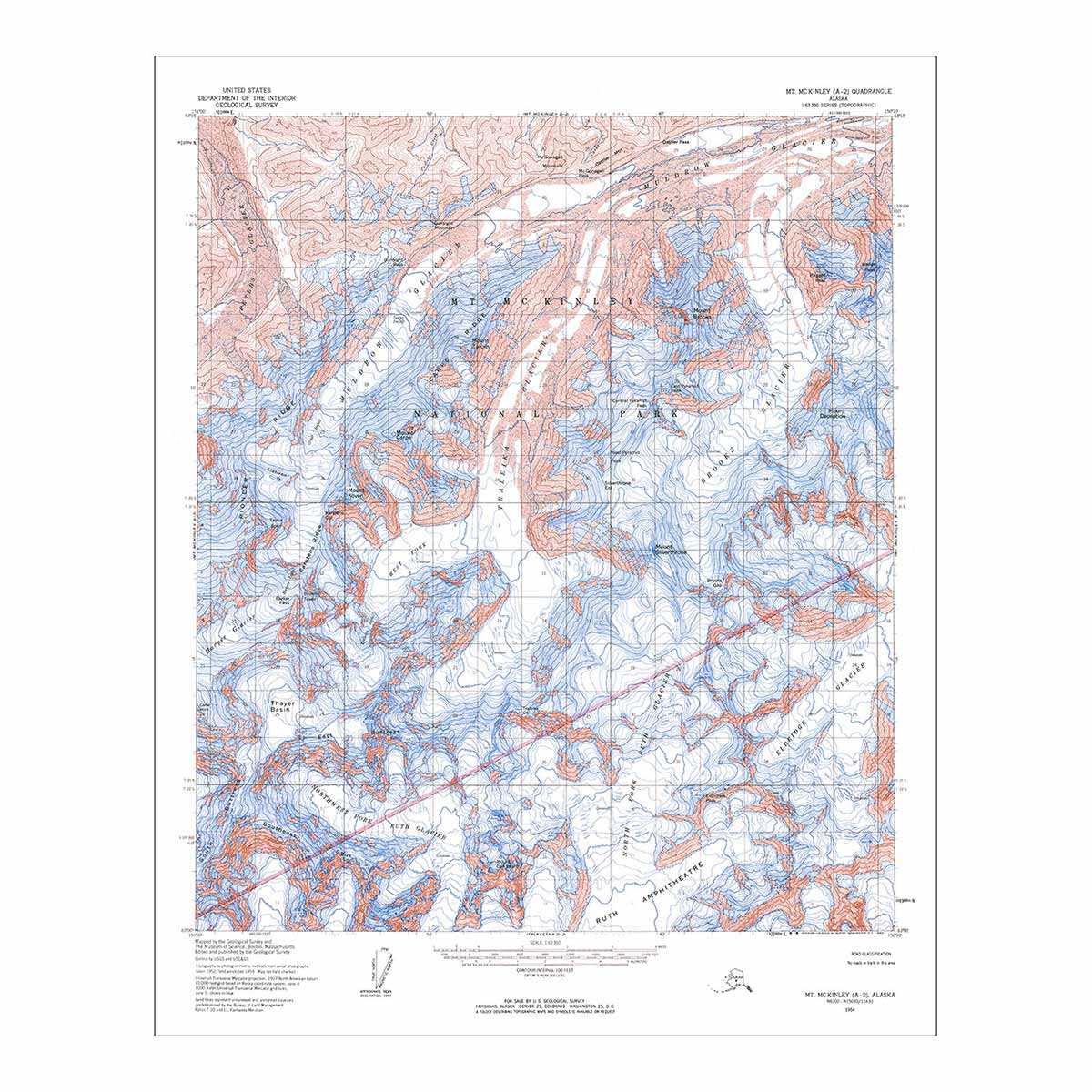
Alaska 1967 Pictorial Map
Alaska 1967 Pictorial Map
W.D. Berry created this pictorial map of Alaska in 1967 showing its islands, cities and towns, rivers, peninsulas, and mountain ranges. More importantly, were his illustrations of wildlife, fisheries, landmarks, and Inuit hunters. We carefully restored the map from a digital scan to make this reproduction print.
Original: $61.95
-70%$61.95
$18.59Product Information
Product Information
Shipping & Returns
Shipping & Returns
Description
W.D. Berry created this pictorial map of Alaska in 1967 showing its islands, cities and towns, rivers, peninsulas, and mountain ranges. More importantly, were his illustrations of wildlife, fisheries, landmarks, and Inuit hunters. We carefully restored the map from a digital scan to make this reproduction print.