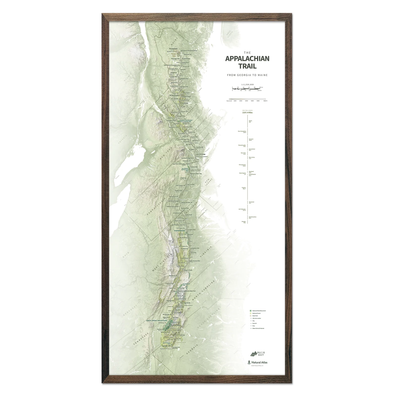
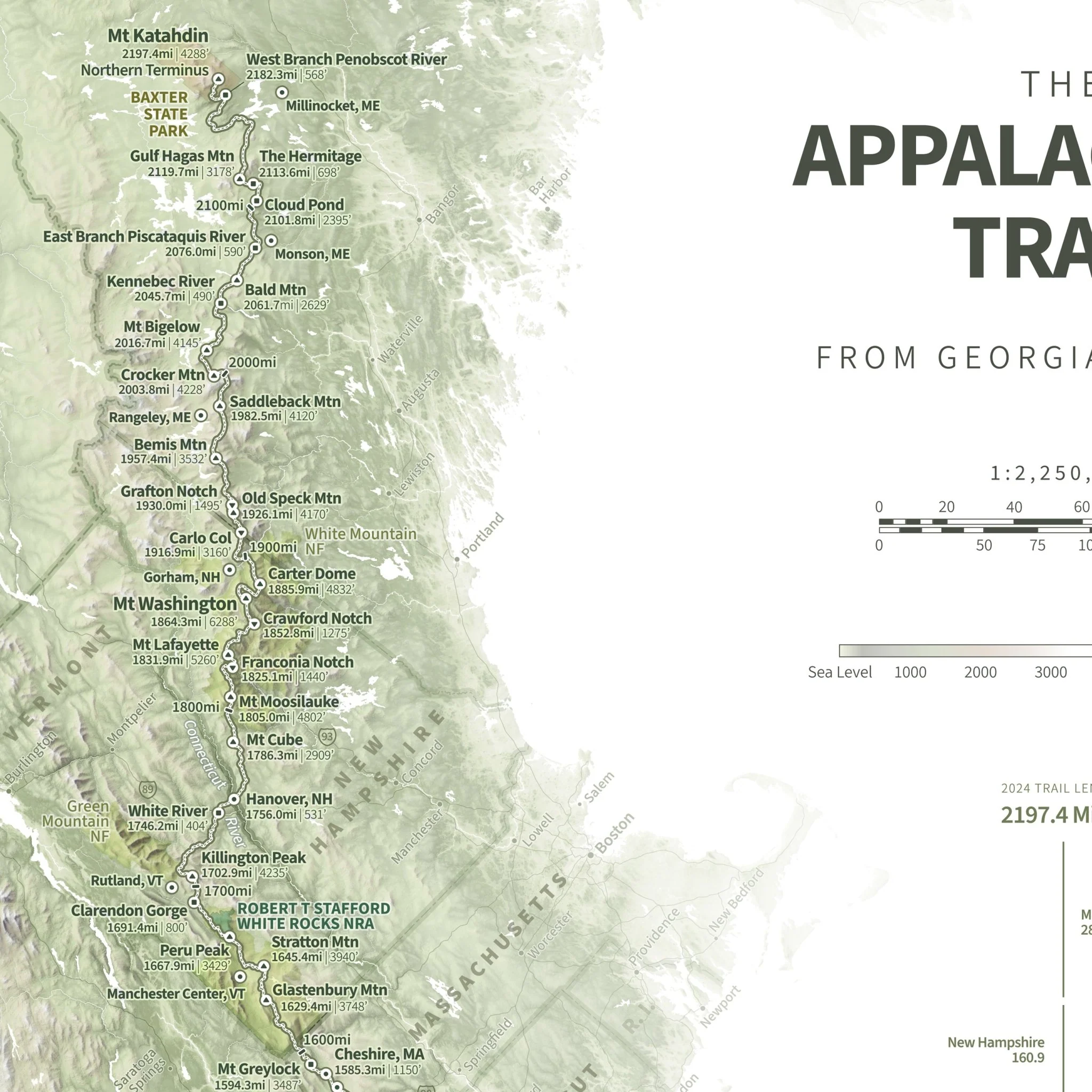
Appalachian Trail Shaded Relief Map
Following the spine of the Appalachians from Springer Mountain in Georgia to Mount Katahdin in Maine, the Appalachian Trail is the classic long-distance trail and the longest hiker-only footpath on the planet. This map showcases the route in all its glory, using beautiful shaded relief to illustrate the topography along the route while highlighting landmarks, trail towns, and other points of interest along the way - all with mileages and elevations for reference. Whether you've thru-hiked, section-hiked, day-hiked, or just daydreamed about the AT, this map will serve as an ode to the trail and, hopefully, an inspiration for future adventures.
Designed in partnership with Natural Atlas.
Product Information
Product Information
Shipping & Returns
Shipping & Returns


Appalachian Trail Shaded Relief Map
Appalachian Trail Shaded Relief Map
Following the spine of the Appalachians from Springer Mountain in Georgia to Mount Katahdin in Maine, the Appalachian Trail is the classic long-distance trail and the longest hiker-only footpath on the planet. This map showcases the route in all its glory, using beautiful shaded relief to illustrate the topography along the route while highlighting landmarks, trail towns, and other points of interest along the way - all with mileages and elevations for reference. Whether you've thru-hiked, section-hiked, day-hiked, or just daydreamed about the AT, this map will serve as an ode to the trail and, hopefully, an inspiration for future adventures.
Designed in partnership with Natural Atlas.
Original: $779.00
-70%$779.00
$233.70Product Information
Product Information
Shipping & Returns
Shipping & Returns
Description
Following the spine of the Appalachians from Springer Mountain in Georgia to Mount Katahdin in Maine, the Appalachian Trail is the classic long-distance trail and the longest hiker-only footpath on the planet. This map showcases the route in all its glory, using beautiful shaded relief to illustrate the topography along the route while highlighting landmarks, trail towns, and other points of interest along the way - all with mileages and elevations for reference. Whether you've thru-hiked, section-hiked, day-hiked, or just daydreamed about the AT, this map will serve as an ode to the trail and, hopefully, an inspiration for future adventures.
Designed in partnership with Natural Atlas.