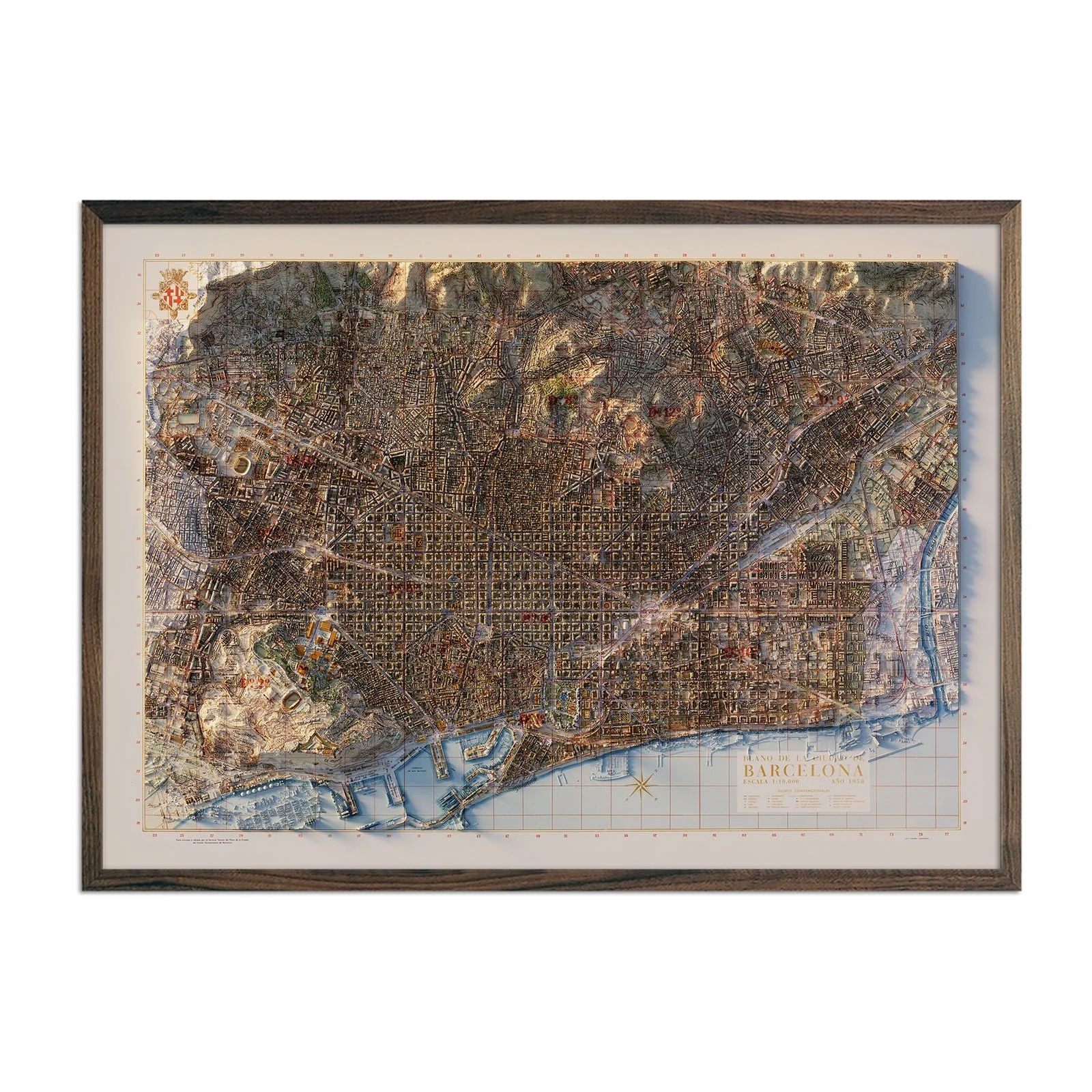
Barcelona 1958 Shaded Relief Map
We transformed the 1958 map of Barcelona into this shaded relief map with the illusion of 3D. Through the use of LIDAR data and digital shading, we were able to add elevation to every part of the city. Since the release of the original 1958 version of the map, the city has grown, especially along the coast so you will see new structures illustrated that the original map did not show.
The shading is printed on the paper and not the result of the terrain protruding from the map.
Please Note: Text on the map can be difficult to read due to the small font size and the age of the map. In areas where the relief shading covers the text, the underlying text is not legible. We suggest the largest size map for better details though the text may still be covered in the darker areas.
Product Information
Product Information
Shipping & Returns
Shipping & Returns

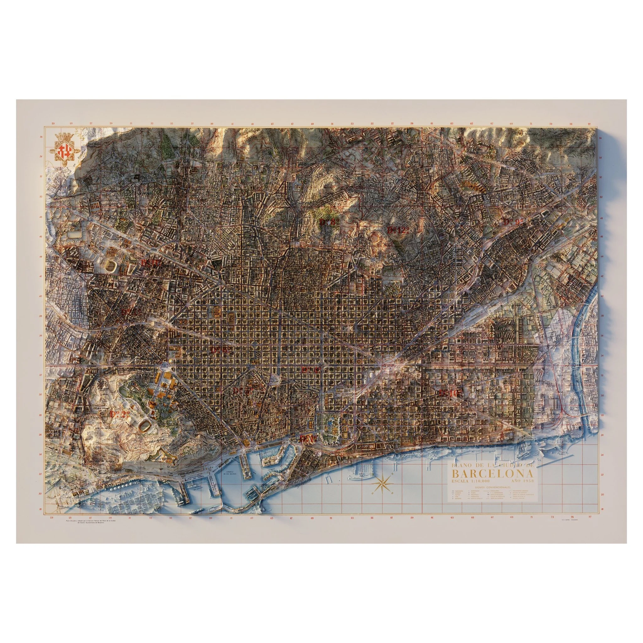

Barcelona 1958 Shaded Relief Map
Barcelona 1958 Shaded Relief Map
We transformed the 1958 map of Barcelona into this shaded relief map with the illusion of 3D. Through the use of LIDAR data and digital shading, we were able to add elevation to every part of the city. Since the release of the original 1958 version of the map, the city has grown, especially along the coast so you will see new structures illustrated that the original map did not show.
The shading is printed on the paper and not the result of the terrain protruding from the map.
Please Note: Text on the map can be difficult to read due to the small font size and the age of the map. In areas where the relief shading covers the text, the underlying text is not legible. We suggest the largest size map for better details though the text may still be covered in the darker areas.
Original: $622.00
-70%$622.00
$186.60Product Information
Product Information
Shipping & Returns
Shipping & Returns
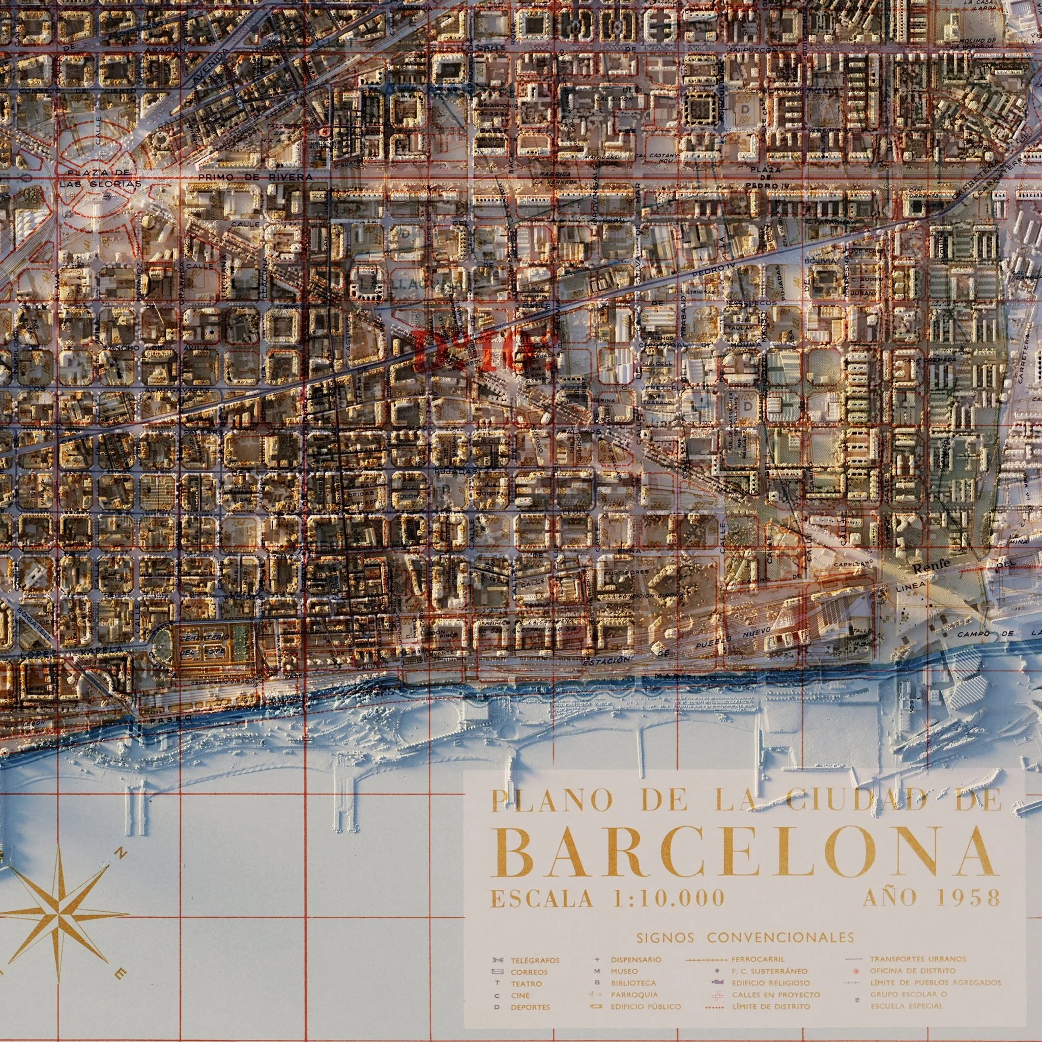
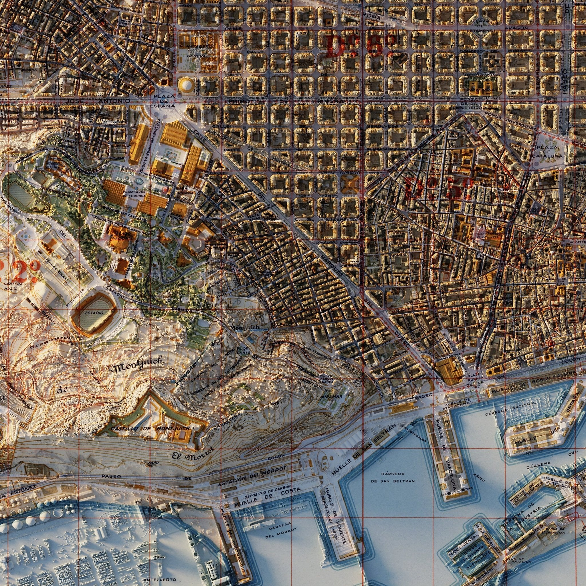
Description
We transformed the 1958 map of Barcelona into this shaded relief map with the illusion of 3D. Through the use of LIDAR data and digital shading, we were able to add elevation to every part of the city. Since the release of the original 1958 version of the map, the city has grown, especially along the coast so you will see new structures illustrated that the original map did not show.
The shading is printed on the paper and not the result of the terrain protruding from the map.
Please Note: Text on the map can be difficult to read due to the small font size and the age of the map. In areas where the relief shading covers the text, the underlying text is not legible. We suggest the largest size map for better details though the text may still be covered in the darker areas.