British Empire in North America 1776 Map
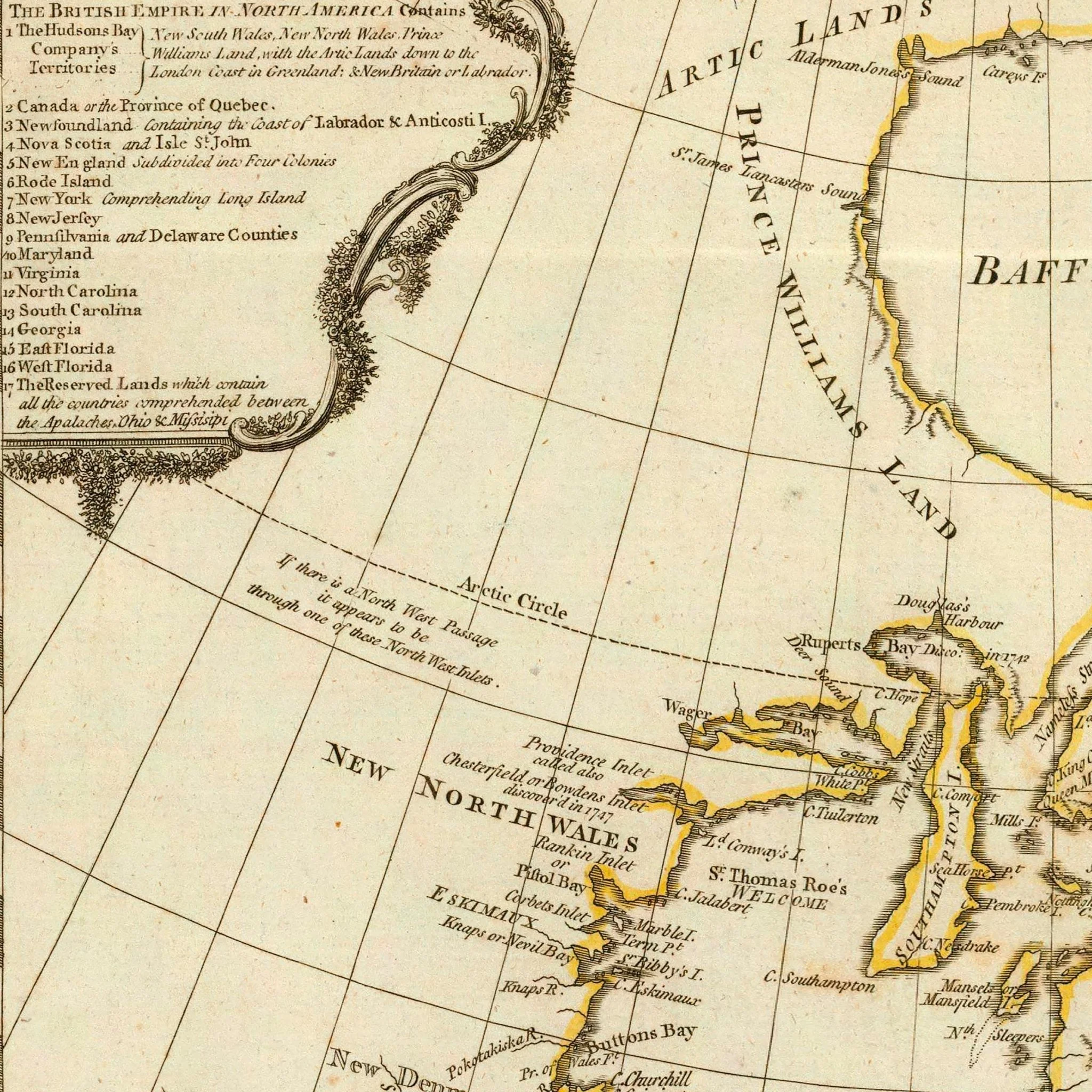
This map documents the British colonies in North America as they were in 1776. There is a detailed cartouche in the upper left-hand corner that shows the full scope of British territorial claims from Hudson's Bay Company lands to West Florida. It encompasses "all the countries comprehended between the Apalaches, Ohio & Missisipi."
Mapmaker Thomas Jefferys had published these territories as separate maps throughout the 1750s and 60s. This 1776 edition represents their first appearance together on a single map. While the Continental Congress was meeting in Philadelphia, cartographers were documenting what would soon become the former British North America.
We remastered this reproduction from a digital scan of the original 1776 map and preserved the period typography and geographic detail. Printed on archival paper with fade-resistant inks, this map captures a specific moment when colonial America was about to become something entirely different.
Available unframed or professionally framed.
Product Information
Product Information
Shipping & Returns
Shipping & Returns


British Empire in North America 1776 Map
British Empire in North America 1776 Map
This map documents the British colonies in North America as they were in 1776. There is a detailed cartouche in the upper left-hand corner that shows the full scope of British territorial claims from Hudson's Bay Company lands to West Florida. It encompasses "all the countries comprehended between the Apalaches, Ohio & Missisipi."
Mapmaker Thomas Jefferys had published these territories as separate maps throughout the 1750s and 60s. This 1776 edition represents their first appearance together on a single map. While the Continental Congress was meeting in Philadelphia, cartographers were documenting what would soon become the former British North America.
We remastered this reproduction from a digital scan of the original 1776 map and preserved the period typography and geographic detail. Printed on archival paper with fade-resistant inks, this map captures a specific moment when colonial America was about to become something entirely different.
Available unframed or professionally framed.
Original: $543.00
-70%$543.00
$162.90Product Information
Product Information
Shipping & Returns
Shipping & Returns
Description
This map documents the British colonies in North America as they were in 1776. There is a detailed cartouche in the upper left-hand corner that shows the full scope of British territorial claims from Hudson's Bay Company lands to West Florida. It encompasses "all the countries comprehended between the Apalaches, Ohio & Missisipi."
Mapmaker Thomas Jefferys had published these territories as separate maps throughout the 1750s and 60s. This 1776 edition represents their first appearance together on a single map. While the Continental Congress was meeting in Philadelphia, cartographers were documenting what would soon become the former British North America.
We remastered this reproduction from a digital scan of the original 1776 map and preserved the period typography and geographic detail. Printed on archival paper with fade-resistant inks, this map captures a specific moment when colonial America was about to become something entirely different.
Available unframed or professionally framed.