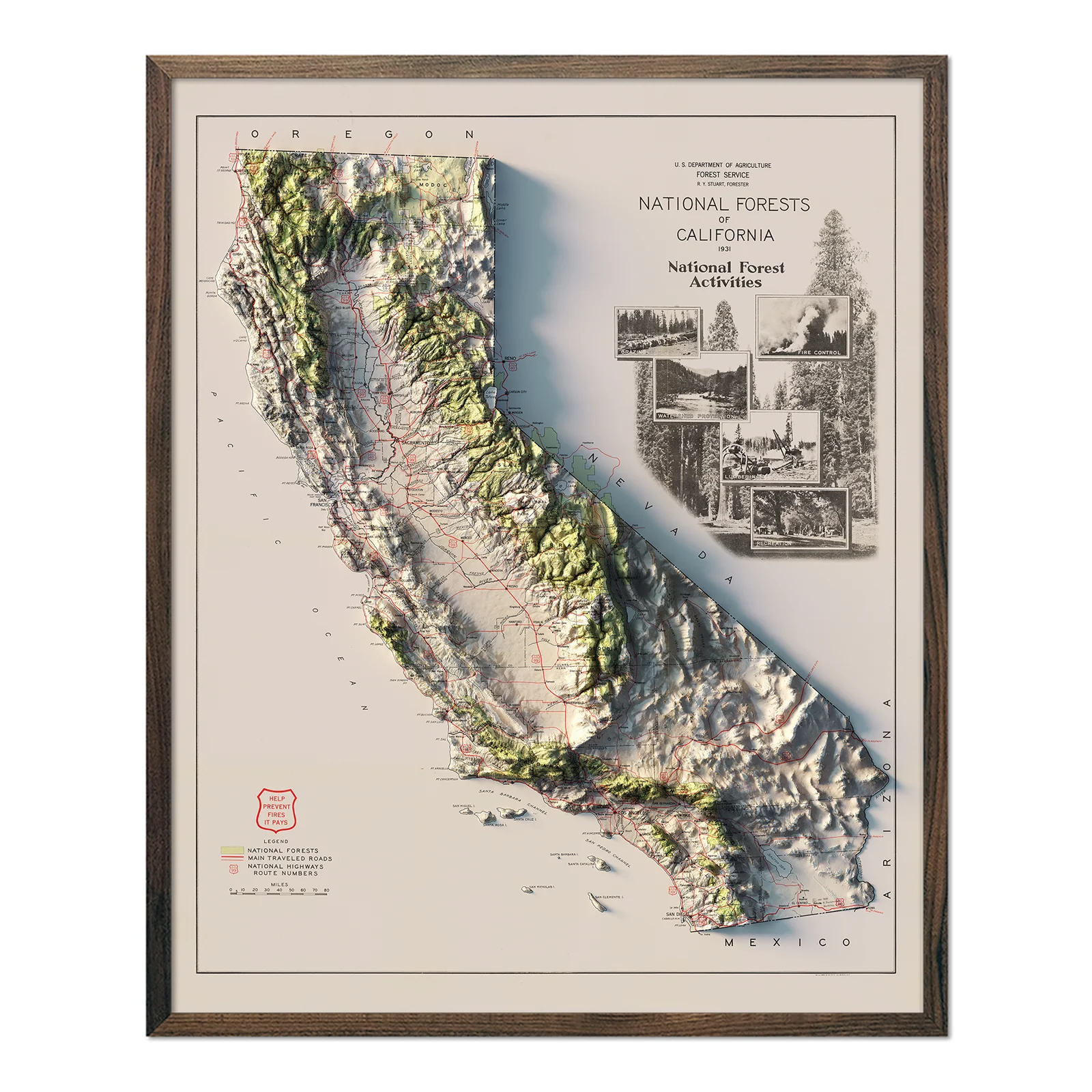
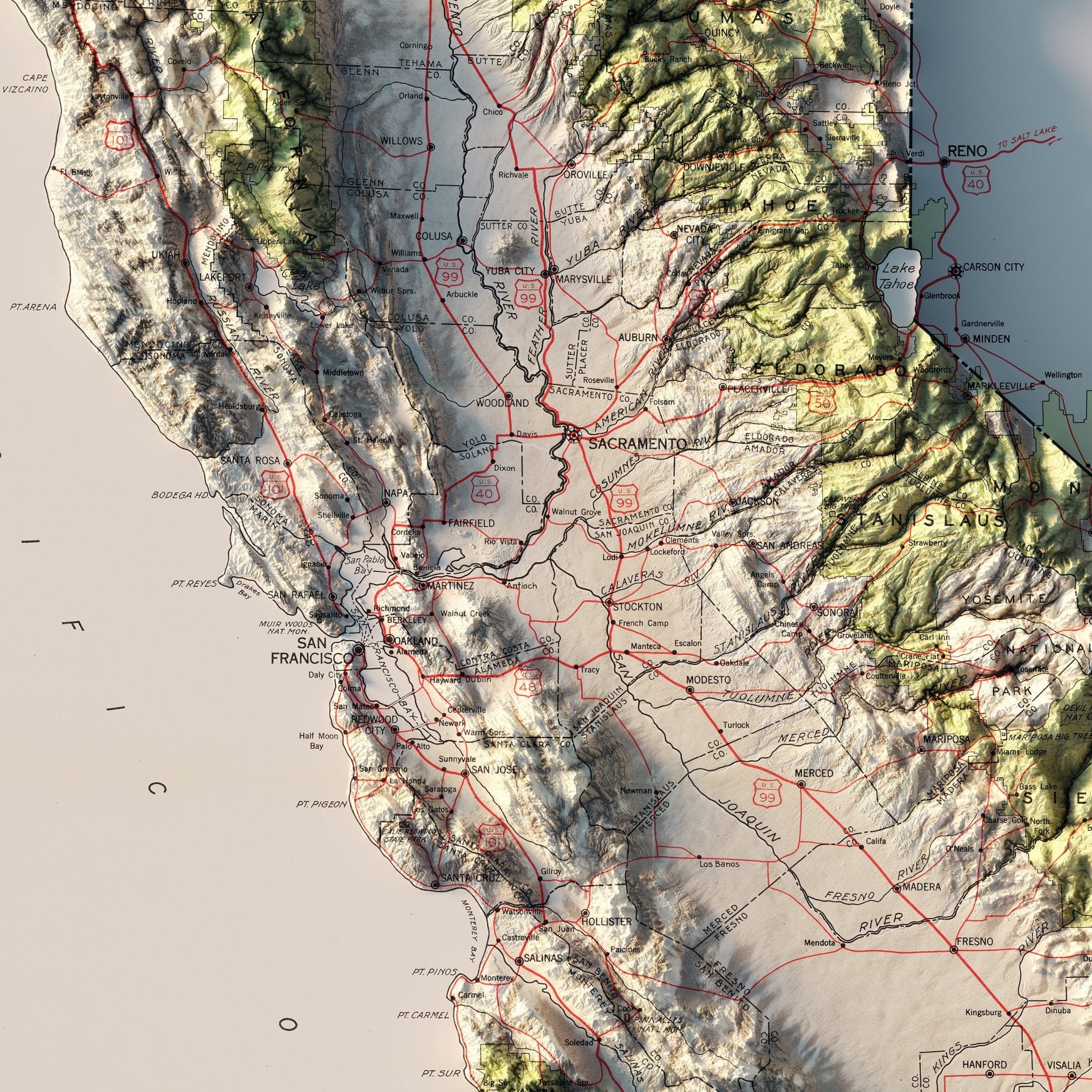
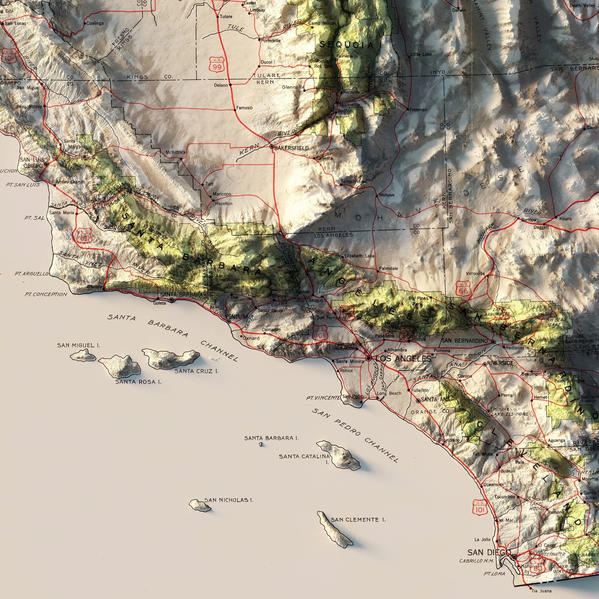
California 1931 National Forests Shaded Relief Map
We created this map with the illusion of 3D by applying Digital Elevation Data and meticulously adding shaded relief to the landscape of the original 1931 National Forests of California map.
In the early 1930s, conservation awareness was on the rise in the United States, with the establishment of many national parks and forests. In California, there was a noticeable contrast between bustling urban areas and untouched wilderness, making it important for residents and visitors to grasp the geography of these protected spaces. This map focuses on national forests, traveled routes, and major highways to highlight how accessible and interconnected these wild areas are to the state's urban centers.
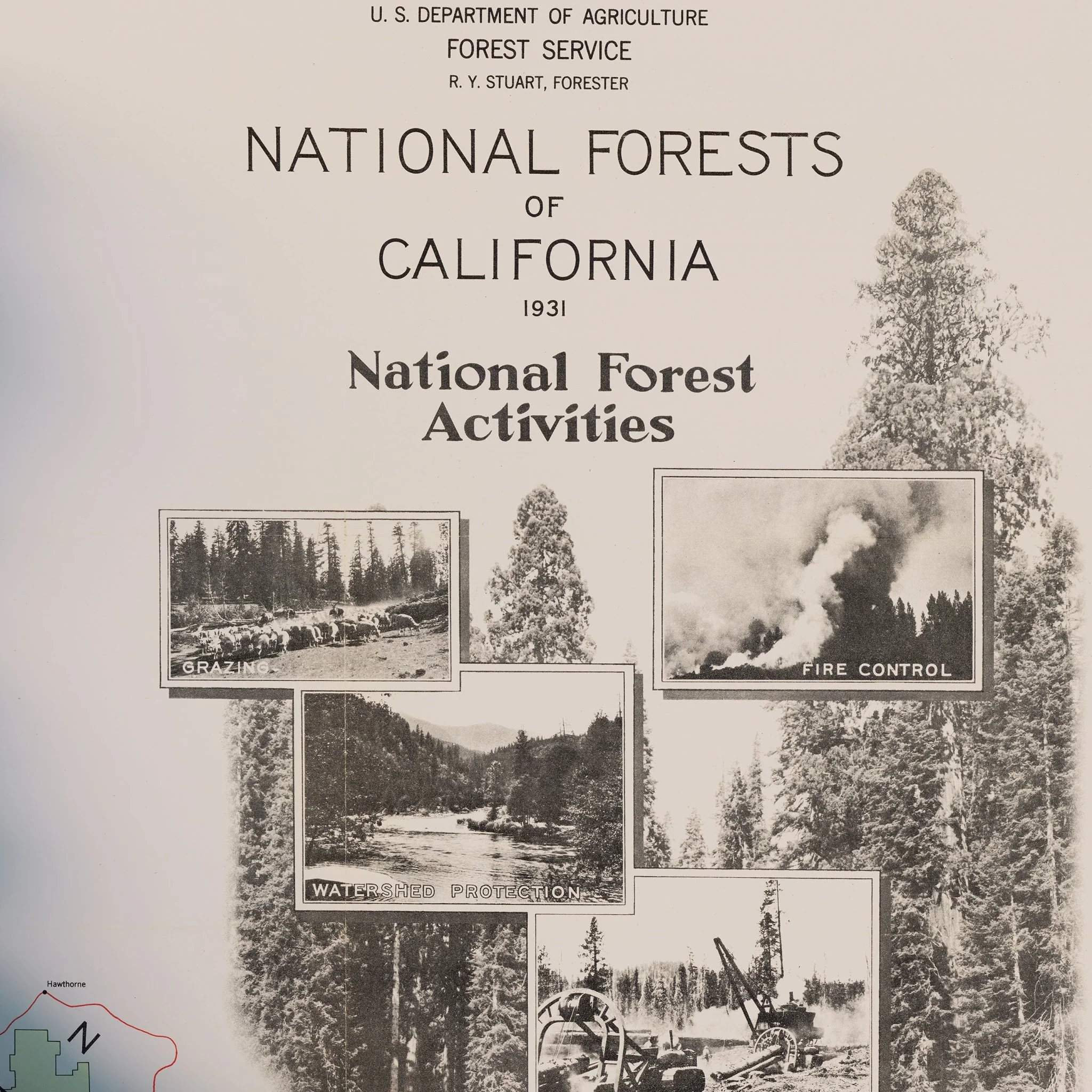
One remarkable feature of this map is the title cartouche in the upper right corner. It combines precise cartographic design with the artistry of early 20th-century photography. The topography is carefully represented using shading techniques, effectively showcasing the diverse terrains and underscoring the abundant biodiversity found in the forests of California.
The shading is printed on the paper and is not a result of the map protruding from the surface.
Please Note: The text on the map can be difficult to read due to the small font size and the age of the map. In areas where the relief shading covers the text, the underlying text may not be legible. We suggest the largest-size map for better details, though the text may still be covered in the darker areas.
Product Information
Product Information
Shipping & Returns
Shipping & Returns
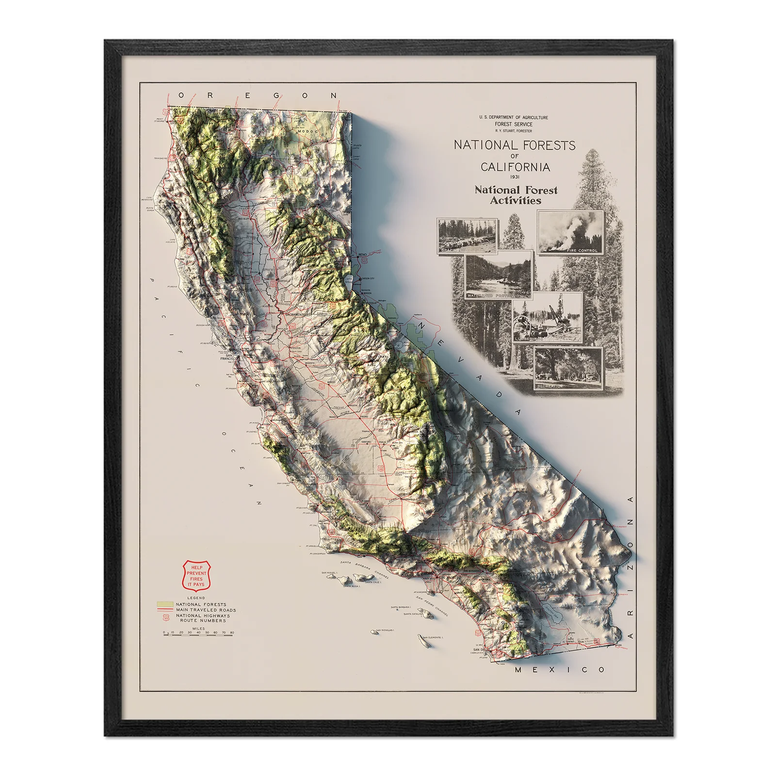
California 1931 National Forests Shaded Relief Map
California 1931 National Forests Shaded Relief Map
We created this map with the illusion of 3D by applying Digital Elevation Data and meticulously adding shaded relief to the landscape of the original 1931 National Forests of California map.
In the early 1930s, conservation awareness was on the rise in the United States, with the establishment of many national parks and forests. In California, there was a noticeable contrast between bustling urban areas and untouched wilderness, making it important for residents and visitors to grasp the geography of these protected spaces. This map focuses on national forests, traveled routes, and major highways to highlight how accessible and interconnected these wild areas are to the state's urban centers.
One remarkable feature of this map is the title cartouche in the upper right corner. It combines precise cartographic design with the artistry of early 20th-century photography. The topography is carefully represented using shading techniques, effectively showcasing the diverse terrains and underscoring the abundant biodiversity found in the forests of California.
The shading is printed on the paper and is not a result of the map protruding from the surface.
Please Note: The text on the map can be difficult to read due to the small font size and the age of the map. In areas where the relief shading covers the text, the underlying text may not be legible. We suggest the largest-size map for better details, though the text may still be covered in the darker areas.
Original: $622.00
-70%$622.00
$186.60Product Information
Product Information
Shipping & Returns
Shipping & Returns
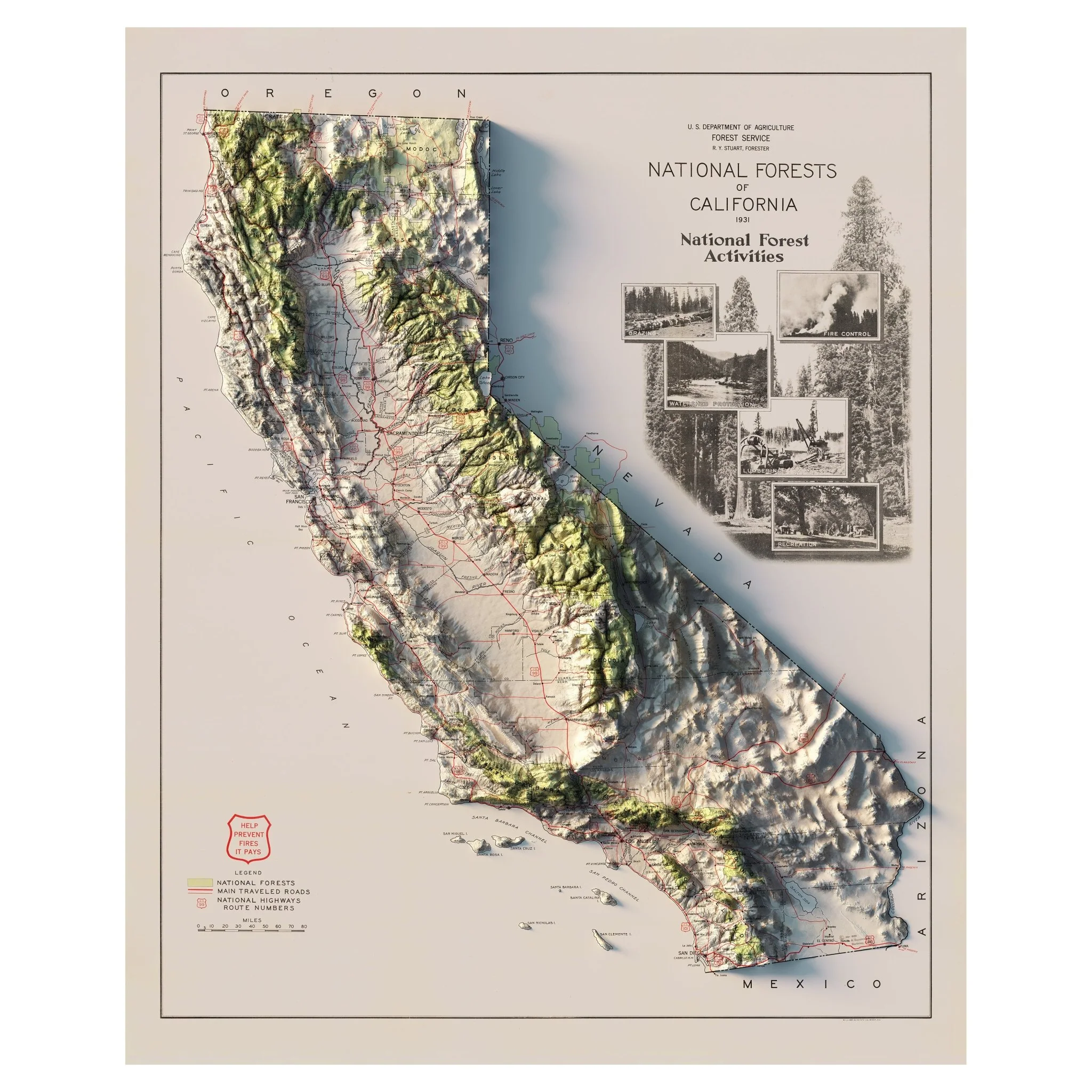
Description
We created this map with the illusion of 3D by applying Digital Elevation Data and meticulously adding shaded relief to the landscape of the original 1931 National Forests of California map.
In the early 1930s, conservation awareness was on the rise in the United States, with the establishment of many national parks and forests. In California, there was a noticeable contrast between bustling urban areas and untouched wilderness, making it important for residents and visitors to grasp the geography of these protected spaces. This map focuses on national forests, traveled routes, and major highways to highlight how accessible and interconnected these wild areas are to the state's urban centers.
One remarkable feature of this map is the title cartouche in the upper right corner. It combines precise cartographic design with the artistry of early 20th-century photography. The topography is carefully represented using shading techniques, effectively showcasing the diverse terrains and underscoring the abundant biodiversity found in the forests of California.
The shading is printed on the paper and is not a result of the map protruding from the surface.
Please Note: The text on the map can be difficult to read due to the small font size and the age of the map. In areas where the relief shading covers the text, the underlying text may not be legible. We suggest the largest-size map for better details, though the text may still be covered in the darker areas.