Cordilleras 1876 Topographic Map
We love old maps. Their coloration, typography, legends, notations, and sometimes even outdated place names all have a nostalgic quality that gives them a special beauty. If you share our love for vintage maps, you’ll appreciate this 1876 Cordilleras Topographic map in our Historic Series.
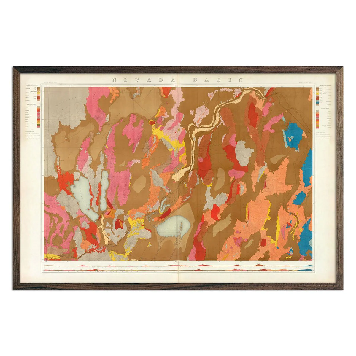
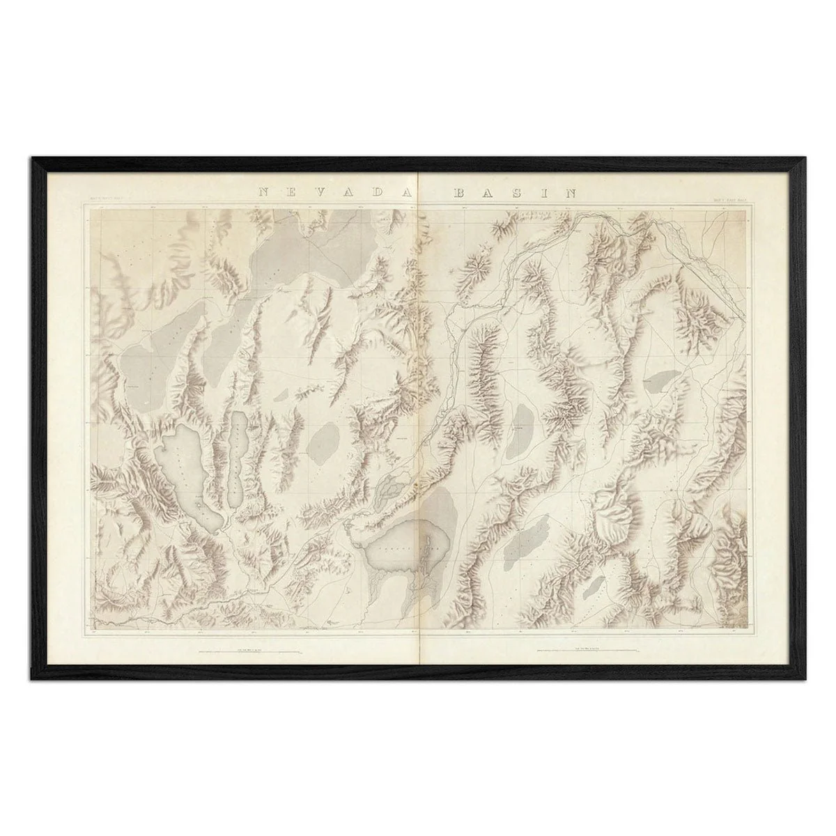
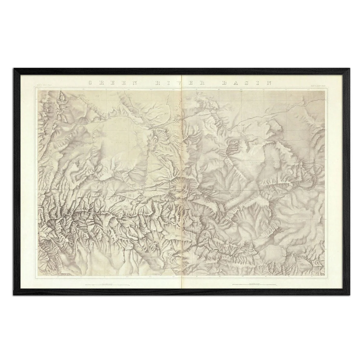
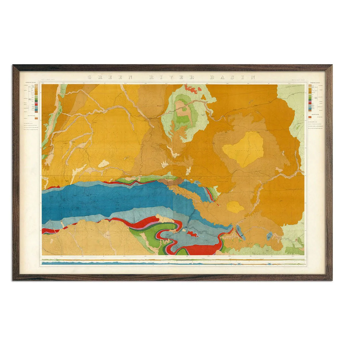
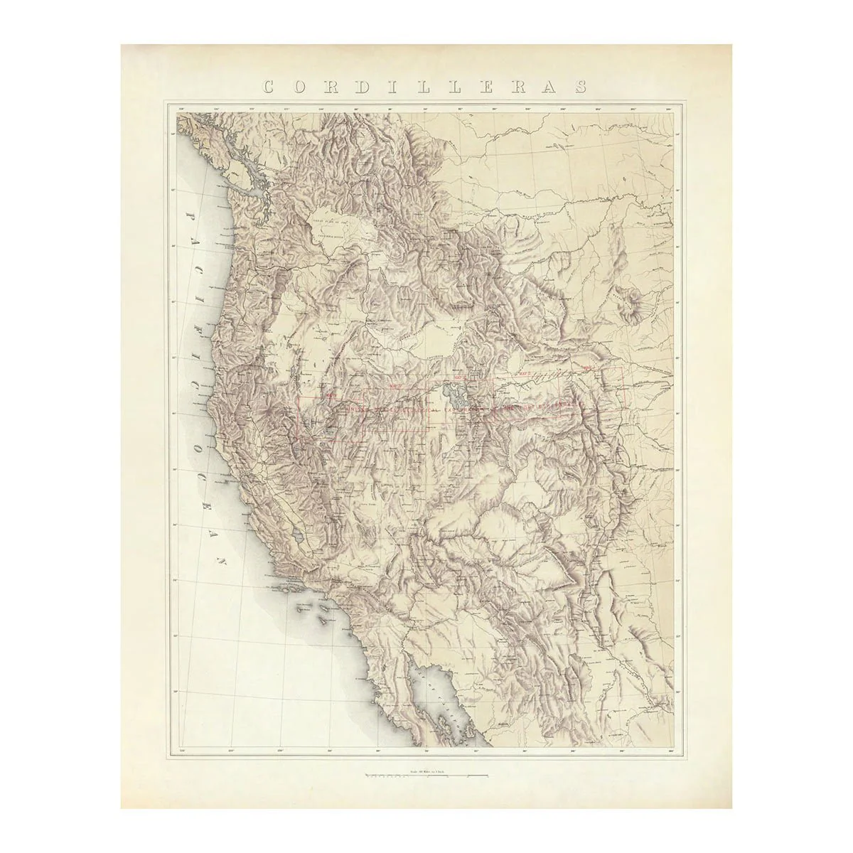
This is a reproduction print of a map of the Western United States showing the geographical boundaries of the five maps of the Geological Exploration of the Fortieth Parallel. The Geologist in charge of this work was Clarence King which was originally published by Julius Bien. The maps show a continuous belt of mountains and plateaus from 104 degrees longitude to 120 degrees, and 170 miles north to south.
Product Information
Product Information
Shipping & Returns
Shipping & Returns


Cordilleras 1876 Topographic Map
Cordilleras 1876 Topographic Map
We love old maps. Their coloration, typography, legends, notations, and sometimes even outdated place names all have a nostalgic quality that gives them a special beauty. If you share our love for vintage maps, you’ll appreciate this 1876 Cordilleras Topographic map in our Historic Series.
This is a reproduction print of a map of the Western United States showing the geographical boundaries of the five maps of the Geological Exploration of the Fortieth Parallel. The Geologist in charge of this work was Clarence King which was originally published by Julius Bien. The maps show a continuous belt of mountains and plateaus from 104 degrees longitude to 120 degrees, and 170 miles north to south.
Original: $5,800.00
-70%$5,800.00
$1,740.00Product Information
Product Information
Shipping & Returns
Shipping & Returns
Description
We love old maps. Their coloration, typography, legends, notations, and sometimes even outdated place names all have a nostalgic quality that gives them a special beauty. If you share our love for vintage maps, you’ll appreciate this 1876 Cordilleras Topographic map in our Historic Series.
This is a reproduction print of a map of the Western United States showing the geographical boundaries of the five maps of the Geological Exploration of the Fortieth Parallel. The Geologist in charge of this work was Clarence King which was originally published by Julius Bien. The maps show a continuous belt of mountains and plateaus from 104 degrees longitude to 120 degrees, and 170 miles north to south.