Czechoslovakia Pictorial Map
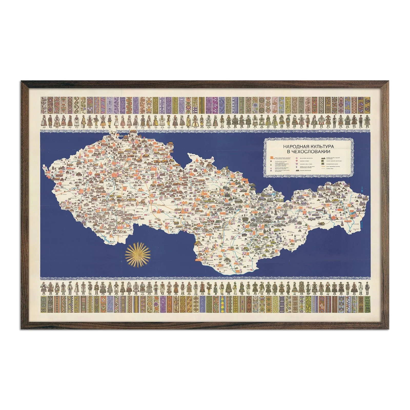
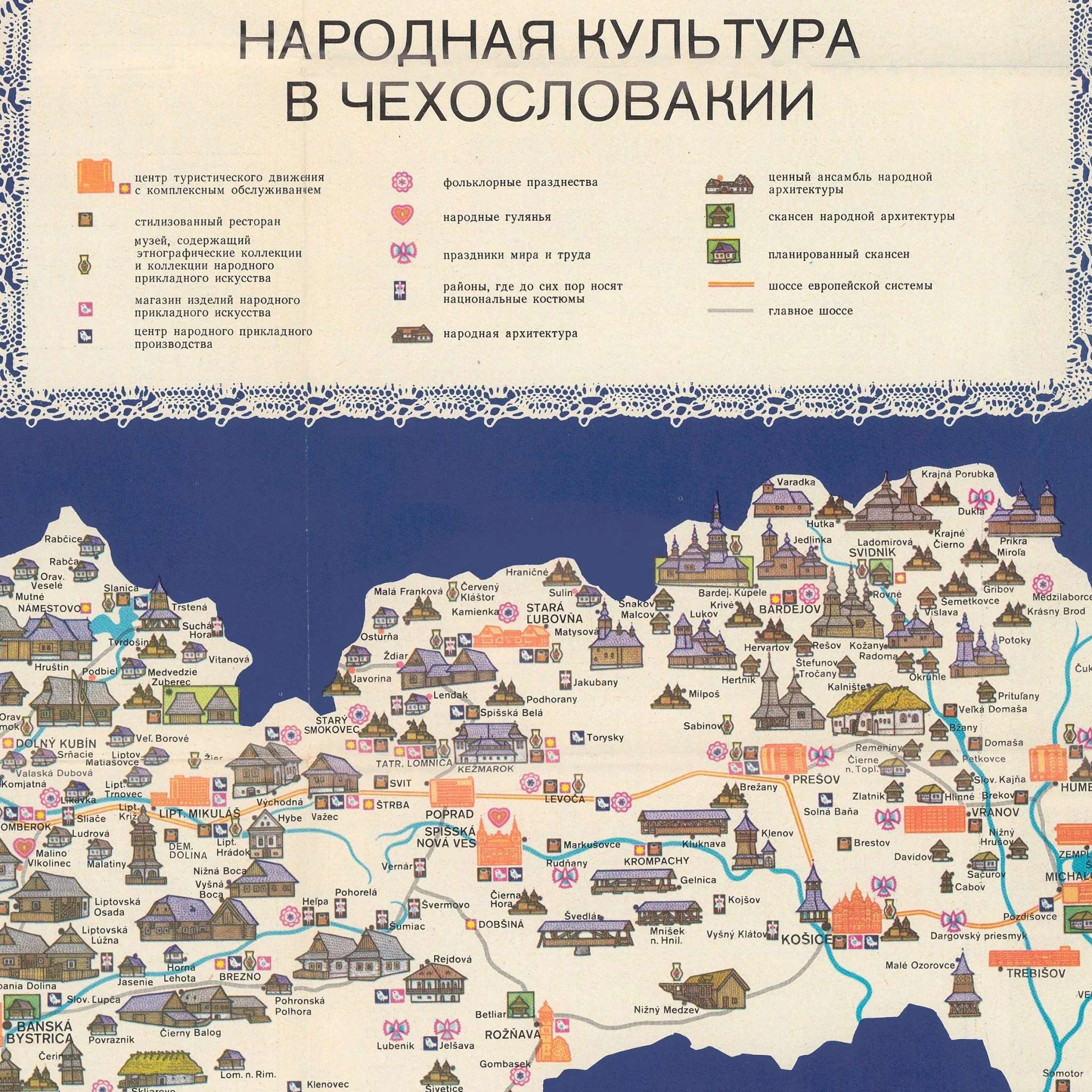
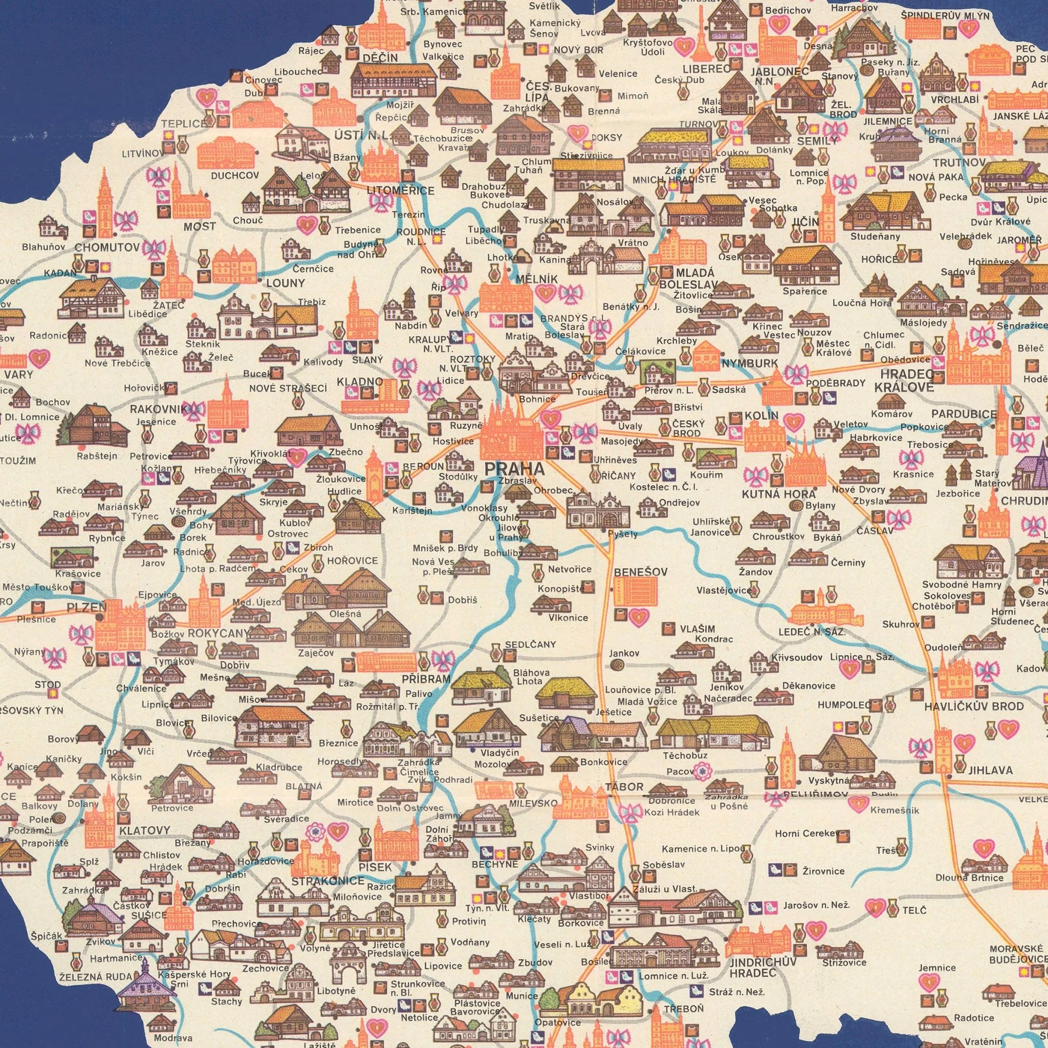
This 1974 Czechoslovakia Pictorial Map by cartographer Jaroslav Vildt transforms political boundaries into a detailed celebration of Central European culture. Created during a significant period in Eastern European history, this colored lithograph combines practical cartographic elements with the cultural heritage that defined this historic nation. Vildt includes political boundaries, railways, roads, architecture, and drainage systems alongside vibrant cultural illustrations.
The map celebrates regional identity through folk figures dressed in traditional costumes from different areas, with each outfit carefully detailed to represent the diverse heritage of Czechoslovakia. Decorative fabric print swatches along the top and bottom margins showcase authentic textile patterns from local craftspeople. Architectural landmarks from Prague's notable buildings to rural churches appear as detailed illustrations throughout the map.
Our reproduction was carefully remastered from a high-resolution digital scan of the original 1974 map. Every folk costume detail and geographic feature maintains its original clarity and color accuracy. We use premium materials made in the USA to create this print, bringing Vildt's historical work into modern homes while preserving its educational and artistic value.
Made in San Diego, CA using premium materials sourced in the USA. Available unframed or with our signature thin wood frame options.
Product Information
Product Information
Shipping & Returns
Shipping & Returns


Czechoslovakia Pictorial Map
Czechoslovakia Pictorial Map
This 1974 Czechoslovakia Pictorial Map by cartographer Jaroslav Vildt transforms political boundaries into a detailed celebration of Central European culture. Created during a significant period in Eastern European history, this colored lithograph combines practical cartographic elements with the cultural heritage that defined this historic nation. Vildt includes political boundaries, railways, roads, architecture, and drainage systems alongside vibrant cultural illustrations.
The map celebrates regional identity through folk figures dressed in traditional costumes from different areas, with each outfit carefully detailed to represent the diverse heritage of Czechoslovakia. Decorative fabric print swatches along the top and bottom margins showcase authentic textile patterns from local craftspeople. Architectural landmarks from Prague's notable buildings to rural churches appear as detailed illustrations throughout the map.
Our reproduction was carefully remastered from a high-resolution digital scan of the original 1974 map. Every folk costume detail and geographic feature maintains its original clarity and color accuracy. We use premium materials made in the USA to create this print, bringing Vildt's historical work into modern homes while preserving its educational and artistic value.
Made in San Diego, CA using premium materials sourced in the USA. Available unframed or with our signature thin wood frame options.
Original: $543.00
-70%$543.00
$162.90Product Information
Product Information
Shipping & Returns
Shipping & Returns
Description
This 1974 Czechoslovakia Pictorial Map by cartographer Jaroslav Vildt transforms political boundaries into a detailed celebration of Central European culture. Created during a significant period in Eastern European history, this colored lithograph combines practical cartographic elements with the cultural heritage that defined this historic nation. Vildt includes political boundaries, railways, roads, architecture, and drainage systems alongside vibrant cultural illustrations.
The map celebrates regional identity through folk figures dressed in traditional costumes from different areas, with each outfit carefully detailed to represent the diverse heritage of Czechoslovakia. Decorative fabric print swatches along the top and bottom margins showcase authentic textile patterns from local craftspeople. Architectural landmarks from Prague's notable buildings to rural churches appear as detailed illustrations throughout the map.
Our reproduction was carefully remastered from a high-resolution digital scan of the original 1974 map. Every folk costume detail and geographic feature maintains its original clarity and color accuracy. We use premium materials made in the USA to create this print, bringing Vildt's historical work into modern homes while preserving its educational and artistic value.
Made in San Diego, CA using premium materials sourced in the USA. Available unframed or with our signature thin wood frame options.