Glacier National Park 1910 Aeroplane Map
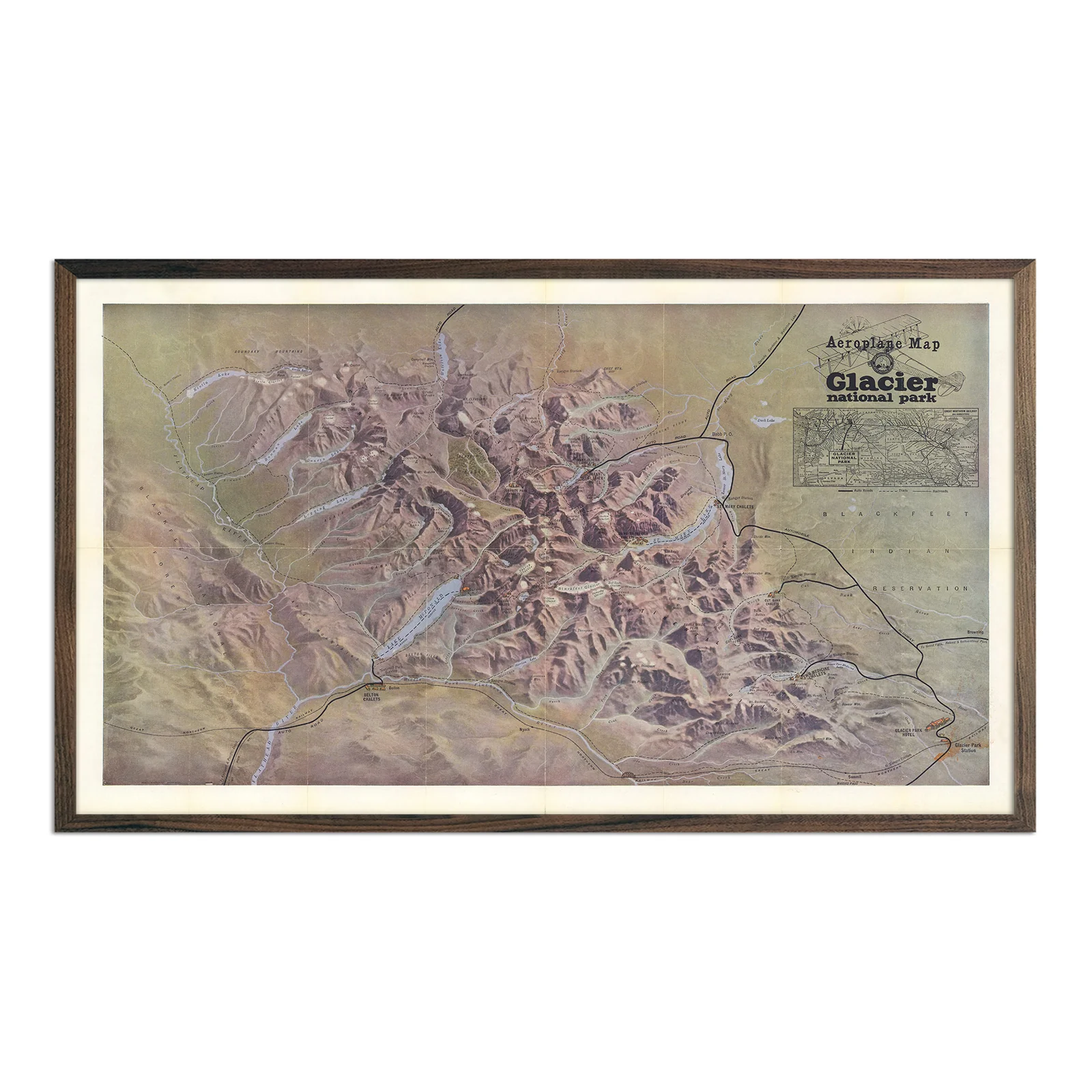
In 1910, Glacier National Park was America's newest national park and aviation was still a marvel. This "Aeroplane Map" of Glacier offered visitors an aerial perspective of the park's rugged landscape that most travelers had never seen. The rich color palette features reddish-brown mountain terrain contrasting with deep sapphire lakes and winding blue rivers that cut through glacially-carved valleys.
The detailed railway inset shows the Great Northern's transcontinental route. This map served as a travel planning tool when reaching Glacier required serious preparation and multiple train connections. The period typography and cartographic styling capture 1910's approach to wilderness access, when the country was opening remote landscapes to visitors while establishing the national park system.
This piece appeals to history enthusiasts, railroad collectors, and anyone interested in Glacier National Park's origins. It documents the early national park era when conservation and public access were new concepts being tested in America's western wilderness. Made in San Diego, CA using premium materials. Available unframed or professionally framed.
Works as both wall art and historical documentation of America's early conservation efforts.
Product Information
Product Information
Shipping & Returns
Shipping & Returns


Glacier National Park 1910 Aeroplane Map
Glacier National Park 1910 Aeroplane Map
In 1910, Glacier National Park was America's newest national park and aviation was still a marvel. This "Aeroplane Map" of Glacier offered visitors an aerial perspective of the park's rugged landscape that most travelers had never seen. The rich color palette features reddish-brown mountain terrain contrasting with deep sapphire lakes and winding blue rivers that cut through glacially-carved valleys.
The detailed railway inset shows the Great Northern's transcontinental route. This map served as a travel planning tool when reaching Glacier required serious preparation and multiple train connections. The period typography and cartographic styling capture 1910's approach to wilderness access, when the country was opening remote landscapes to visitors while establishing the national park system.
This piece appeals to history enthusiasts, railroad collectors, and anyone interested in Glacier National Park's origins. It documents the early national park era when conservation and public access were new concepts being tested in America's western wilderness. Made in San Diego, CA using premium materials. Available unframed or professionally framed.
Works as both wall art and historical documentation of America's early conservation efforts.
Original: $700.00
-70%$700.00
$210.00Product Information
Product Information
Shipping & Returns
Shipping & Returns
Description
In 1910, Glacier National Park was America's newest national park and aviation was still a marvel. This "Aeroplane Map" of Glacier offered visitors an aerial perspective of the park's rugged landscape that most travelers had never seen. The rich color palette features reddish-brown mountain terrain contrasting with deep sapphire lakes and winding blue rivers that cut through glacially-carved valleys.
The detailed railway inset shows the Great Northern's transcontinental route. This map served as a travel planning tool when reaching Glacier required serious preparation and multiple train connections. The period typography and cartographic styling capture 1910's approach to wilderness access, when the country was opening remote landscapes to visitors while establishing the national park system.
This piece appeals to history enthusiasts, railroad collectors, and anyone interested in Glacier National Park's origins. It documents the early national park era when conservation and public access were new concepts being tested in America's western wilderness. Made in San Diego, CA using premium materials. Available unframed or professionally framed.
Works as both wall art and historical documentation of America's early conservation efforts.