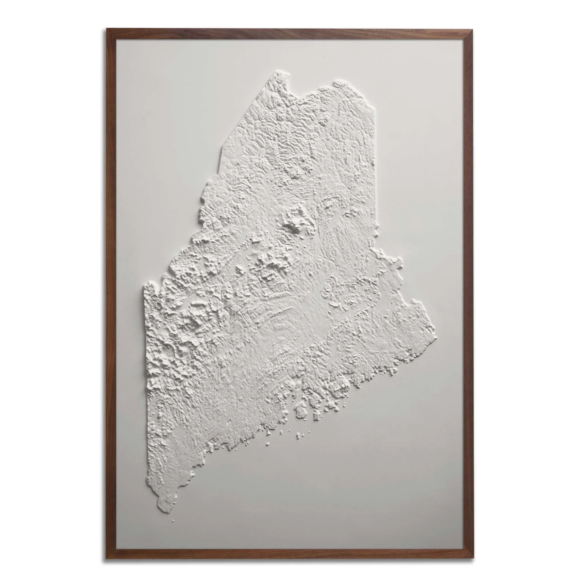
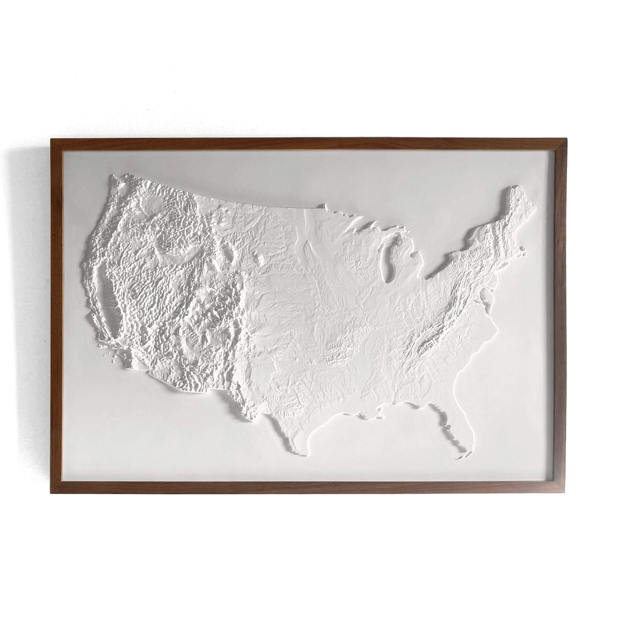
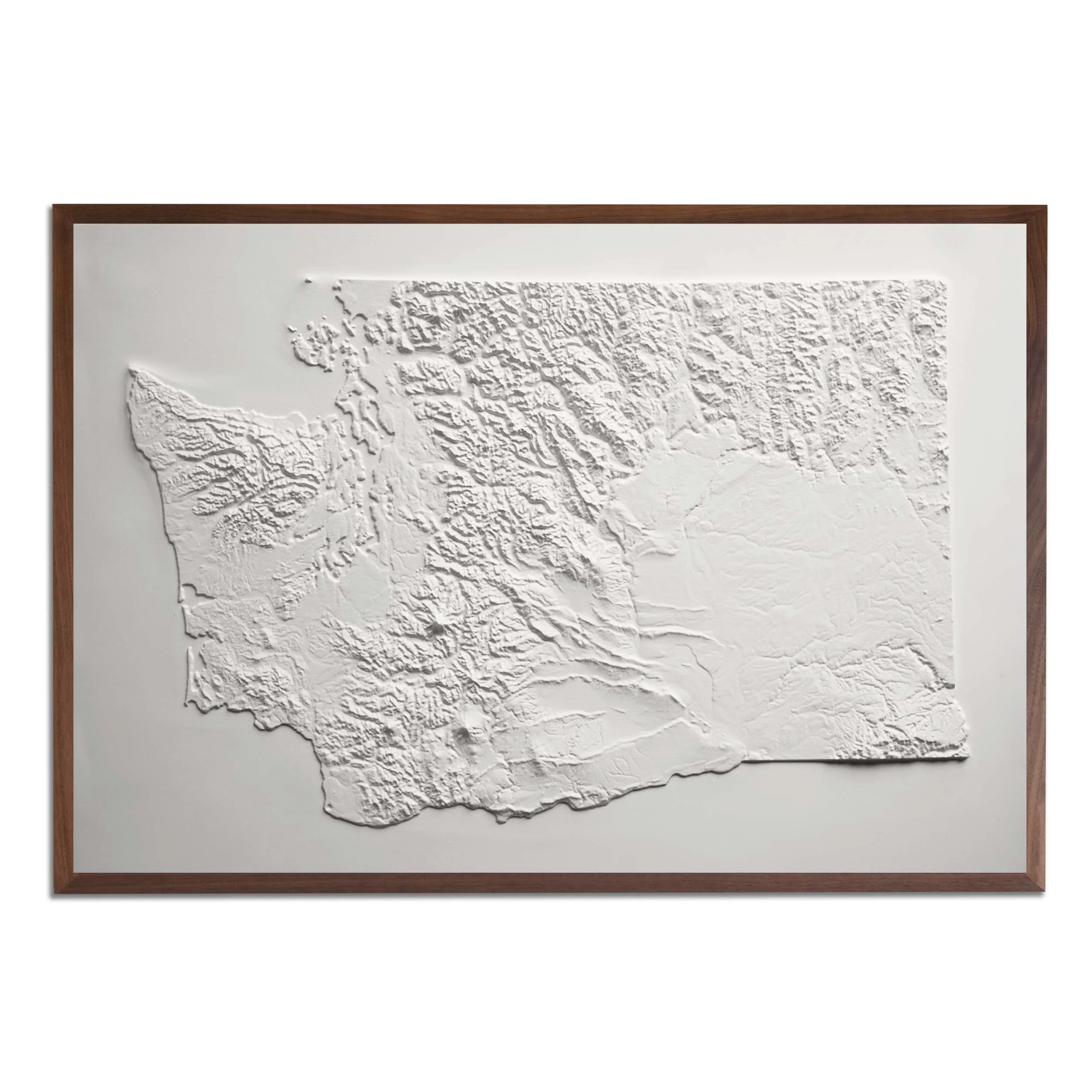
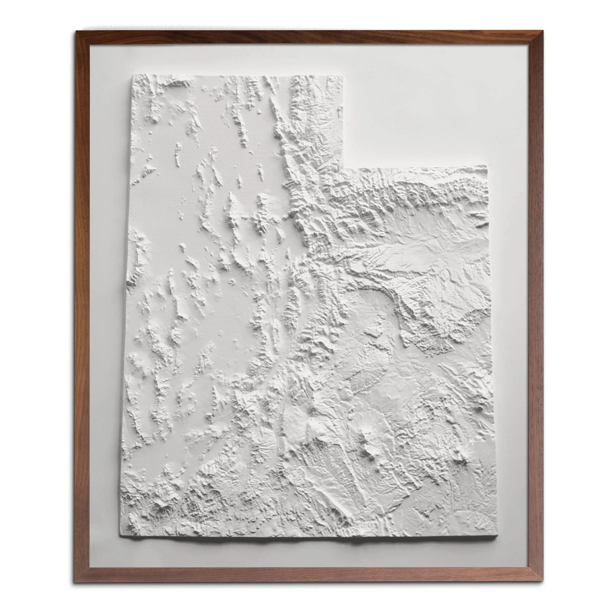
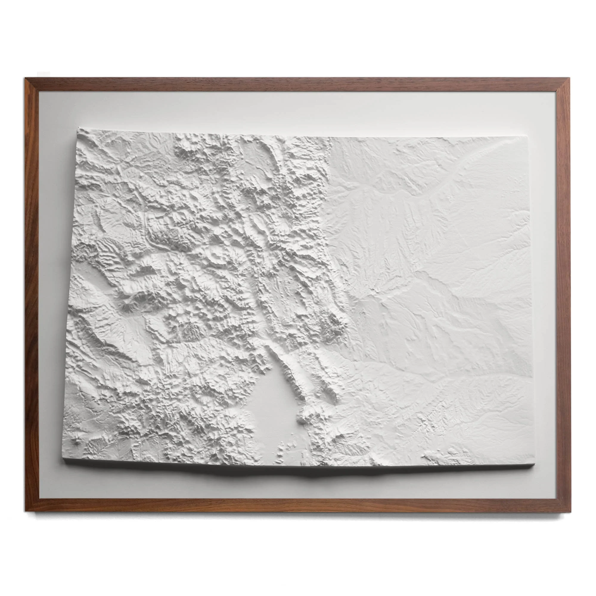
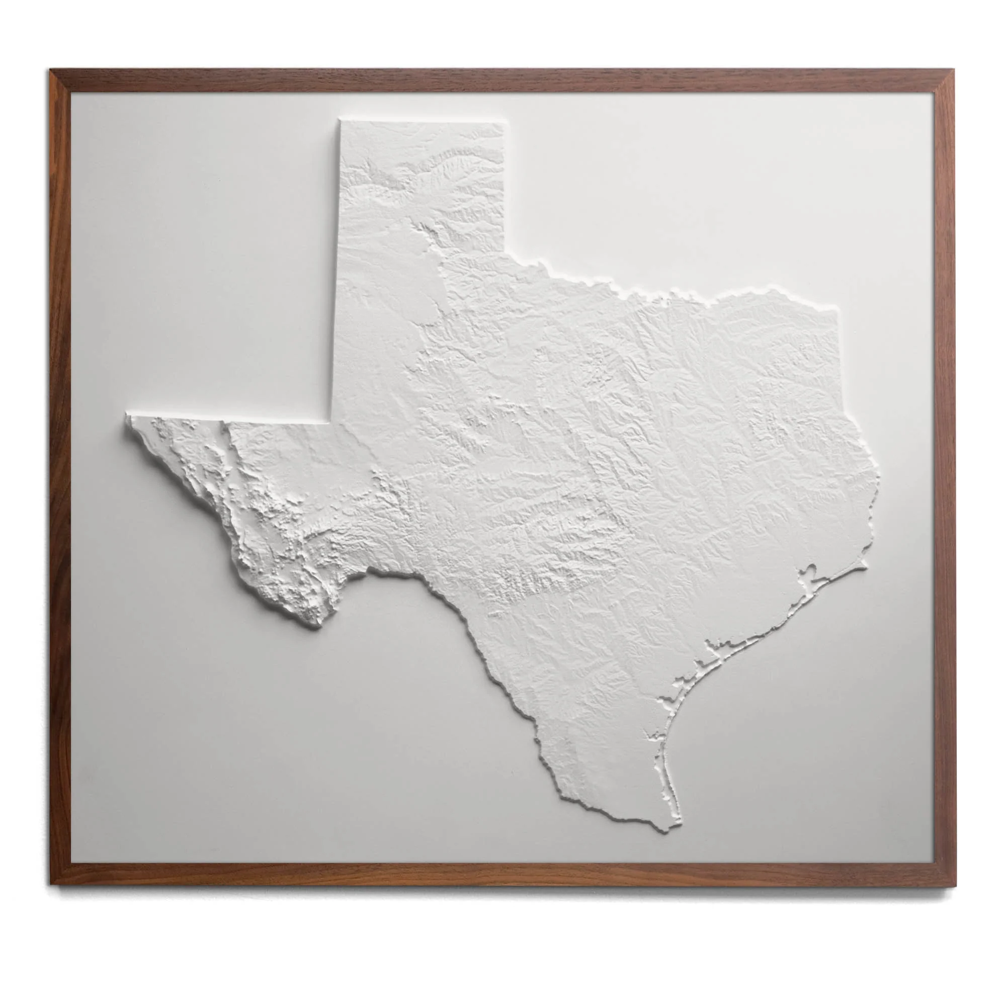
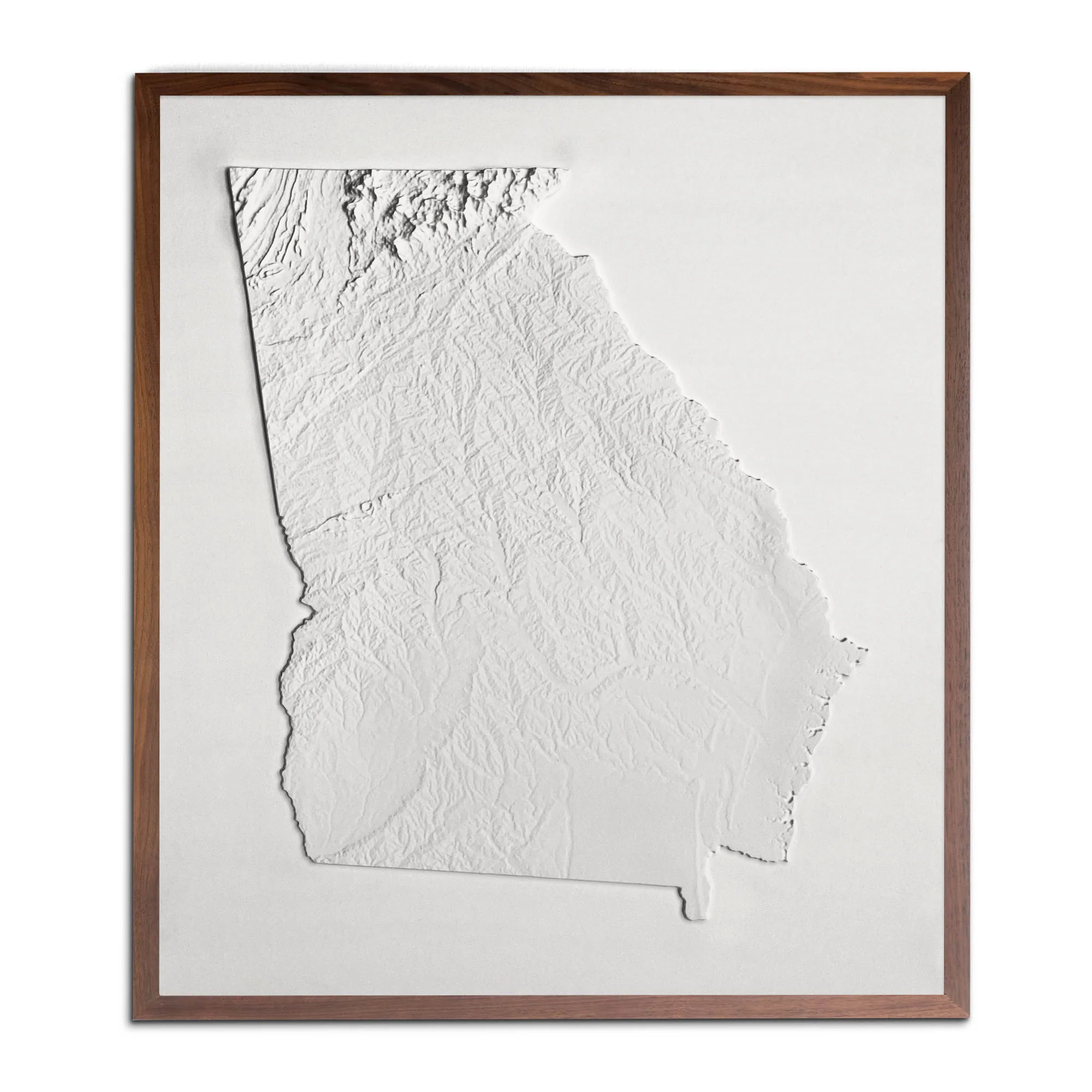
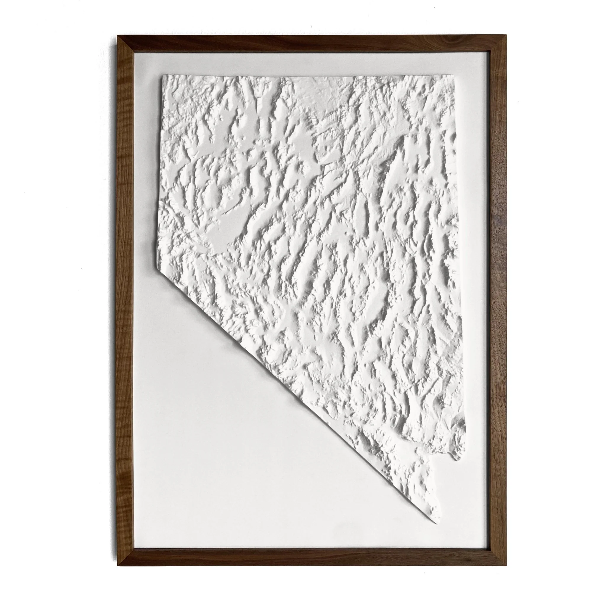
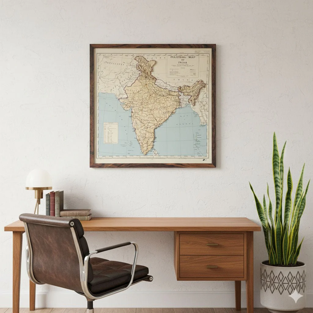
India 1954 3D Raised Relief Map
Real raised relief to explore through touch and feel.
- Size - unframed 27x26 inches
- Size - framed 28x27 inches
- Material - plastic mounted on foam board
- Handmade real Walnut frame available
- Individually made in our San Diego, CA shop
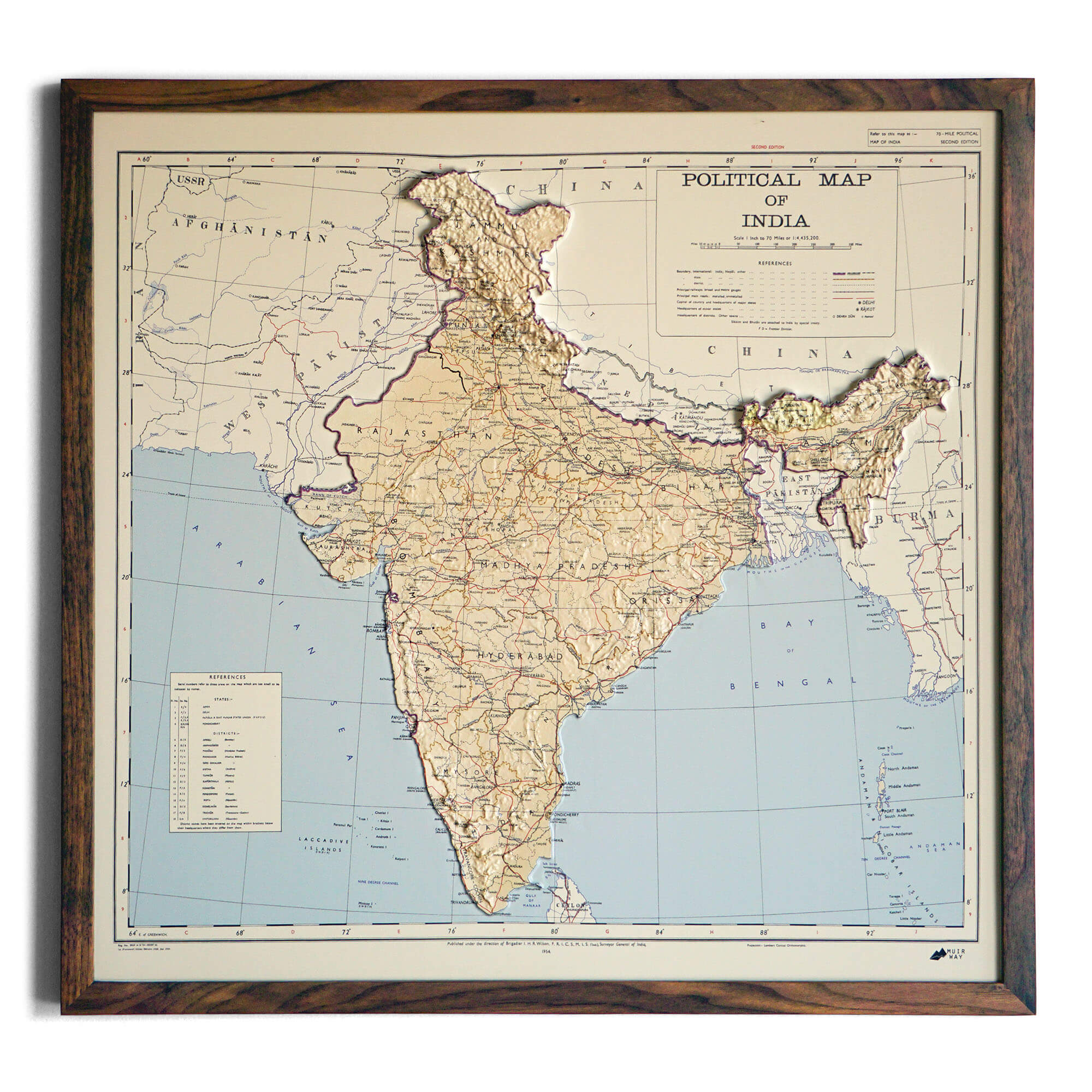
Explore the diverse landscape of India like never before with this original creation from Muir Way. We've taken the historical 1954 Political Map and transformed it into a breathtaking, 3D Raised Relief piece, allowing you to visually and tactilely connect with the country's fascinating topography.
A Fusion of History and Topography
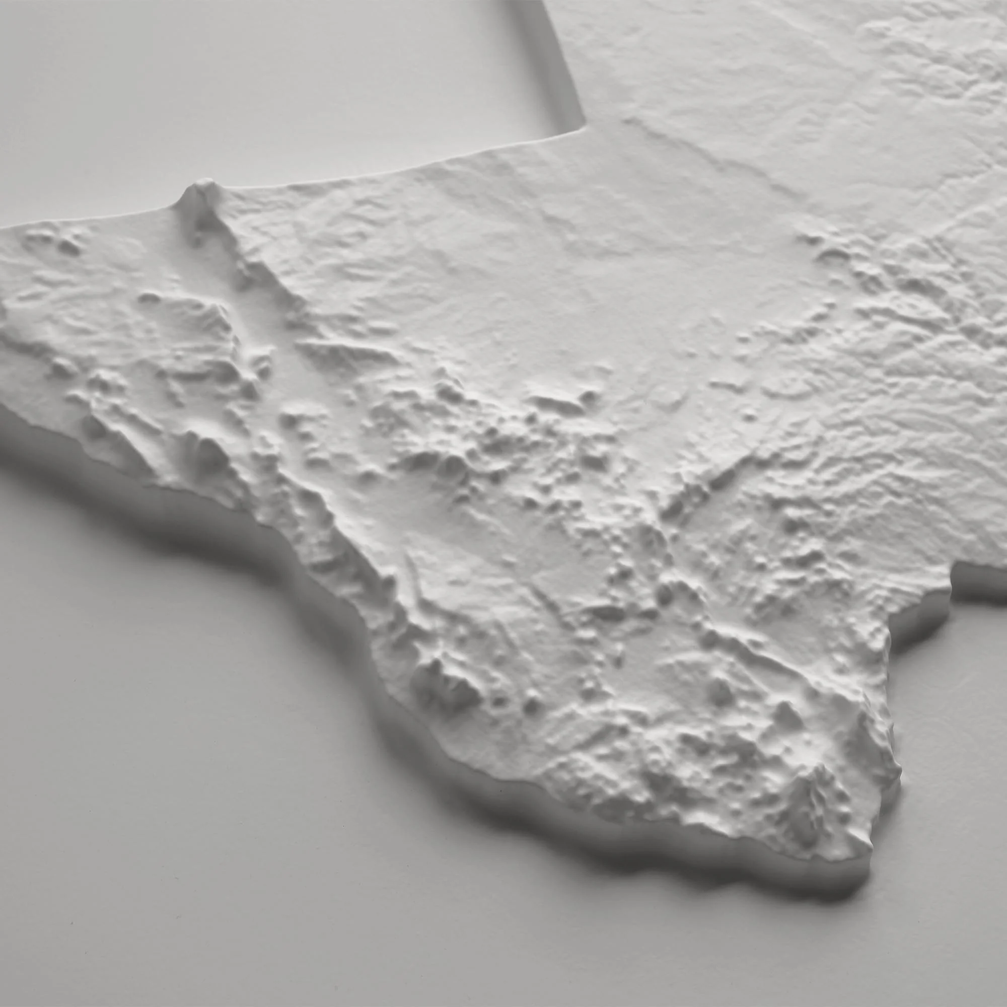
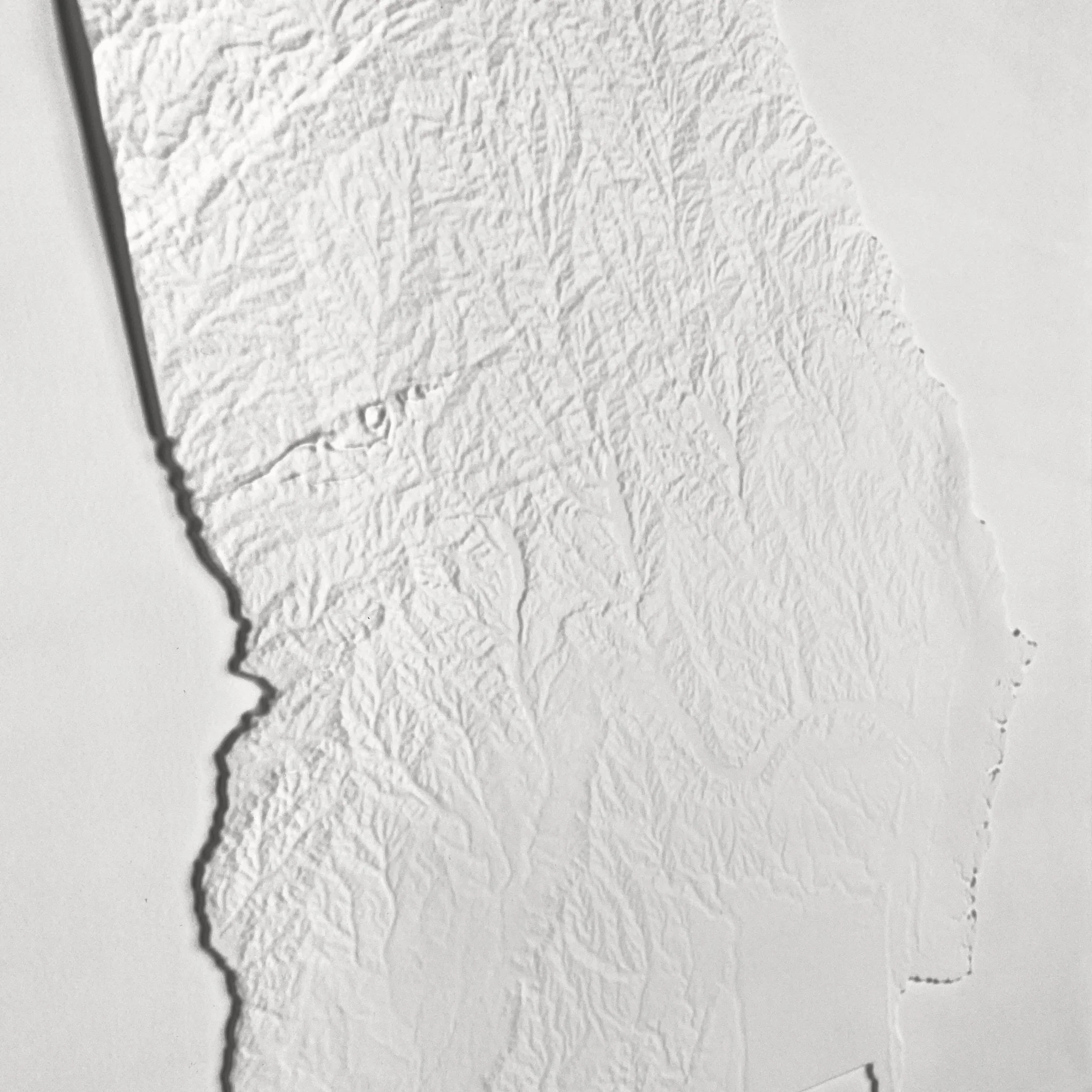
This isn't just a flat map; it's a meticulously crafted experience. Here’s how this unique piece comes to life:
-
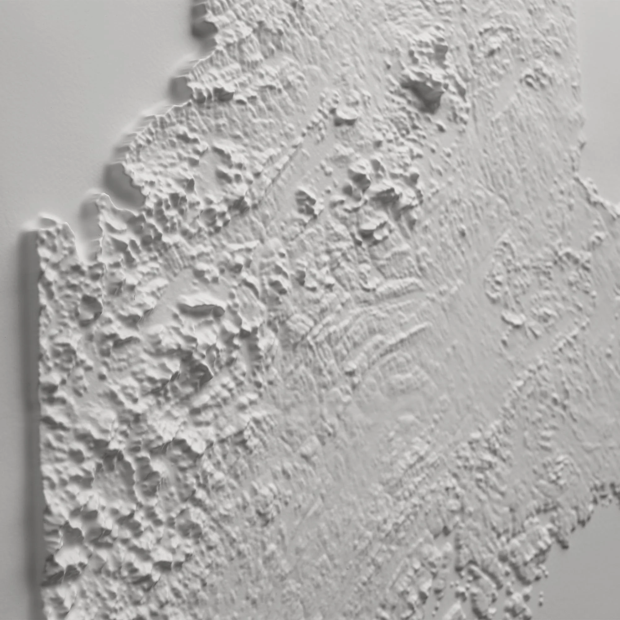
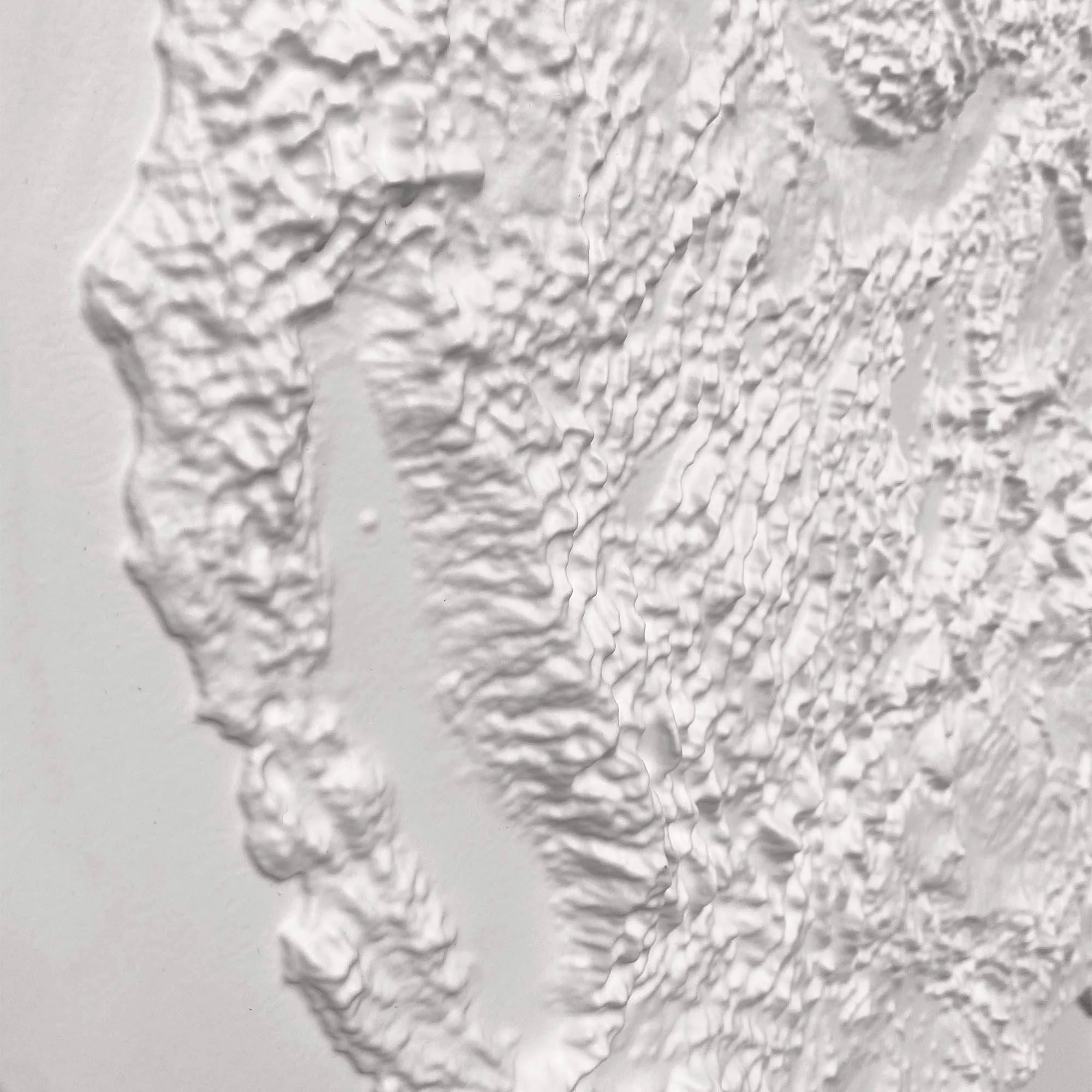
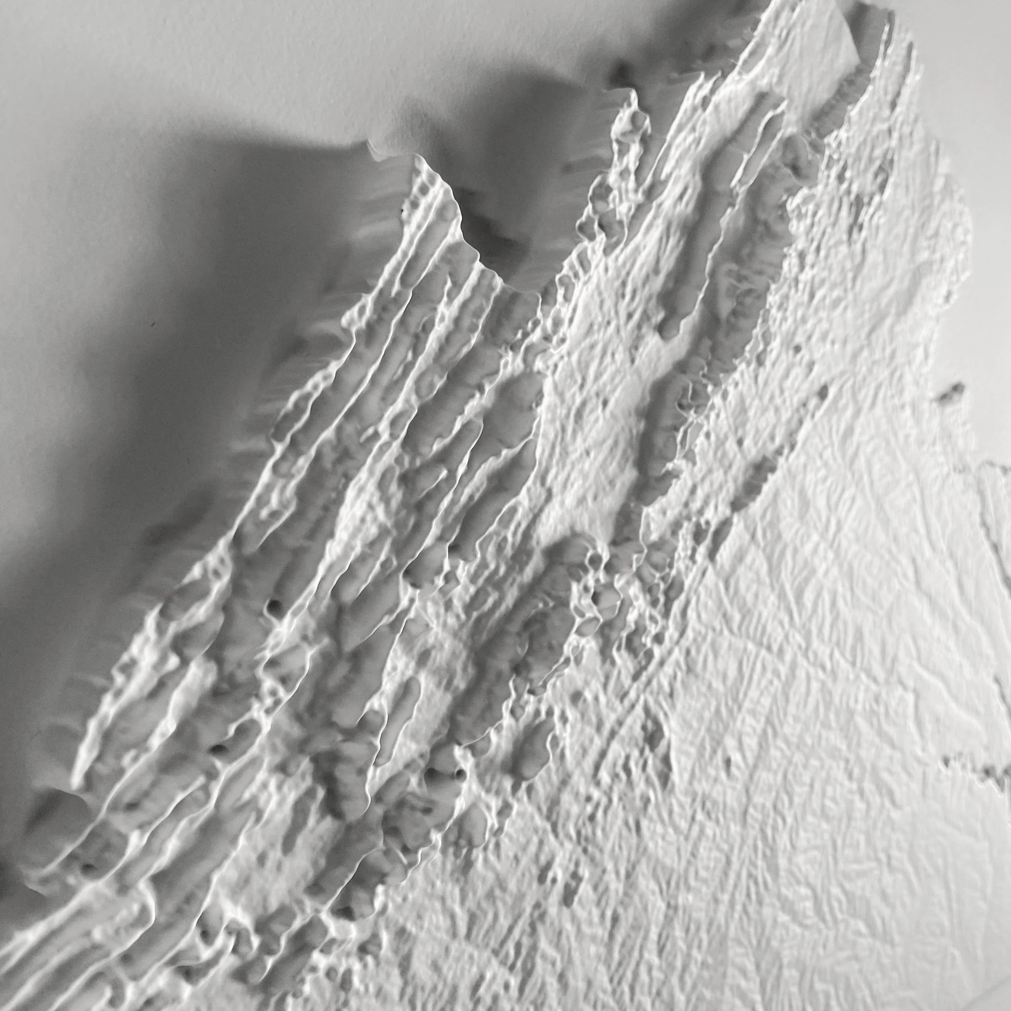
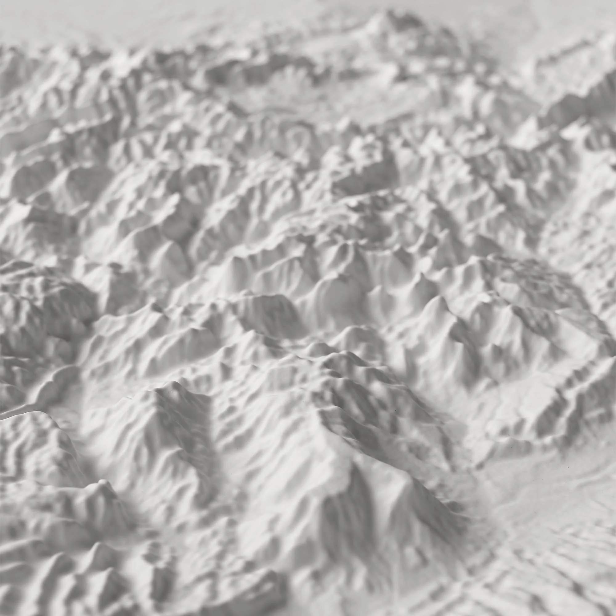
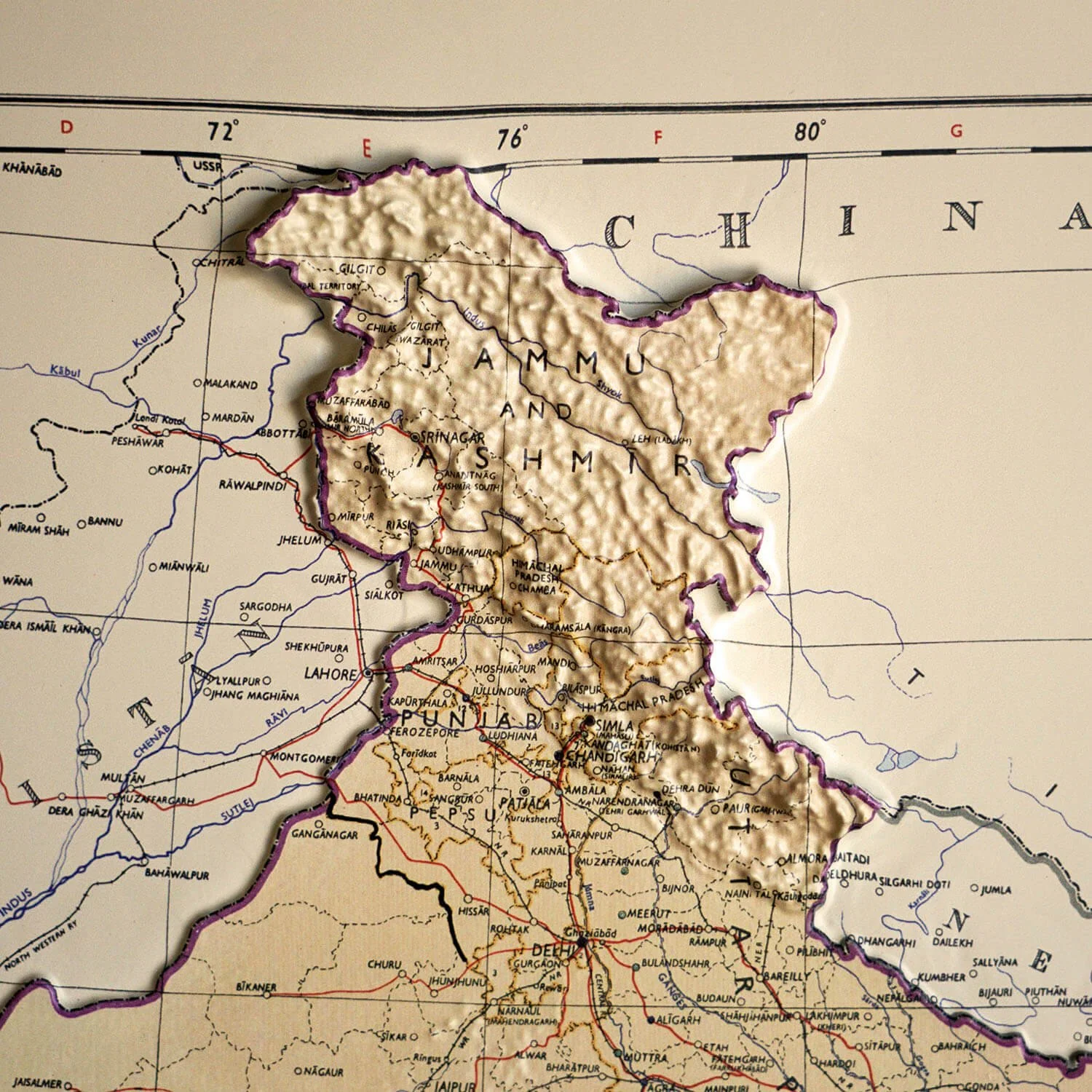
Intricate 3D Mold: We start by creating an intricately detailed 3D mold of India's terrain, perfectly aligned with the 1954 map's geographical features.
-
Meticulous Transformation: The printed map then undergoes a specialized process. It is heated and vacuum-formed precisely over the mold, setting the topography in stone—or rather, in relief.
-
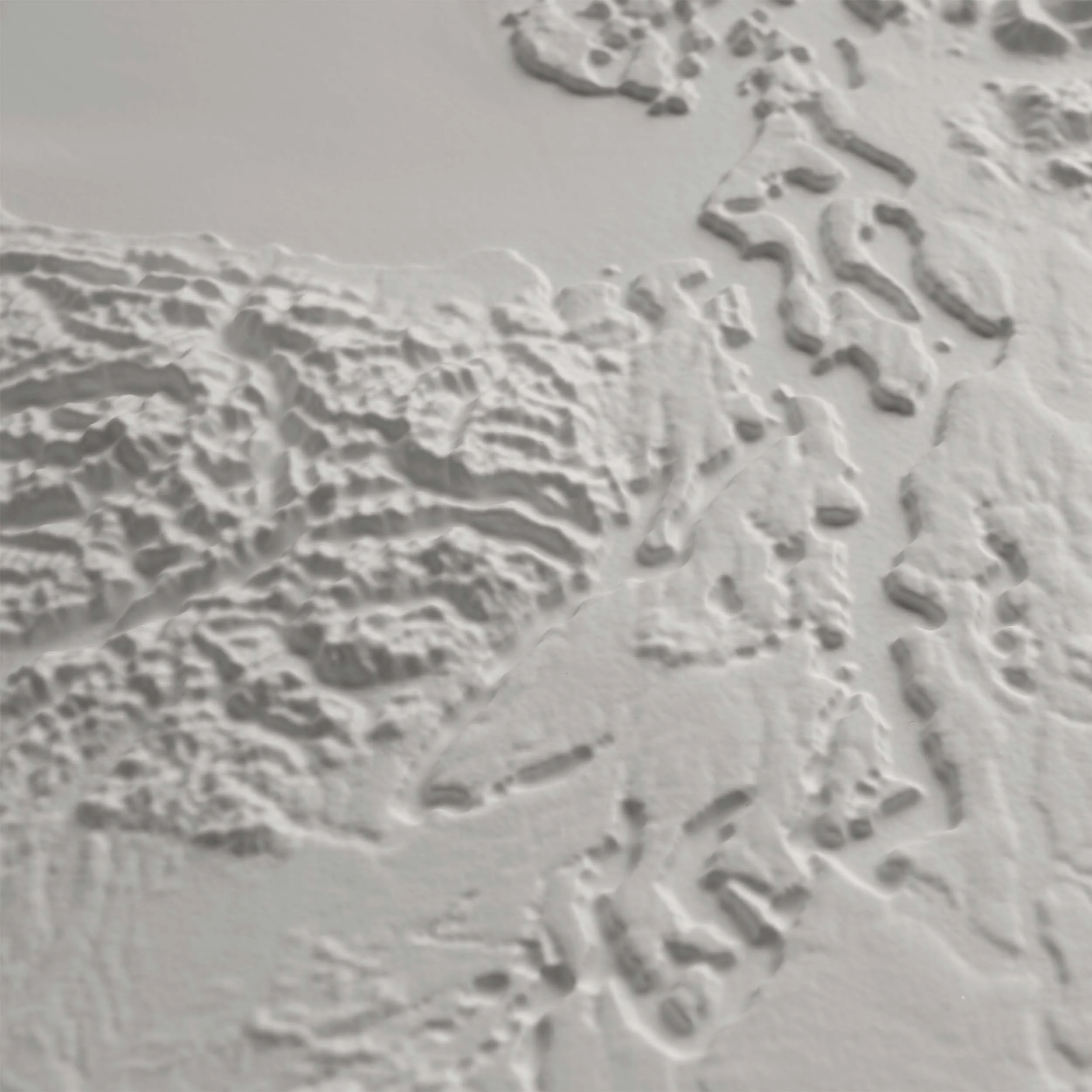
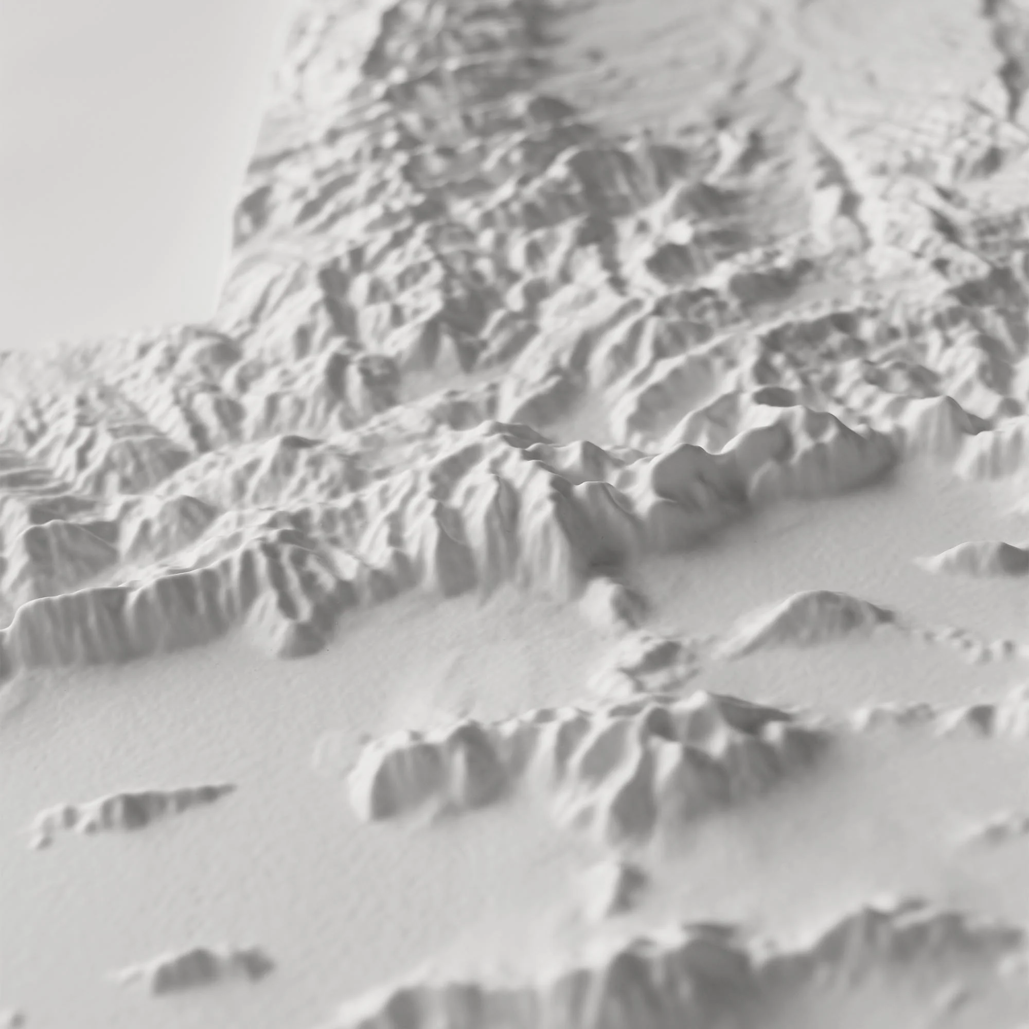
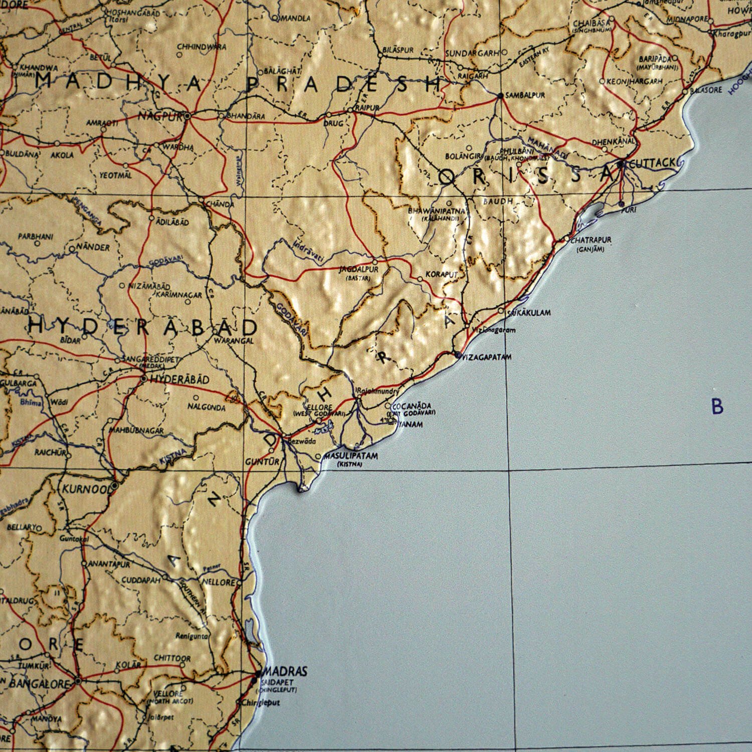
Explore the Terrain: The result is a stunning, dimensional map that invites you to run your fingers over the land. Explore the country's diverse terrain, from the towering peaks of the Himalayan Mountains in the north to the sprawling Coastal Plains and plateaus across the peninsula.
This map is a perfect centerpiece for historians, geographers, or anyone with a deep connection to India.
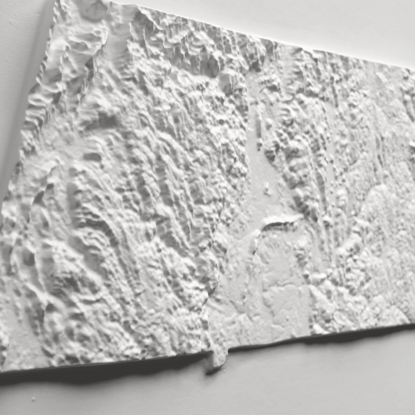
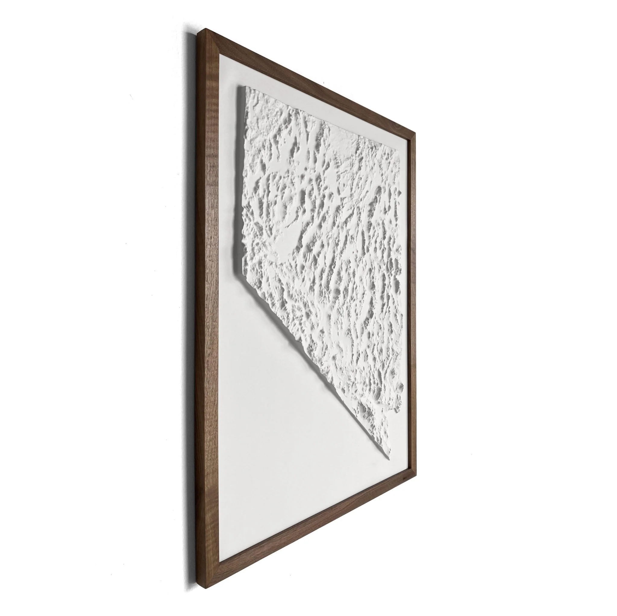
Framed maps do not have glass or acrylic over them, so you can touch the map and explore its intricacies.
PLEASE NOTE
You will love this map if you embrace its anomalies. When the plastic is heated and stretched over the 3D mold, the image may be altered, causing warped lines and text around higher elevations.
Product Information
Product Information
Shipping & Returns
Shipping & Returns


India 1954 3D Raised Relief Map
India 1954 3D Raised Relief Map
Real raised relief to explore through touch and feel.
- Size - unframed 27x26 inches
- Size - framed 28x27 inches
- Material - plastic mounted on foam board
- Handmade real Walnut frame available
- Individually made in our San Diego, CA shop
Explore the diverse landscape of India like never before with this original creation from Muir Way. We've taken the historical 1954 Political Map and transformed it into a breathtaking, 3D Raised Relief piece, allowing you to visually and tactilely connect with the country's fascinating topography.
A Fusion of History and Topography
This isn't just a flat map; it's a meticulously crafted experience. Here’s how this unique piece comes to life:
-
Intricate 3D Mold: We start by creating an intricately detailed 3D mold of India's terrain, perfectly aligned with the 1954 map's geographical features.
-
Meticulous Transformation: The printed map then undergoes a specialized process. It is heated and vacuum-formed precisely over the mold, setting the topography in stone—or rather, in relief.
-
Explore the Terrain: The result is a stunning, dimensional map that invites you to run your fingers over the land. Explore the country's diverse terrain, from the towering peaks of the Himalayan Mountains in the north to the sprawling Coastal Plains and plateaus across the peninsula.
This map is a perfect centerpiece for historians, geographers, or anyone with a deep connection to India.
Framed maps do not have glass or acrylic over them, so you can touch the map and explore its intricacies.
PLEASE NOTE
You will love this map if you embrace its anomalies. When the plastic is heated and stretched over the 3D mold, the image may be altered, causing warped lines and text around higher elevations.
Original: $1,337.00
-70%$1,337.00
$401.10Product Information
Product Information
Shipping & Returns
Shipping & Returns
Description
Real raised relief to explore through touch and feel.
- Size - unframed 27x26 inches
- Size - framed 28x27 inches
- Material - plastic mounted on foam board
- Handmade real Walnut frame available
- Individually made in our San Diego, CA shop
Explore the diverse landscape of India like never before with this original creation from Muir Way. We've taken the historical 1954 Political Map and transformed it into a breathtaking, 3D Raised Relief piece, allowing you to visually and tactilely connect with the country's fascinating topography.
A Fusion of History and Topography
This isn't just a flat map; it's a meticulously crafted experience. Here’s how this unique piece comes to life:
-
Intricate 3D Mold: We start by creating an intricately detailed 3D mold of India's terrain, perfectly aligned with the 1954 map's geographical features.
-
Meticulous Transformation: The printed map then undergoes a specialized process. It is heated and vacuum-formed precisely over the mold, setting the topography in stone—or rather, in relief.
-
Explore the Terrain: The result is a stunning, dimensional map that invites you to run your fingers over the land. Explore the country's diverse terrain, from the towering peaks of the Himalayan Mountains in the north to the sprawling Coastal Plains and plateaus across the peninsula.
This map is a perfect centerpiece for historians, geographers, or anyone with a deep connection to India.
Framed maps do not have glass or acrylic over them, so you can touch the map and explore its intricacies.
PLEASE NOTE
You will love this map if you embrace its anomalies. When the plastic is heated and stretched over the 3D mold, the image may be altered, causing warped lines and text around higher elevations.