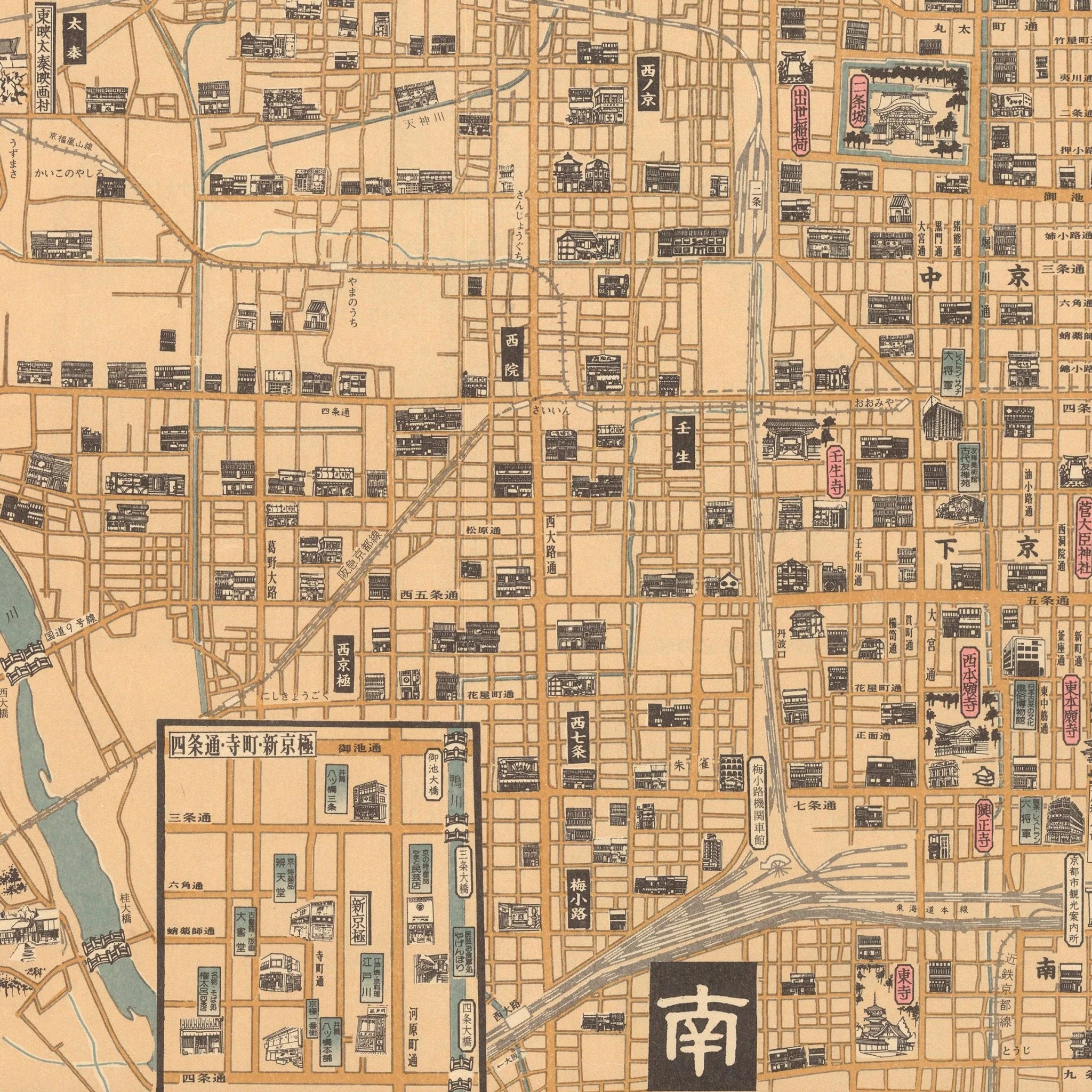
Kyoto 1960 Map
This 1960 pictorial map documents Kyoto fifteen years after World War II ended. Keishinsha Publishing created it to show the city through a distinctly Japanese perspective during the country's rapid economic growth. The map features hand-illustrated buildings with architectural details, from temples and shrines to residential neighborhoods. All text appears in Japanese characters and includes detailed descriptions. The cartographer included two detailed inset maps that focus on specific areas with greater precision.
This reproduction has been remastered from a digital scan of the original 1960 map. It maintains the period typography and illustration work that documents how Kyoto appeared to Japanese mapmakers in 1960 and captures Japanese cartographic artistry from this period.
Product Information
Product Information
Shipping & Returns
Shipping & Returns


Kyoto 1960 Map
Kyoto 1960 Map
This 1960 pictorial map documents Kyoto fifteen years after World War II ended. Keishinsha Publishing created it to show the city through a distinctly Japanese perspective during the country's rapid economic growth. The map features hand-illustrated buildings with architectural details, from temples and shrines to residential neighborhoods. All text appears in Japanese characters and includes detailed descriptions. The cartographer included two detailed inset maps that focus on specific areas with greater precision.
This reproduction has been remastered from a digital scan of the original 1960 map. It maintains the period typography and illustration work that documents how Kyoto appeared to Japanese mapmakers in 1960 and captures Japanese cartographic artistry from this period.
Original: $543.00
-70%$543.00
$162.90Product Information
Product Information
Shipping & Returns
Shipping & Returns
Description
This 1960 pictorial map documents Kyoto fifteen years after World War II ended. Keishinsha Publishing created it to show the city through a distinctly Japanese perspective during the country's rapid economic growth. The map features hand-illustrated buildings with architectural details, from temples and shrines to residential neighborhoods. All text appears in Japanese characters and includes detailed descriptions. The cartographer included two detailed inset maps that focus on specific areas with greater precision.
This reproduction has been remastered from a digital scan of the original 1960 map. It maintains the period typography and illustration work that documents how Kyoto appeared to Japanese mapmakers in 1960 and captures Japanese cartographic artistry from this period.