Luxembourg City 1961 Map
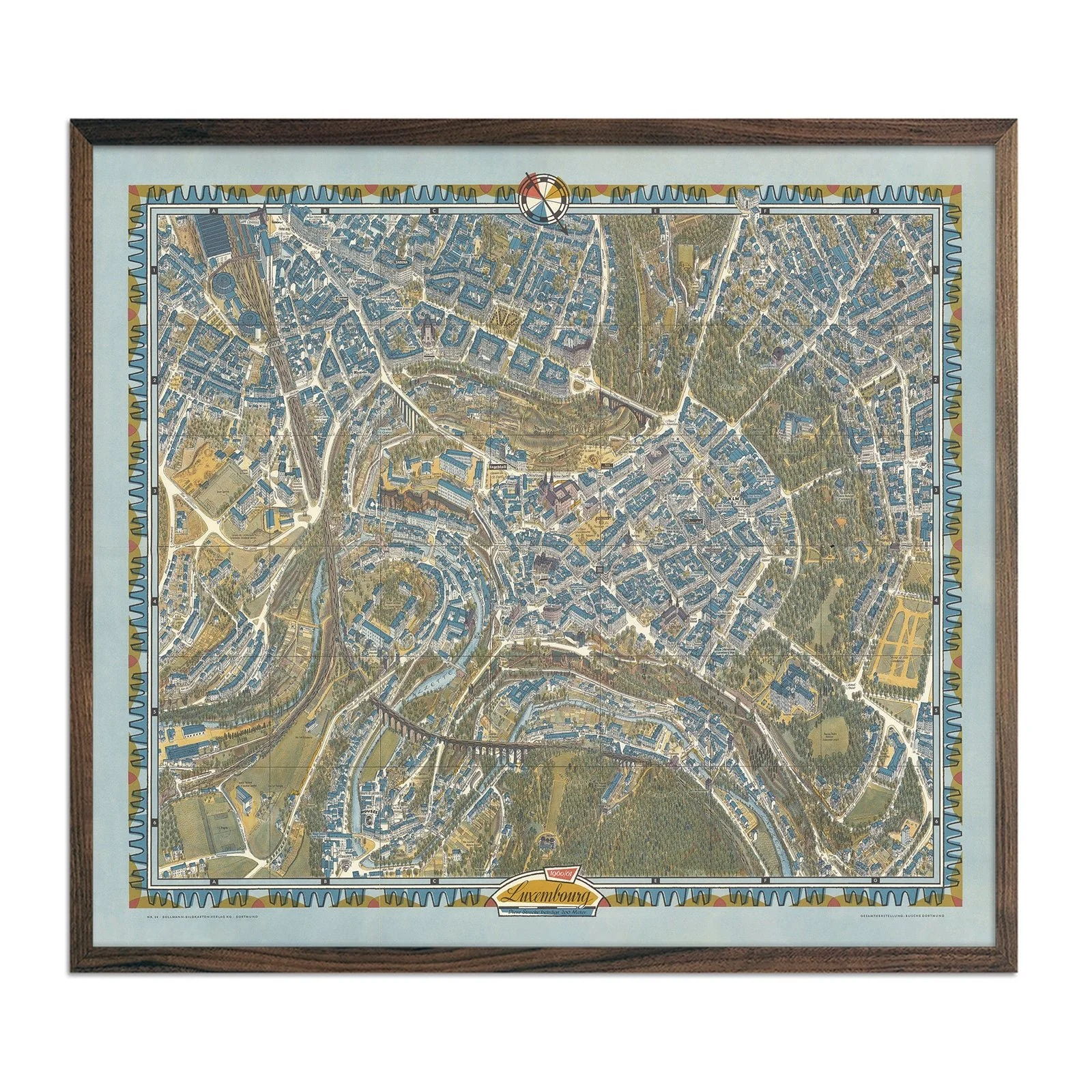
German cartographer Hermann Bollmann created this detailed bird's-eye view map of Luxembourg City in 1961. His graphic artist background brought artistic precision to the traditional Vogelschaukarten technique.
Bollmann's style renders the city as if viewed from above, showing buildings in three-dimensional detail rather than flat symbols. You can trace the winding streets of the Grund valley and follow the fortress walls along the Chemin de la Corniche.
This reproduction preserves the original's intricate linework and topographical accuracy. Made with archival materials in San Diego, CA.
This reproduction print was carefully remastered from a digital scan of the original 1961 map.
Product Information
Product Information
Shipping & Returns
Shipping & Returns


Luxembourg City 1961 Map
Luxembourg City 1961 Map
German cartographer Hermann Bollmann created this detailed bird's-eye view map of Luxembourg City in 1961. His graphic artist background brought artistic precision to the traditional Vogelschaukarten technique.
Bollmann's style renders the city as if viewed from above, showing buildings in three-dimensional detail rather than flat symbols. You can trace the winding streets of the Grund valley and follow the fortress walls along the Chemin de la Corniche.
This reproduction preserves the original's intricate linework and topographical accuracy. Made with archival materials in San Diego, CA.
This reproduction print was carefully remastered from a digital scan of the original 1961 map.
Original: $779.00
-70%$779.00
$233.70Product Information
Product Information
Shipping & Returns
Shipping & Returns
Description
German cartographer Hermann Bollmann created this detailed bird's-eye view map of Luxembourg City in 1961. His graphic artist background brought artistic precision to the traditional Vogelschaukarten technique.
Bollmann's style renders the city as if viewed from above, showing buildings in three-dimensional detail rather than flat symbols. You can trace the winding streets of the Grund valley and follow the fortress walls along the Chemin de la Corniche.
This reproduction preserves the original's intricate linework and topographical accuracy. Made with archival materials in San Diego, CA.
This reproduction print was carefully remastered from a digital scan of the original 1961 map.