Moon Geological 3D Raised Relief Map
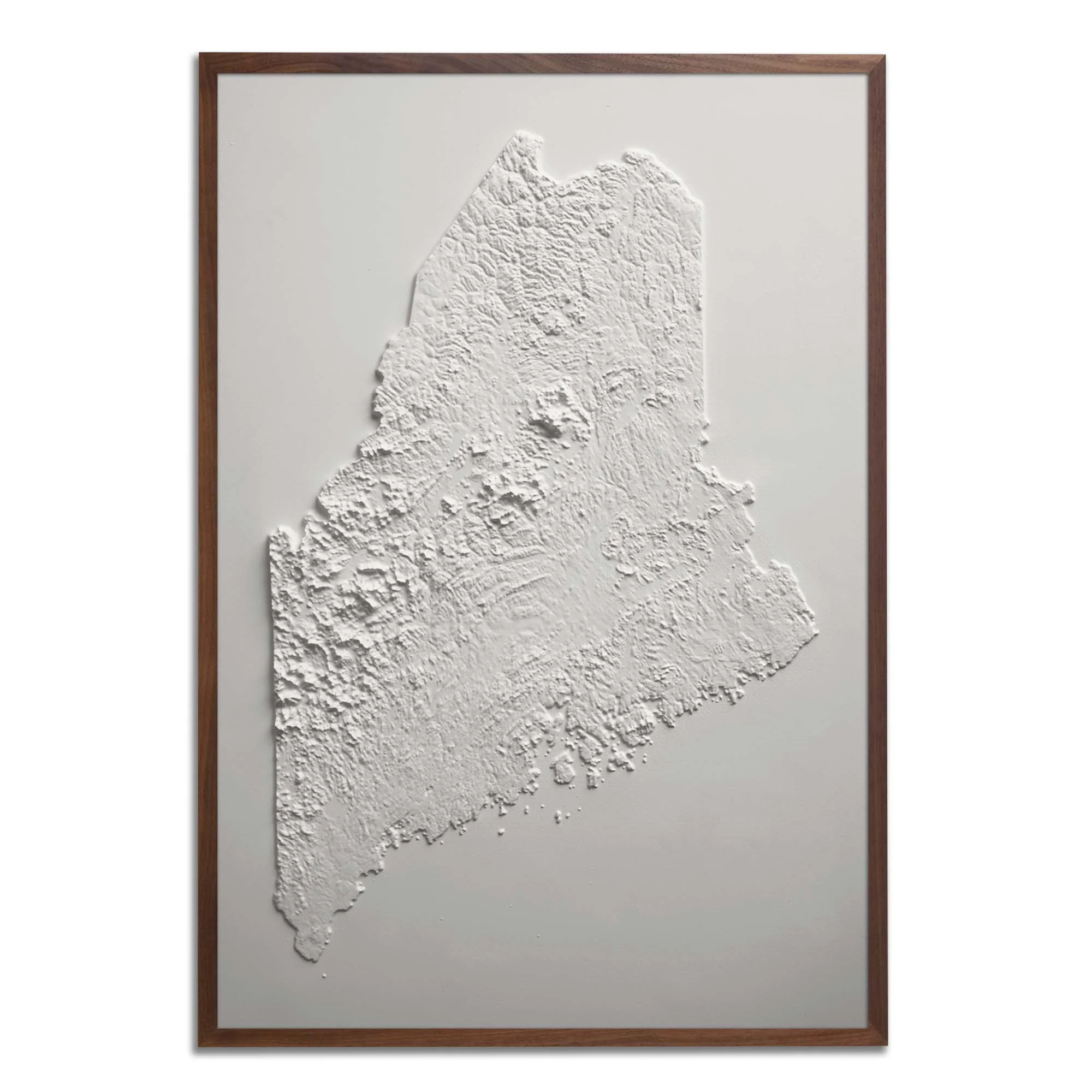
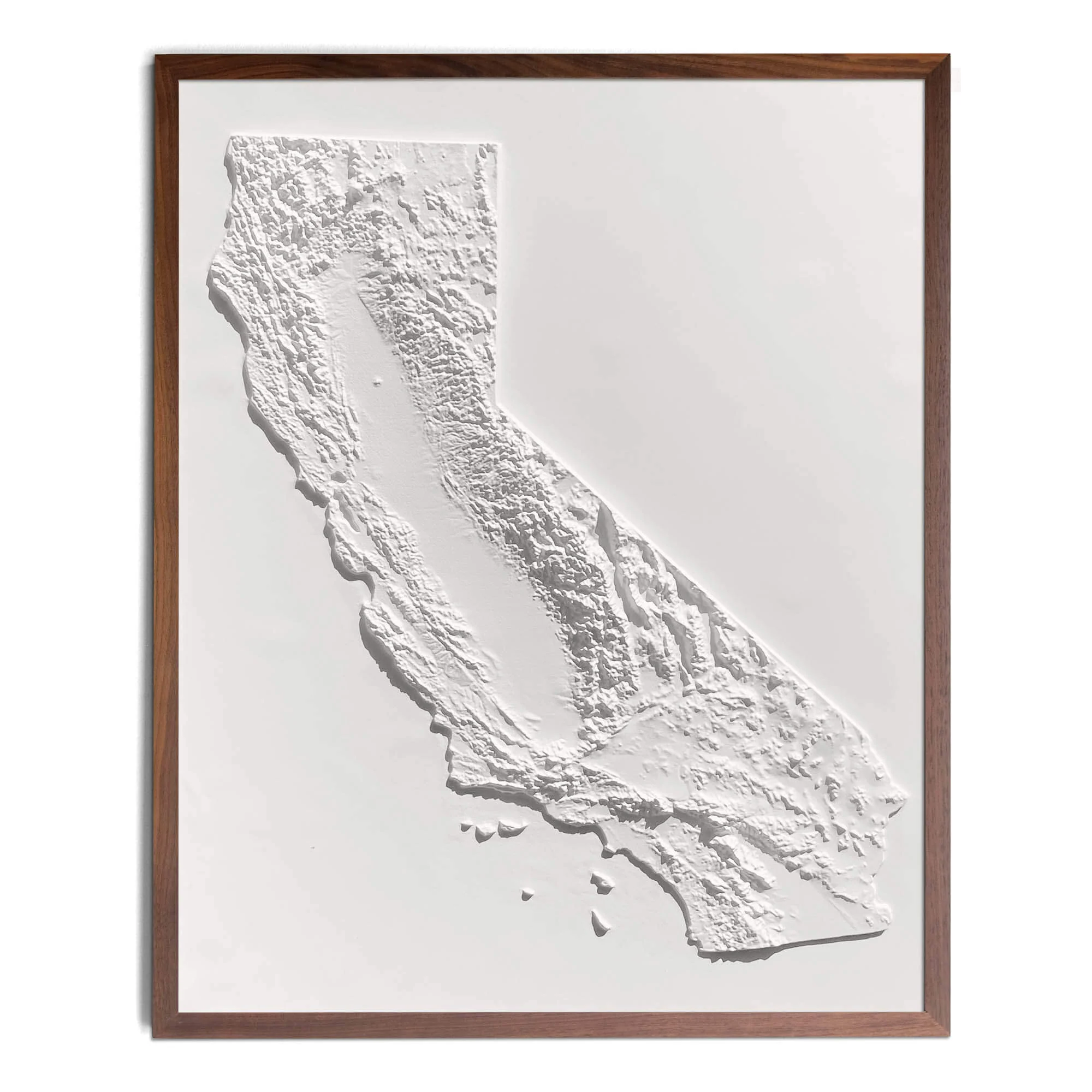
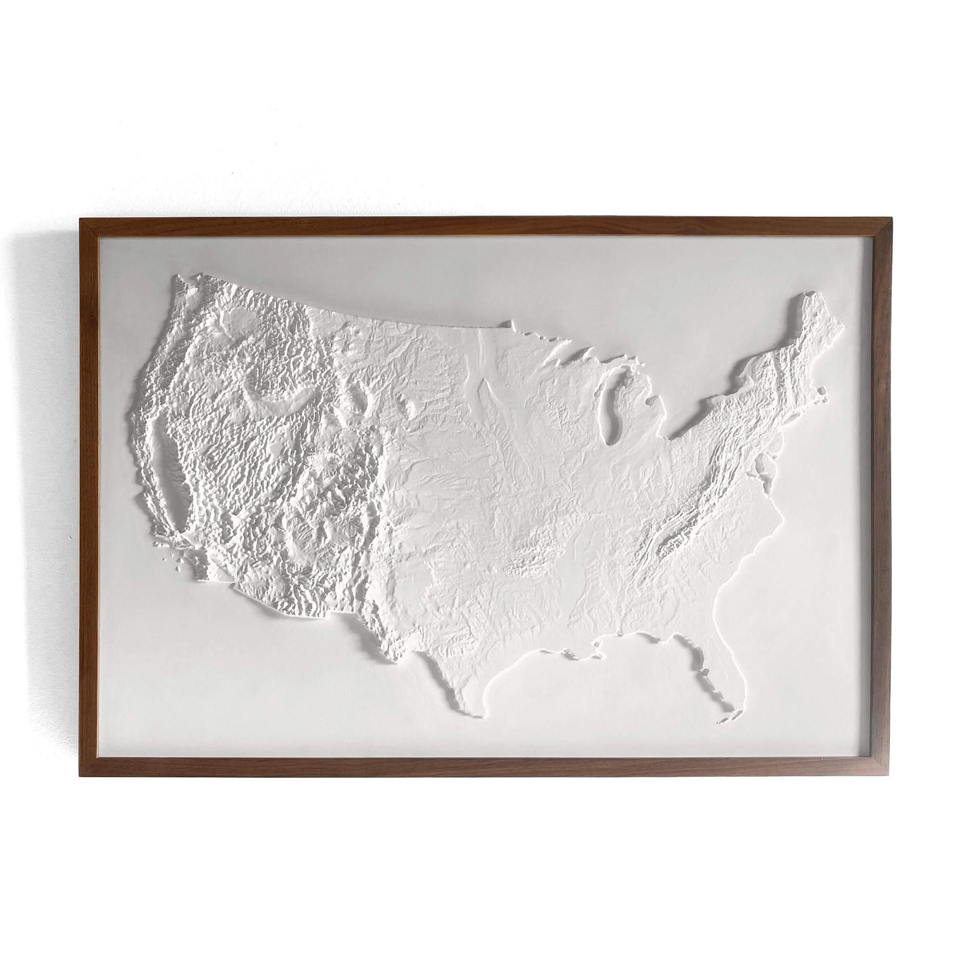
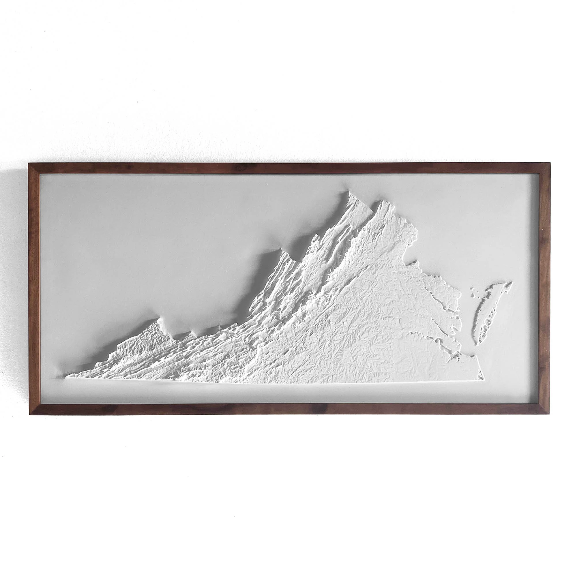
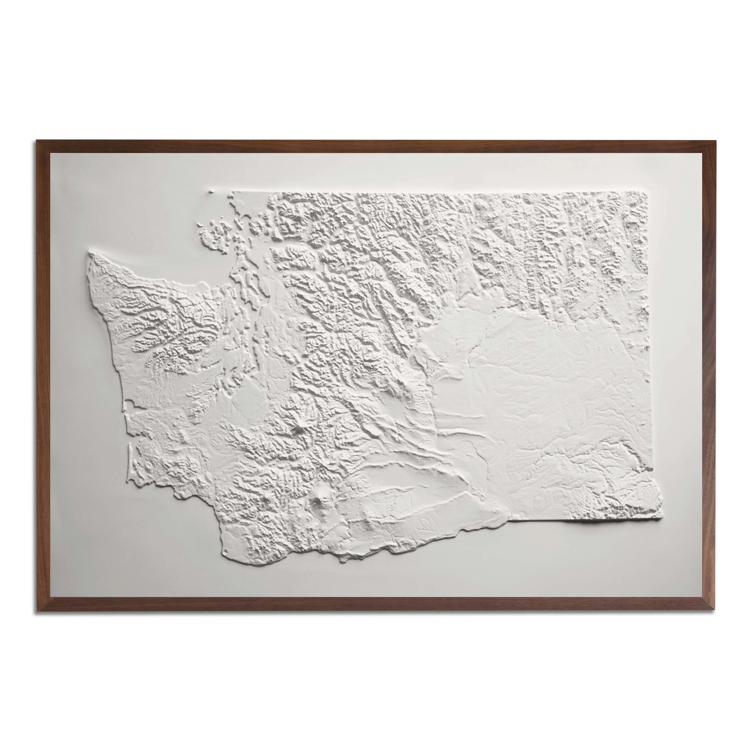
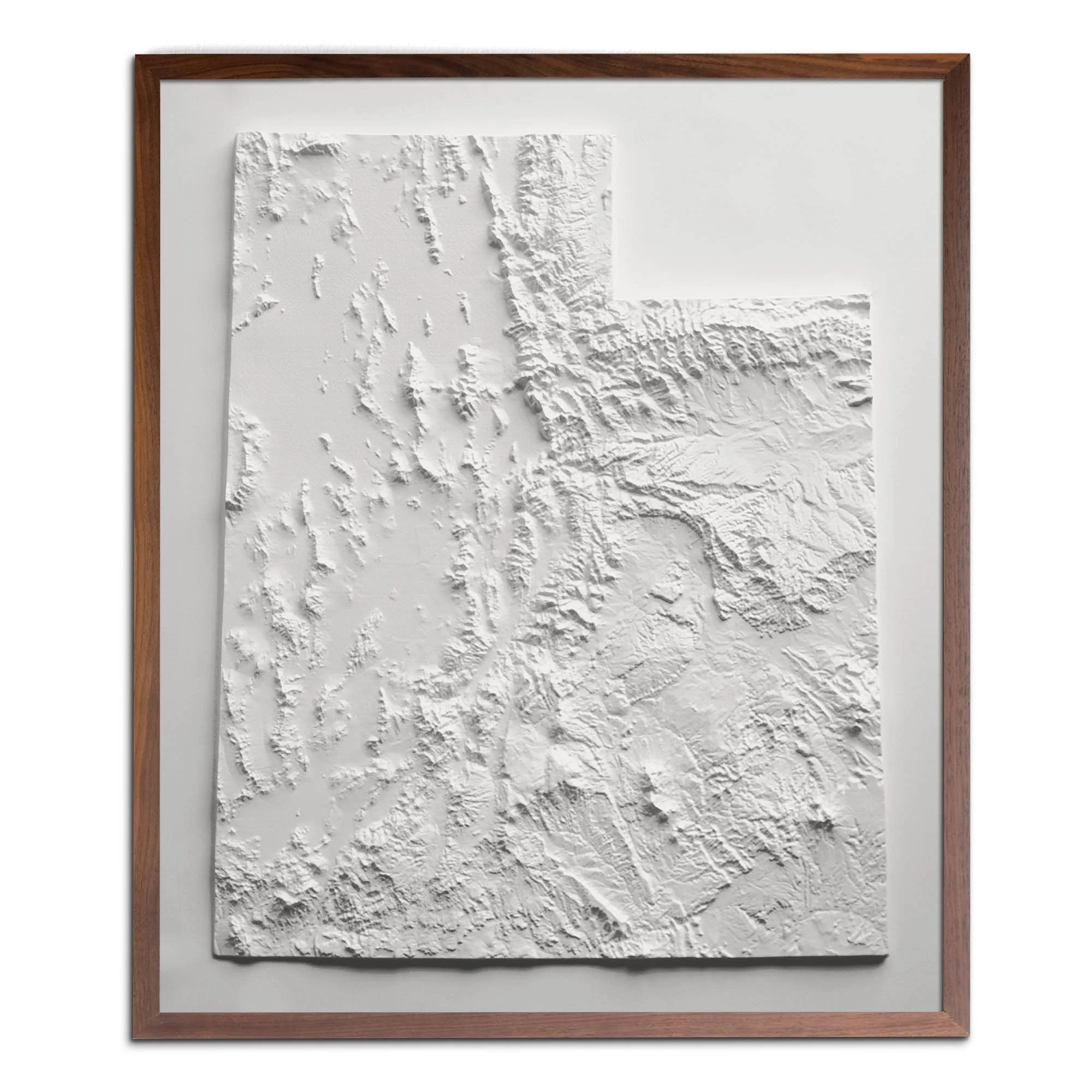
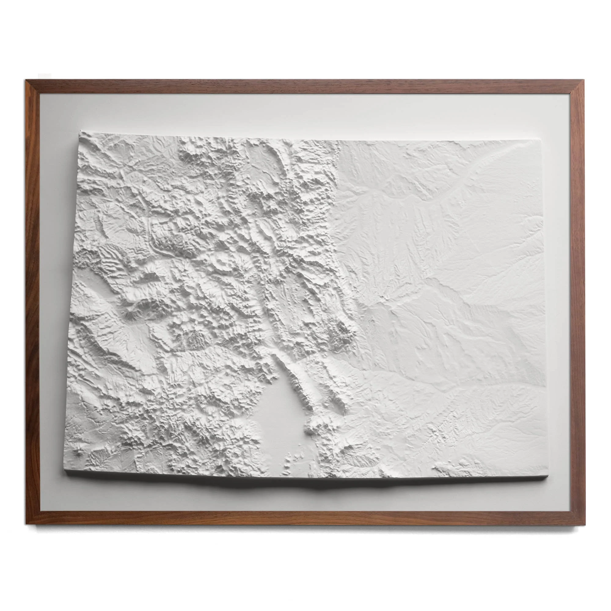
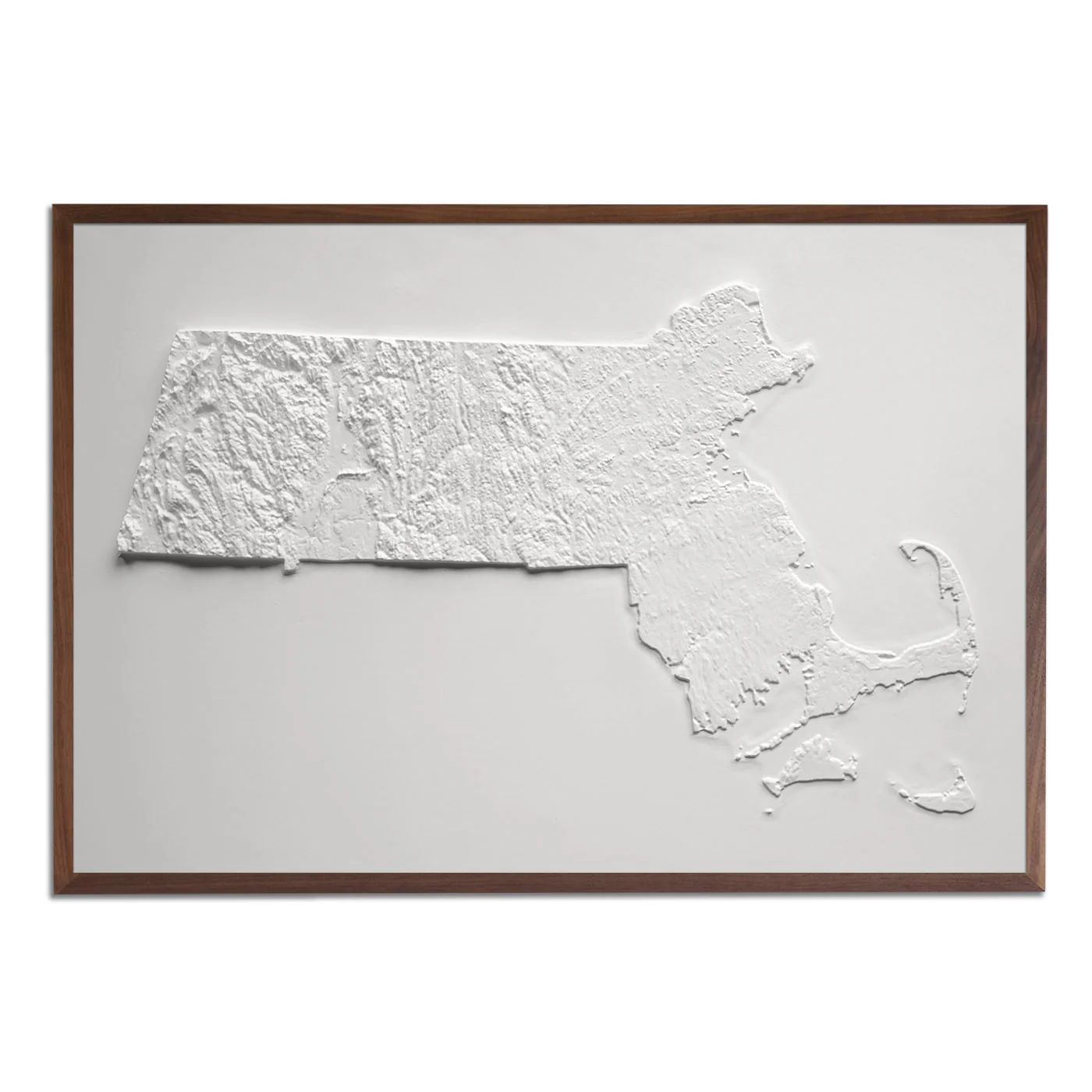
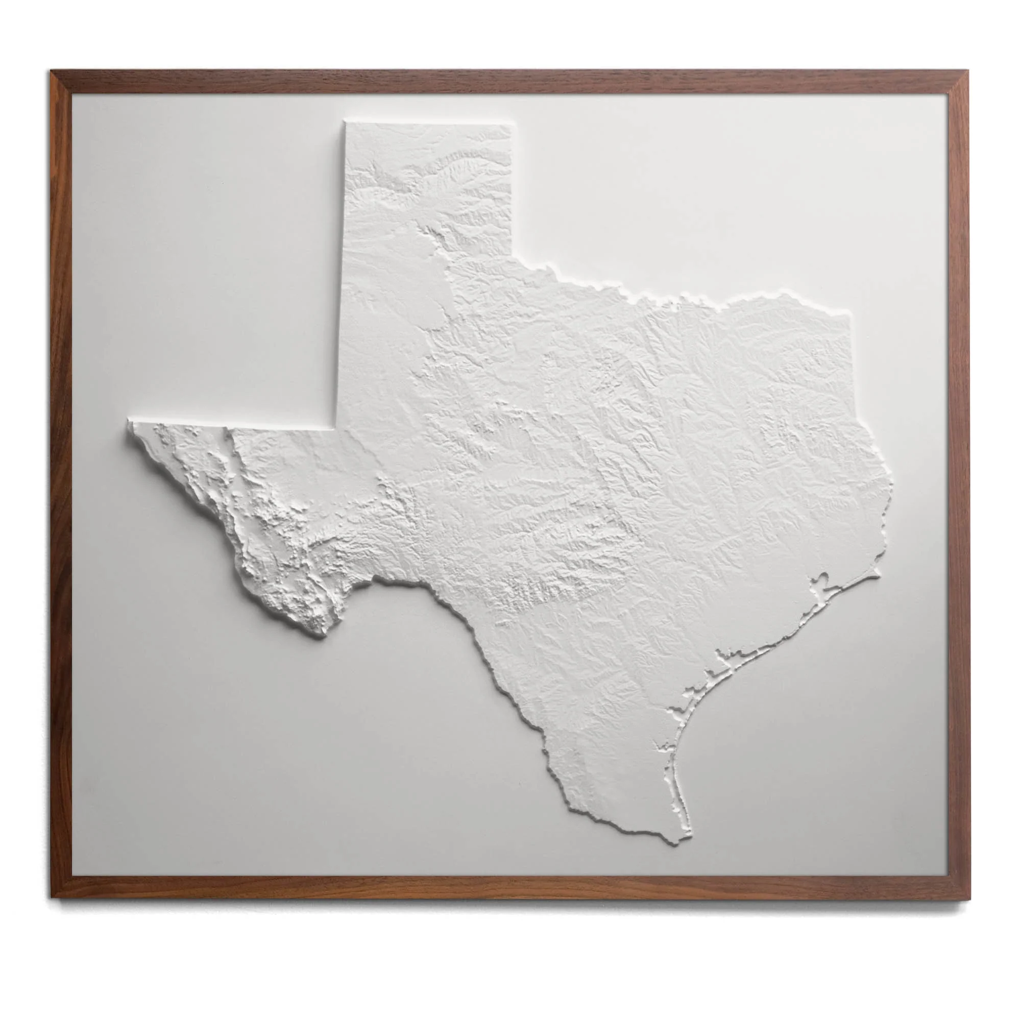
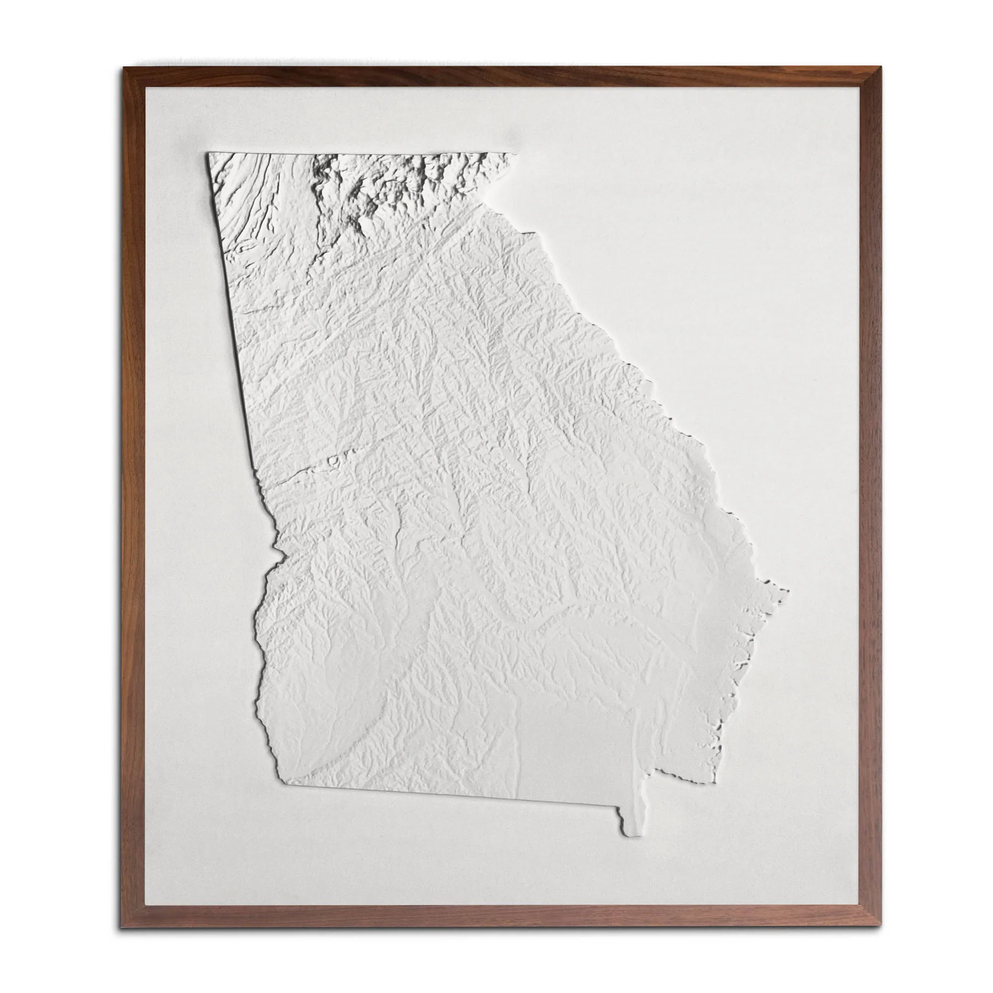
Real raised relief to explore through touch and feel.
- Size - unframed 24x28 inches
- Size - framed 25x29 inches
- Material - plastic mounted on foam board
- Handmade real Walnut frame available
- Individually made in our San Diego, CA shop
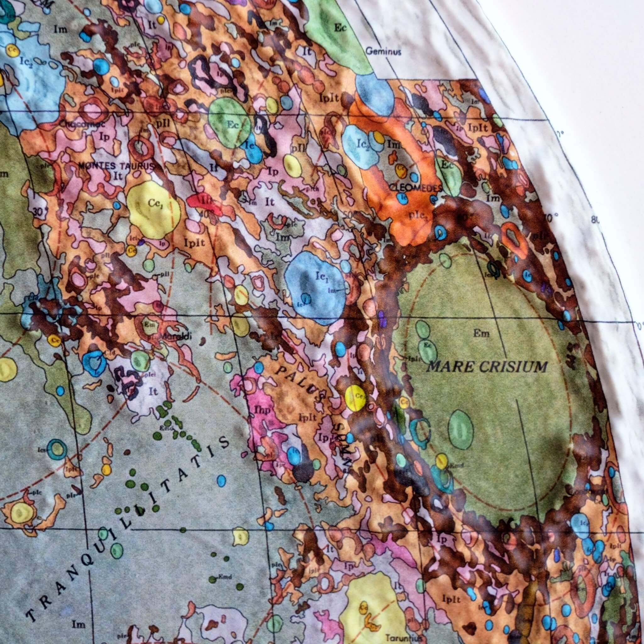
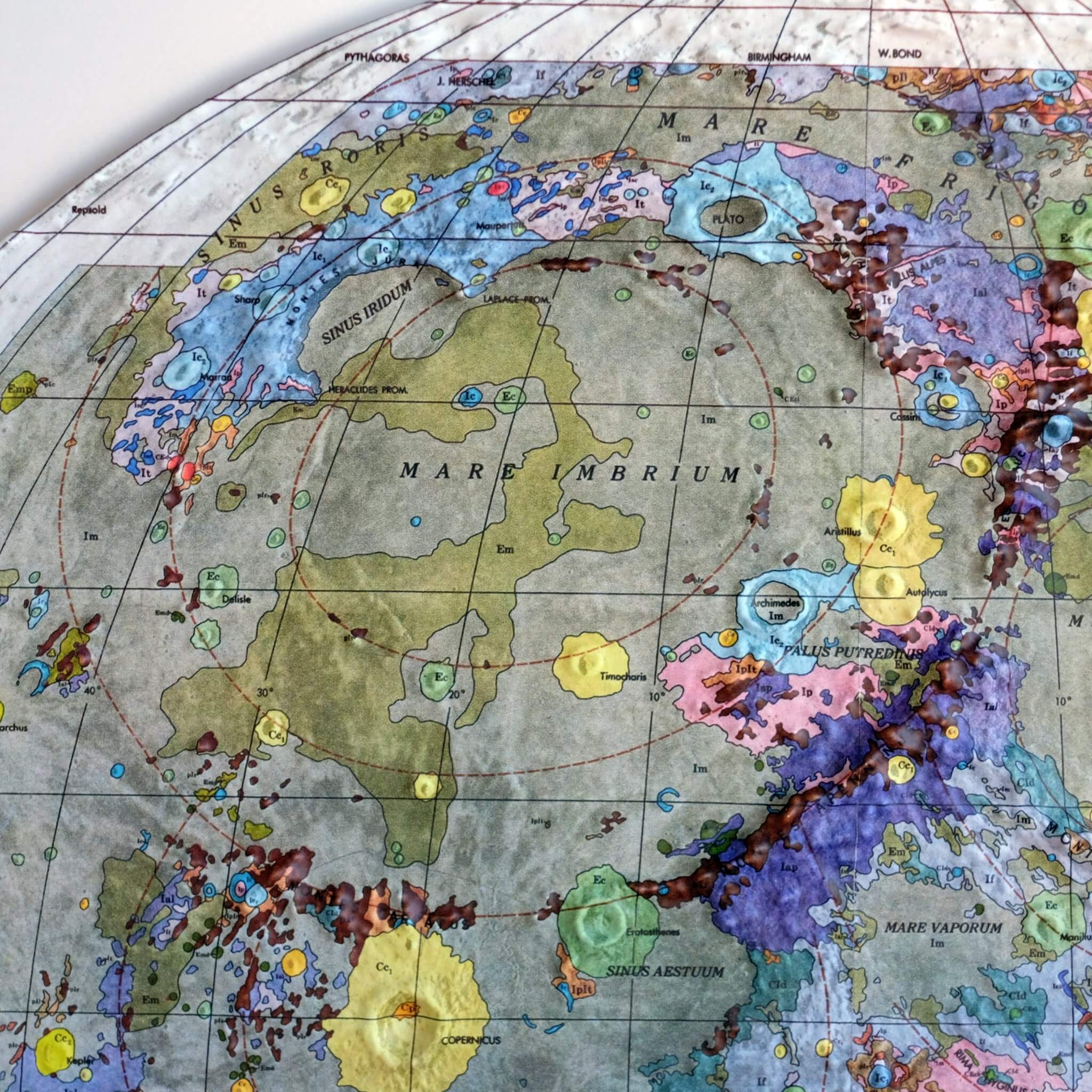
Our 3D Raised Relief Map of the Near Side of the Moon captivates with its geological details. The map was originally designed in 1971 was designed by Don Wilhelms and John McCauley. It was based both on results of the telescopic mapping program and on data from the unmanned lunar exploration program in the late 1960s, particularly the regional coverage of Lunar Orbiter IV. The color legend for the geological data is printed separately on flat paper and is included with this map.
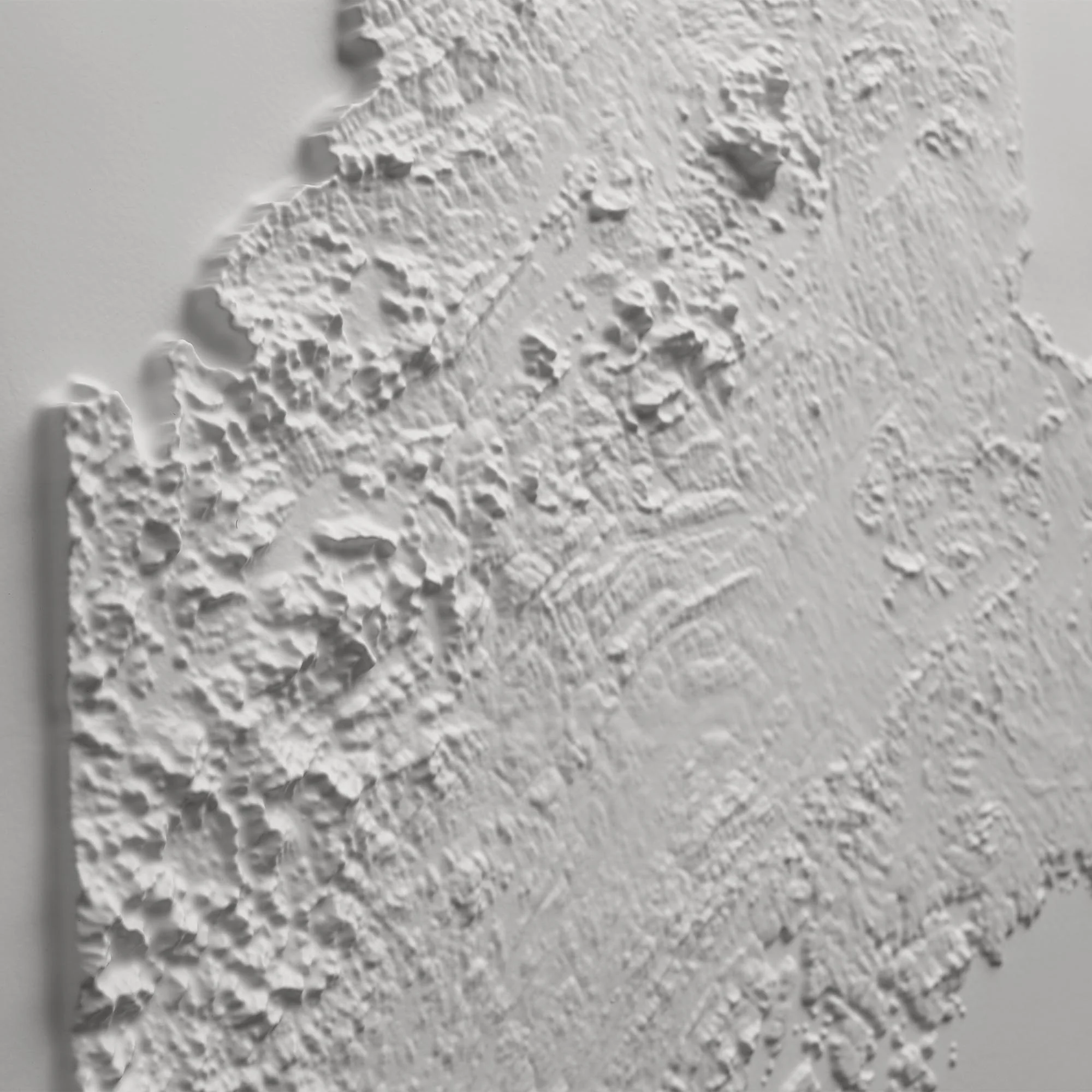
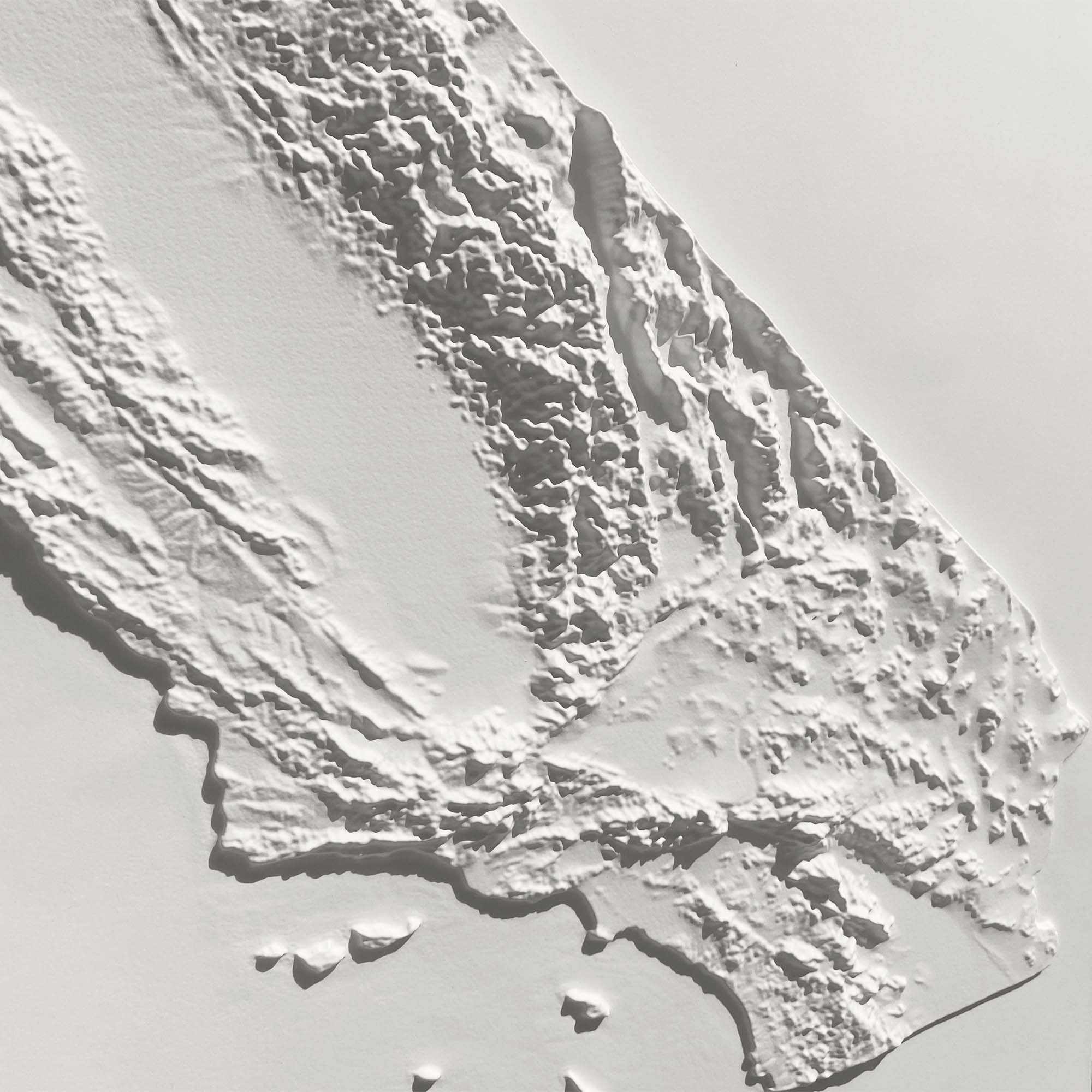
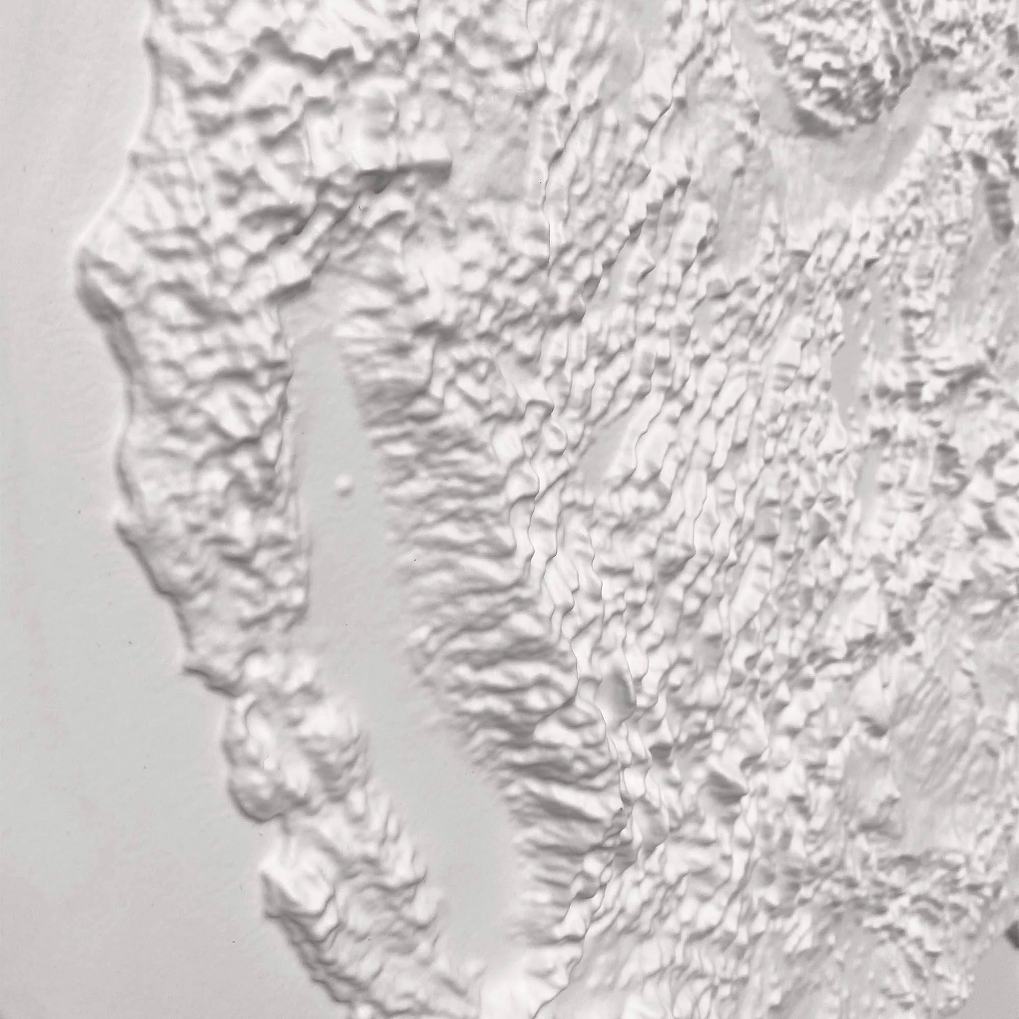
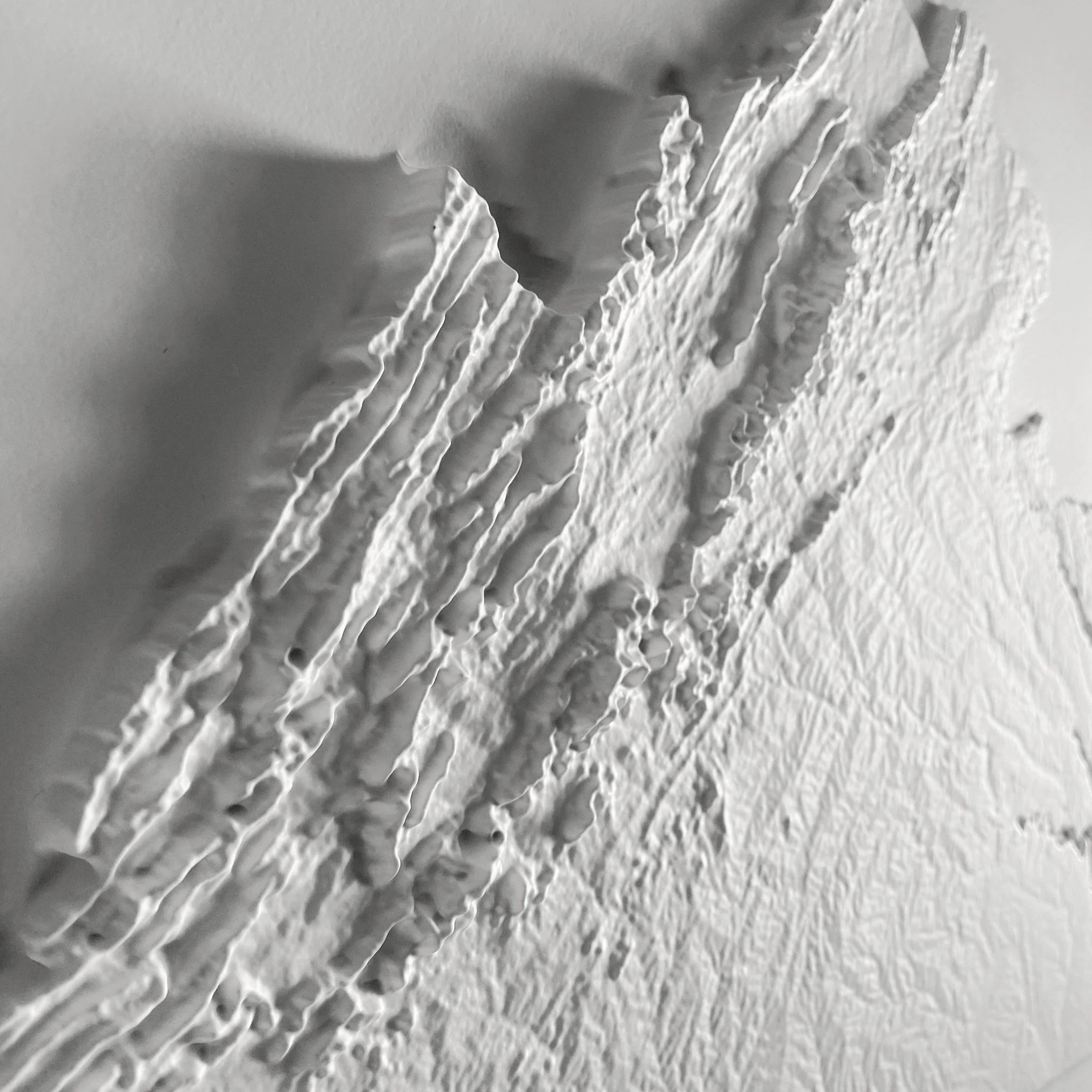
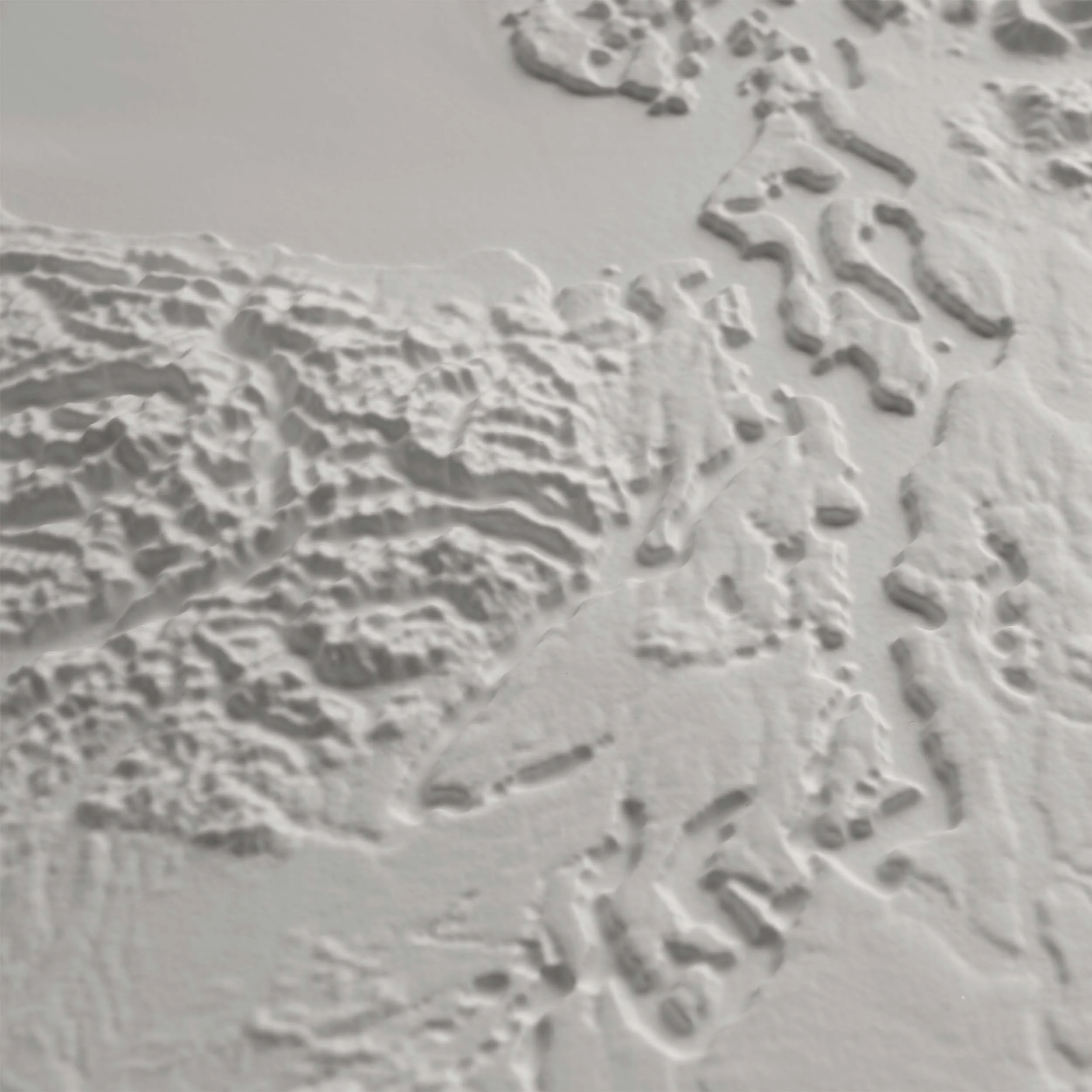
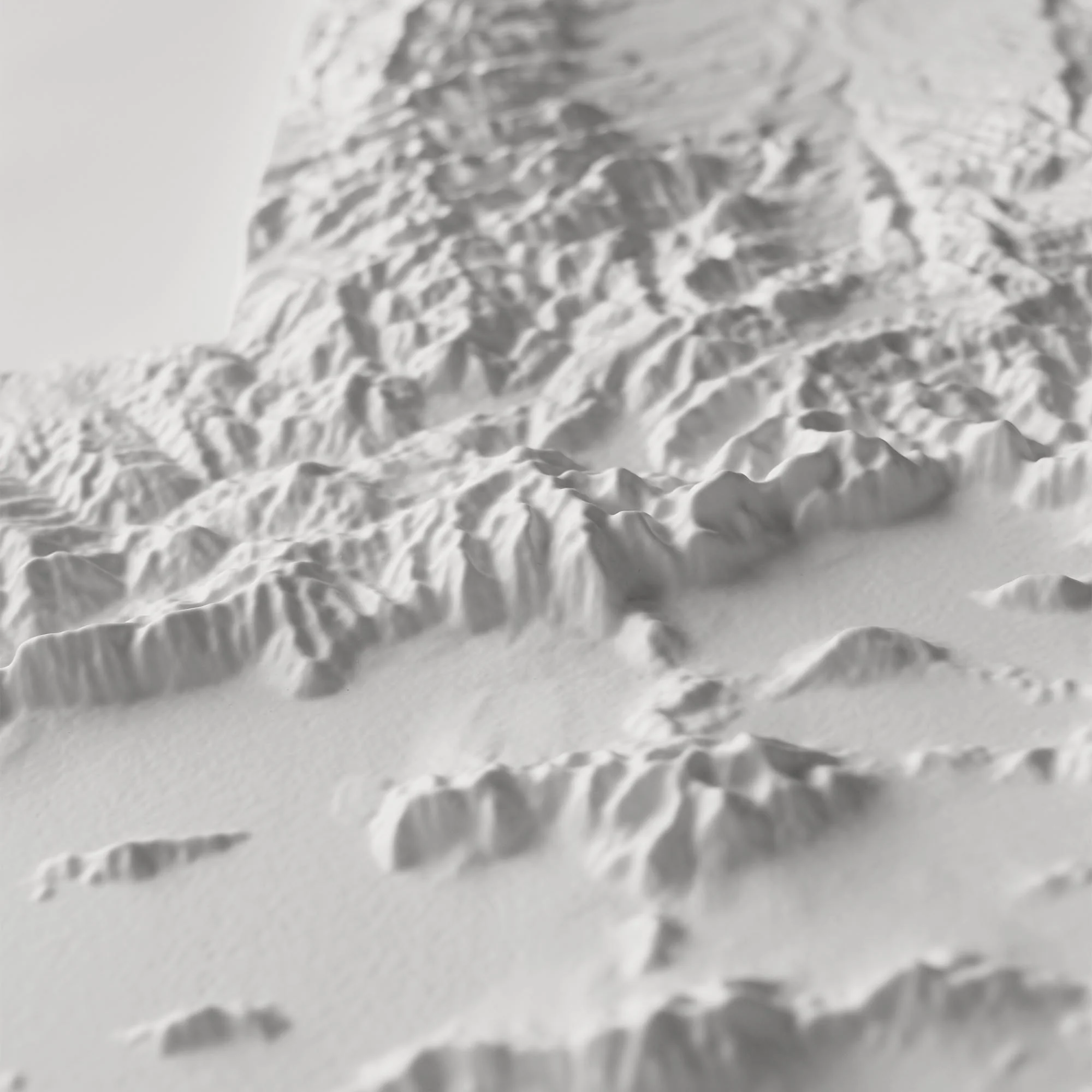
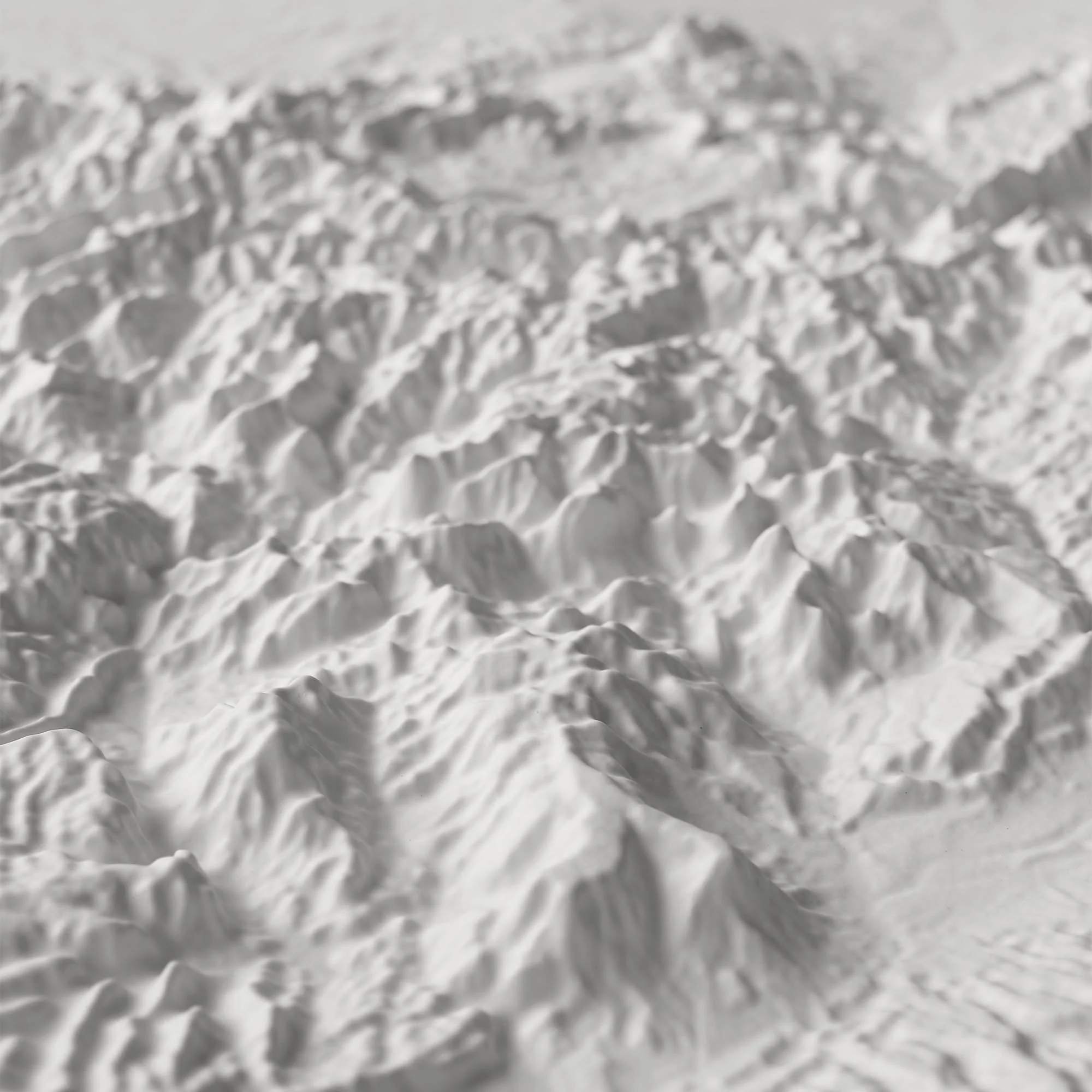
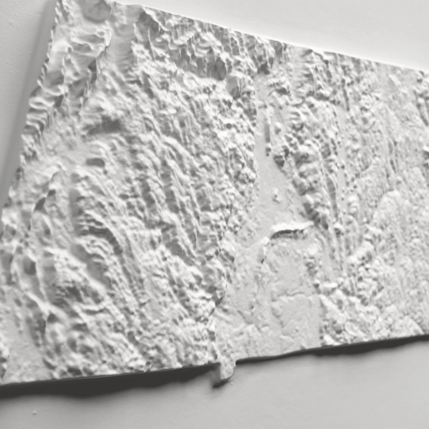
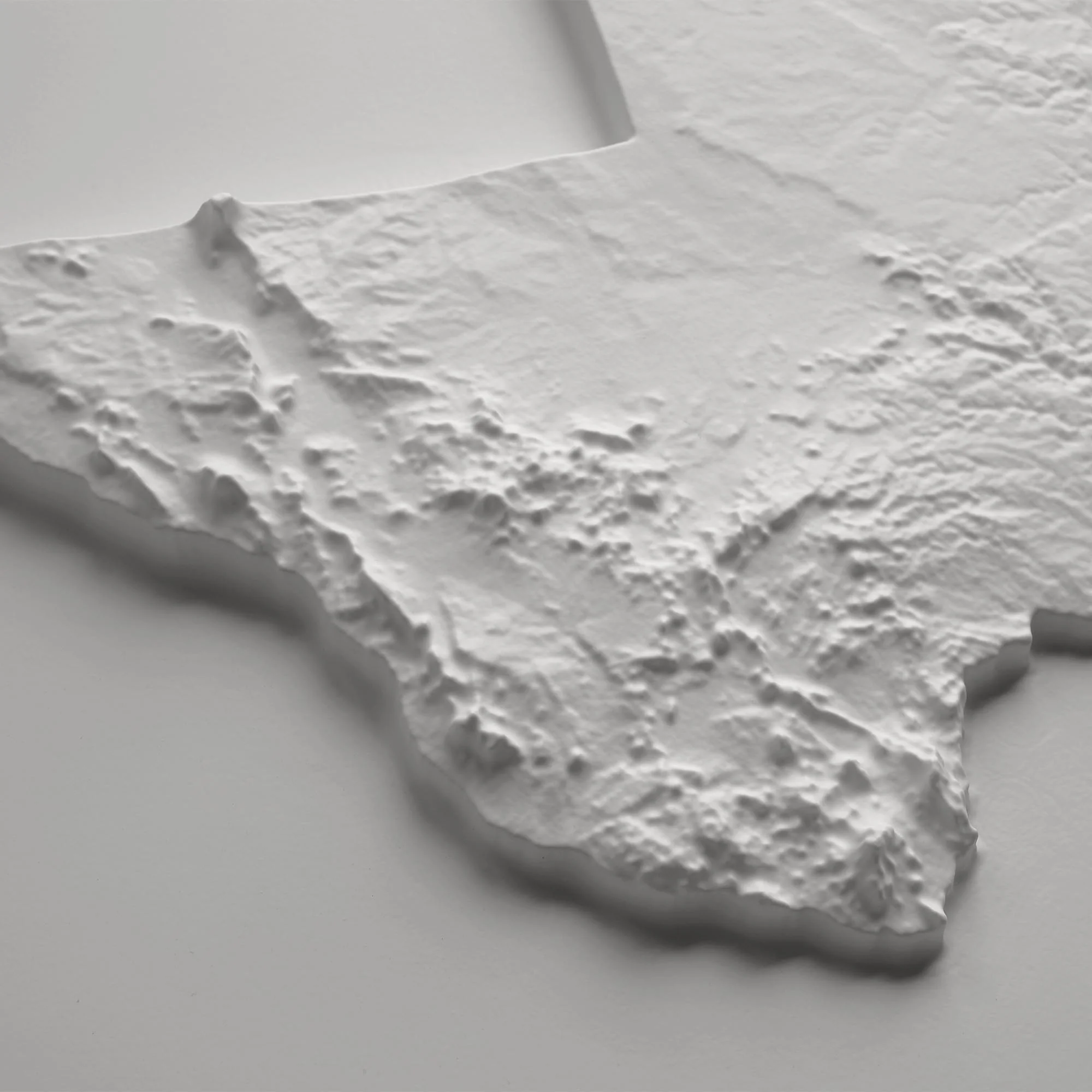
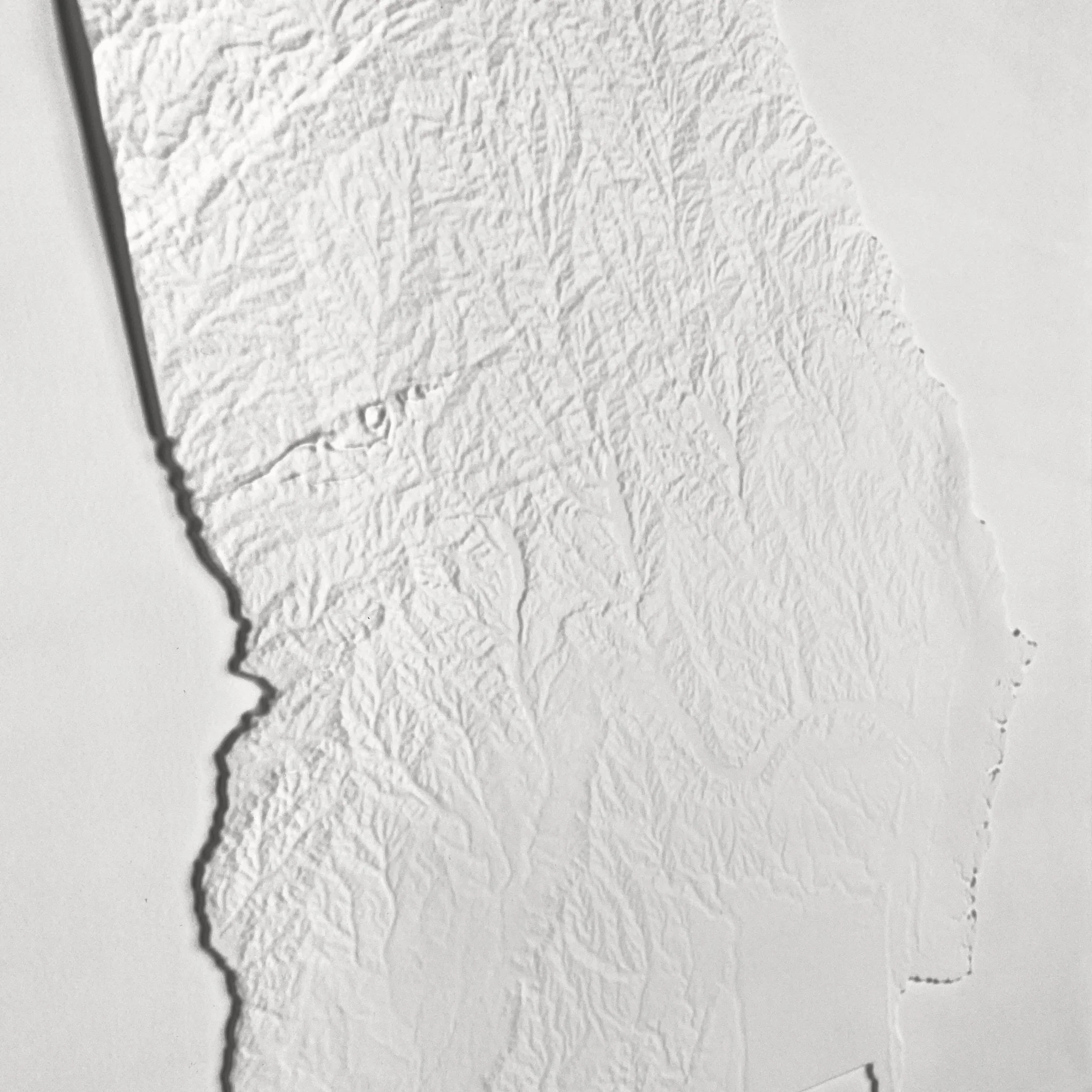
The map undergoes a meticulous process where it is printed, heated, and vacuum-formed over an intricately detailed 3D mold. The result is a unique map that allows you to visually and tactilely explore the Moon's terrain, from the small craters to the Mare Imbrium crater.
Framed maps do not have glass or acrylic over them, so you can touch the map and explore its intricacies.
PLEASE NOTE
You will love this map if you embrace its anomalies. When the plastic is heated and stretched over the 3D mold, the image may be altered, causing warped lines and text around higher elevations.
Product Information
Product Information
Shipping & Returns
Shipping & Returns


Moon Geological 3D Raised Relief Map
Moon Geological 3D Raised Relief Map
Real raised relief to explore through touch and feel.
- Size - unframed 24x28 inches
- Size - framed 25x29 inches
- Material - plastic mounted on foam board
- Handmade real Walnut frame available
- Individually made in our San Diego, CA shop
Our 3D Raised Relief Map of the Near Side of the Moon captivates with its geological details. The map was originally designed in 1971 was designed by Don Wilhelms and John McCauley. It was based both on results of the telescopic mapping program and on data from the unmanned lunar exploration program in the late 1960s, particularly the regional coverage of Lunar Orbiter IV. The color legend for the geological data is printed separately on flat paper and is included with this map.
The map undergoes a meticulous process where it is printed, heated, and vacuum-formed over an intricately detailed 3D mold. The result is a unique map that allows you to visually and tactilely explore the Moon's terrain, from the small craters to the Mare Imbrium crater.
Framed maps do not have glass or acrylic over them, so you can touch the map and explore its intricacies.
PLEASE NOTE
You will love this map if you embrace its anomalies. When the plastic is heated and stretched over the 3D mold, the image may be altered, causing warped lines and text around higher elevations.
Original: $1,337.00
-70%$1,337.00
$401.10Product Information
Product Information
Shipping & Returns
Shipping & Returns
Description
Real raised relief to explore through touch and feel.
- Size - unframed 24x28 inches
- Size - framed 25x29 inches
- Material - plastic mounted on foam board
- Handmade real Walnut frame available
- Individually made in our San Diego, CA shop
Our 3D Raised Relief Map of the Near Side of the Moon captivates with its geological details. The map was originally designed in 1971 was designed by Don Wilhelms and John McCauley. It was based both on results of the telescopic mapping program and on data from the unmanned lunar exploration program in the late 1960s, particularly the regional coverage of Lunar Orbiter IV. The color legend for the geological data is printed separately on flat paper and is included with this map.
The map undergoes a meticulous process where it is printed, heated, and vacuum-formed over an intricately detailed 3D mold. The result is a unique map that allows you to visually and tactilely explore the Moon's terrain, from the small craters to the Mare Imbrium crater.
Framed maps do not have glass or acrylic over them, so you can touch the map and explore its intricacies.
PLEASE NOTE
You will love this map if you embrace its anomalies. When the plastic is heated and stretched over the 3D mold, the image may be altered, causing warped lines and text around higher elevations.