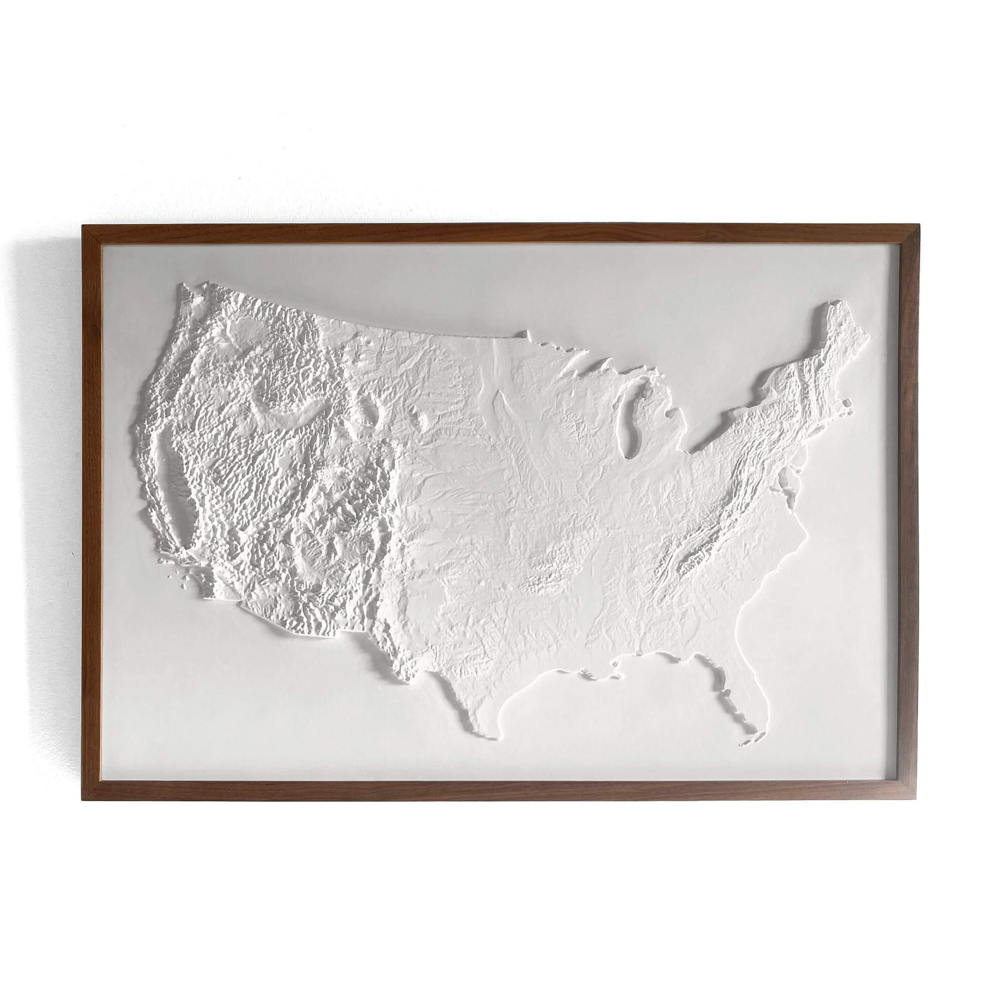
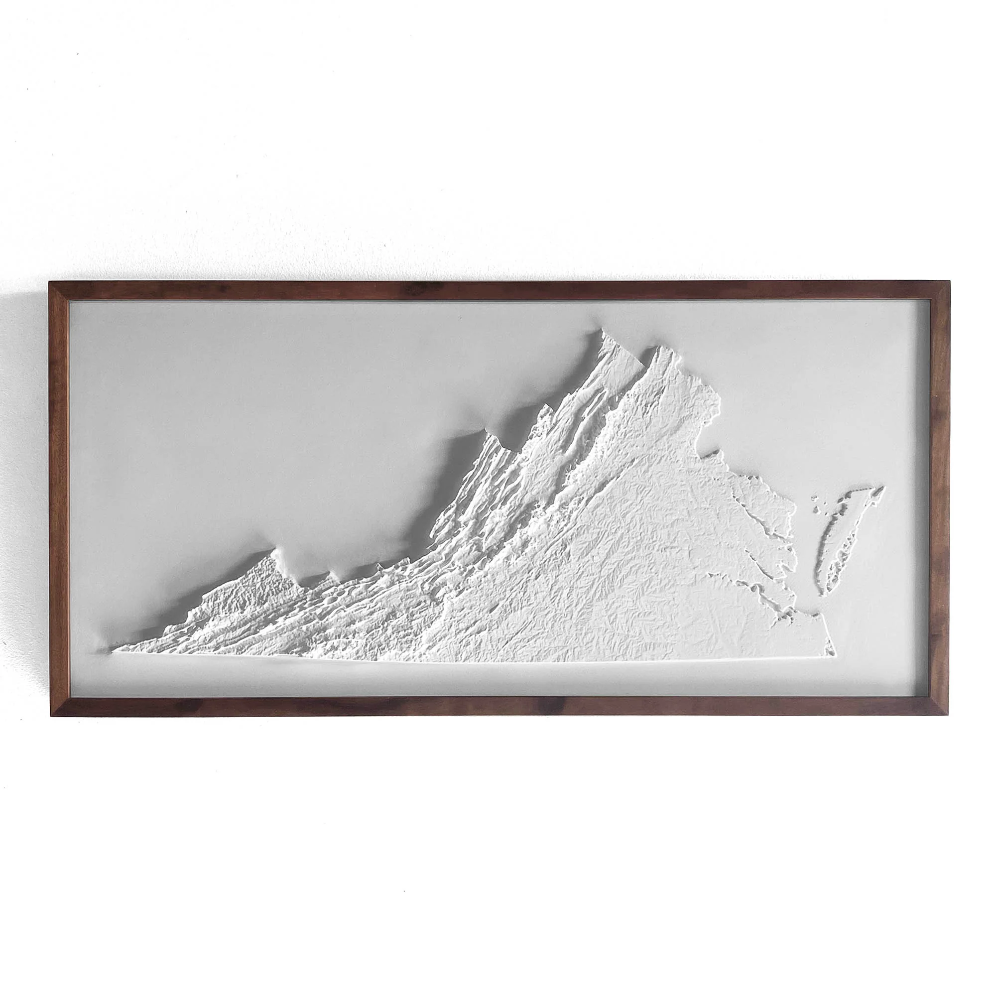
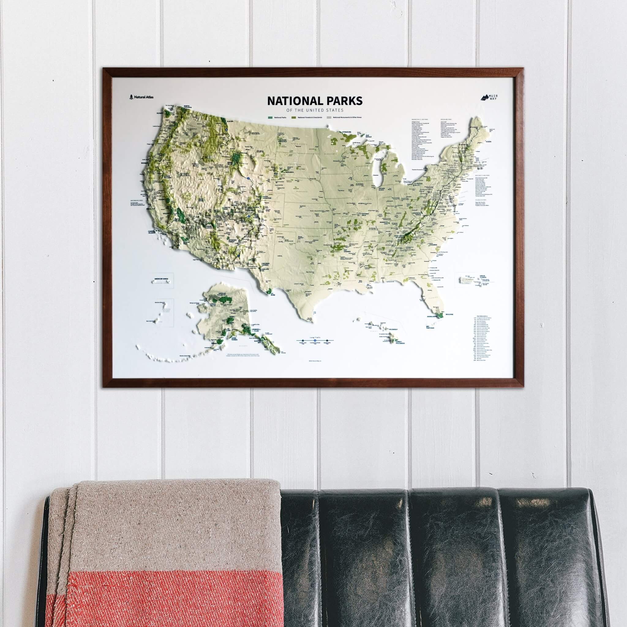
USA National Parks 3D Raised Relief Map
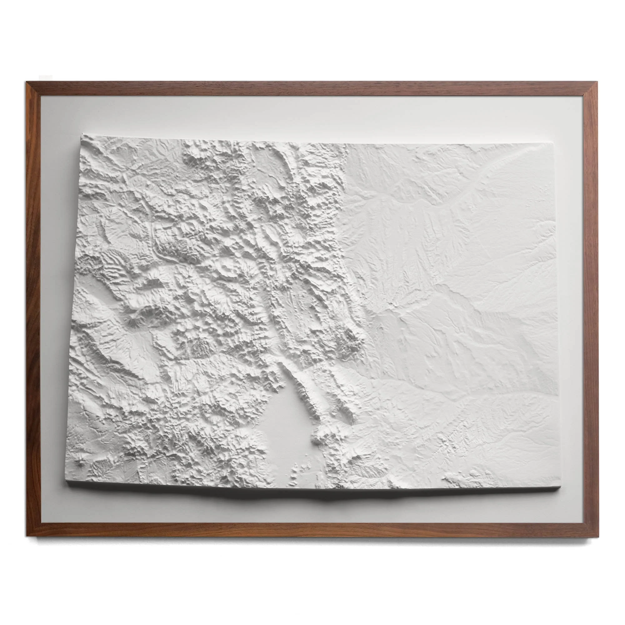
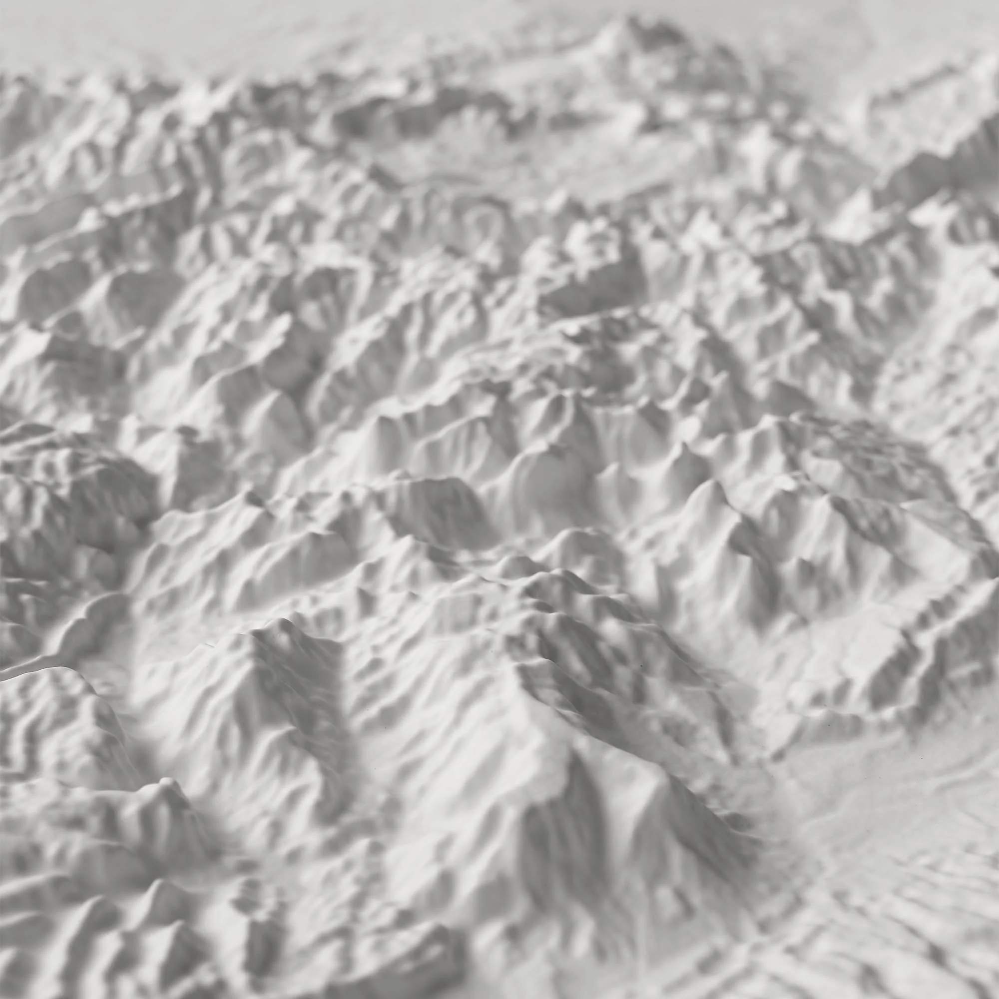
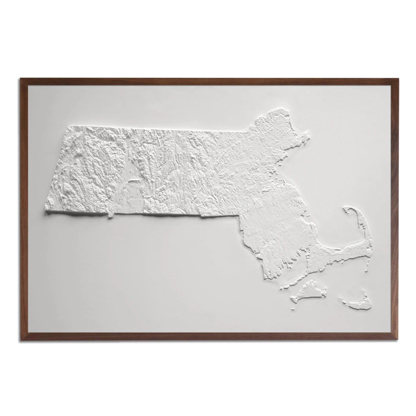
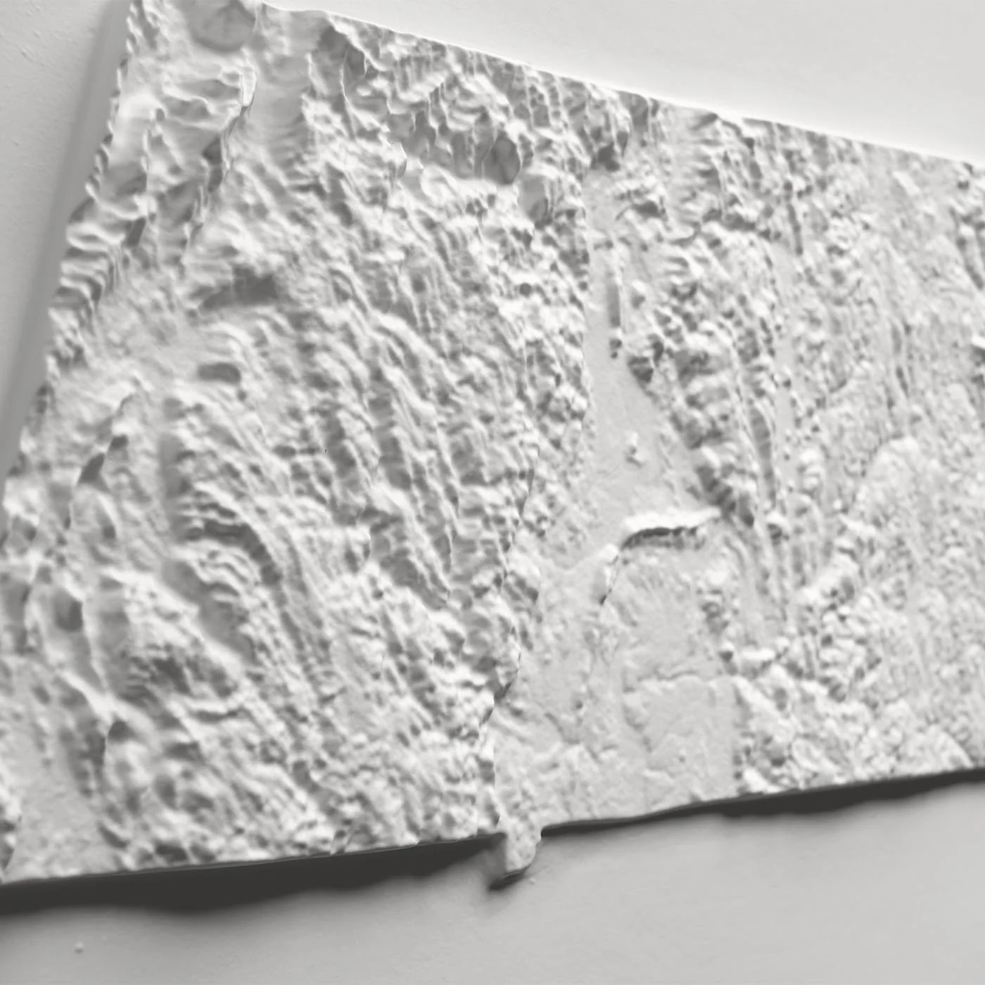
3D Real raised relief to explore through touch and feel.
- Perfect as a Push Pin map
- Size - unframed 32x24 inches
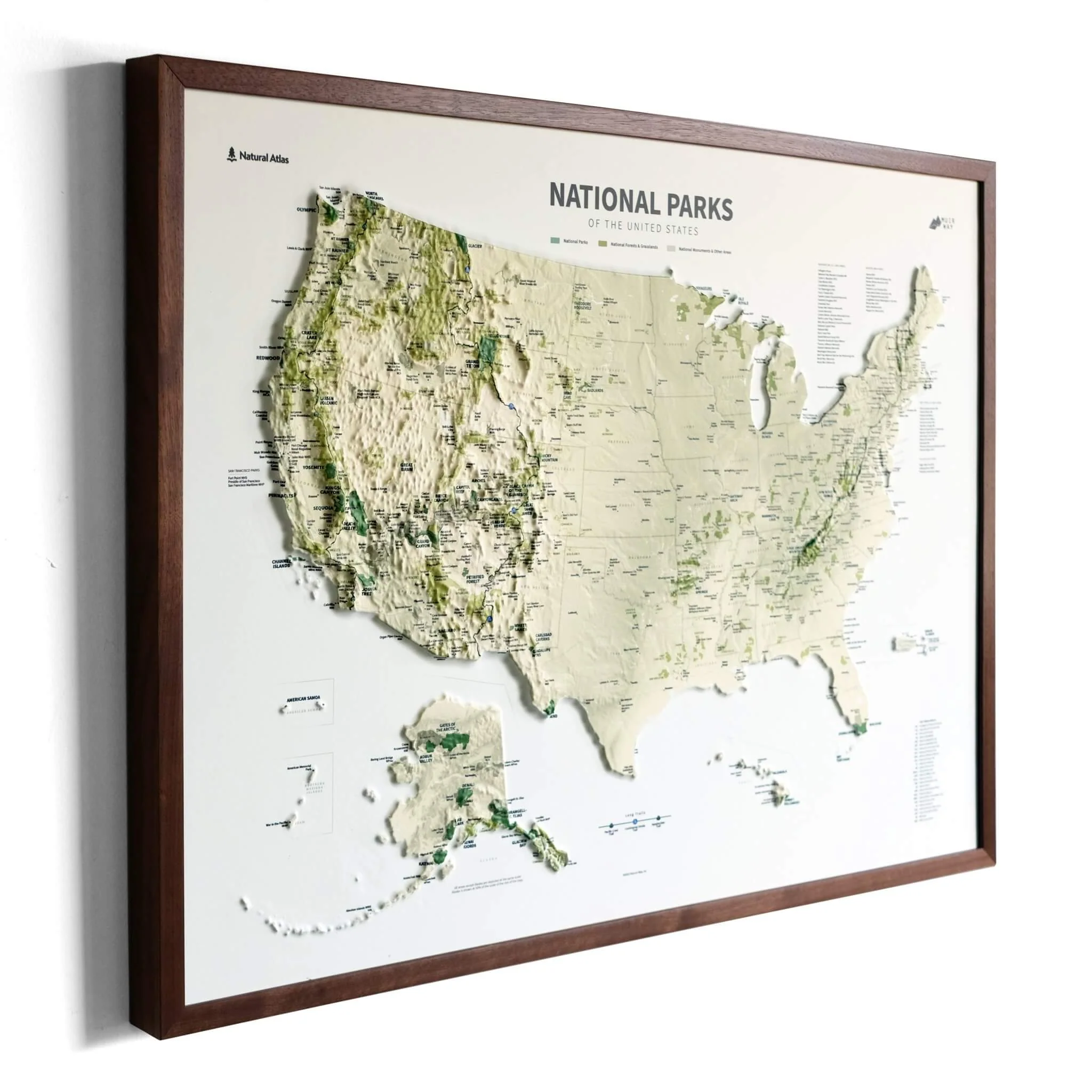
- Size - framed 33x25 inches
- Material - plastic mounted on foamboard
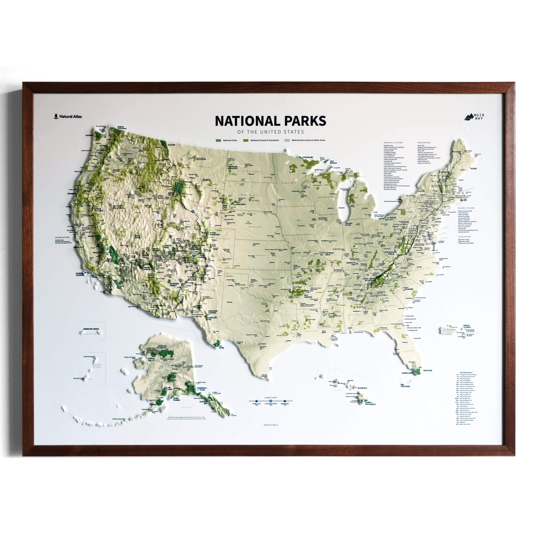
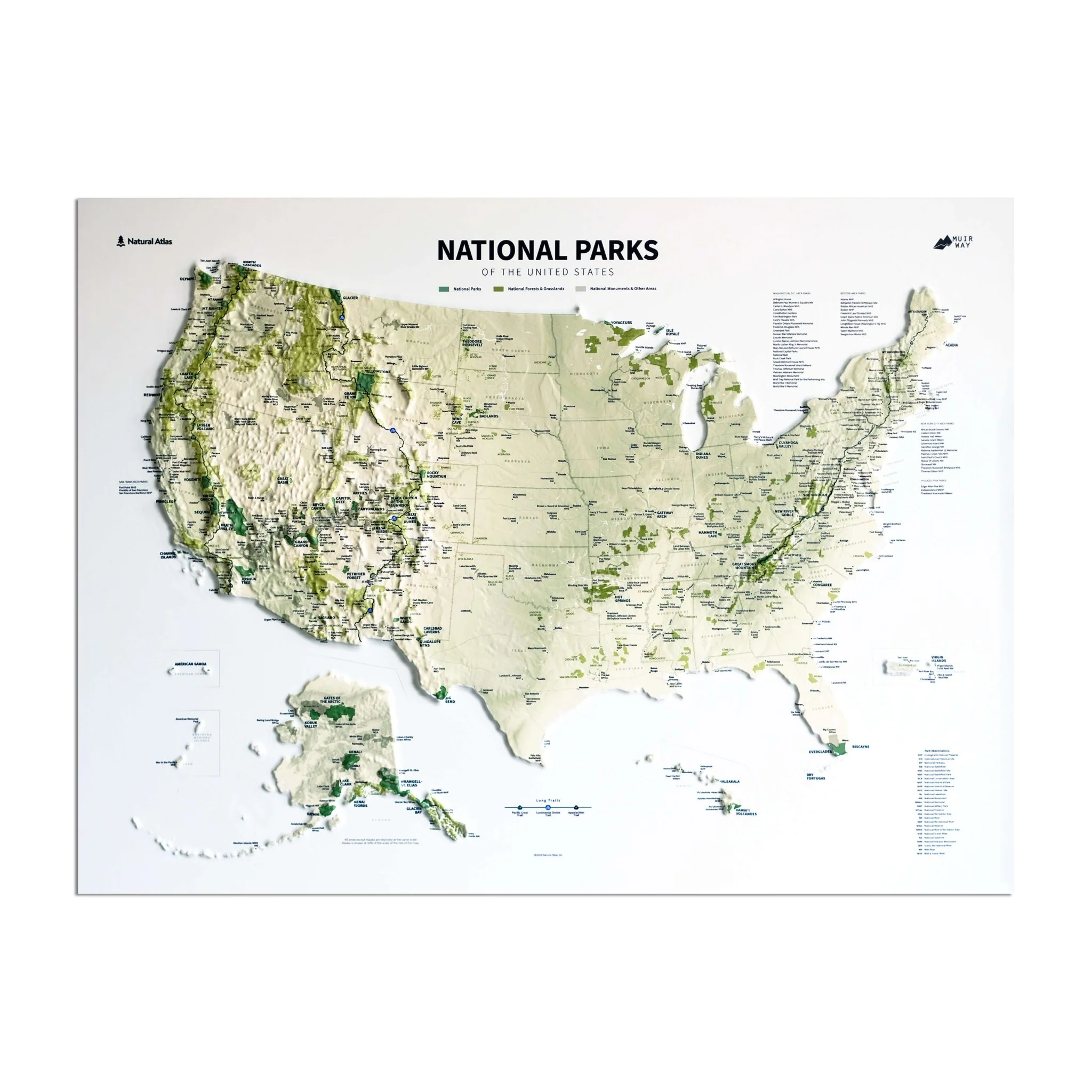
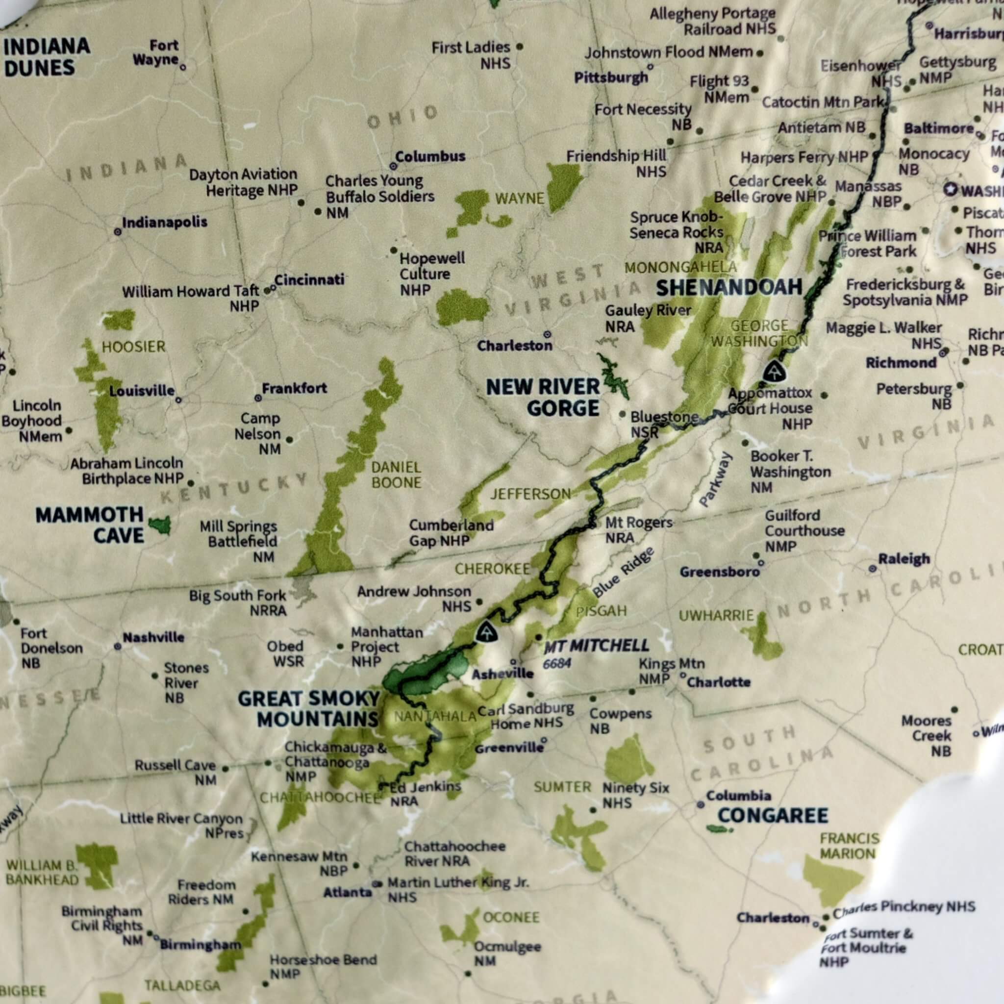
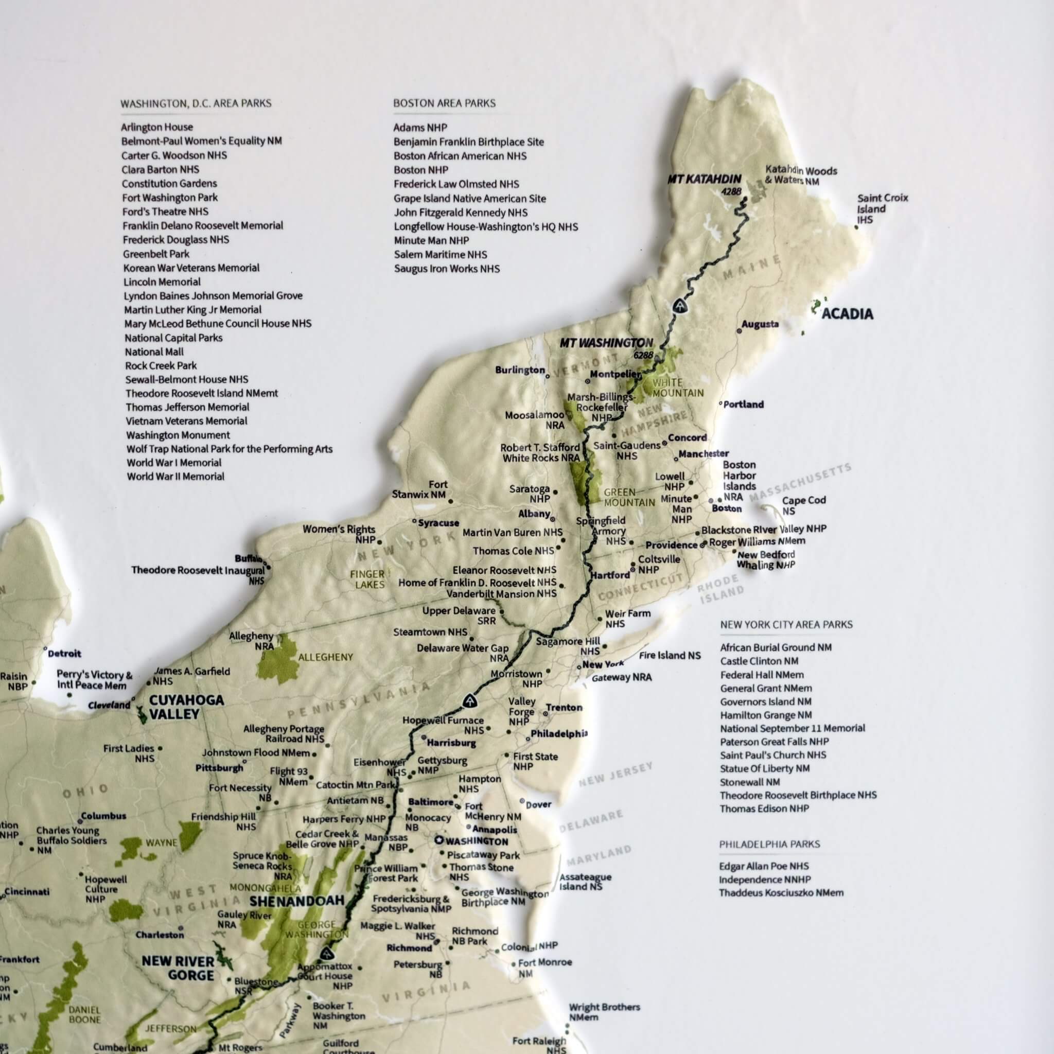
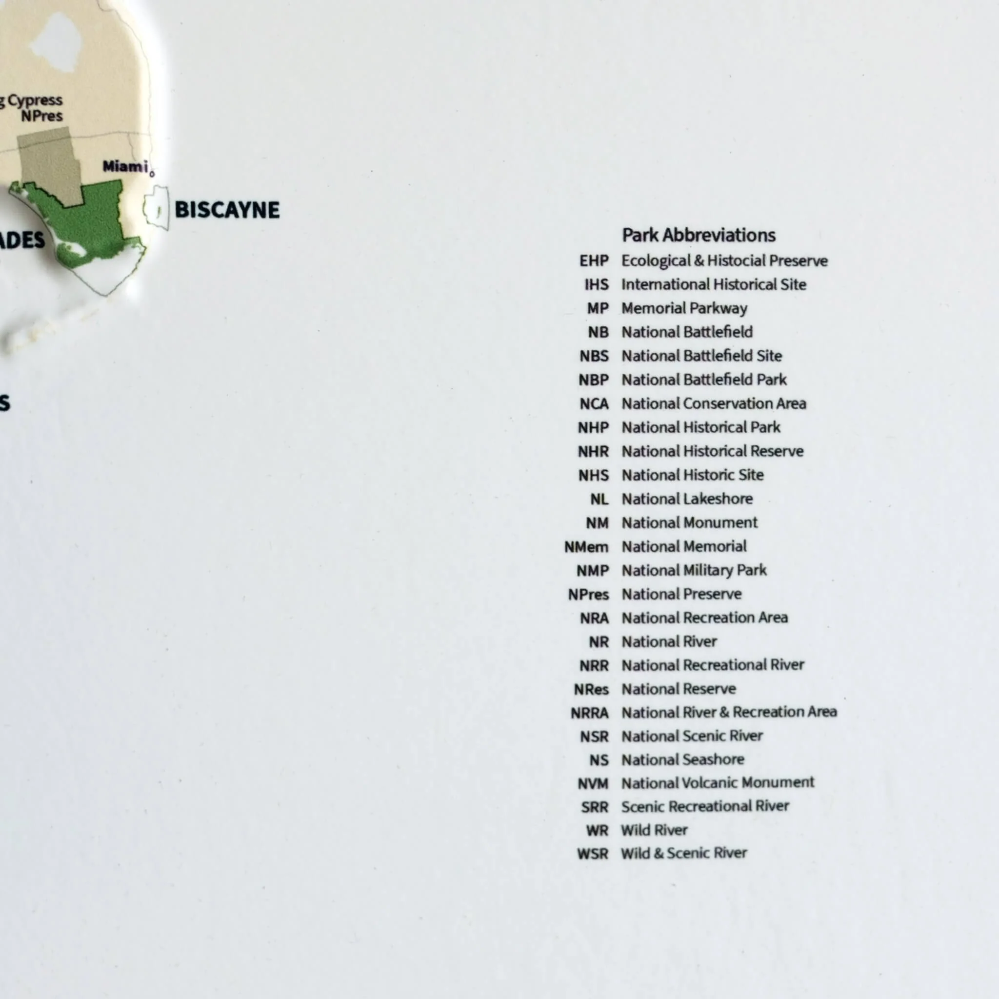
- Every park in the National Park system (National Parks, Monuments, Seashore, Historical, River, Battlefield, etc.)
- Triple Crown of Hiking (Pacific Crest Trail, Continental Divide Trail, and Appalachian Trail)
- Every National Forest and Grassland
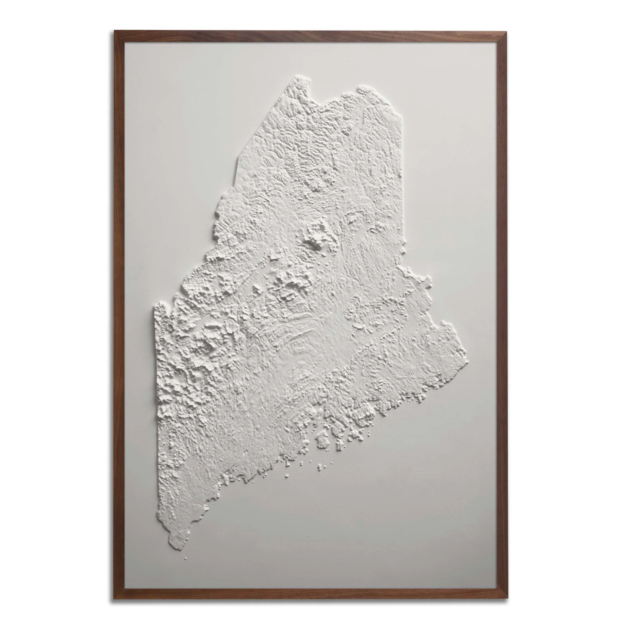
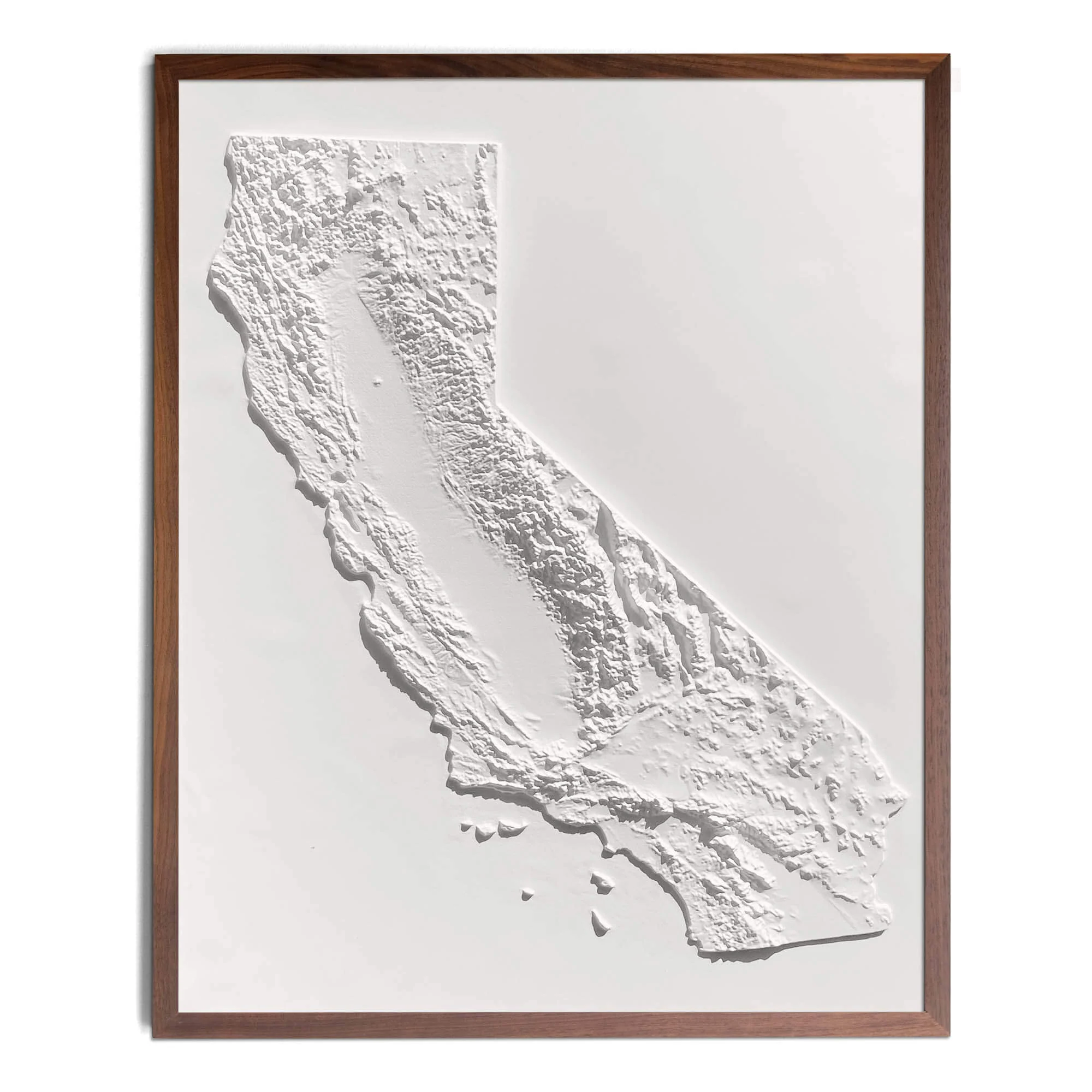
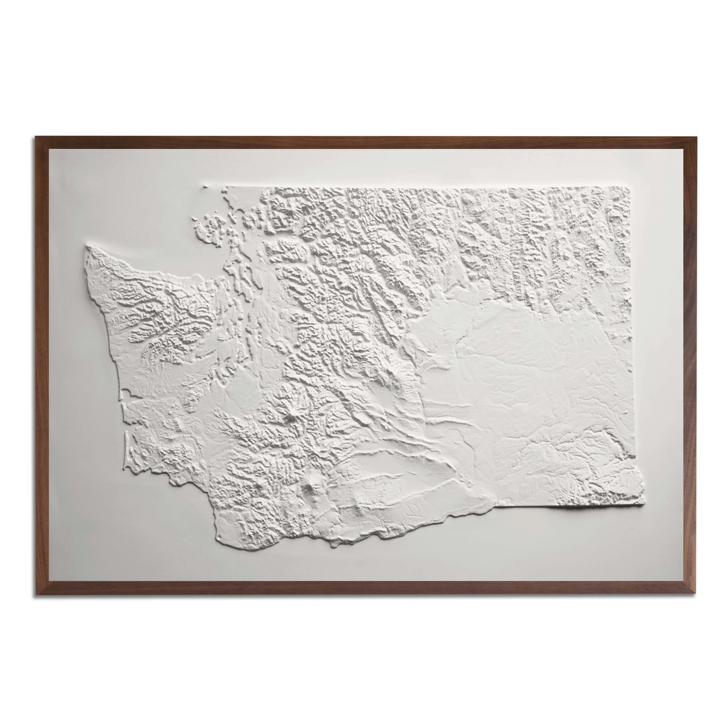
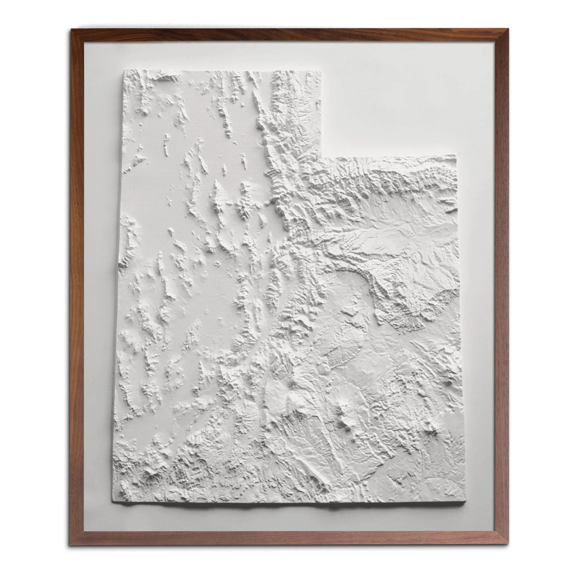
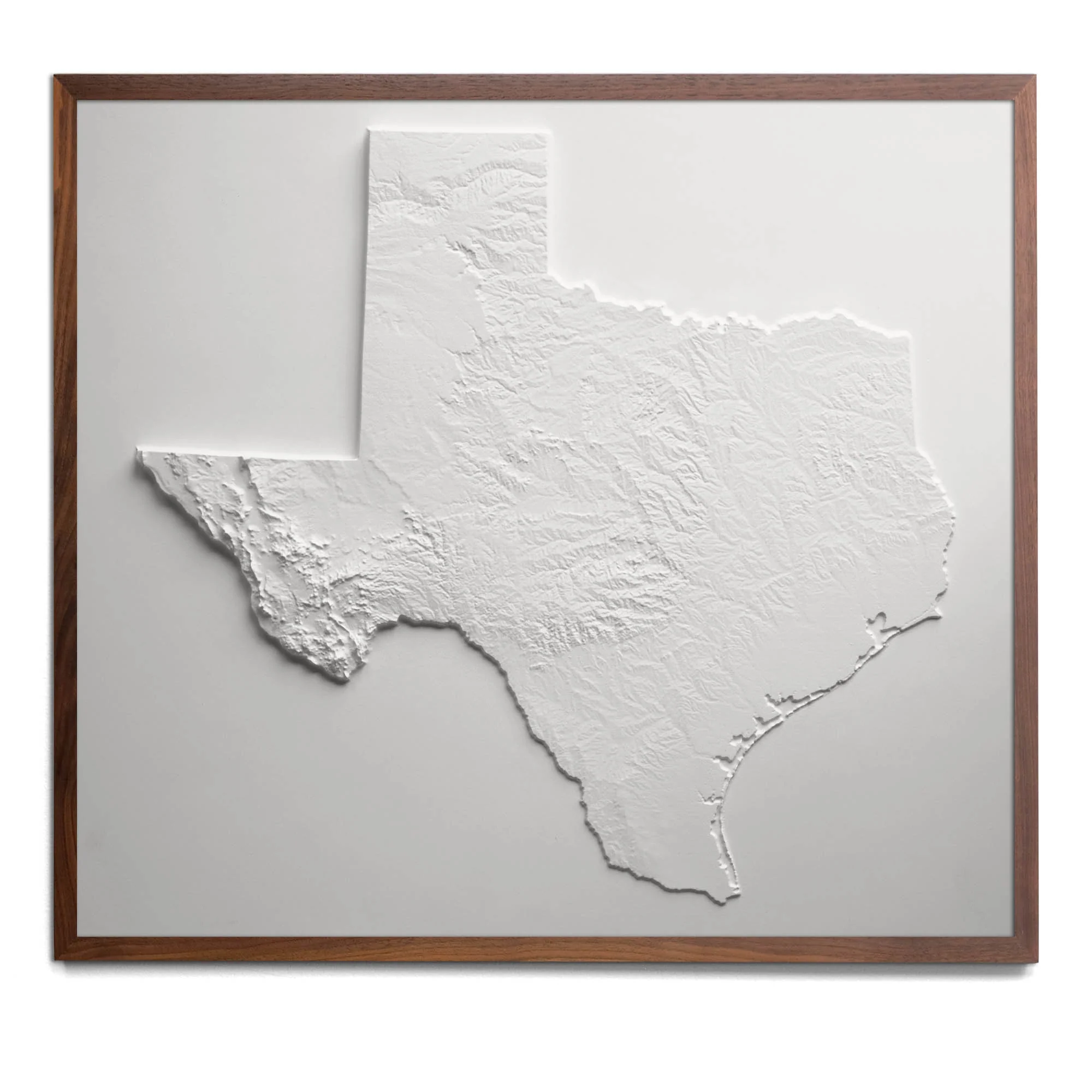
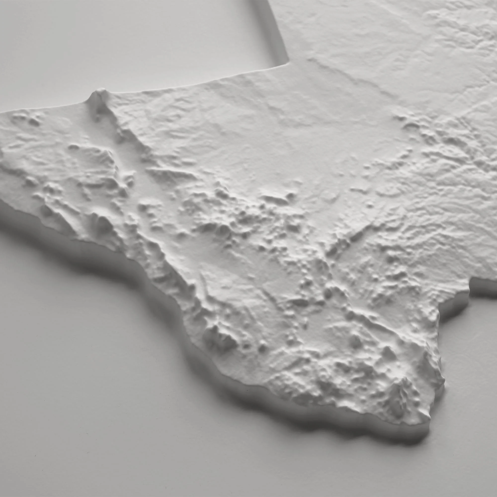
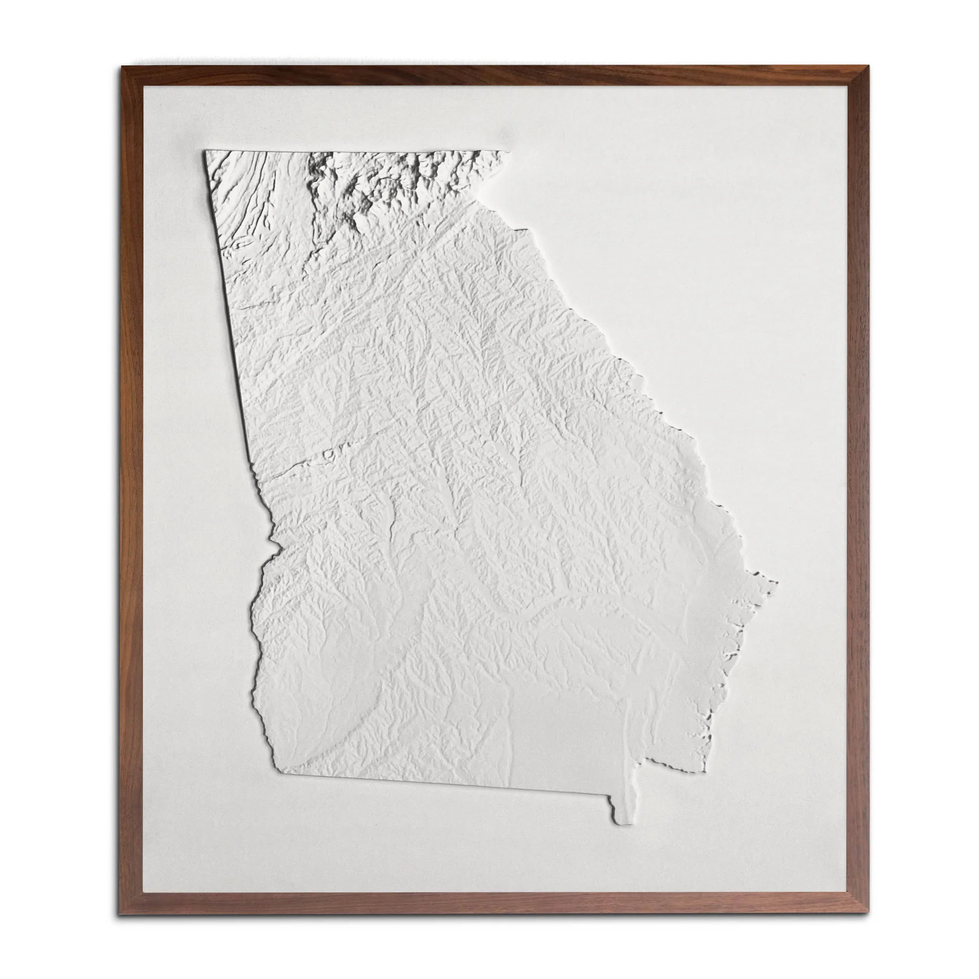
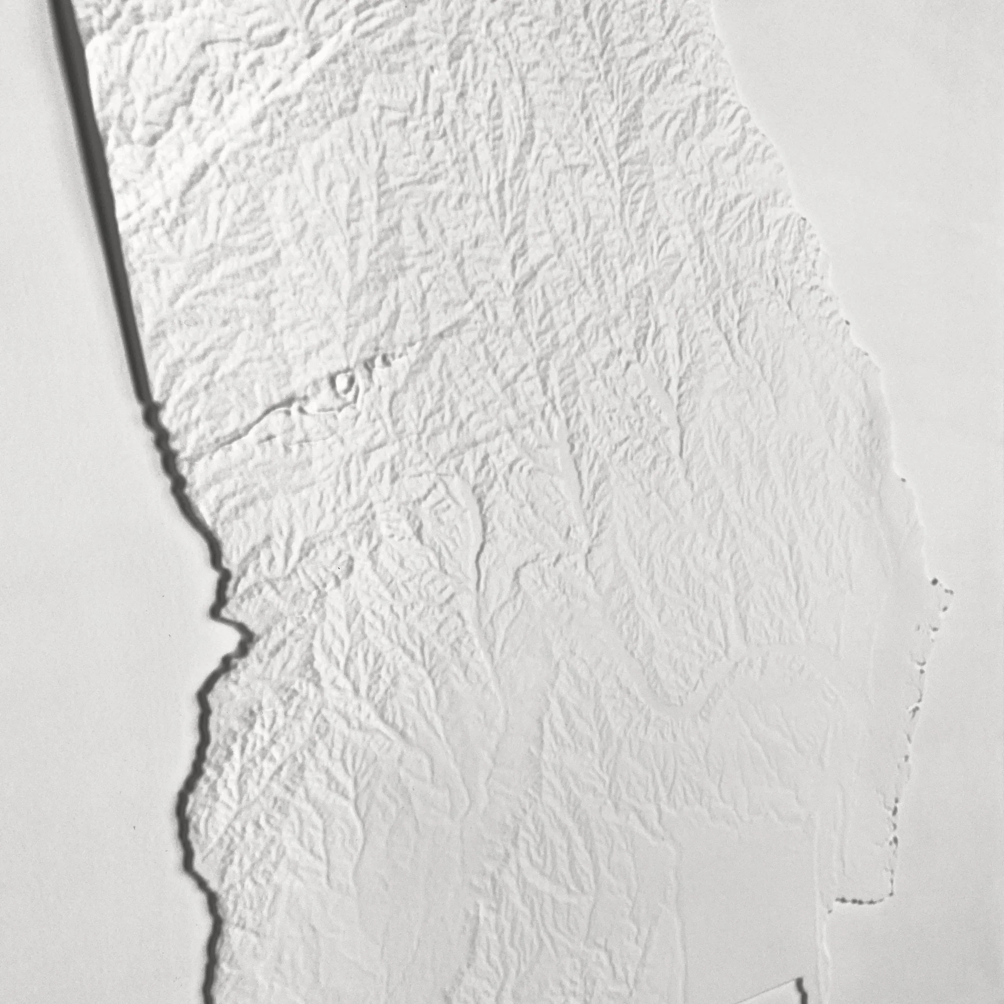
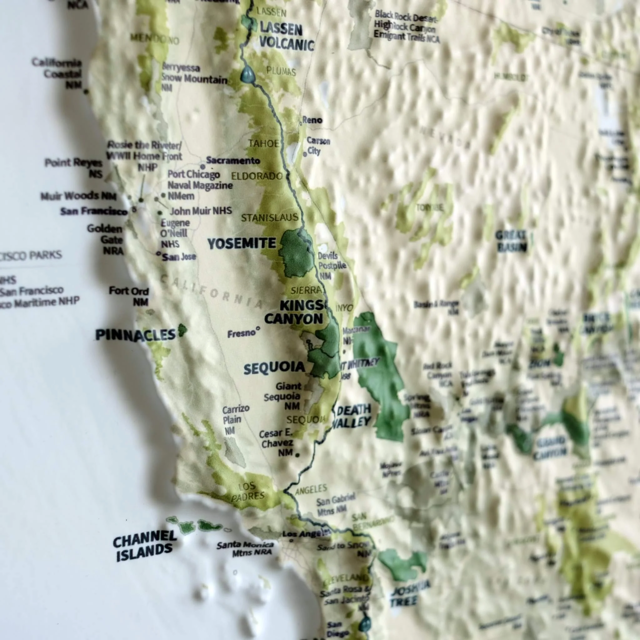
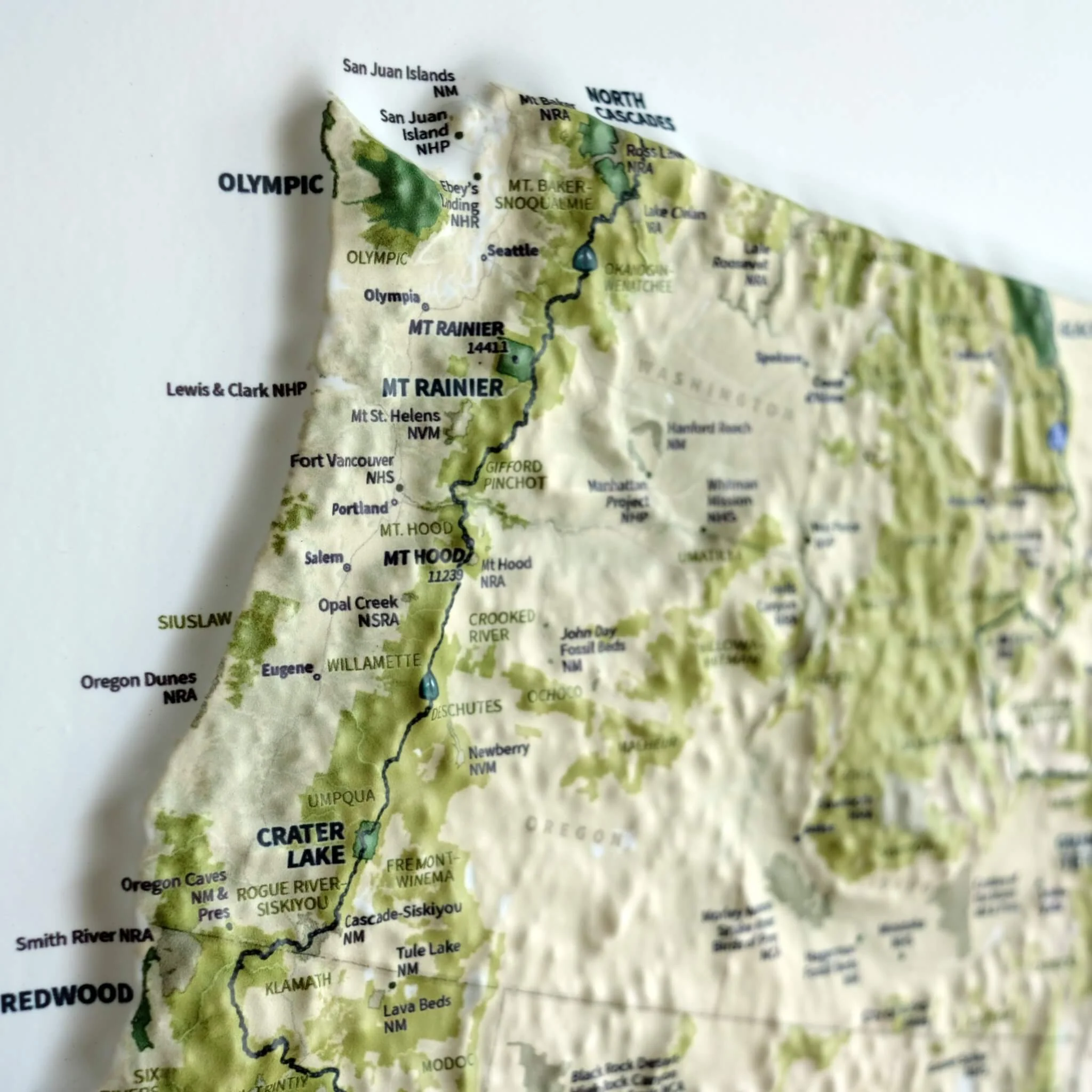
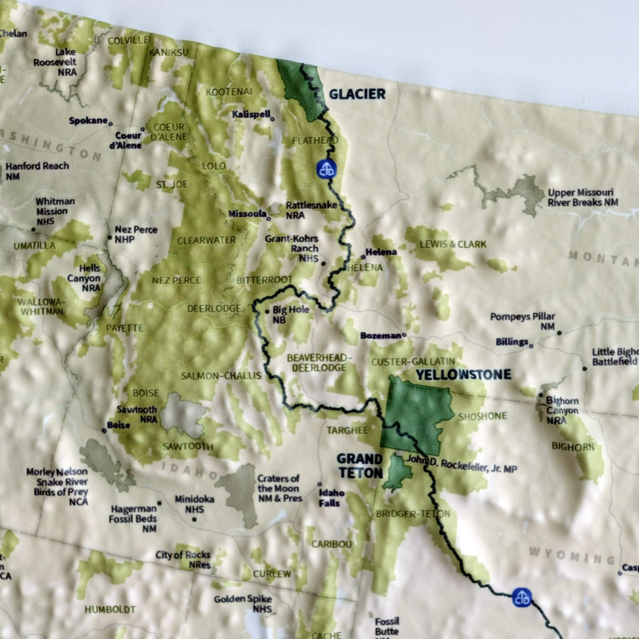
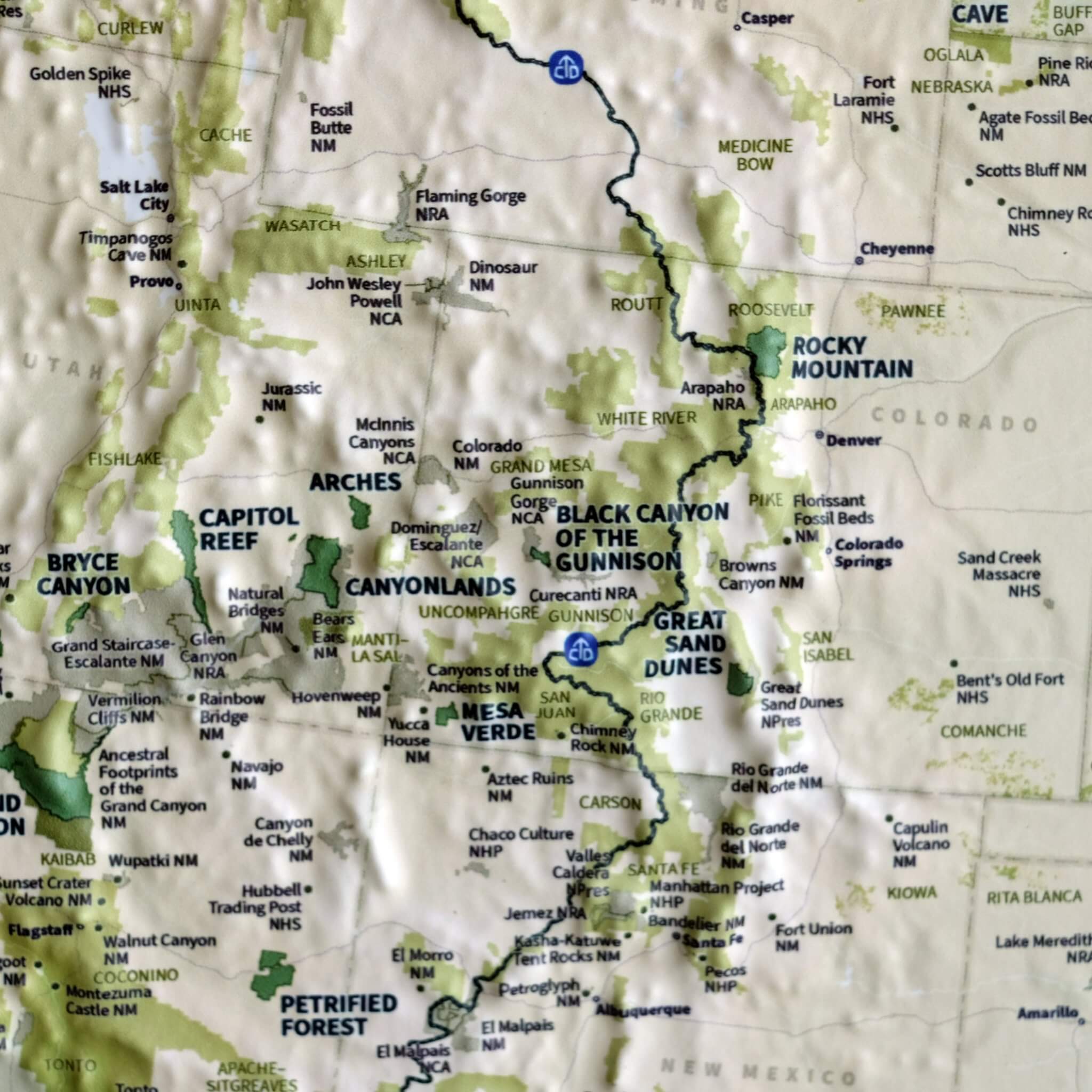
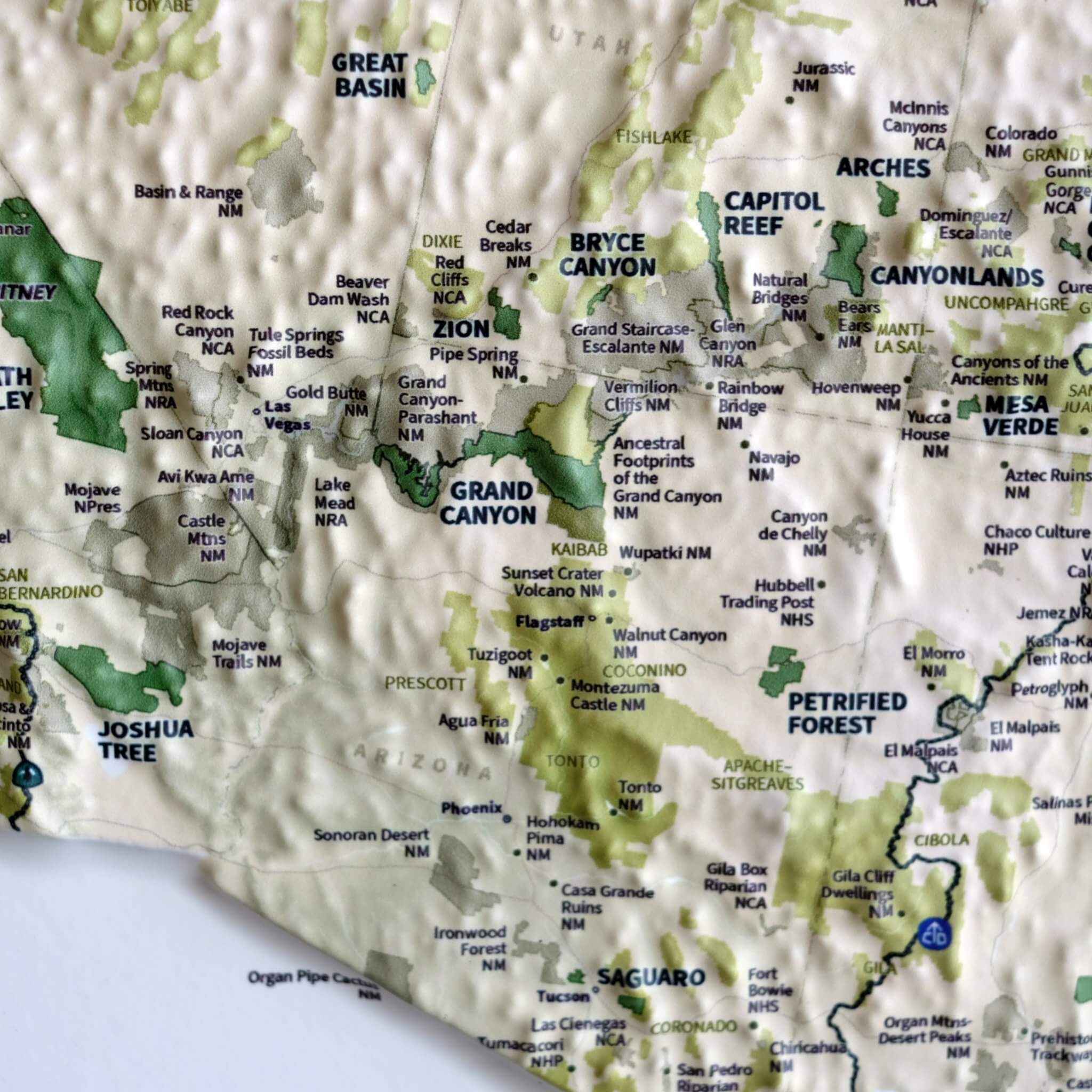
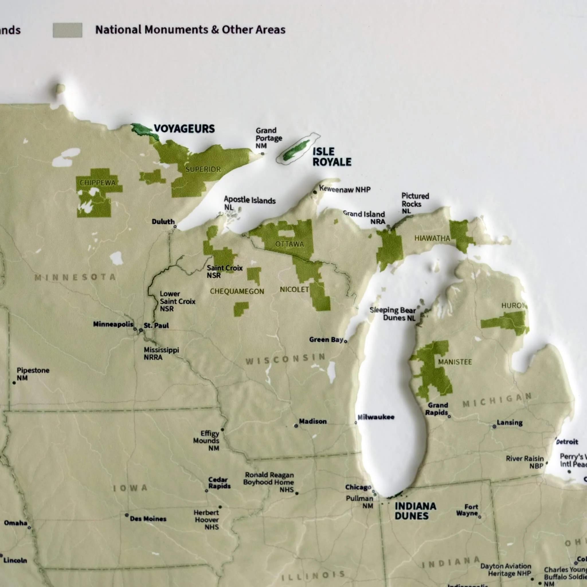
From Acadia to Zion, from Denali to Death Valley, our national parks preserve some of the grandest landscapes on the planet. With hand-placed labels and 3D raised-relief, this map showcases the parks in their unique geographic settings, from the red rocks of Utah to the distant islands of Hawaii and American Samoa. National forests, national monuments, and other National Park Service sites are shown, too, plus the Triple Crown of hiking: the PCT, CDT, and the AT. It's a gorgeous display of America's public lands and their endless potential for adventure and exploration.
Designed in partnership of Natural Atlas.
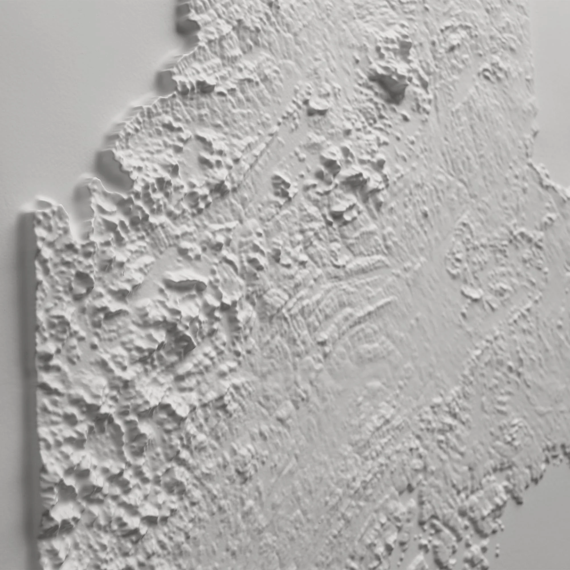
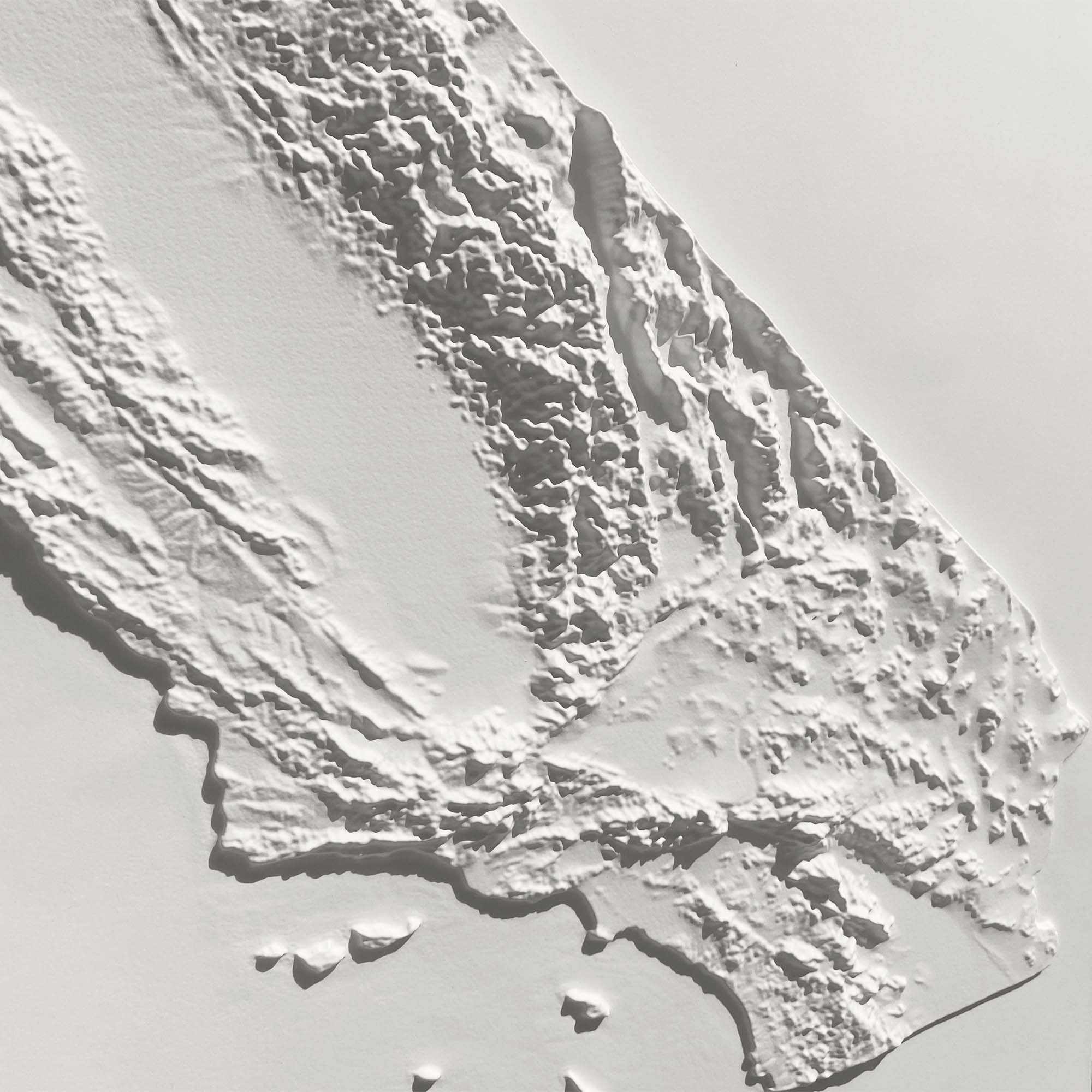
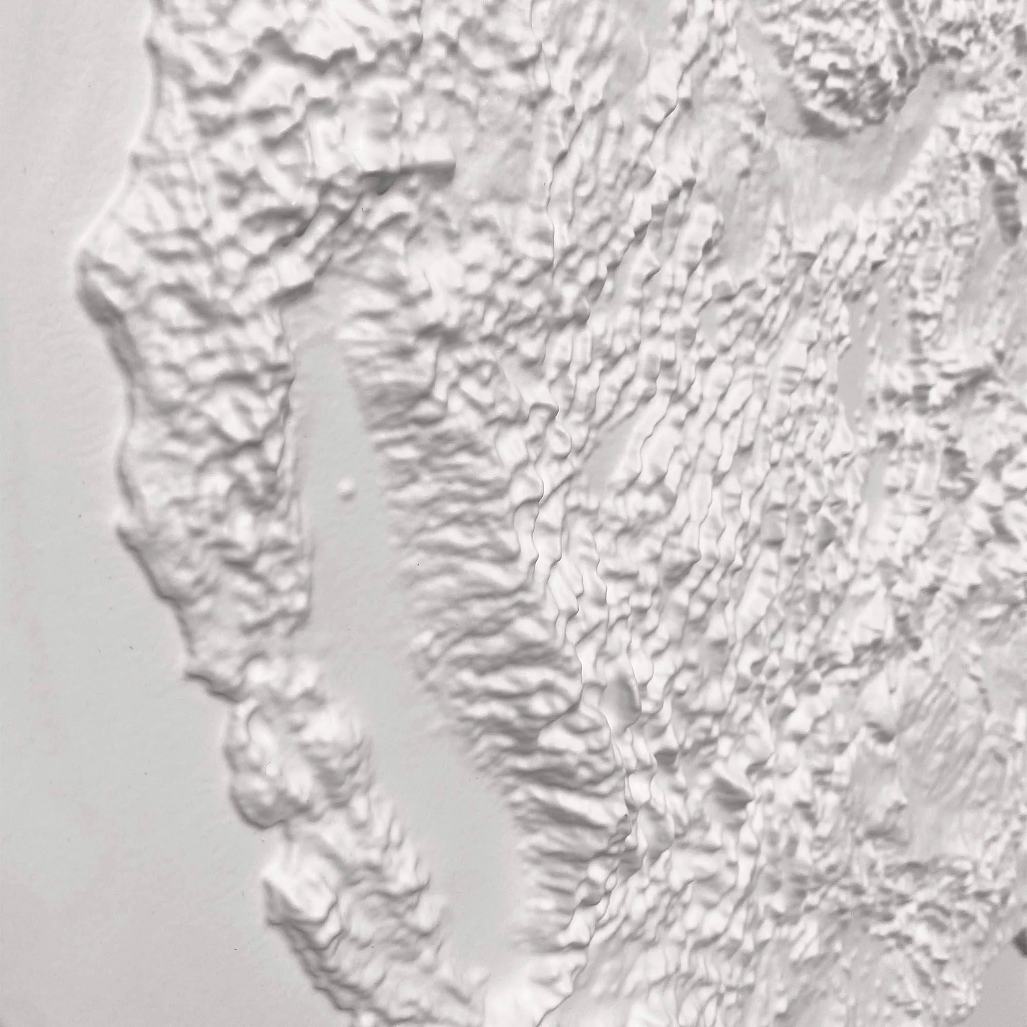
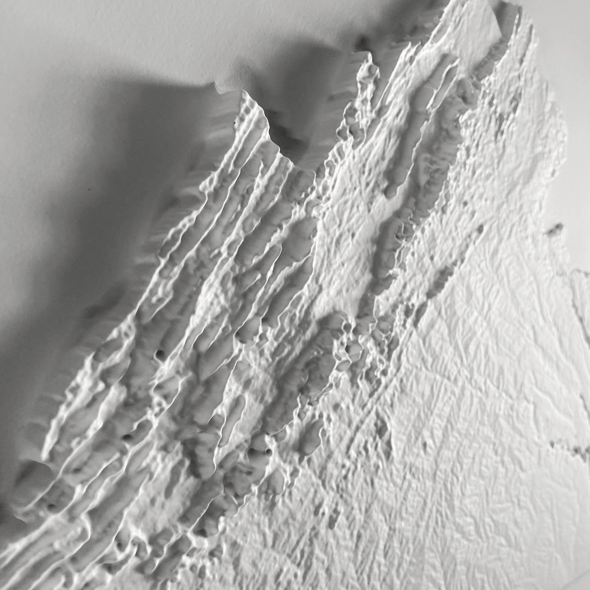
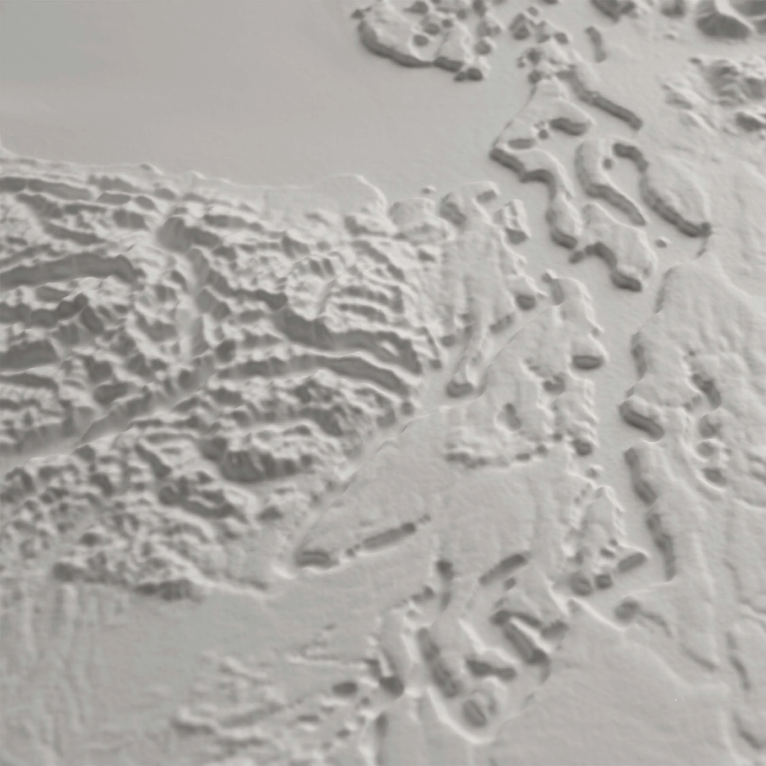
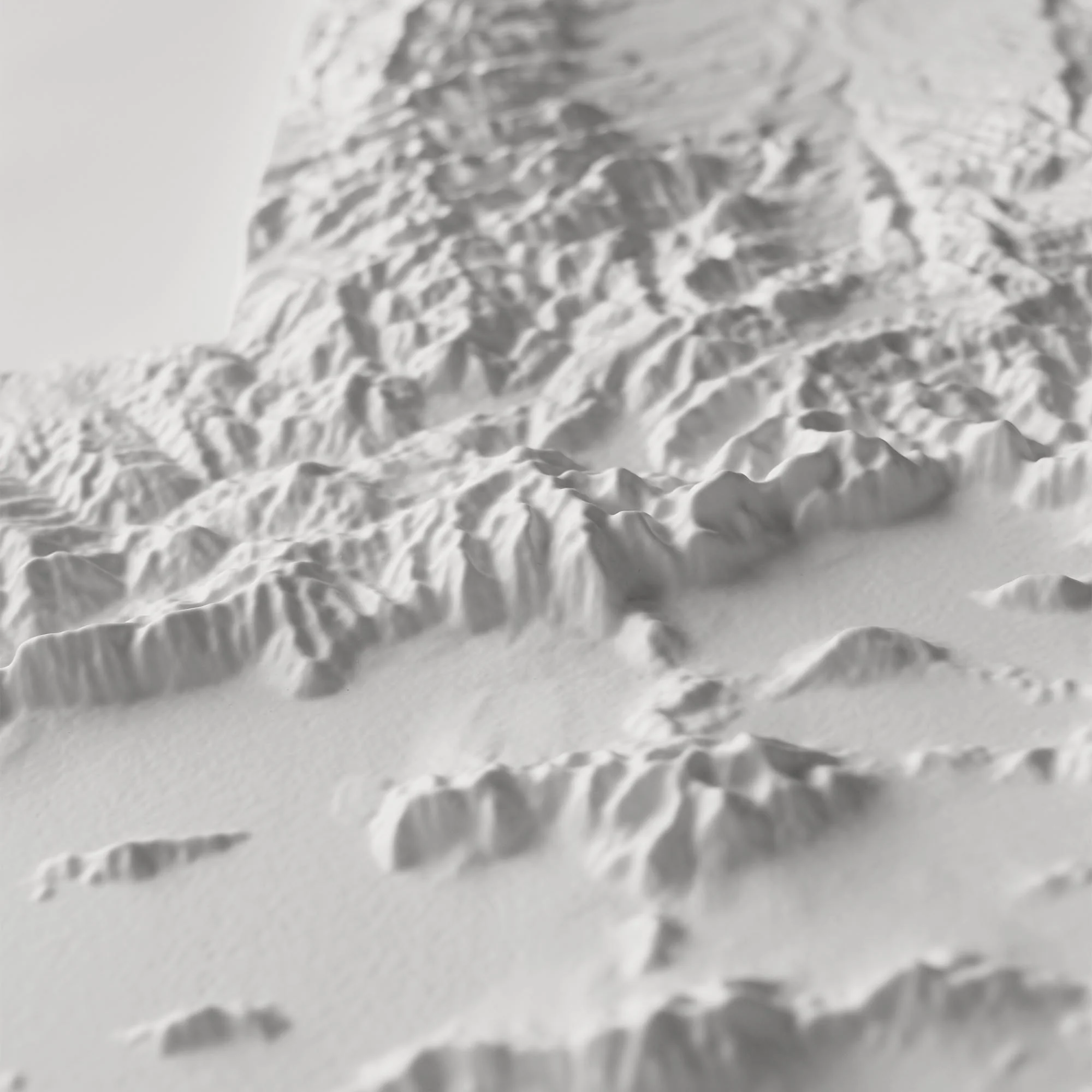
This unique map has undergone a meticulous process where it was printed, heated, and vacuum-formed over an intricately detailed 3D mold. The result is a map that allows you to visually and tactilely explore every park in the National Parks system.
Framed maps do not have glass or acrylic over them, so you can touch the map and explore its intricacies.
Product Information
Product Information
Shipping & Returns
Shipping & Returns

USA National Parks 3D Raised Relief Map
USA National Parks 3D Raised Relief Map
3D Real raised relief to explore through touch and feel.
- Perfect as a Push Pin map
- Size - unframed 32x24 inches
- Size - framed 33x25 inches
- Material - plastic mounted on foamboard
- Every park in the National Park system (National Parks, Monuments, Seashore, Historical, River, Battlefield, etc.)
- Triple Crown of Hiking (Pacific Crest Trail, Continental Divide Trail, and Appalachian Trail)
- Every National Forest and Grassland
From Acadia to Zion, from Denali to Death Valley, our national parks preserve some of the grandest landscapes on the planet. With hand-placed labels and 3D raised-relief, this map showcases the parks in their unique geographic settings, from the red rocks of Utah to the distant islands of Hawaii and American Samoa. National forests, national monuments, and other National Park Service sites are shown, too, plus the Triple Crown of hiking: the PCT, CDT, and the AT. It's a gorgeous display of America's public lands and their endless potential for adventure and exploration.
Designed in partnership of Natural Atlas.
This unique map has undergone a meticulous process where it was printed, heated, and vacuum-formed over an intricately detailed 3D mold. The result is a map that allows you to visually and tactilely explore every park in the National Parks system.
Framed maps do not have glass or acrylic over them, so you can touch the map and explore its intricacies.
Original: $1,455.00
-70%$1,455.00
$436.50Product Information
Product Information
Shipping & Returns
Shipping & Returns
Description
3D Real raised relief to explore through touch and feel.
- Perfect as a Push Pin map
- Size - unframed 32x24 inches
- Size - framed 33x25 inches
- Material - plastic mounted on foamboard
- Every park in the National Park system (National Parks, Monuments, Seashore, Historical, River, Battlefield, etc.)
- Triple Crown of Hiking (Pacific Crest Trail, Continental Divide Trail, and Appalachian Trail)
- Every National Forest and Grassland
From Acadia to Zion, from Denali to Death Valley, our national parks preserve some of the grandest landscapes on the planet. With hand-placed labels and 3D raised-relief, this map showcases the parks in their unique geographic settings, from the red rocks of Utah to the distant islands of Hawaii and American Samoa. National forests, national monuments, and other National Park Service sites are shown, too, plus the Triple Crown of hiking: the PCT, CDT, and the AT. It's a gorgeous display of America's public lands and their endless potential for adventure and exploration.
Designed in partnership of Natural Atlas.
This unique map has undergone a meticulous process where it was printed, heated, and vacuum-formed over an intricately detailed 3D mold. The result is a map that allows you to visually and tactilely explore every park in the National Parks system.
Framed maps do not have glass or acrylic over them, so you can touch the map and explore its intricacies.