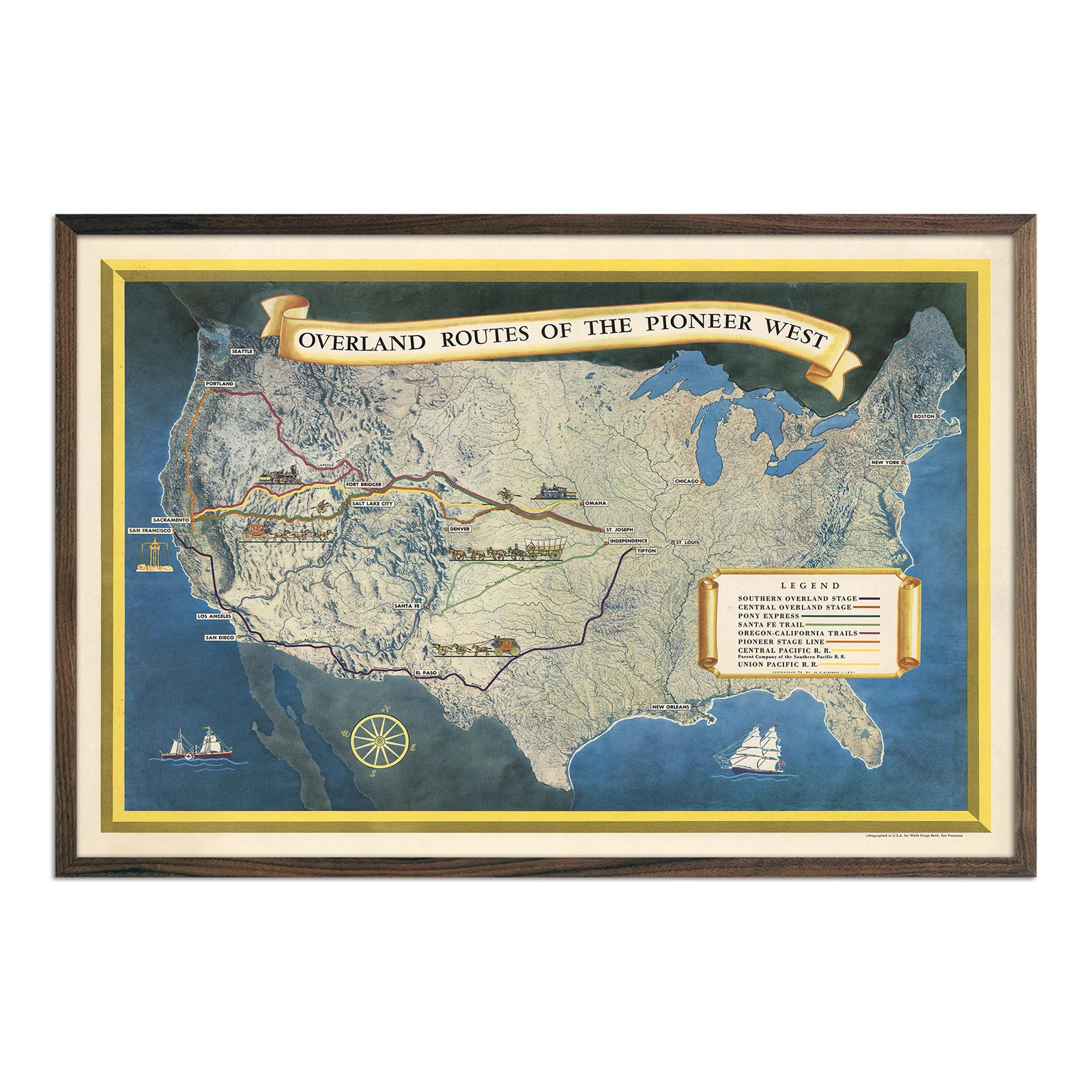
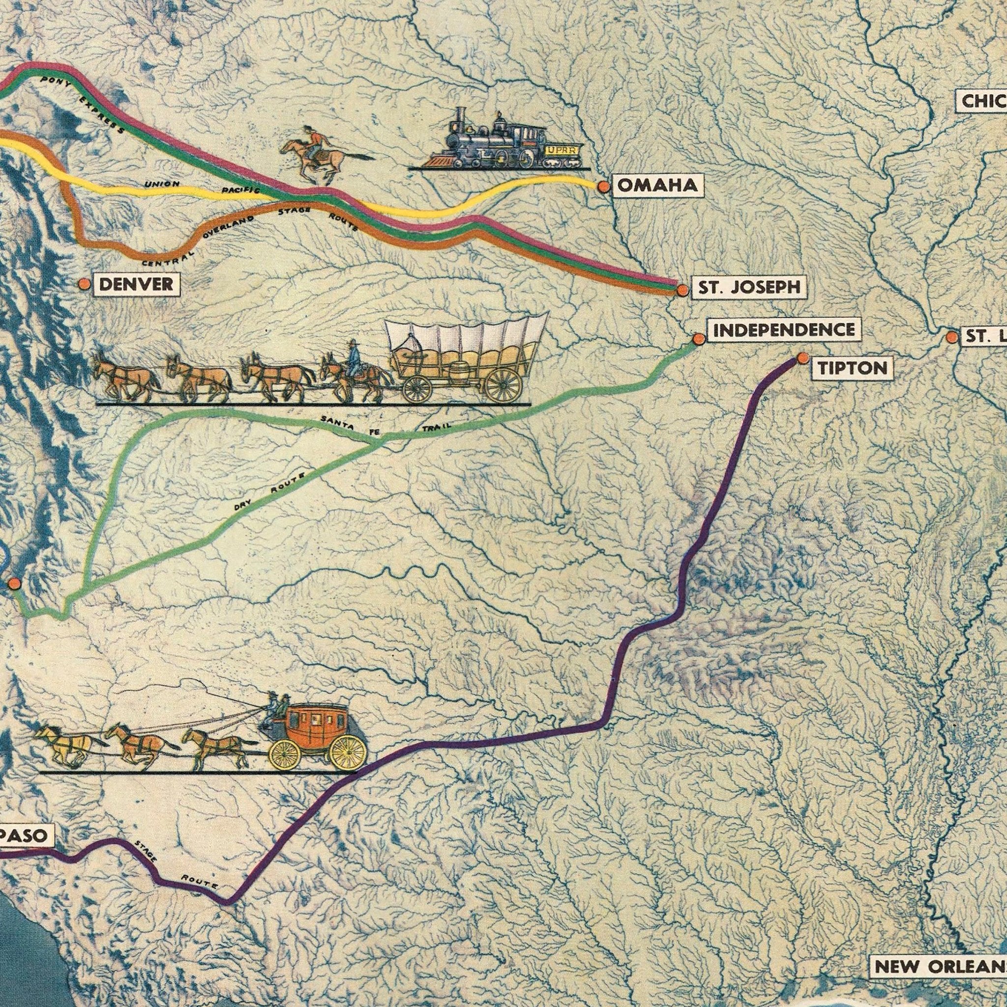
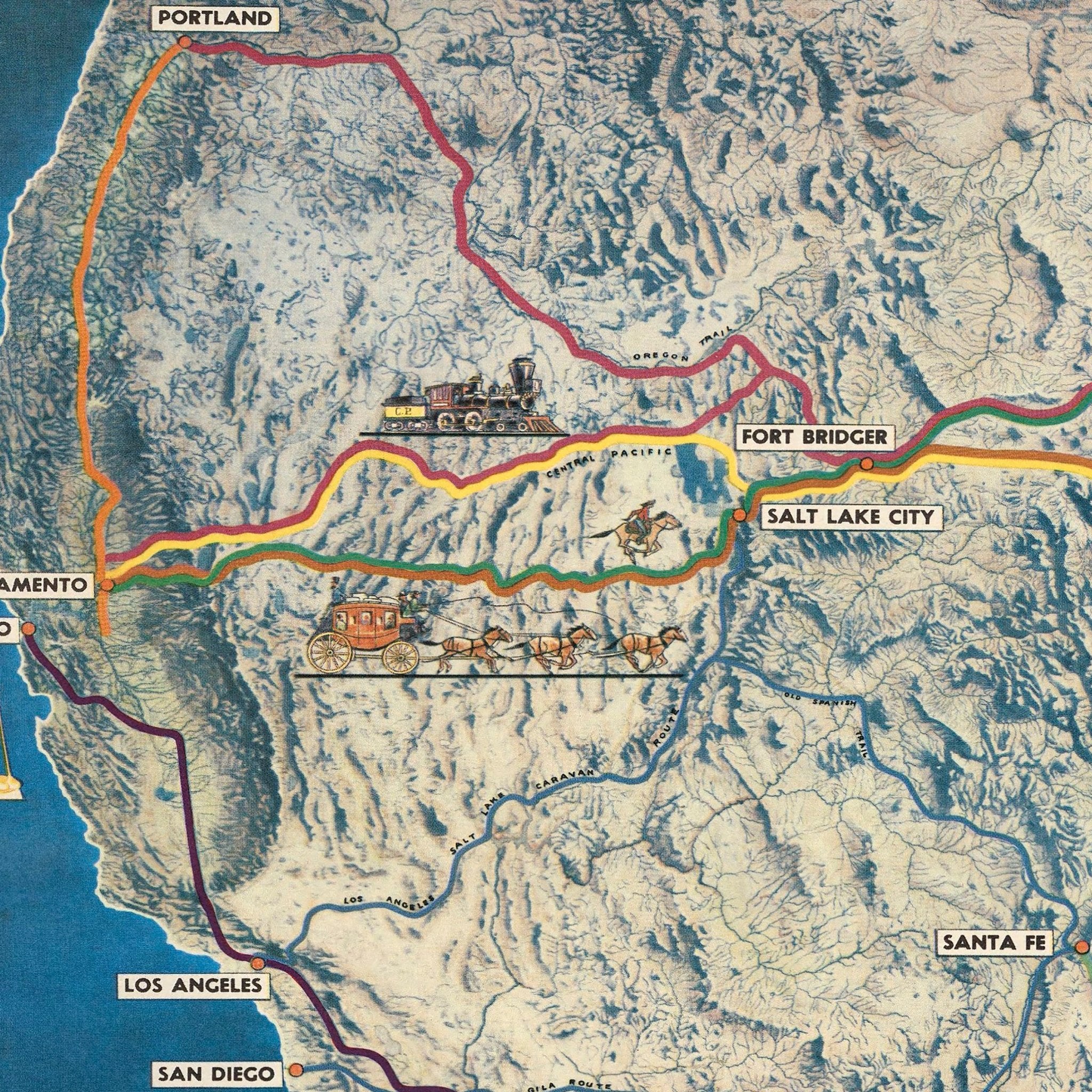
Overland Routes of the Pioneer West
Al Dinsdale originally created this vintage map in 1951 for Wells Fargo Bank. The map documents the routes that connected the American West, including the Santa Fe Trail, Pony Express, Oregon-California Trail, and the Union Pacific Railroad. The shaded relief terrain shows the actual topography the US.
The historical map features detailed period illustrations of stagecoaches, steam locomotives, sailing ships, and a decorative compass rose. Dinsdale combined cartographic precision with artistic storytelling. He created a piece that functions as both geographical reference and historical document. You can see why certain routes followed specific valleys or avoided particular mountain ranges.
We have remastered this print from a high-resolution scan of the original 1951 version. We enhanced clarity while preserving the authentic details. This raised relief map appeals to history enthusiasts, cartography collectors, and anyone interested in how transportation networks shaped American expansion. The print shows the practical realities behind westward movement and reveals where people actually traveled and why.
We make and ship this map from our San Diego studio using premium archival materials. We offer it unframed or with premium thin wood framing.
Product Information
Product Information
Shipping & Returns
Shipping & Returns
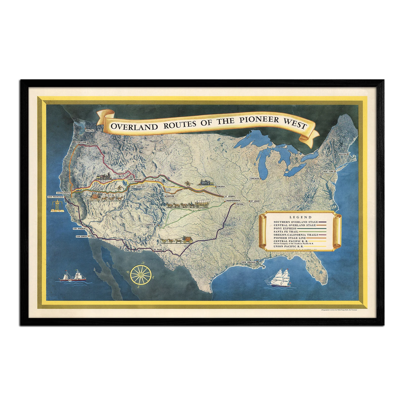
Overland Routes of the Pioneer West
Overland Routes of the Pioneer West
Al Dinsdale originally created this vintage map in 1951 for Wells Fargo Bank. The map documents the routes that connected the American West, including the Santa Fe Trail, Pony Express, Oregon-California Trail, and the Union Pacific Railroad. The shaded relief terrain shows the actual topography the US.
The historical map features detailed period illustrations of stagecoaches, steam locomotives, sailing ships, and a decorative compass rose. Dinsdale combined cartographic precision with artistic storytelling. He created a piece that functions as both geographical reference and historical document. You can see why certain routes followed specific valleys or avoided particular mountain ranges.
We have remastered this print from a high-resolution scan of the original 1951 version. We enhanced clarity while preserving the authentic details. This raised relief map appeals to history enthusiasts, cartography collectors, and anyone interested in how transportation networks shaped American expansion. The print shows the practical realities behind westward movement and reveals where people actually traveled and why.
We make and ship this map from our San Diego studio using premium archival materials. We offer it unframed or with premium thin wood framing.
Original: $543.00
-70%$543.00
$162.90Product Information
Product Information
Shipping & Returns
Shipping & Returns
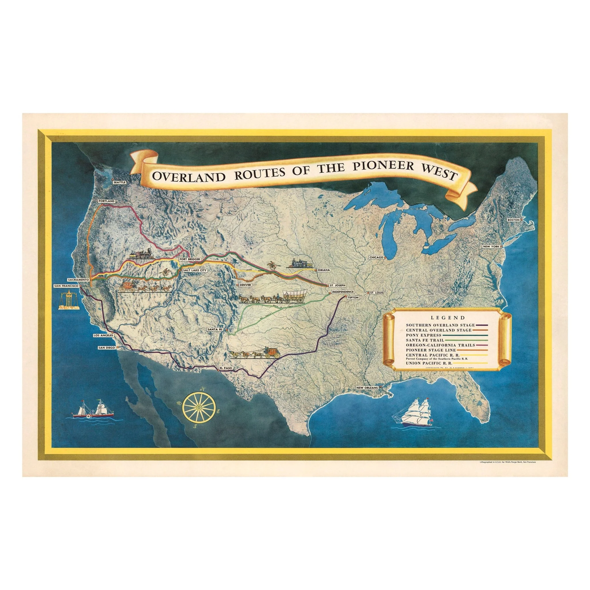
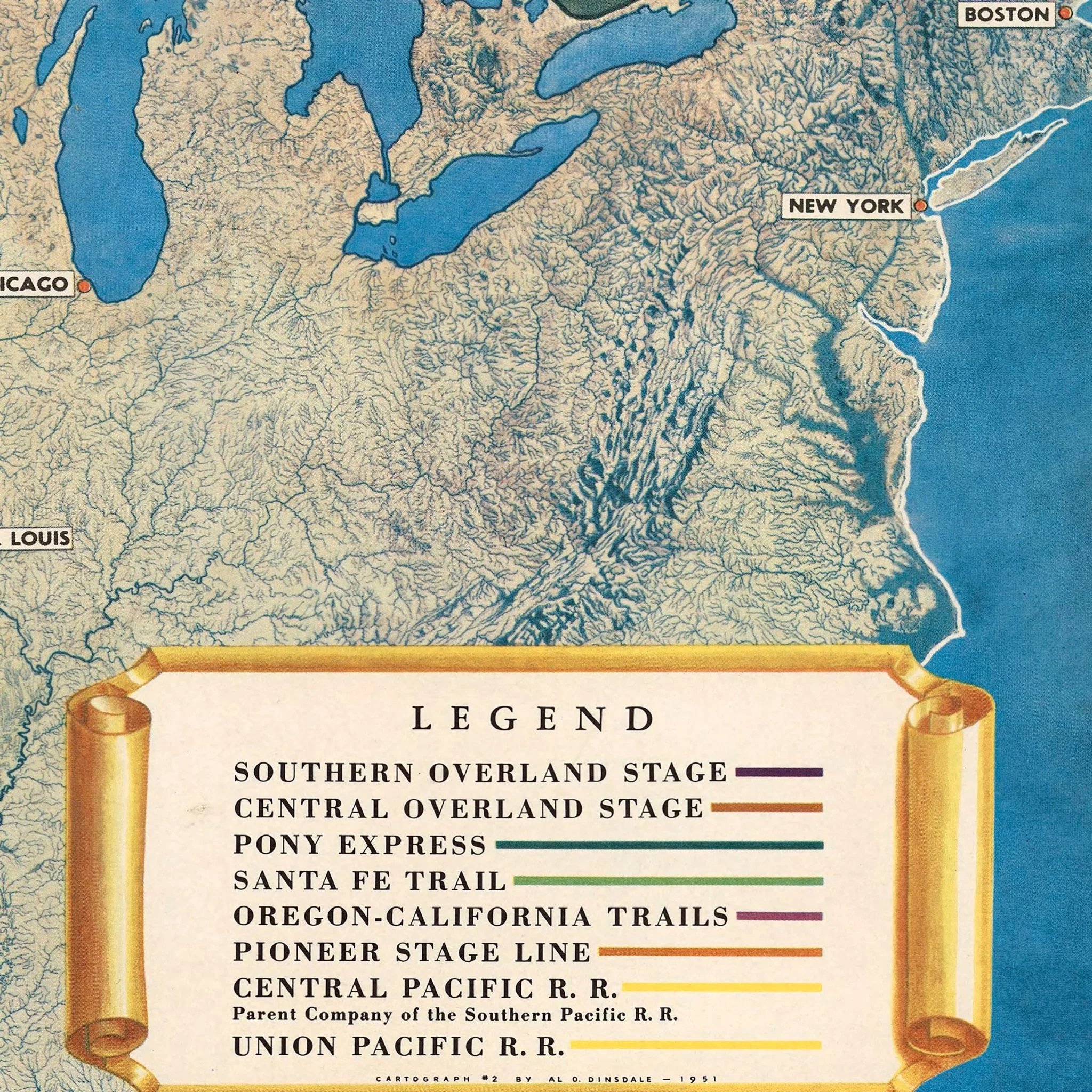
Description
Al Dinsdale originally created this vintage map in 1951 for Wells Fargo Bank. The map documents the routes that connected the American West, including the Santa Fe Trail, Pony Express, Oregon-California Trail, and the Union Pacific Railroad. The shaded relief terrain shows the actual topography the US.
The historical map features detailed period illustrations of stagecoaches, steam locomotives, sailing ships, and a decorative compass rose. Dinsdale combined cartographic precision with artistic storytelling. He created a piece that functions as both geographical reference and historical document. You can see why certain routes followed specific valleys or avoided particular mountain ranges.
We have remastered this print from a high-resolution scan of the original 1951 version. We enhanced clarity while preserving the authentic details. This raised relief map appeals to history enthusiasts, cartography collectors, and anyone interested in how transportation networks shaped American expansion. The print shows the practical realities behind westward movement and reveals where people actually traveled and why.
We make and ship this map from our San Diego studio using premium archival materials. We offer it unframed or with premium thin wood framing.