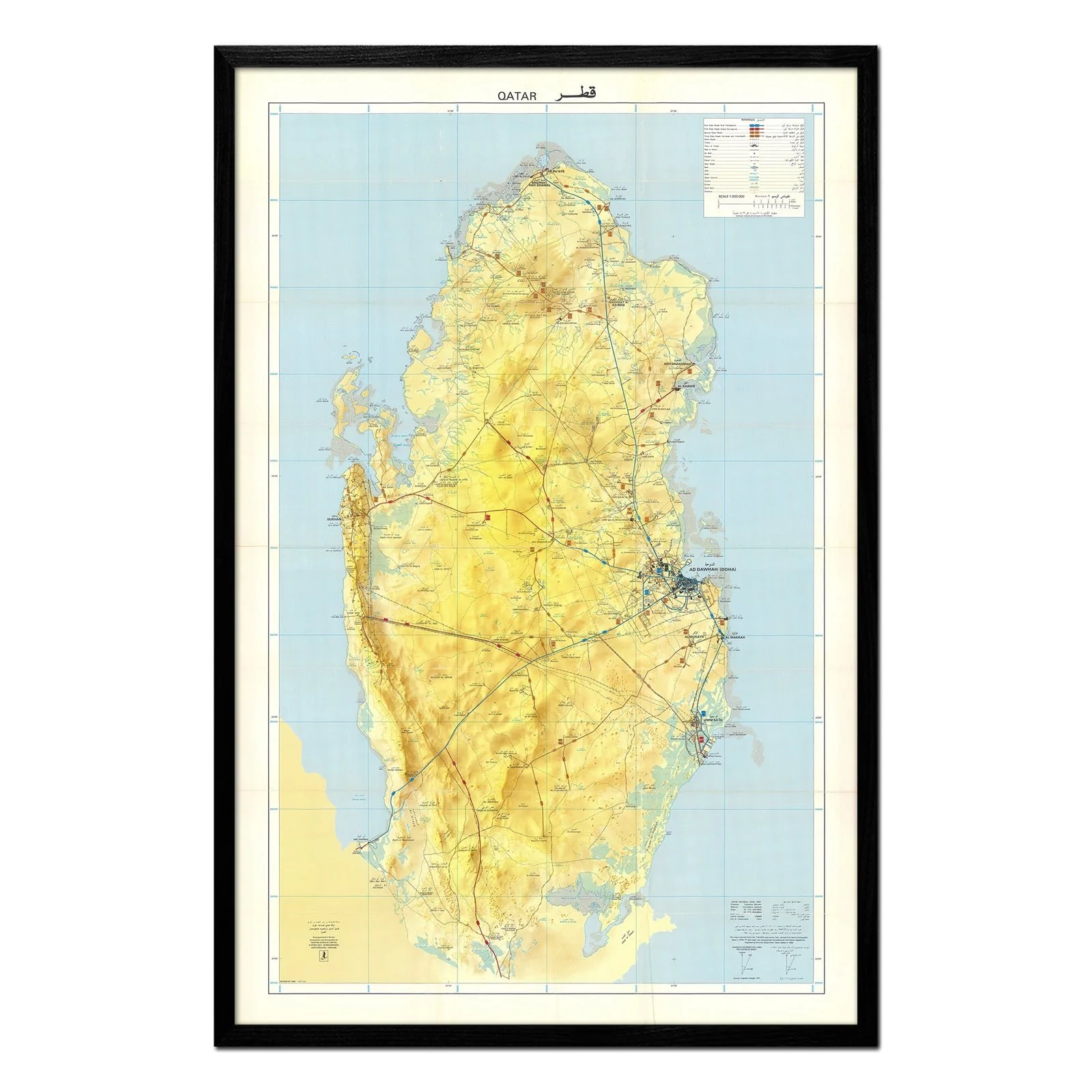
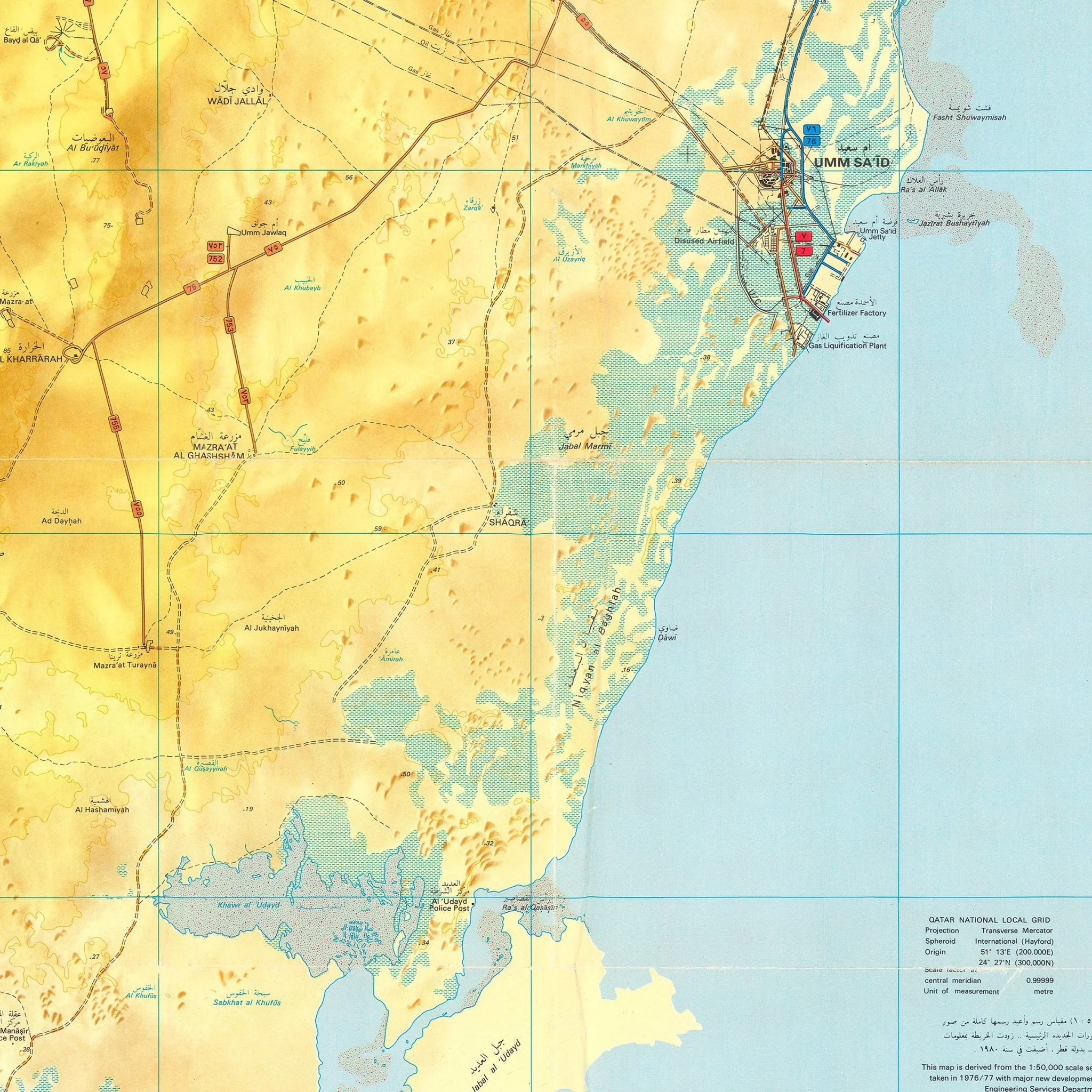
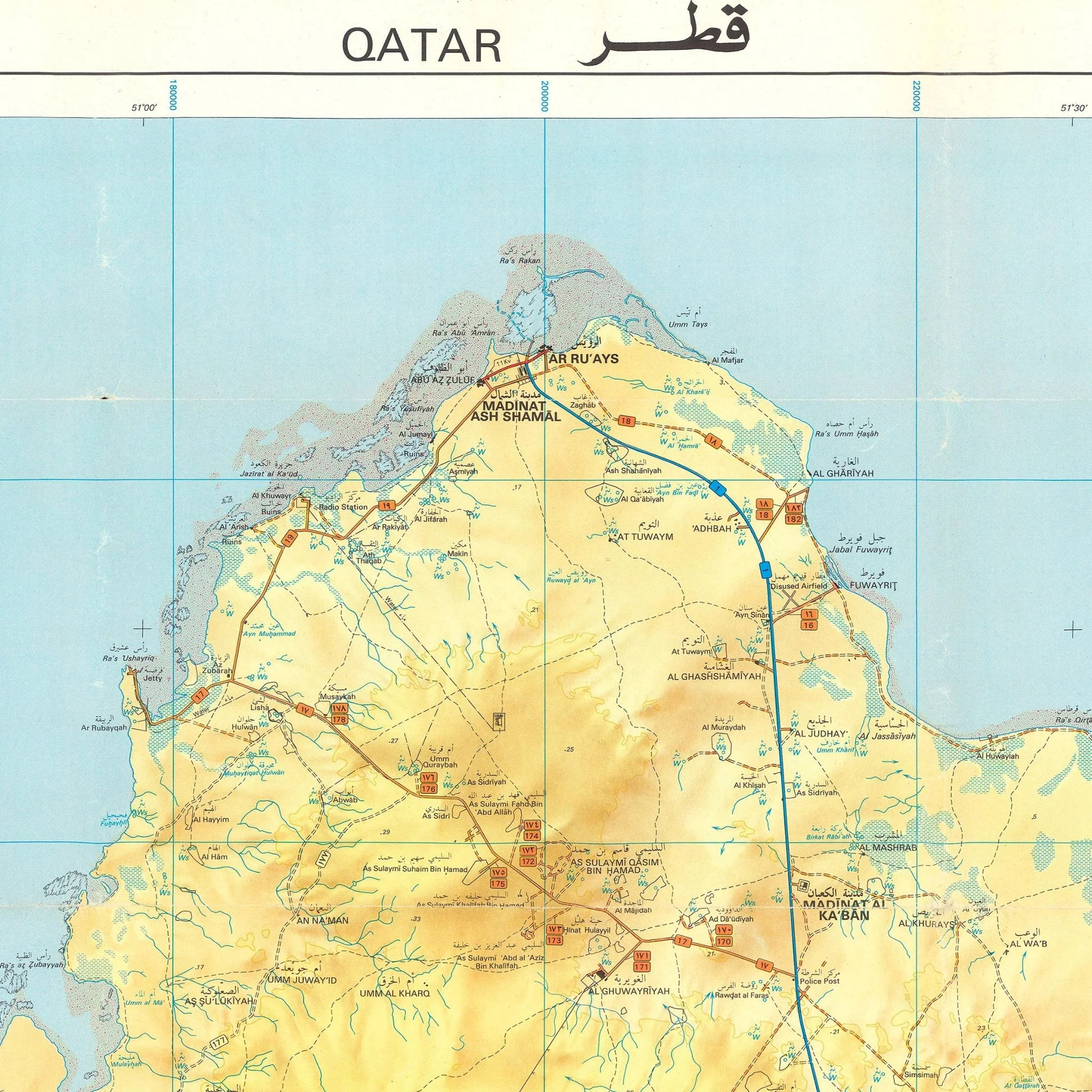
Qatar 1982 Map
This 1982 topographical map by Qatar's Ministry of Information documents the nation just over a decade after independence, during a period of rapid infrastructure development that would reshape the Arabian Peninsula. The map was revised from aerial photography taken in 1976 and 1977, with major new developments and additional information supplied by Qatar's Engineering Services Department in 1980.
The map shows Qatar's yellow and tan peninsula against blue Arabian Gulf waters. Topographical contour lines detail the subtle elevations and coastal geography. Bilingual Arabic-English labeling (QATAR قطر) marks major settlements, road networks, and geographic features with the technical precision of official government cartography. The comprehensive legend and coordinate grid system demonstrate the mapping capabilities of Qatar's own surveyors.
This reproduction was carefully remastered from a digital scan of the original survey. It preserves the authentic detail of the 1982 source material. Made in San Diego, CA on archival paper.
Product Information
Product Information
Shipping & Returns
Shipping & Returns


Qatar 1982 Map
Qatar 1982 Map
This 1982 topographical map by Qatar's Ministry of Information documents the nation just over a decade after independence, during a period of rapid infrastructure development that would reshape the Arabian Peninsula. The map was revised from aerial photography taken in 1976 and 1977, with major new developments and additional information supplied by Qatar's Engineering Services Department in 1980.
The map shows Qatar's yellow and tan peninsula against blue Arabian Gulf waters. Topographical contour lines detail the subtle elevations and coastal geography. Bilingual Arabic-English labeling (QATAR قطر) marks major settlements, road networks, and geographic features with the technical precision of official government cartography. The comprehensive legend and coordinate grid system demonstrate the mapping capabilities of Qatar's own surveyors.
This reproduction was carefully remastered from a digital scan of the original survey. It preserves the authentic detail of the 1982 source material. Made in San Diego, CA on archival paper.
Original: $700.00
-70%$700.00
$210.00Product Information
Product Information
Shipping & Returns
Shipping & Returns
Description
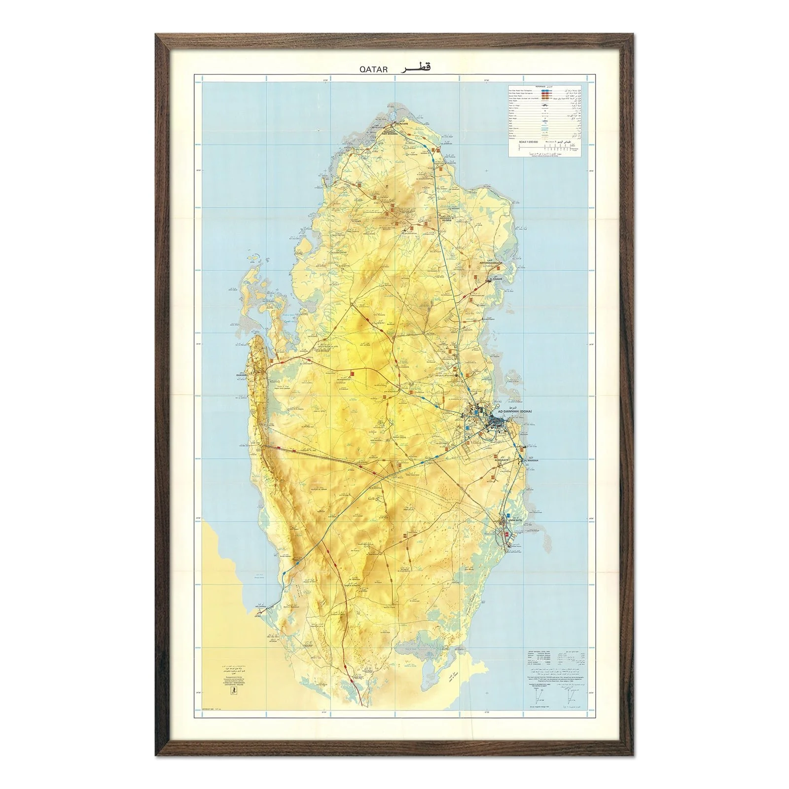
This 1982 topographical map by Qatar's Ministry of Information documents the nation just over a decade after independence, during a period of rapid infrastructure development that would reshape the Arabian Peninsula. The map was revised from aerial photography taken in 1976 and 1977, with major new developments and additional information supplied by Qatar's Engineering Services Department in 1980.
The map shows Qatar's yellow and tan peninsula against blue Arabian Gulf waters. Topographical contour lines detail the subtle elevations and coastal geography. Bilingual Arabic-English labeling (QATAR قطر) marks major settlements, road networks, and geographic features with the technical precision of official government cartography. The comprehensive legend and coordinate grid system demonstrate the mapping capabilities of Qatar's own surveyors.
This reproduction was carefully remastered from a digital scan of the original survey. It preserves the authentic detail of the 1982 source material. Made in San Diego, CA on archival paper.