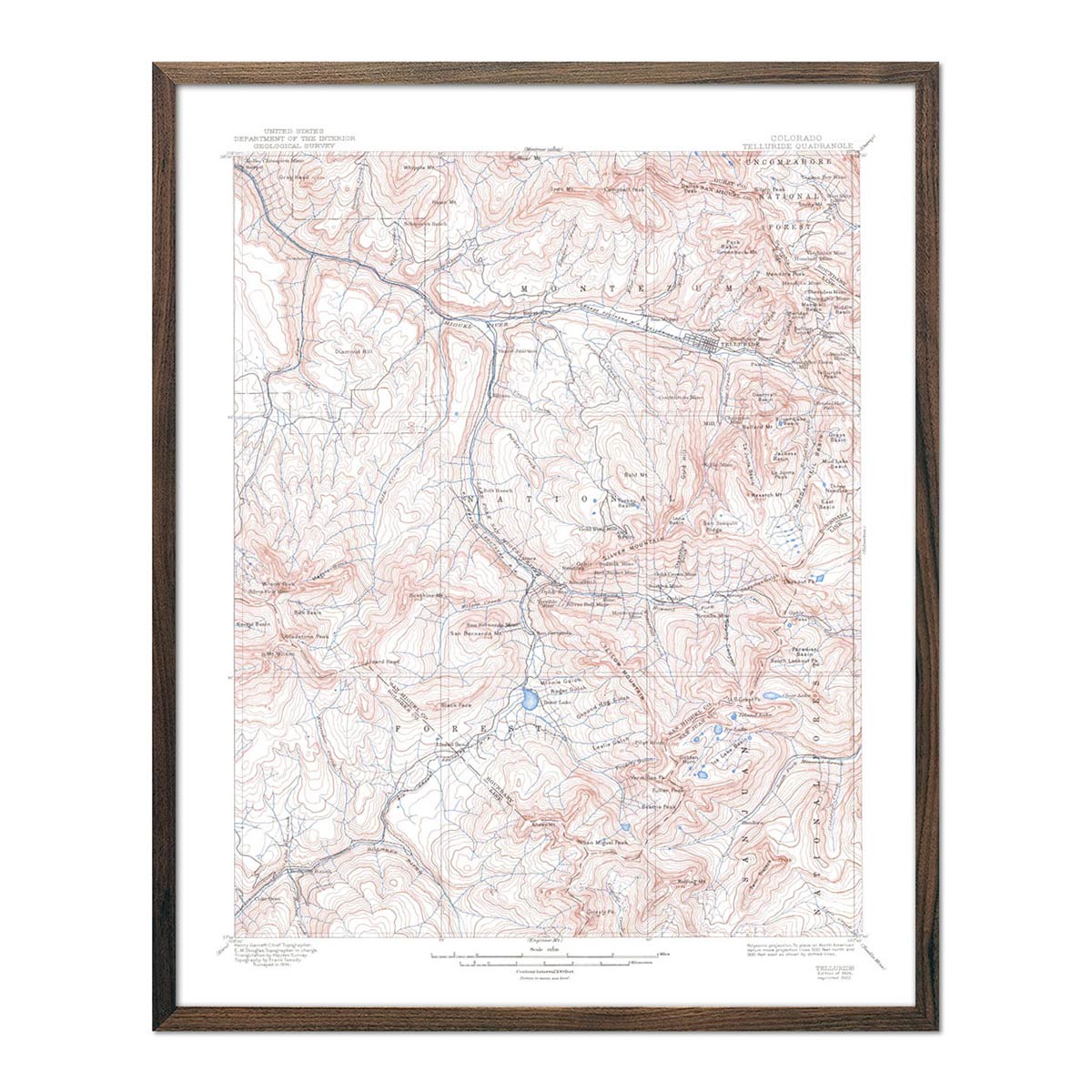
Rio Grande Regional Hydrological Map
Our series of regional hydrological maps show the Water Resource Regions of the USA which is the first level of classification used by the USGS. Its purpose is to divide the US into smaller hydrologic units which are then subdivided. The 21 major Water Resource Regions contain the drainage area of either a major river or the combined drainage areas of a series of rivers.

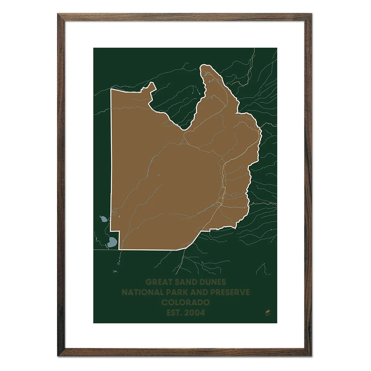
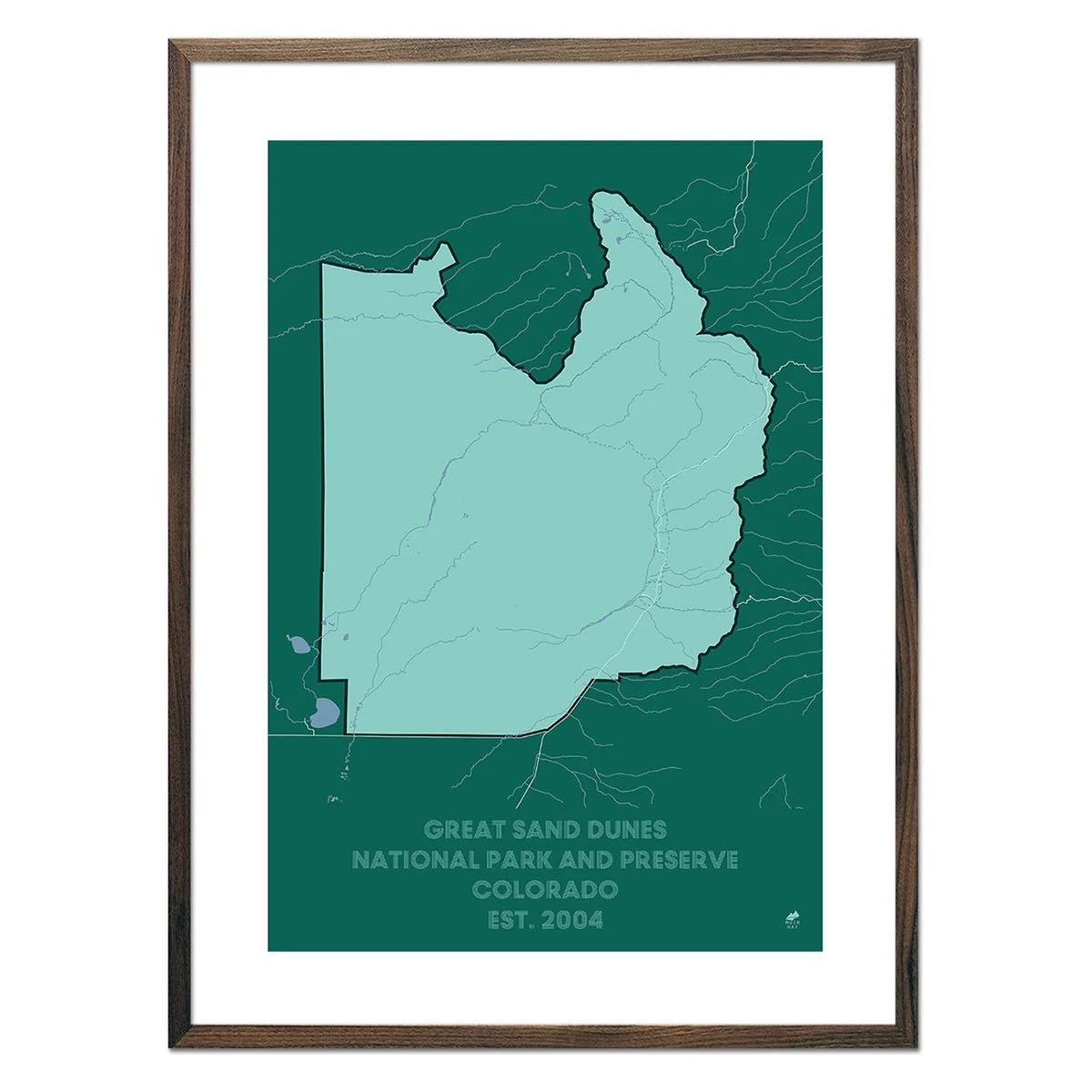
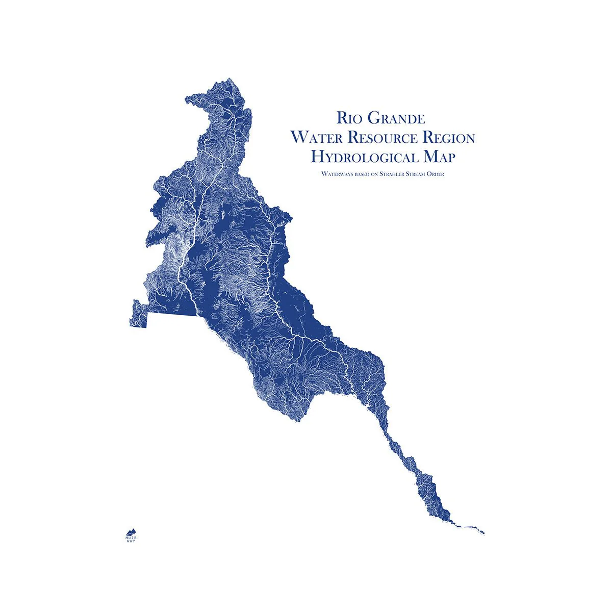
Water is literally the lifeblood of our country. If you’re drawn to water, you know that how and where it flows tells the story of a place. The Rio Grande Region contains the Rio Grande Basin, San Luis Valley, North Plains, Plains of San Agustin, Mimbres River, Estancia, Jornada del Muerto, Tularosa Valley, and Salt Basin. This map shows in fascinating detail how the rivers and streams flow and interconnect, merge and diverge, carrying life to the land. The flow of water also has an inherent aesthetic elegance that our map captures beautifully.
It’s all in the details. Our map depicts every river in the Water Resource Region—even intermittent streams—and every body of water with a diameter greater than .2 miles. For an extra aesthetic touch, we apply a method called the Strahler Stream Order to show the hierarchy of streams as they flow from their source—rivers are shown thicker as they acquire the flow of tributaries. We think it enhances a sense of the interconnectedness of our waterways.
In our Hydrology Series, you’ll not only find your favorite rivers and lakes, but you’ll also be able to trace their origins and outflow and appreciate the beauty of their connections.
Product Information
Product Information
Shipping & Returns
Shipping & Returns


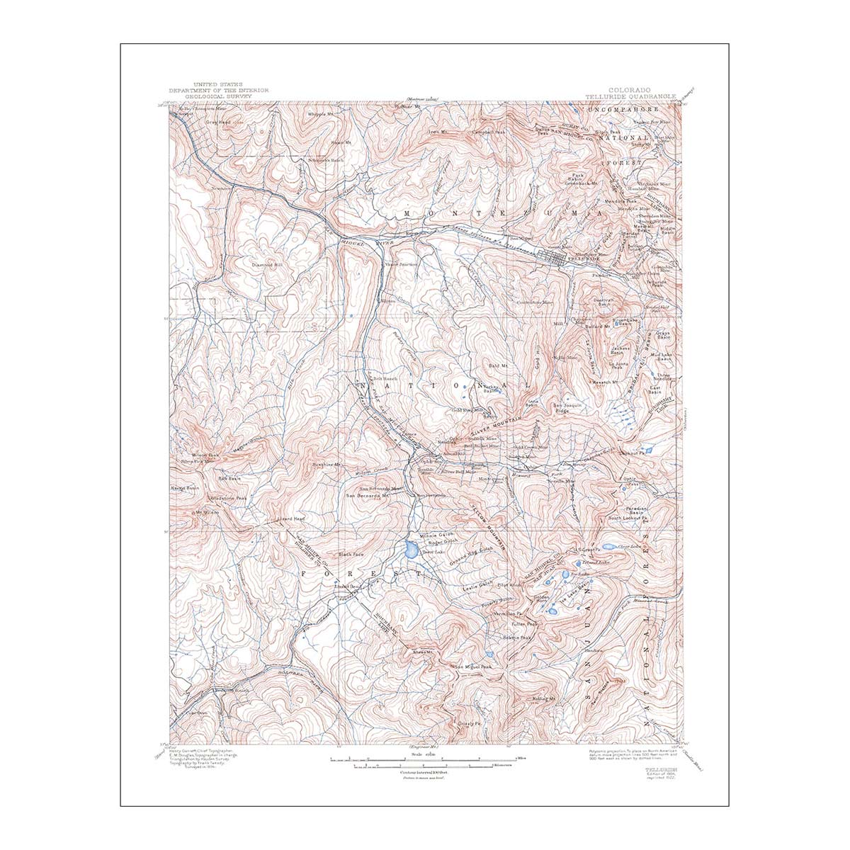
Rio Grande Regional Hydrological Map
Rio Grande Regional Hydrological Map
Our series of regional hydrological maps show the Water Resource Regions of the USA which is the first level of classification used by the USGS. Its purpose is to divide the US into smaller hydrologic units which are then subdivided. The 21 major Water Resource Regions contain the drainage area of either a major river or the combined drainage areas of a series of rivers.
Water is literally the lifeblood of our country. If you’re drawn to water, you know that how and where it flows tells the story of a place. The Rio Grande Region contains the Rio Grande Basin, San Luis Valley, North Plains, Plains of San Agustin, Mimbres River, Estancia, Jornada del Muerto, Tularosa Valley, and Salt Basin. This map shows in fascinating detail how the rivers and streams flow and interconnect, merge and diverge, carrying life to the land. The flow of water also has an inherent aesthetic elegance that our map captures beautifully.
It’s all in the details. Our map depicts every river in the Water Resource Region—even intermittent streams—and every body of water with a diameter greater than .2 miles. For an extra aesthetic touch, we apply a method called the Strahler Stream Order to show the hierarchy of streams as they flow from their source—rivers are shown thicker as they acquire the flow of tributaries. We think it enhances a sense of the interconnectedness of our waterways.
In our Hydrology Series, you’ll not only find your favorite rivers and lakes, but you’ll also be able to trace their origins and outflow and appreciate the beauty of their connections.
Original: $7,100.00
-70%$7,100.00
$2,130.00Product Information
Product Information
Shipping & Returns
Shipping & Returns
Description
Our series of regional hydrological maps show the Water Resource Regions of the USA which is the first level of classification used by the USGS. Its purpose is to divide the US into smaller hydrologic units which are then subdivided. The 21 major Water Resource Regions contain the drainage area of either a major river or the combined drainage areas of a series of rivers.
Water is literally the lifeblood of our country. If you’re drawn to water, you know that how and where it flows tells the story of a place. The Rio Grande Region contains the Rio Grande Basin, San Luis Valley, North Plains, Plains of San Agustin, Mimbres River, Estancia, Jornada del Muerto, Tularosa Valley, and Salt Basin. This map shows in fascinating detail how the rivers and streams flow and interconnect, merge and diverge, carrying life to the land. The flow of water also has an inherent aesthetic elegance that our map captures beautifully.
It’s all in the details. Our map depicts every river in the Water Resource Region—even intermittent streams—and every body of water with a diameter greater than .2 miles. For an extra aesthetic touch, we apply a method called the Strahler Stream Order to show the hierarchy of streams as they flow from their source—rivers are shown thicker as they acquire the flow of tributaries. We think it enhances a sense of the interconnectedness of our waterways.
In our Hydrology Series, you’ll not only find your favorite rivers and lakes, but you’ll also be able to trace their origins and outflow and appreciate the beauty of their connections.