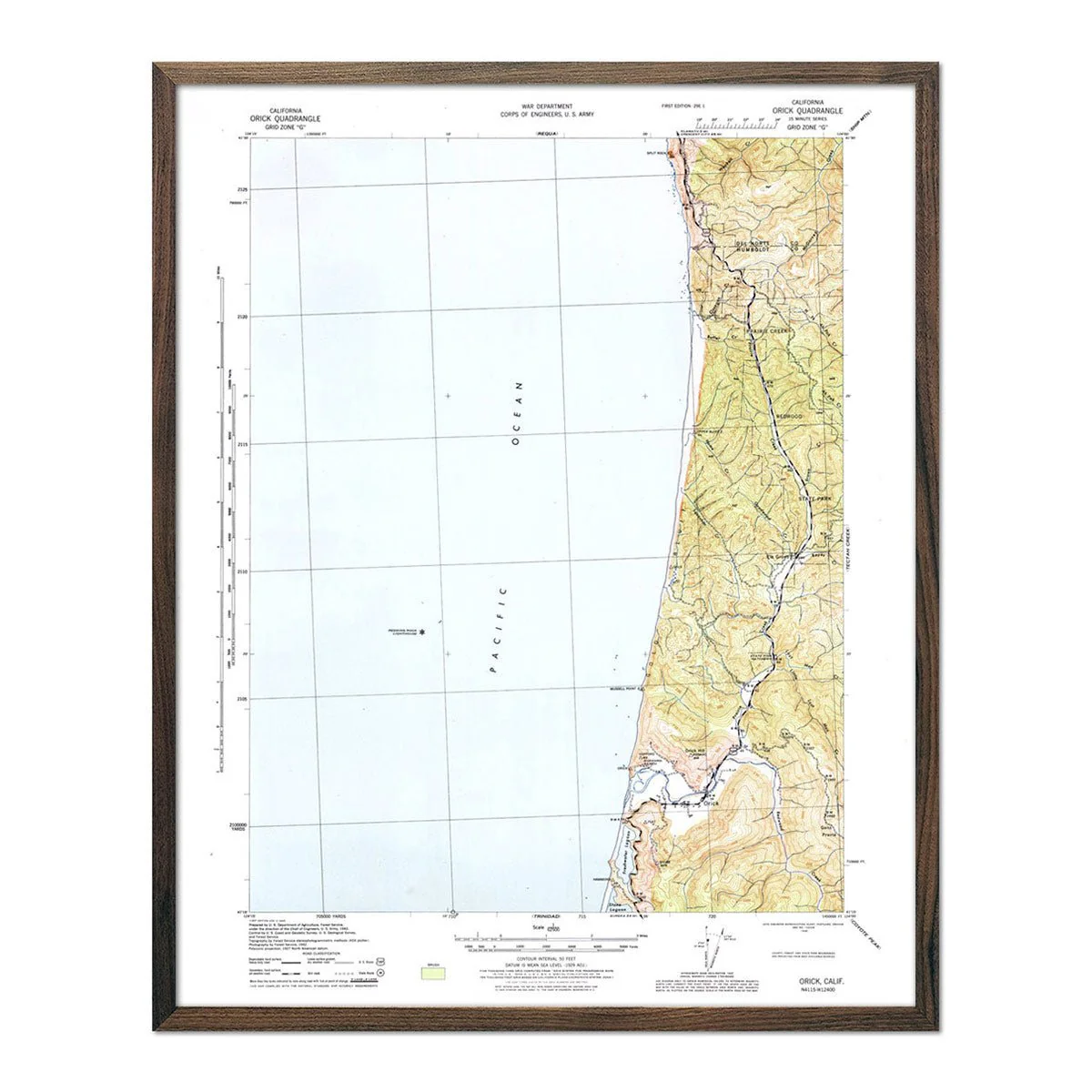
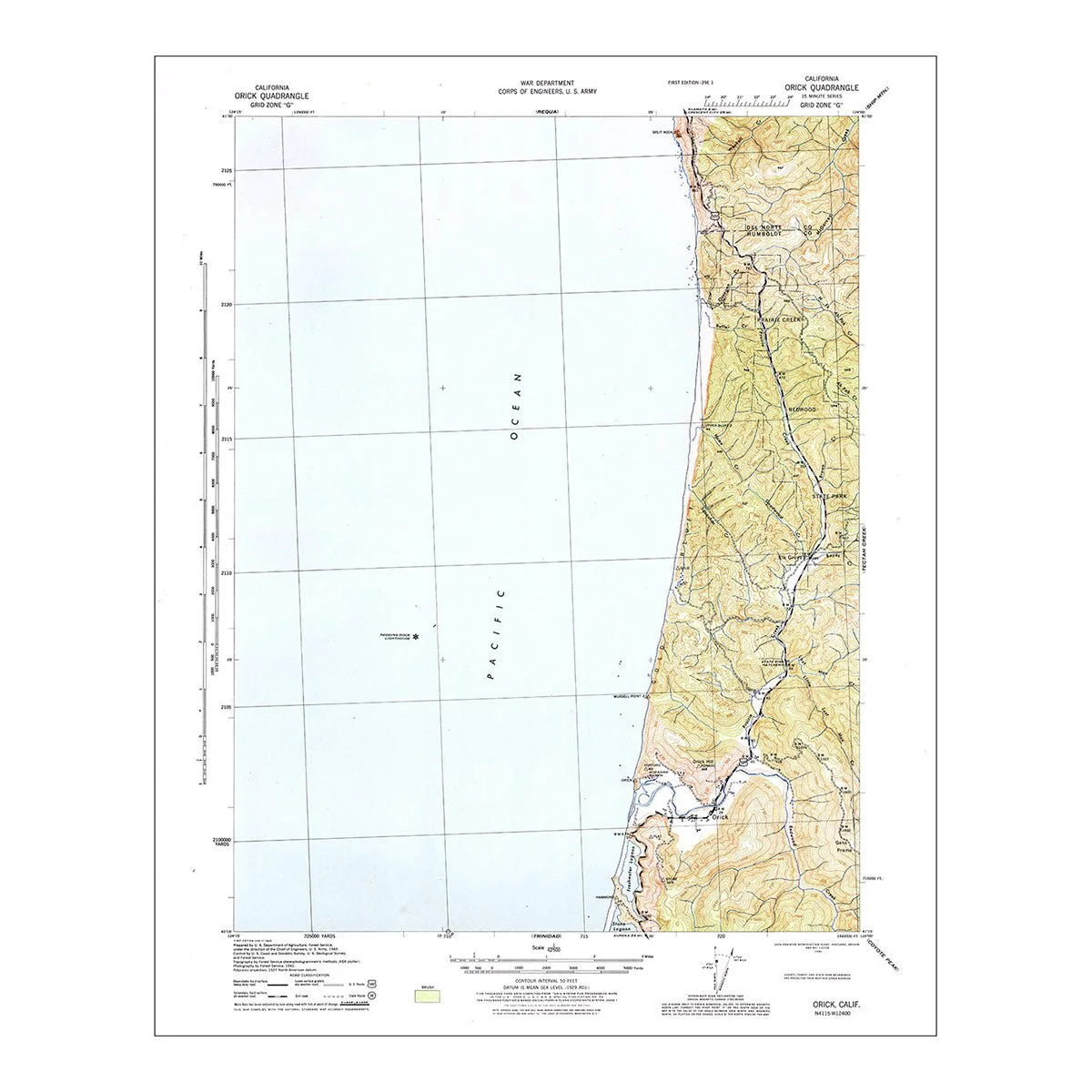
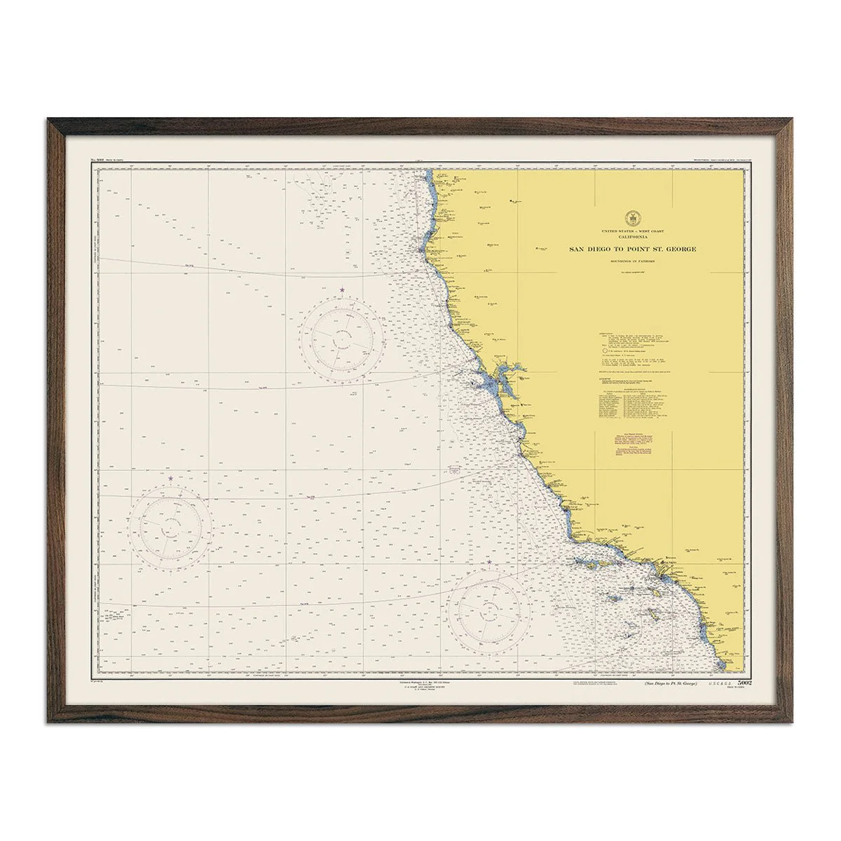
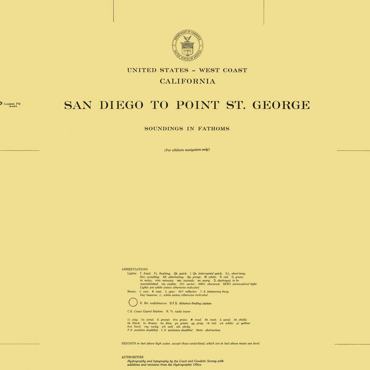
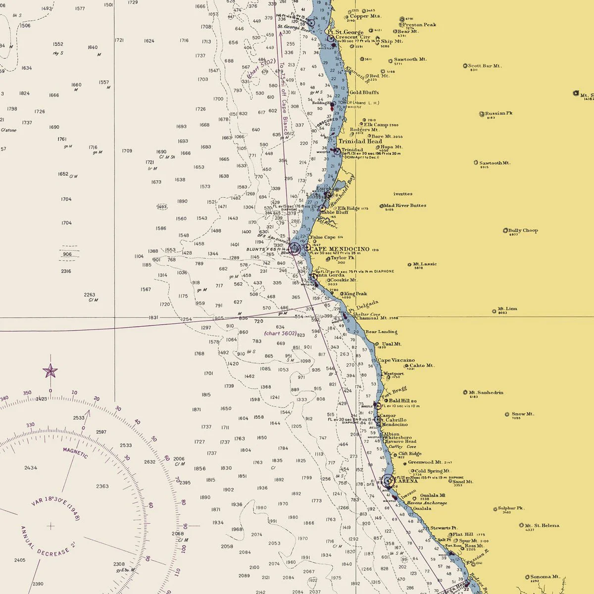
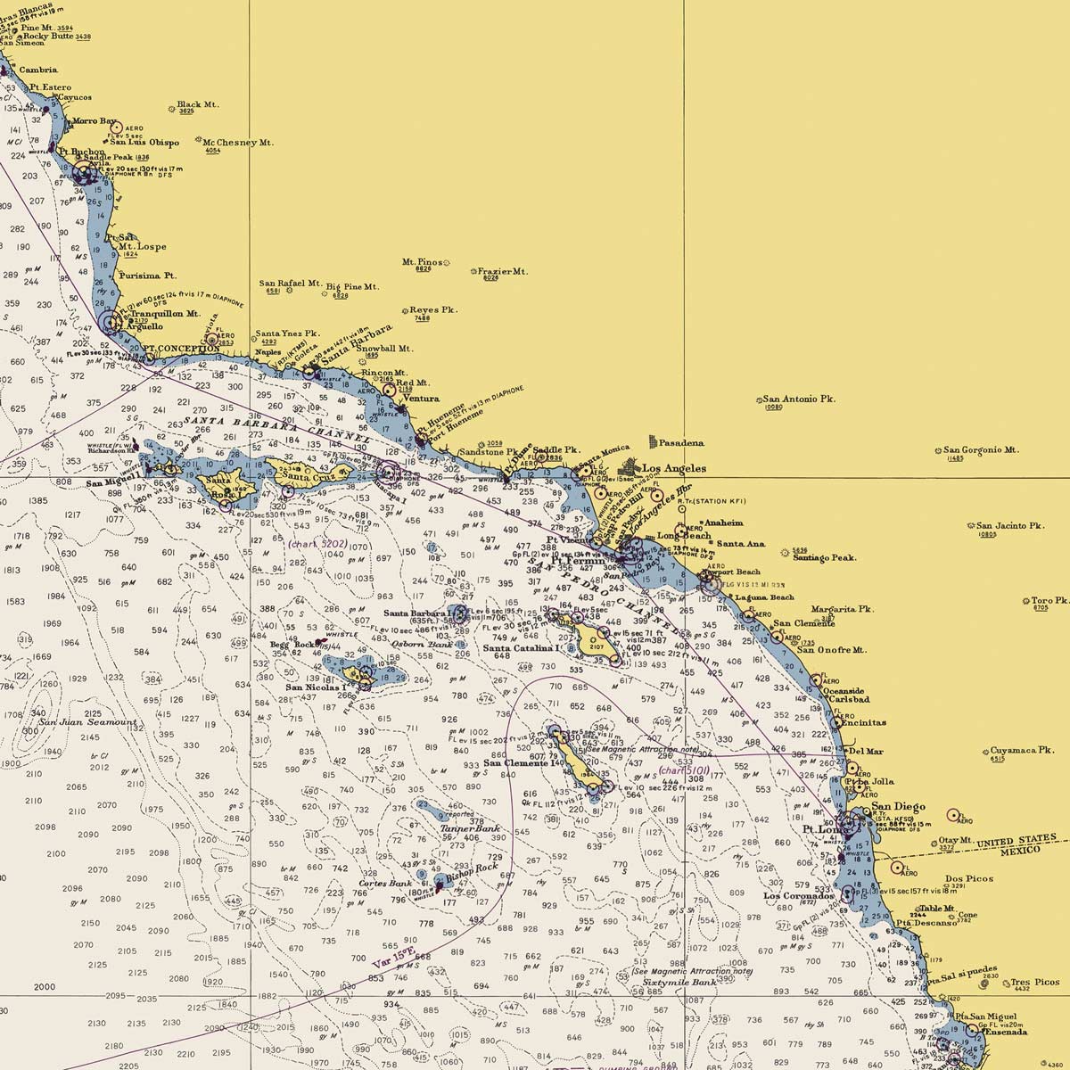
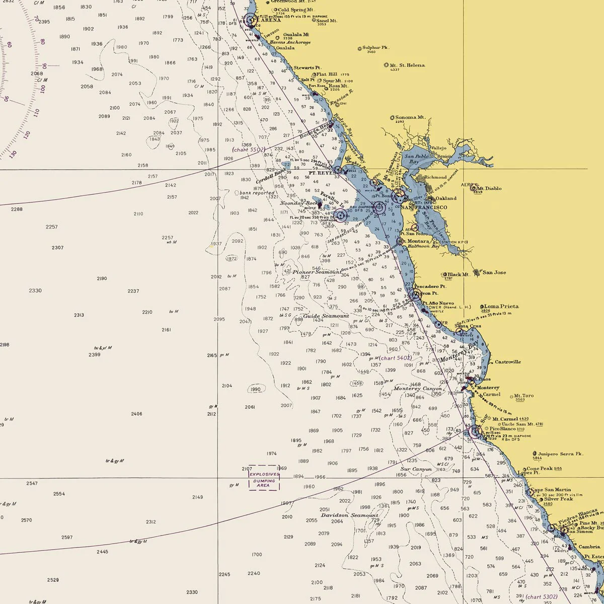
San Diego to Point St. George Nautical Chart 1948
We digitally corrected the original map by removing creases, tears, writing, stamps, etc., to create a remastered version of this historical San Diego to Point St. George map.
Product Information
Product Information
Shipping & Returns
Shipping & Returns
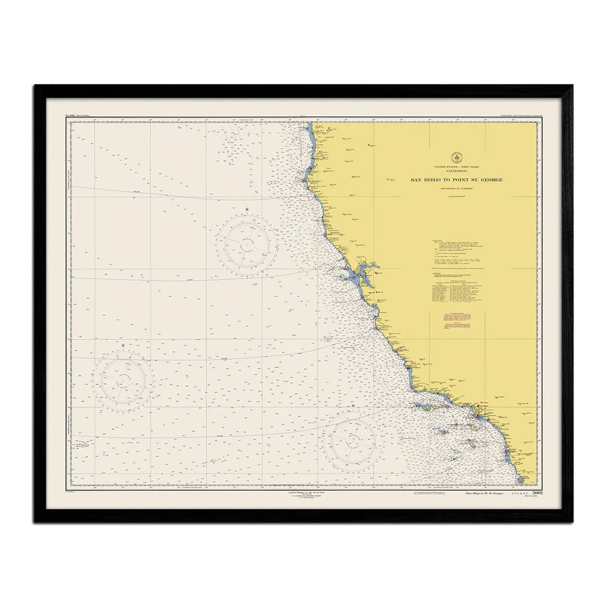
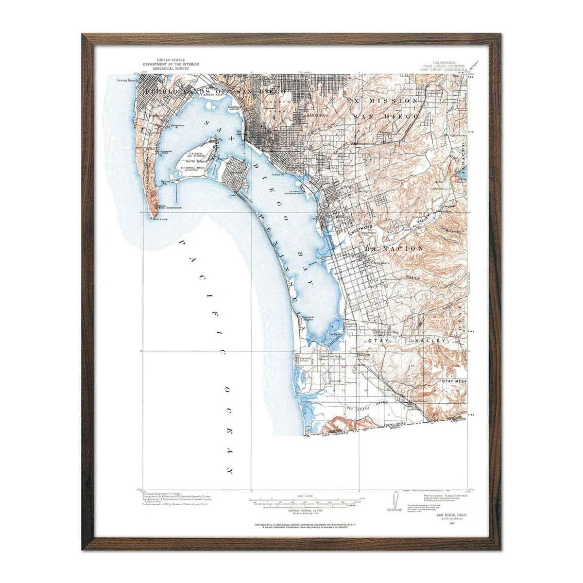
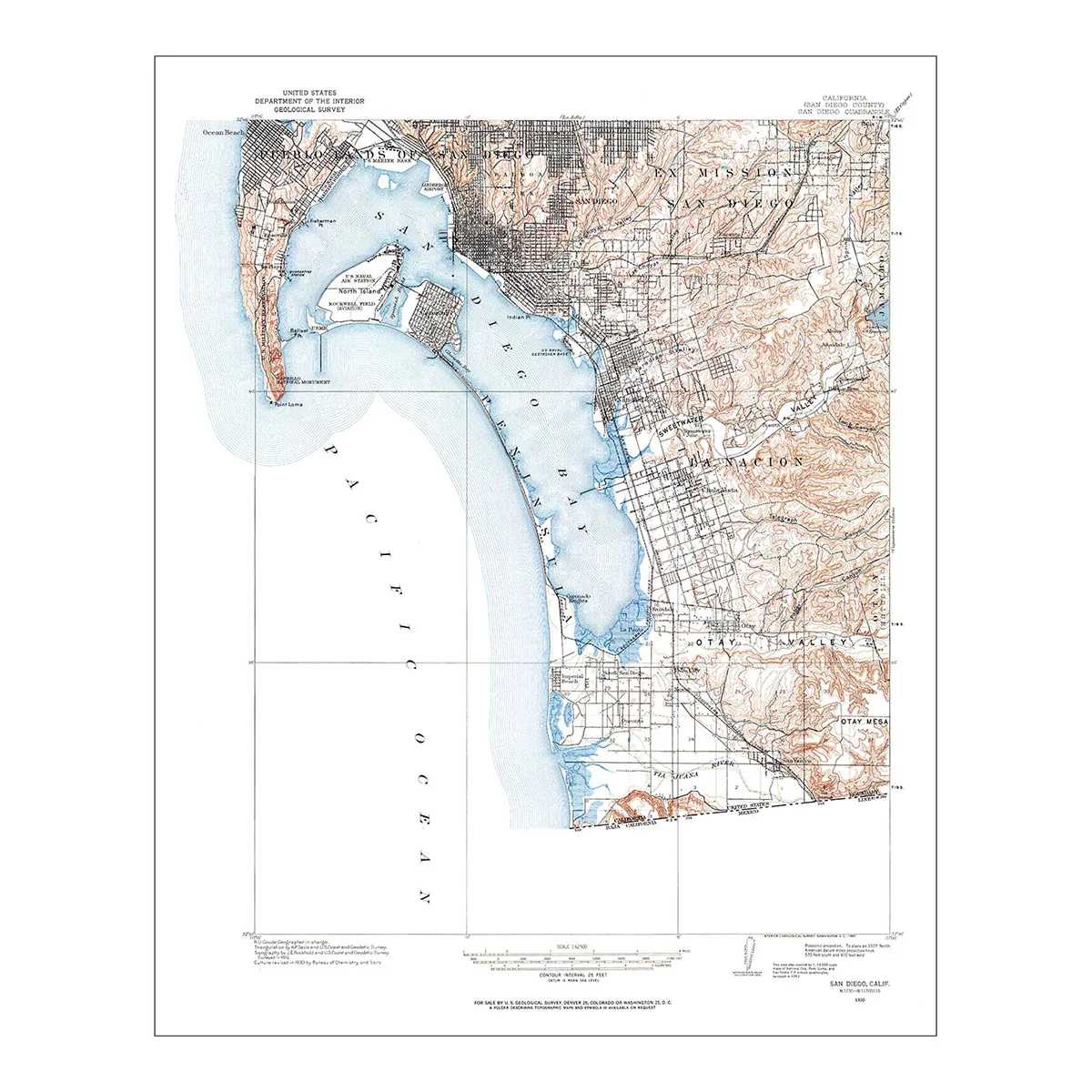
San Diego to Point St. George Nautical Chart 1948
San Diego to Point St. George Nautical Chart 1948
We digitally corrected the original map by removing creases, tears, writing, stamps, etc., to create a remastered version of this historical San Diego to Point St. George map.
Select Size
Select Material
Select Frame
From $333,000.00
Original: $1,110,000.00
-70%San Diego to Point St. George Nautical Chart 1948—
$1,110,000.00
$333,000.00Product Information
Product Information
Shipping & Returns
Shipping & Returns
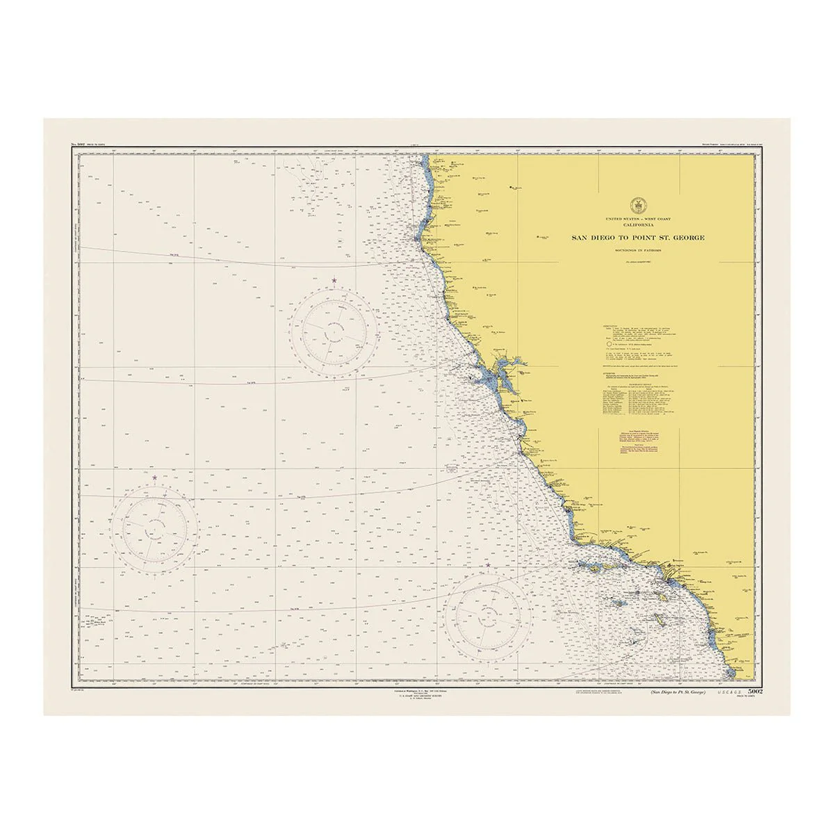
Description
We digitally corrected the original map by removing creases, tears, writing, stamps, etc., to create a remastered version of this historical San Diego to Point St. George map.