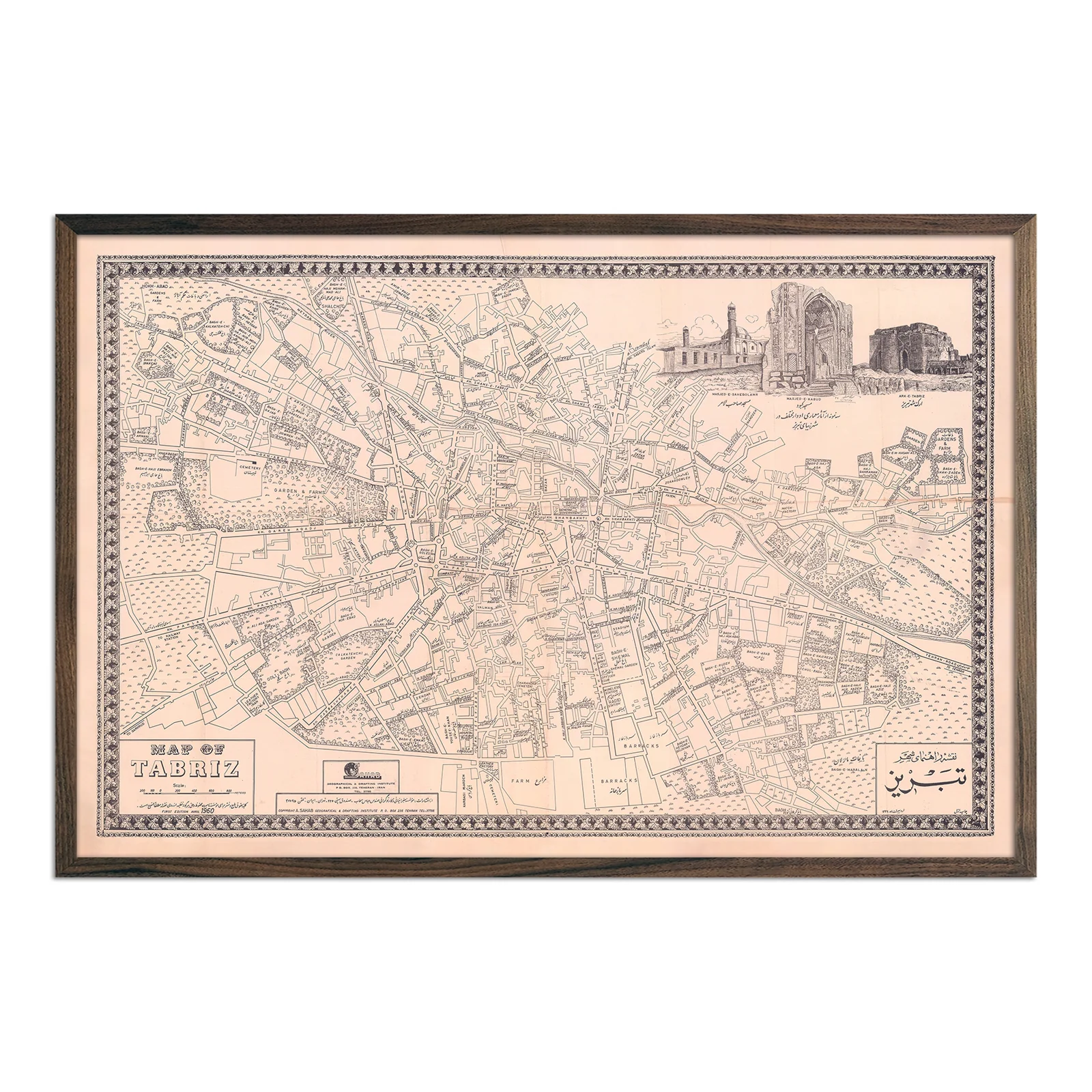
Tabriz City 1960 Map
This is a reproduction of a 1960 city guide originally created by the Sahab Geographic & Drafting Institute. It offers a precise view of Tabriz, Iran, during a period of major urban development. The map details the city’s street layout, districts, and green spaces.
It features labels in both Persian and English, along with illustrated architectural landmarks such as the Saheb-ol-Amr Mosque, Blue Mosque, and Ark e Ali Shah Mosque. A patterned border and preserved paper tone reflect the visual style of the period. The ornate border also calls to mind the intricate hand-woven rugs that have been crafted in the city since the 16th century.
Remastered for display or research, this reproduction of the 1960 map is printed on archival-quality paper. It combines historical accuracy with visual clarity.
Product Information
Product Information
Shipping & Returns
Shipping & Returns
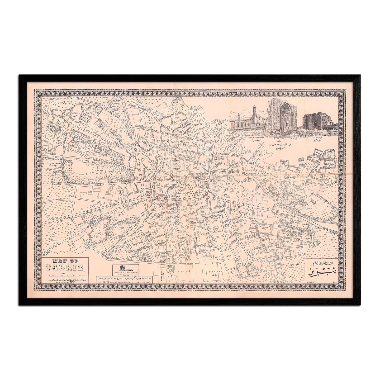


Tabriz City 1960 Map
Tabriz City 1960 Map
This is a reproduction of a 1960 city guide originally created by the Sahab Geographic & Drafting Institute. It offers a precise view of Tabriz, Iran, during a period of major urban development. The map details the city’s street layout, districts, and green spaces.
It features labels in both Persian and English, along with illustrated architectural landmarks such as the Saheb-ol-Amr Mosque, Blue Mosque, and Ark e Ali Shah Mosque. A patterned border and preserved paper tone reflect the visual style of the period. The ornate border also calls to mind the intricate hand-woven rugs that have been crafted in the city since the 16th century.
Remastered for display or research, this reproduction of the 1960 map is printed on archival-quality paper. It combines historical accuracy with visual clarity.
Select Size
Select Material
Select Frame
From $162.90
Original: $543.00
-70%Tabriz City 1960 Map—
$543.00
$162.90Product Information
Product Information
Shipping & Returns
Shipping & Returns
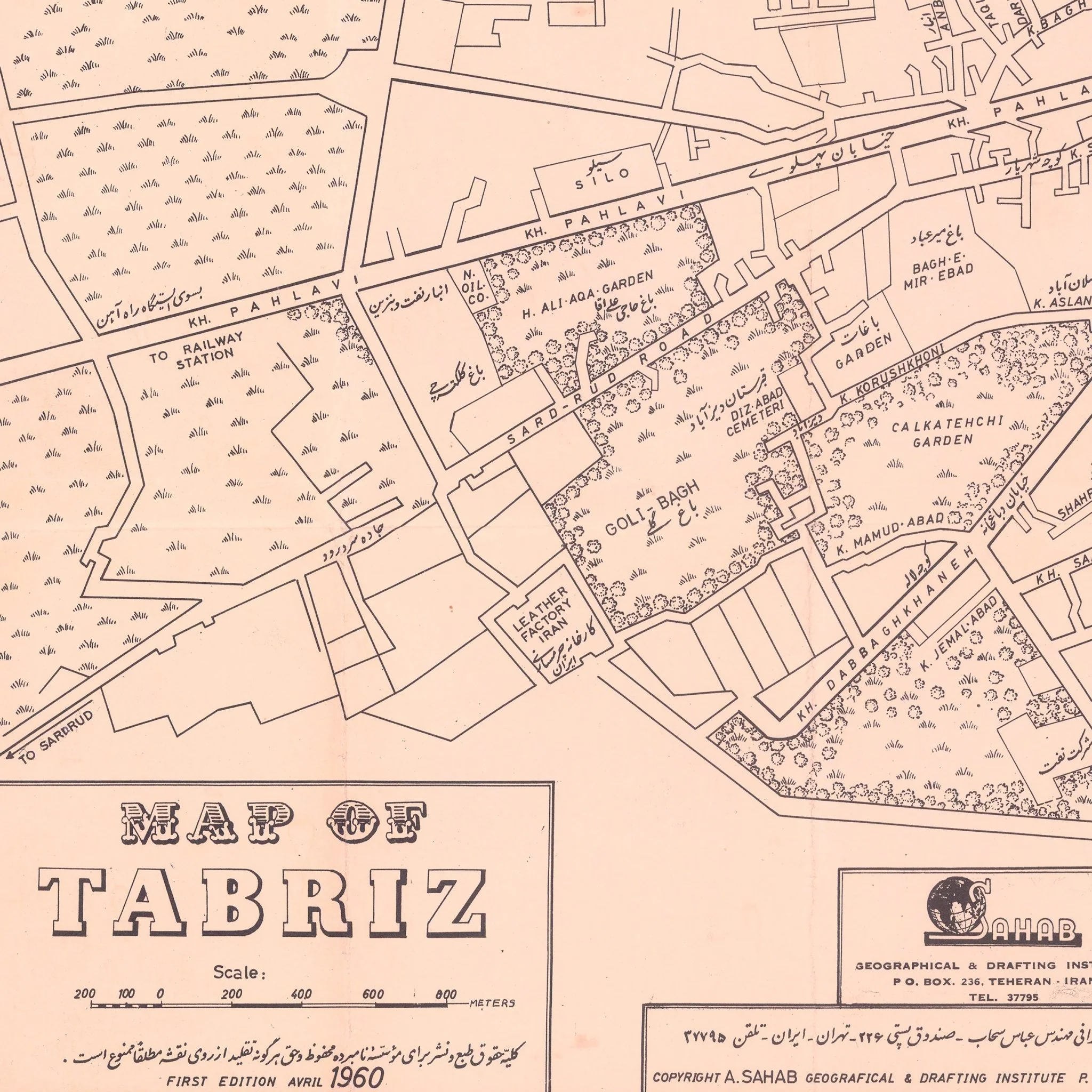
Description
This is a reproduction of a 1960 city guide originally created by the Sahab Geographic & Drafting Institute. It offers a precise view of Tabriz, Iran, during a period of major urban development. The map details the city’s street layout, districts, and green spaces.
It features labels in both Persian and English, along with illustrated architectural landmarks such as the Saheb-ol-Amr Mosque, Blue Mosque, and Ark e Ali Shah Mosque. A patterned border and preserved paper tone reflect the visual style of the period. The ornate border also calls to mind the intricate hand-woven rugs that have been crafted in the city since the 16th century.
Remastered for display or research, this reproduction of the 1960 map is printed on archival-quality paper. It combines historical accuracy with visual clarity.