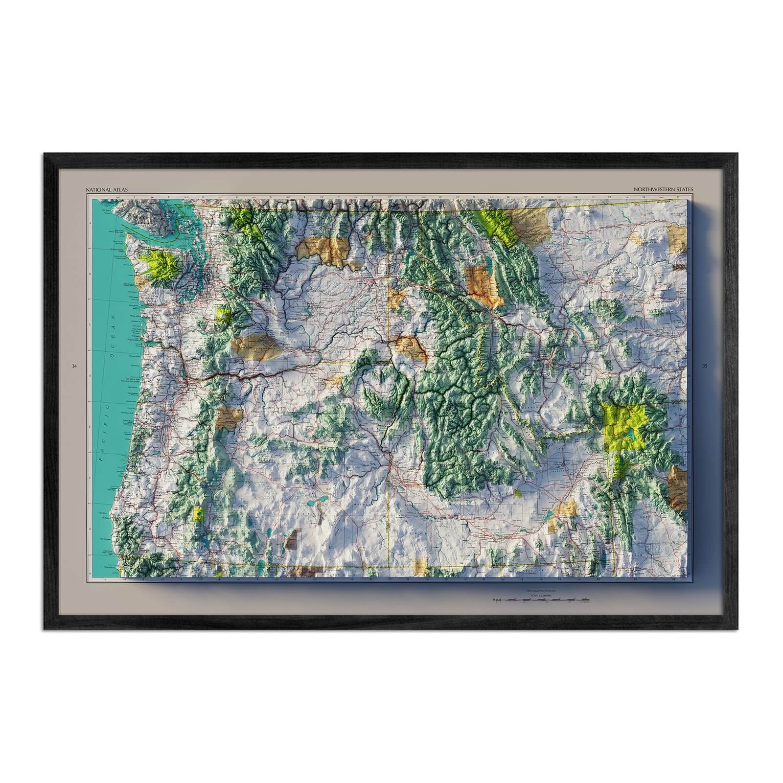
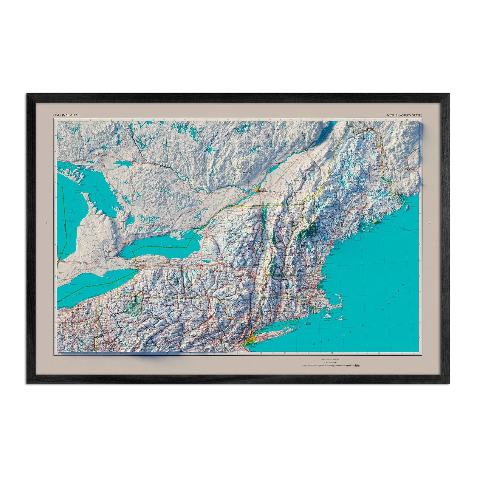
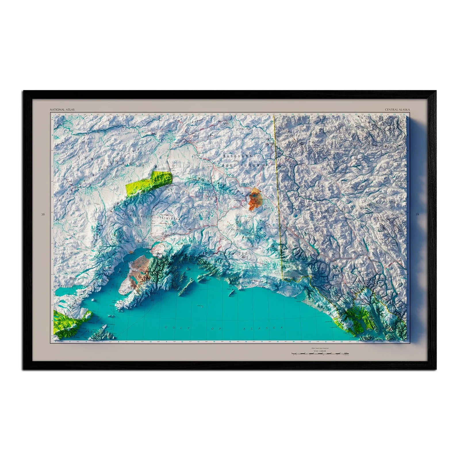
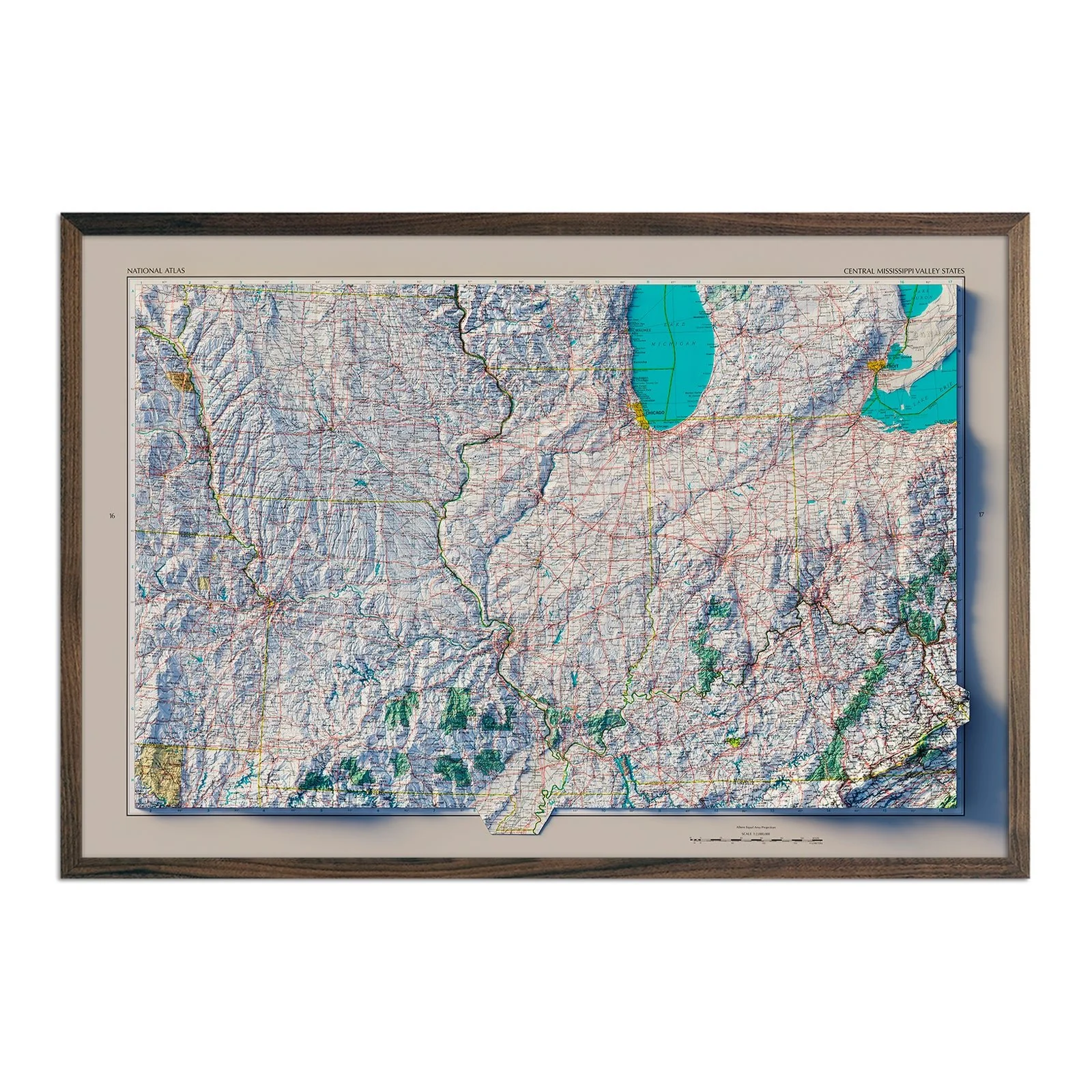
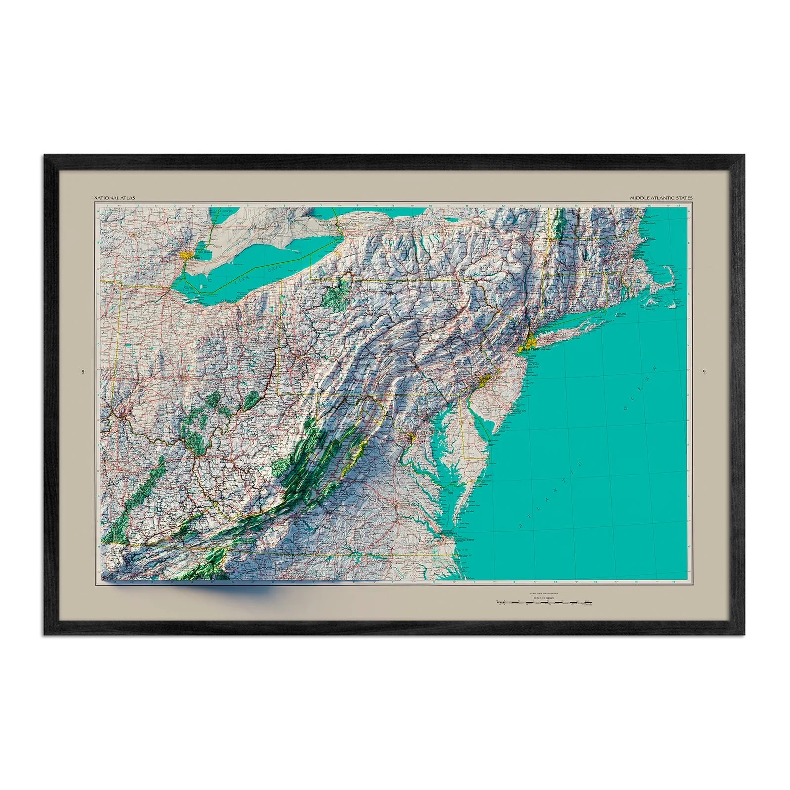
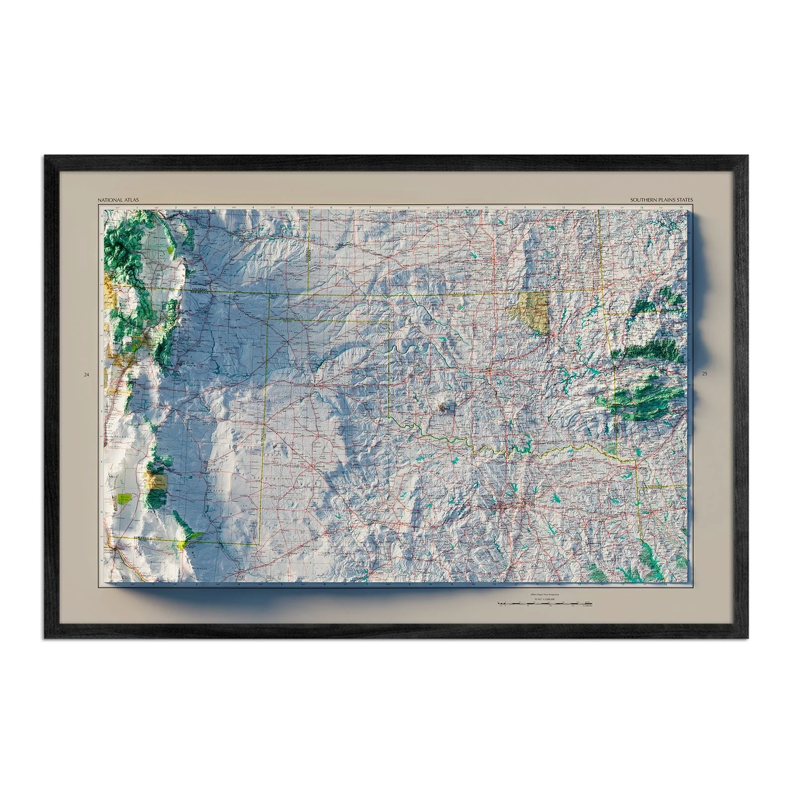
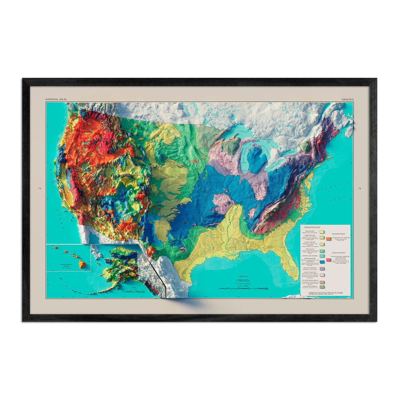
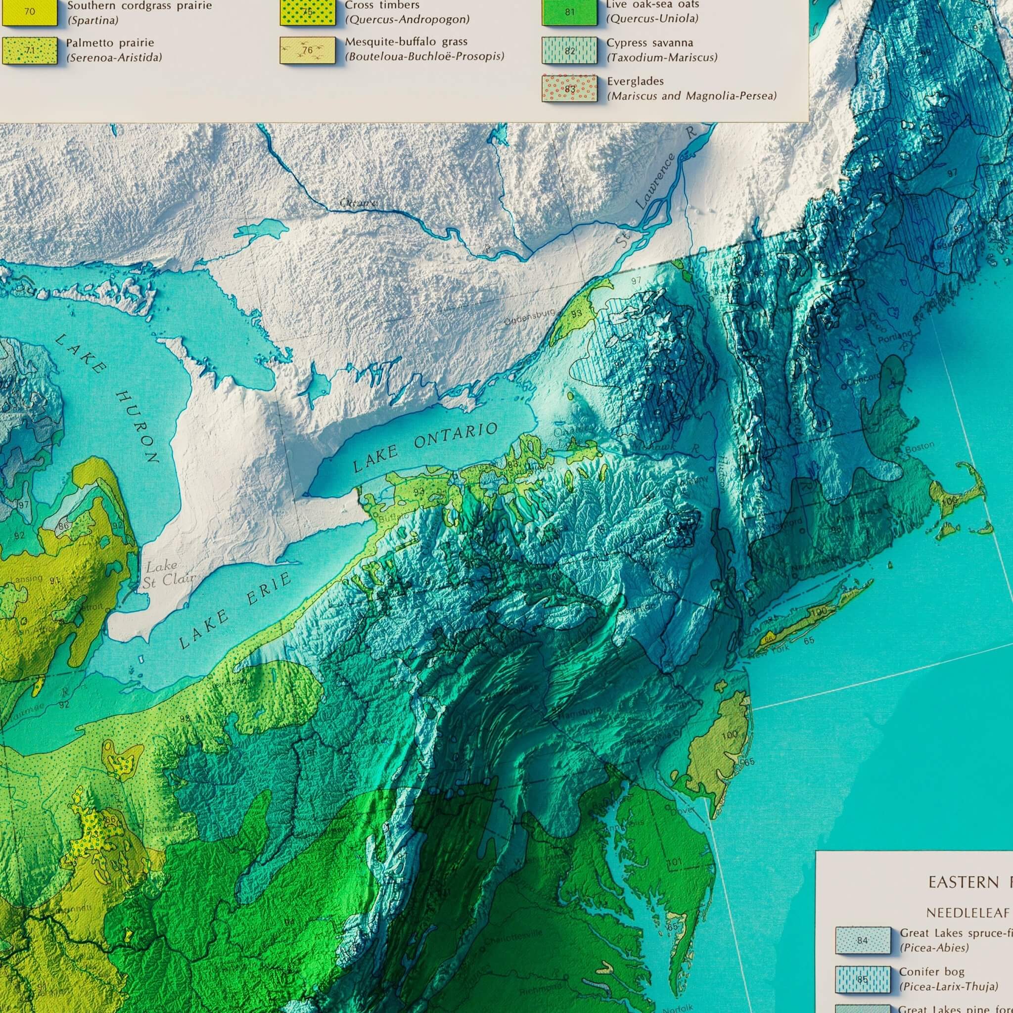
USA Natural Vegetation 1970 Shaded Relief Map
We created this map with the illusion of 3D by applying Digital Elevation Data and meticulously adding shaded relief to the landscape of the original. The map of the USA Potential Natural Vegetation was first published as part of the 1970 United States National Atlas created by the USGS and includes political boundaries, cities, railways, roads, ferry lines, Indian reservations, national forests and parks, mountains, mesas, valleys, deserts, bodies of water, drainage, coastlines, and islands. The shading that we added is printed on the paper and is not a result of the map protruding from the surface.
Please Note: Text on the map can be difficult to read due to the small font size and the age of the map. In areas where the relief shading covers the text, the underlying text is not legible. We suggest the largest size map for better details though the text may still be covered in the darker areas.
Product Information
Product Information
Shipping & Returns
Shipping & Returns


USA Natural Vegetation 1970 Shaded Relief Map
USA Natural Vegetation 1970 Shaded Relief Map
We created this map with the illusion of 3D by applying Digital Elevation Data and meticulously adding shaded relief to the landscape of the original. The map of the USA Potential Natural Vegetation was first published as part of the 1970 United States National Atlas created by the USGS and includes political boundaries, cities, railways, roads, ferry lines, Indian reservations, national forests and parks, mountains, mesas, valleys, deserts, bodies of water, drainage, coastlines, and islands. The shading that we added is printed on the paper and is not a result of the map protruding from the surface.
Please Note: Text on the map can be difficult to read due to the small font size and the age of the map. In areas where the relief shading covers the text, the underlying text is not legible. We suggest the largest size map for better details though the text may still be covered in the darker areas.
Original: $1,370,000.00
-70%$1,370,000.00
$411,000.00Product Information
Product Information
Shipping & Returns
Shipping & Returns
Description
We created this map with the illusion of 3D by applying Digital Elevation Data and meticulously adding shaded relief to the landscape of the original. The map of the USA Potential Natural Vegetation was first published as part of the 1970 United States National Atlas created by the USGS and includes political boundaries, cities, railways, roads, ferry lines, Indian reservations, national forests and parks, mountains, mesas, valleys, deserts, bodies of water, drainage, coastlines, and islands. The shading that we added is printed on the paper and is not a result of the map protruding from the surface.
Please Note: Text on the map can be difficult to read due to the small font size and the age of the map. In areas where the relief shading covers the text, the underlying text is not legible. We suggest the largest size map for better details though the text may still be covered in the darker areas.