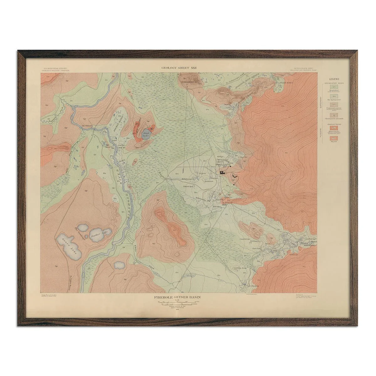
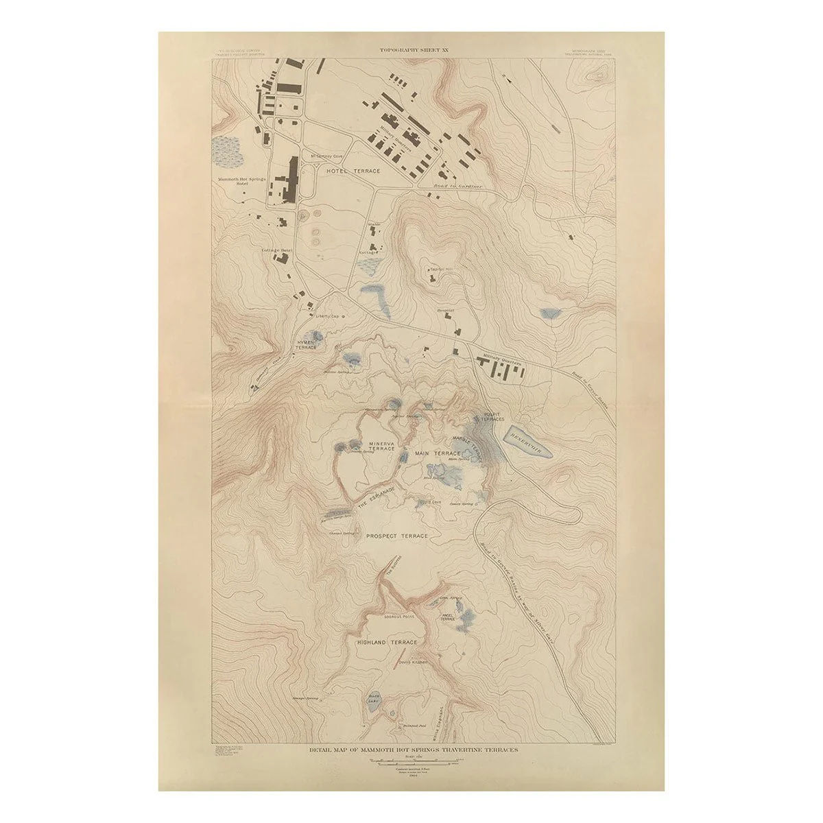
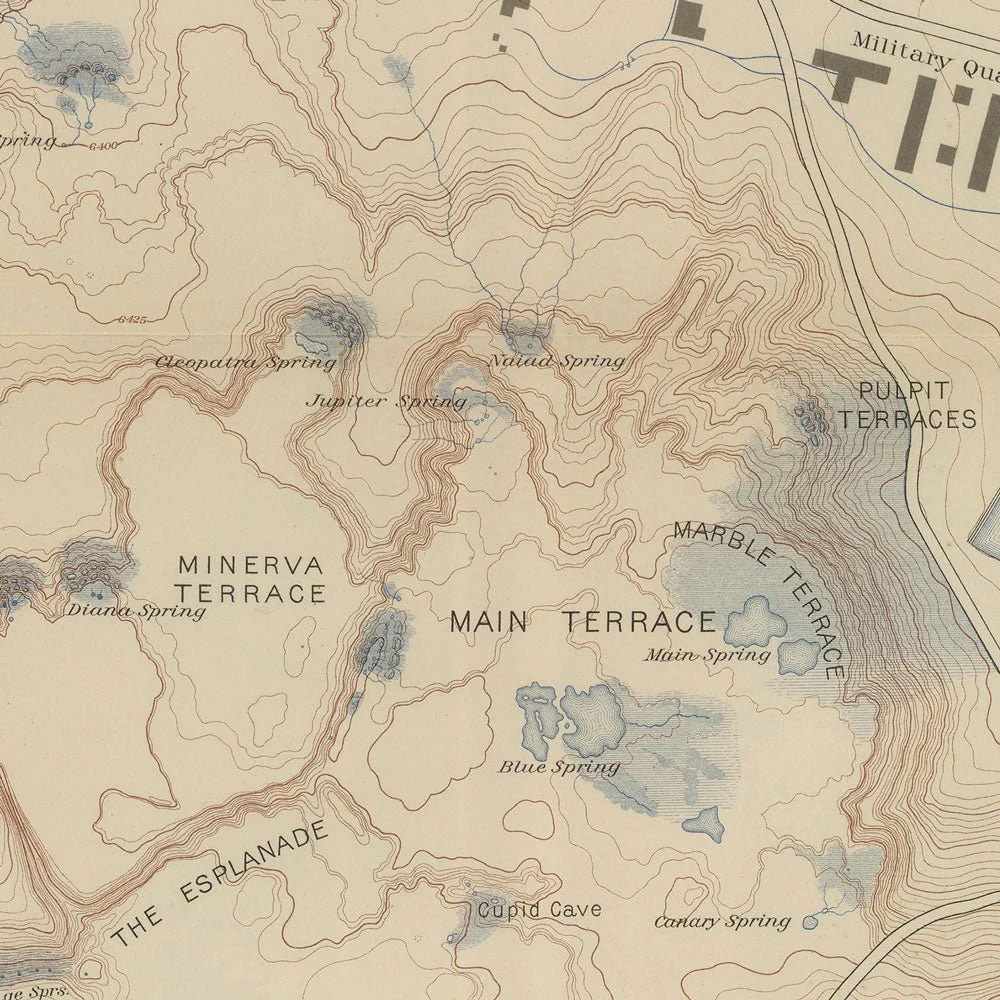
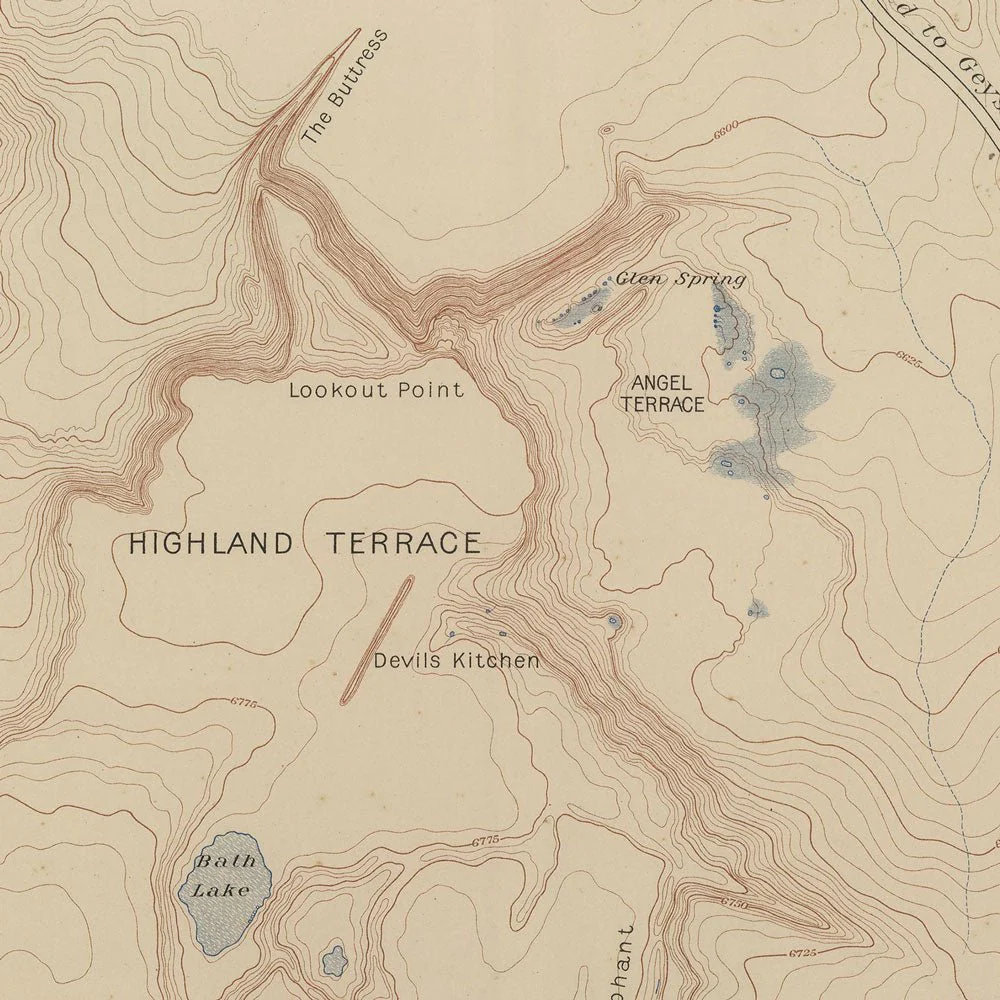
Yellowstone Topographic Map of Mammoth Springs and Travertine Terraces 1904 Map
We love old maps. Their coloration, typography, legends, notations, and sometimes even outdated place names all have a nostalgic quality that gives them a special beauty. If you share our love for vintage maps, you’ll appreciate this Topographic map of Yellowstone Mammoth Springs and Travertine Terraces in our Historic Series.
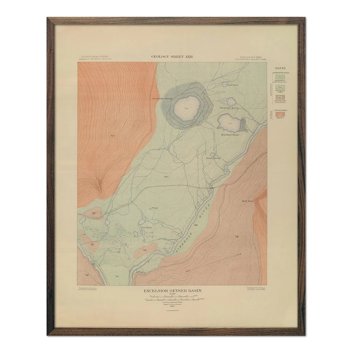
This is a reproduction print of the 1904 Topographic map of Mammoth Springs and Travertine Terraces of Yellowstone created by the USGS. The Geologist in charge of this work was Arnold Hague which was printed by Julies Bien and Co. The topography is shown with contour lines in 100-foot intervals, overlaid in color indicating 26 different rock types and faults.
Product Information
Product Information
Shipping & Returns
Shipping & Returns


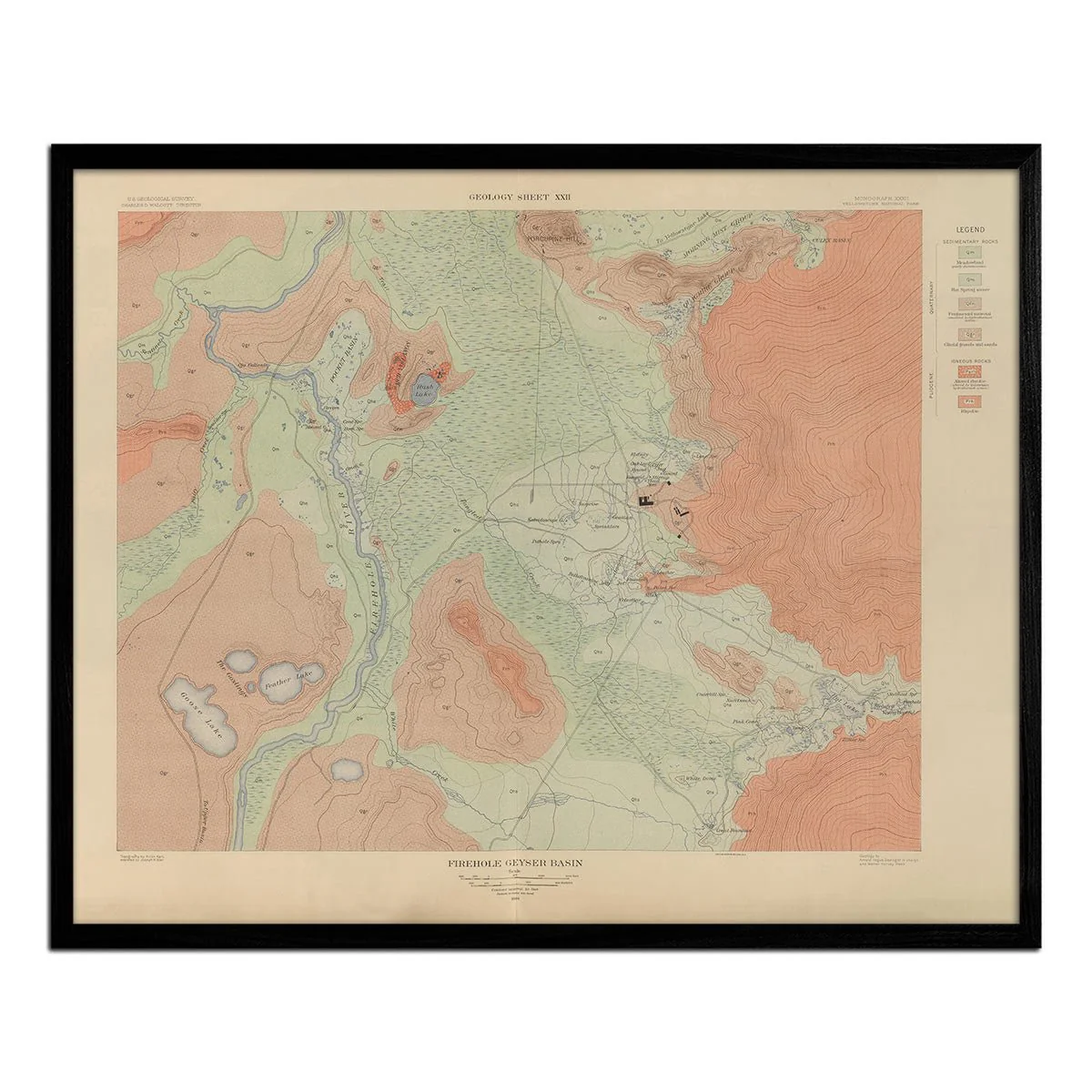
Yellowstone Topographic Map of Mammoth Springs and Travertine Terraces 1904 Map
Yellowstone Topographic Map of Mammoth Springs and Travertine Terraces 1904 Map
We love old maps. Their coloration, typography, legends, notations, and sometimes even outdated place names all have a nostalgic quality that gives them a special beauty. If you share our love for vintage maps, you’ll appreciate this Topographic map of Yellowstone Mammoth Springs and Travertine Terraces in our Historic Series.
This is a reproduction print of the 1904 Topographic map of Mammoth Springs and Travertine Terraces of Yellowstone created by the USGS. The Geologist in charge of this work was Arnold Hague which was printed by Julies Bien and Co. The topography is shown with contour lines in 100-foot intervals, overlaid in color indicating 26 different rock types and faults.
Original: $6,200.00
-70%$6,200.00
$1,860.00Product Information
Product Information
Shipping & Returns
Shipping & Returns
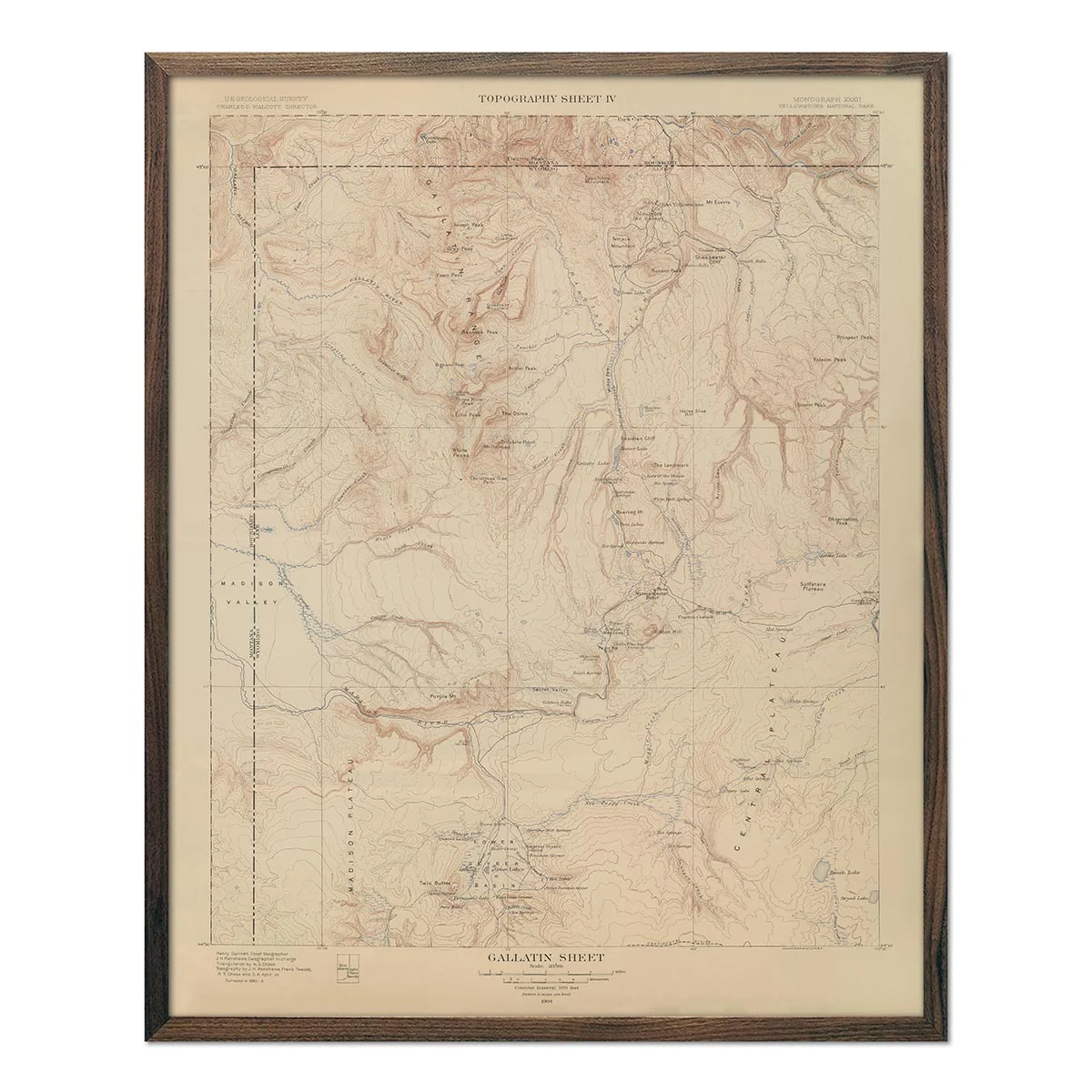
Description
We love old maps. Their coloration, typography, legends, notations, and sometimes even outdated place names all have a nostalgic quality that gives them a special beauty. If you share our love for vintage maps, you’ll appreciate this Topographic map of Yellowstone Mammoth Springs and Travertine Terraces in our Historic Series.
This is a reproduction print of the 1904 Topographic map of Mammoth Springs and Travertine Terraces of Yellowstone created by the USGS. The Geologist in charge of this work was Arnold Hague which was printed by Julies Bien and Co. The topography is shown with contour lines in 100-foot intervals, overlaid in color indicating 26 different rock types and faults.