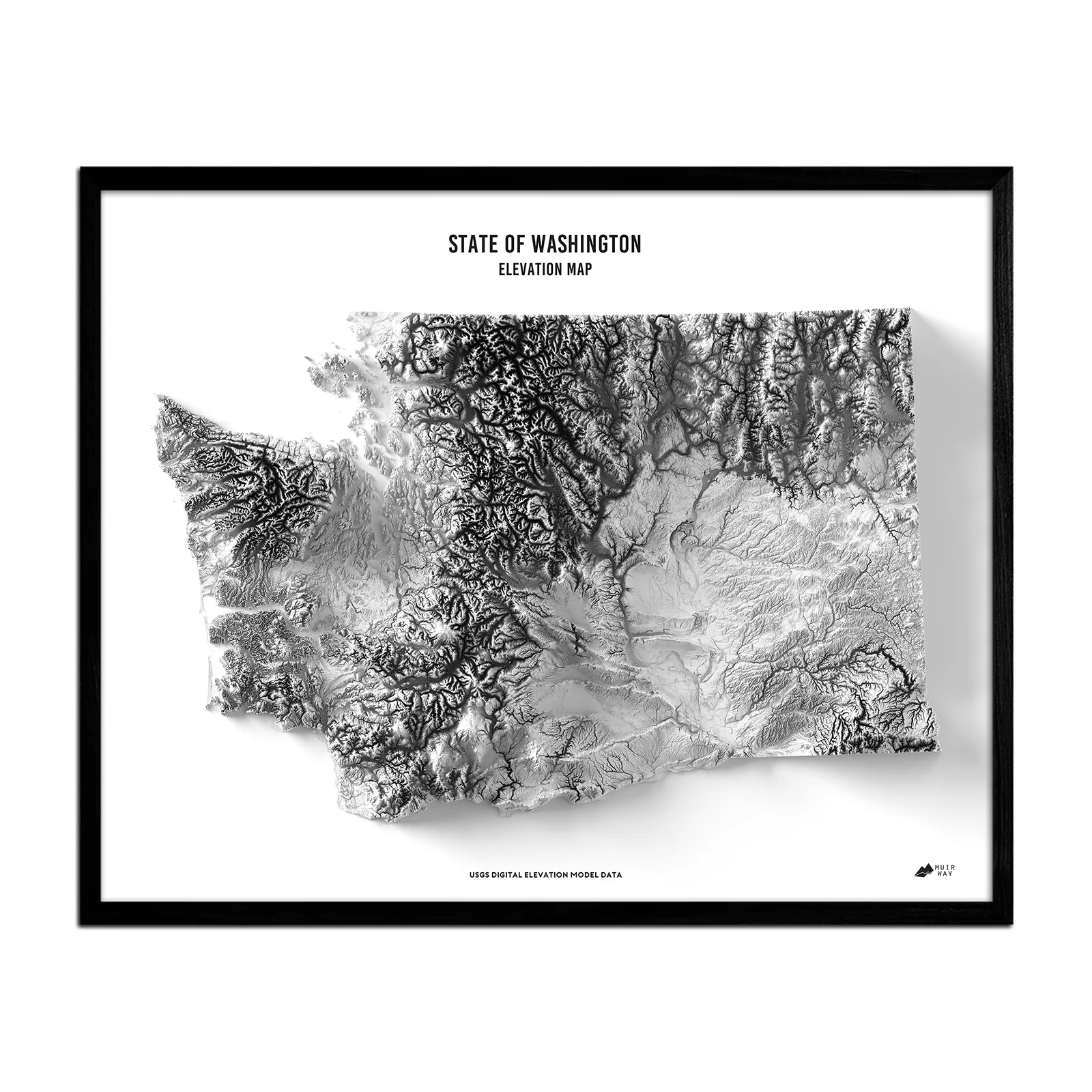
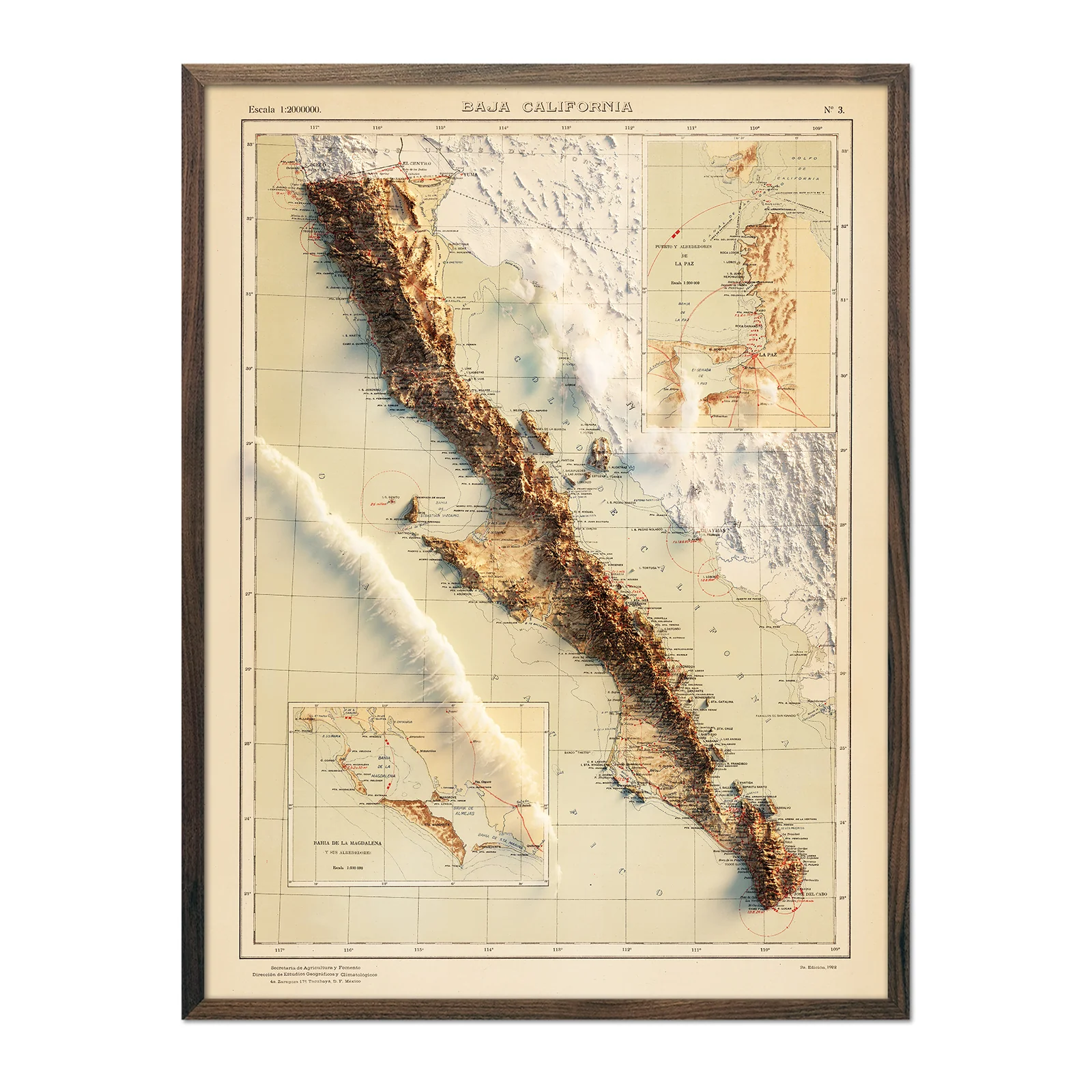
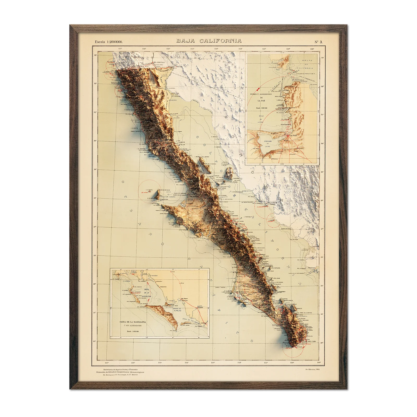
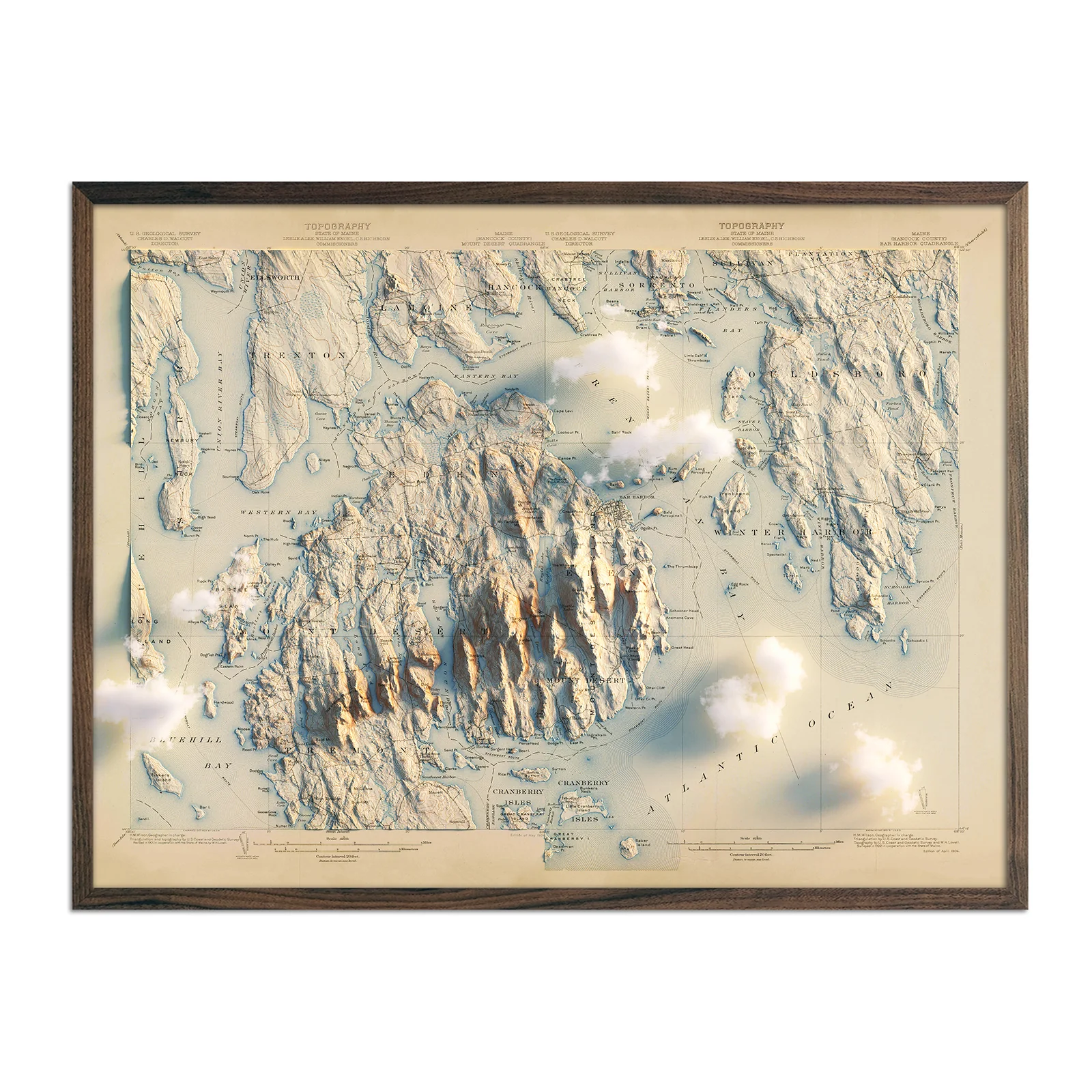
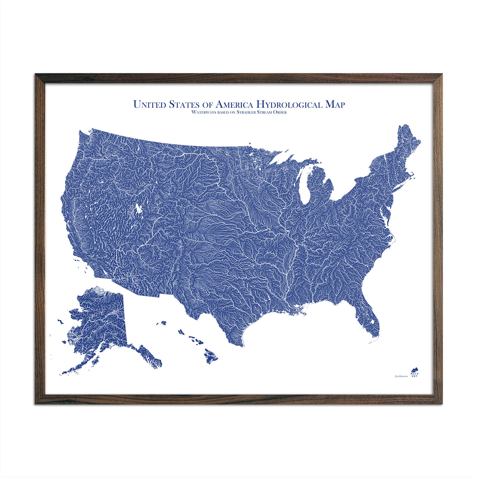
US Hydrological Map
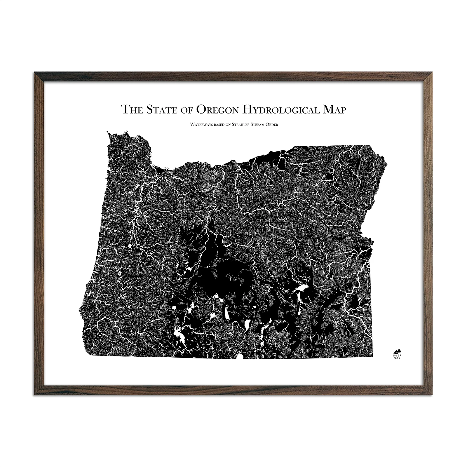
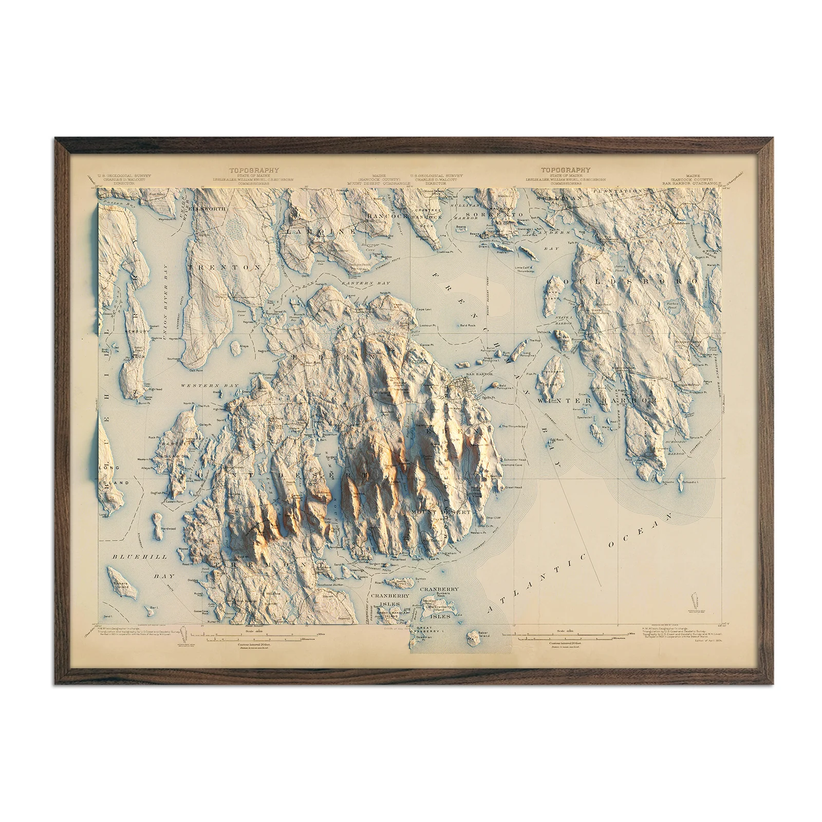
Water is literally the lifeblood of any country. If you’re drawn to water, you know that how and where it flows tells the story of a place.
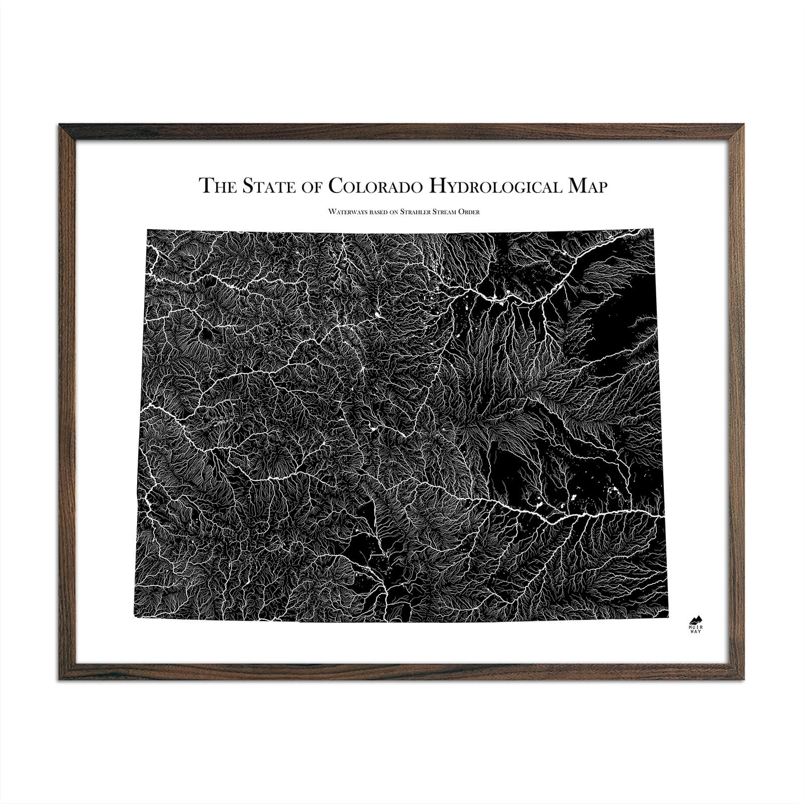
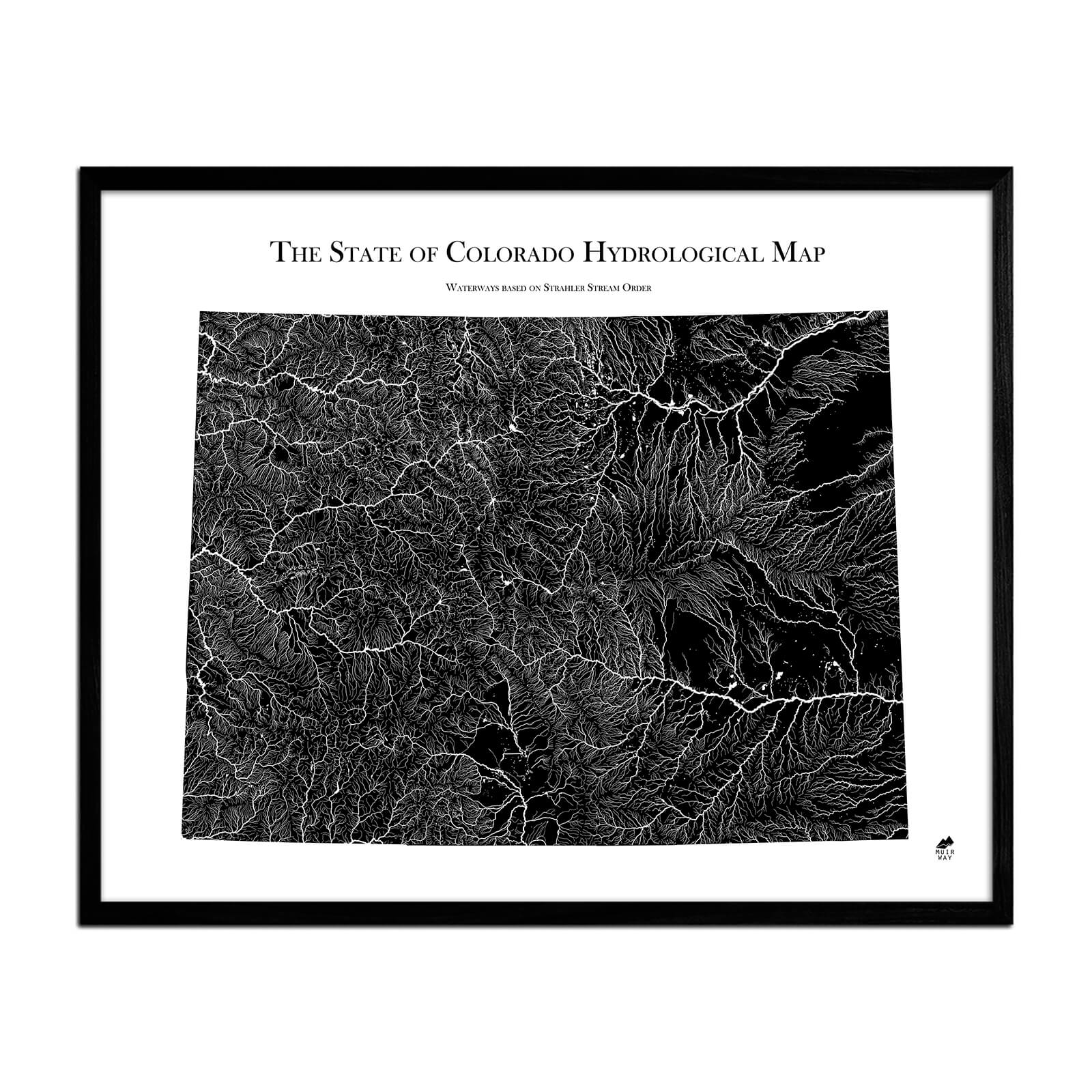
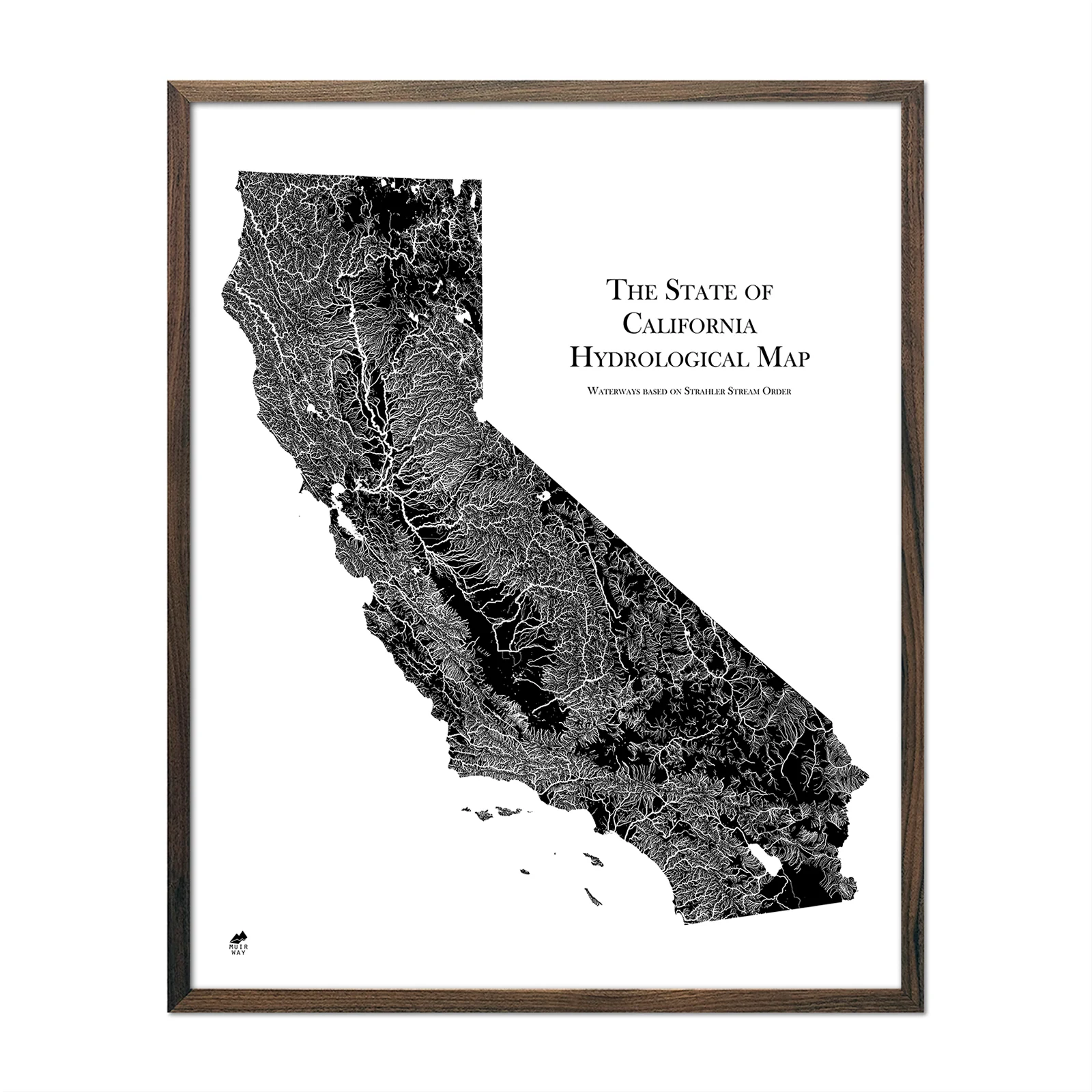
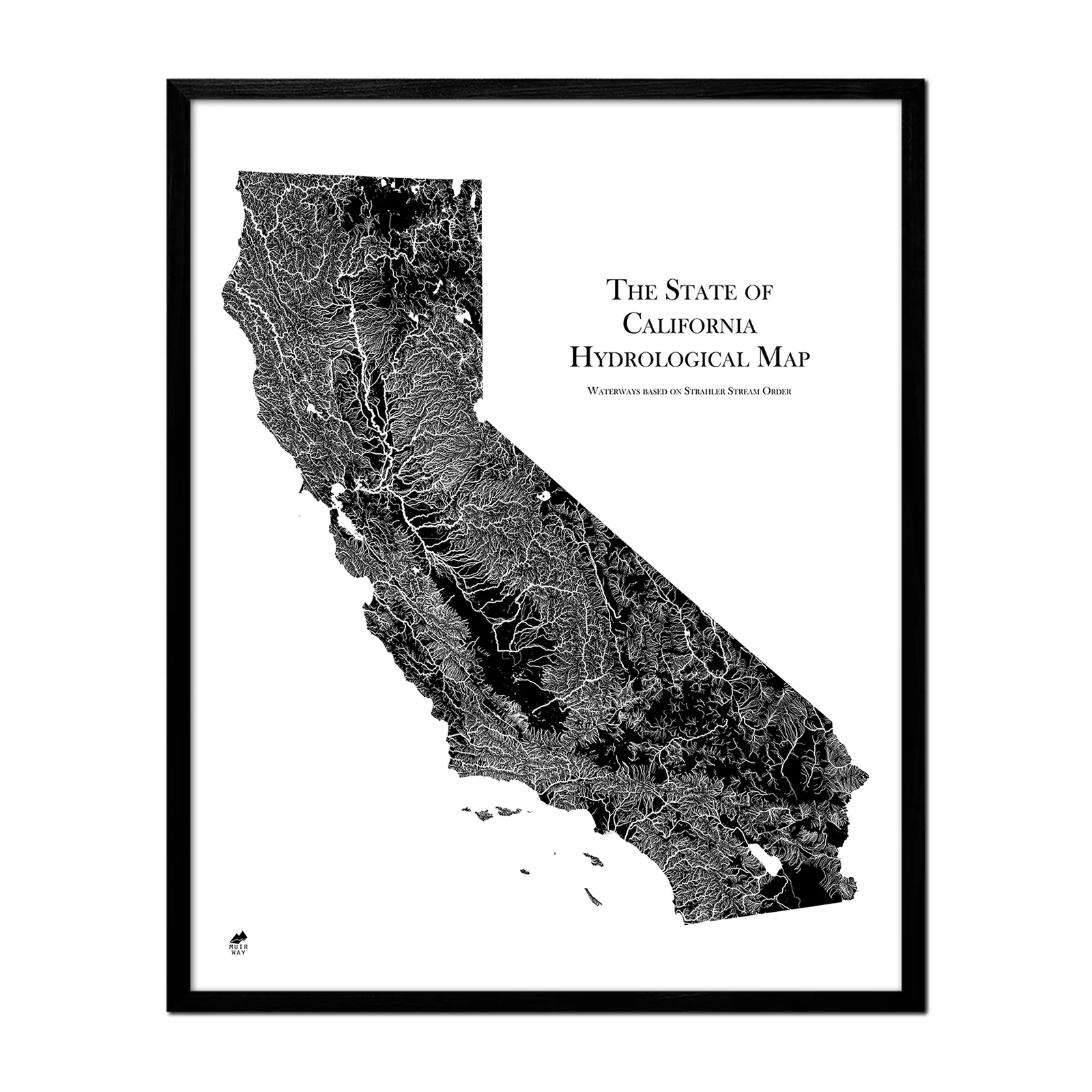
The USA Hydrological Map shows every river, stream, and lake, including non-perennial waterways, in fascinating detail. Our map of these water bodies displays the USA’s (Lower-48, Hawaii, and Alaska) rivers and streams using the Strahler Stream Order method. This method displays them graphically by rank, mapping how they interconnect in their intricate watersheds. The flow of water also has a dendritic, aesthetic elegance that our map captures beautifully.
Our map of the USA depicts every watercourse in the country in detail, from large rivers to intermittent streams, and every body of water with a diameter greater than 6 miles. For an extra aesthetic touch, we apply the Strahler Stream Order method to show the hierarchy of streams as they flow from their source. Lines representing rivers thicken as they acquire the flow of tributaries and gain relative importance. This allows us to legibly map a dry gulch in Nevada alongside the mighty Mississippi-Missouri River system, and enhances a sense of the interconnectedness of our waterways.
In our Hydrology Series, you’ll not only find your favorite rivers and lakes, but you’ll also be able to trace their origins and outflow and appreciate the beauty of their connections.
Product Information
Product Information
Shipping & Returns
Shipping & Returns


US Hydrological Map
US Hydrological Map
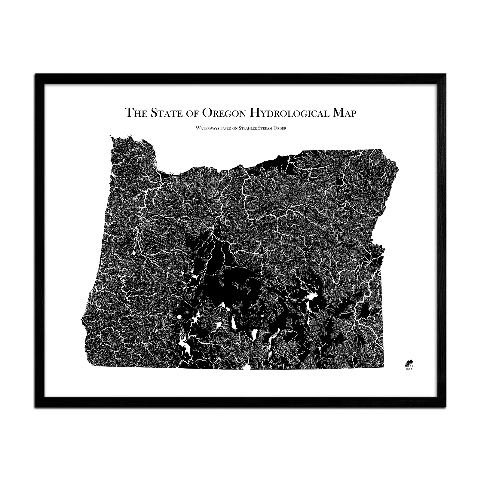
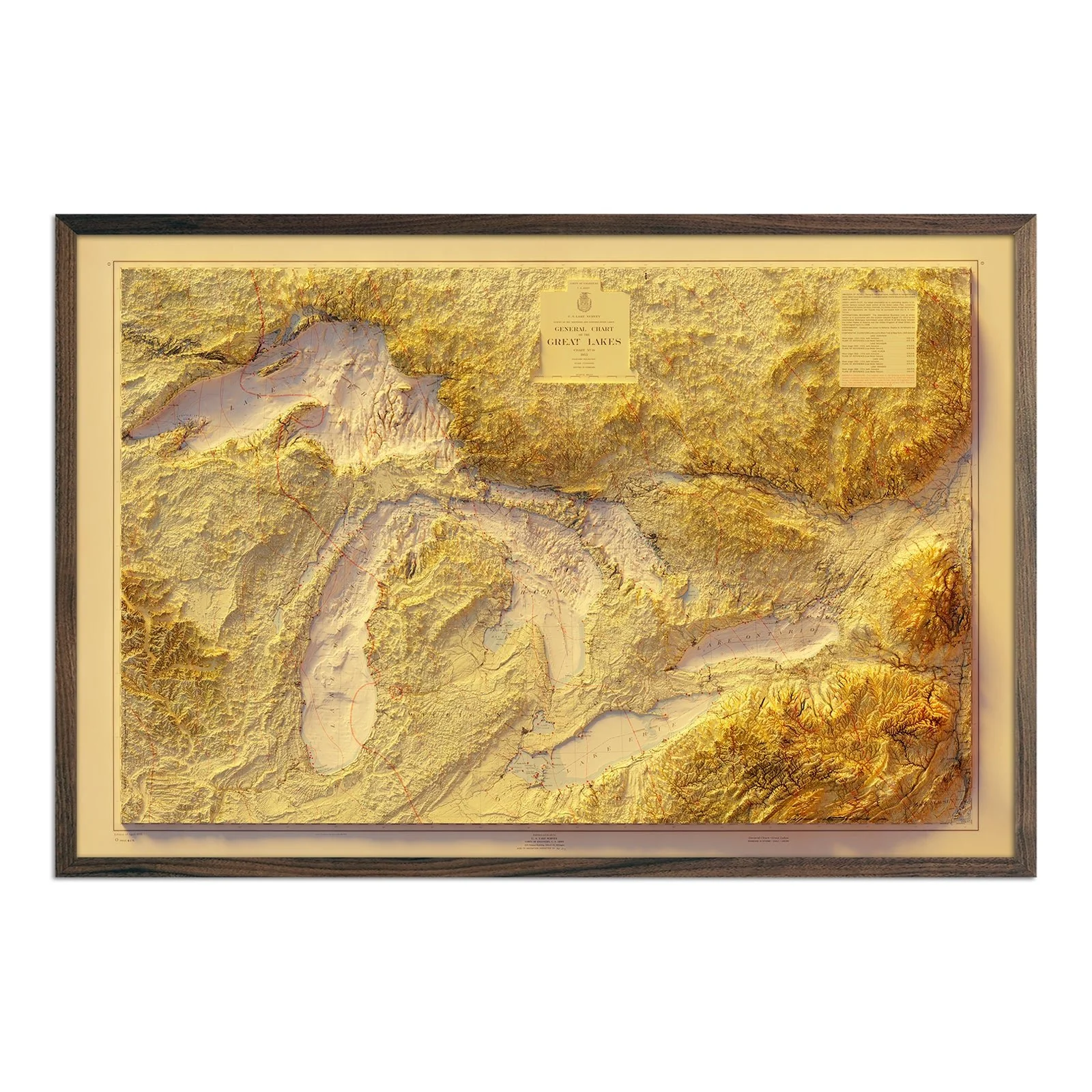
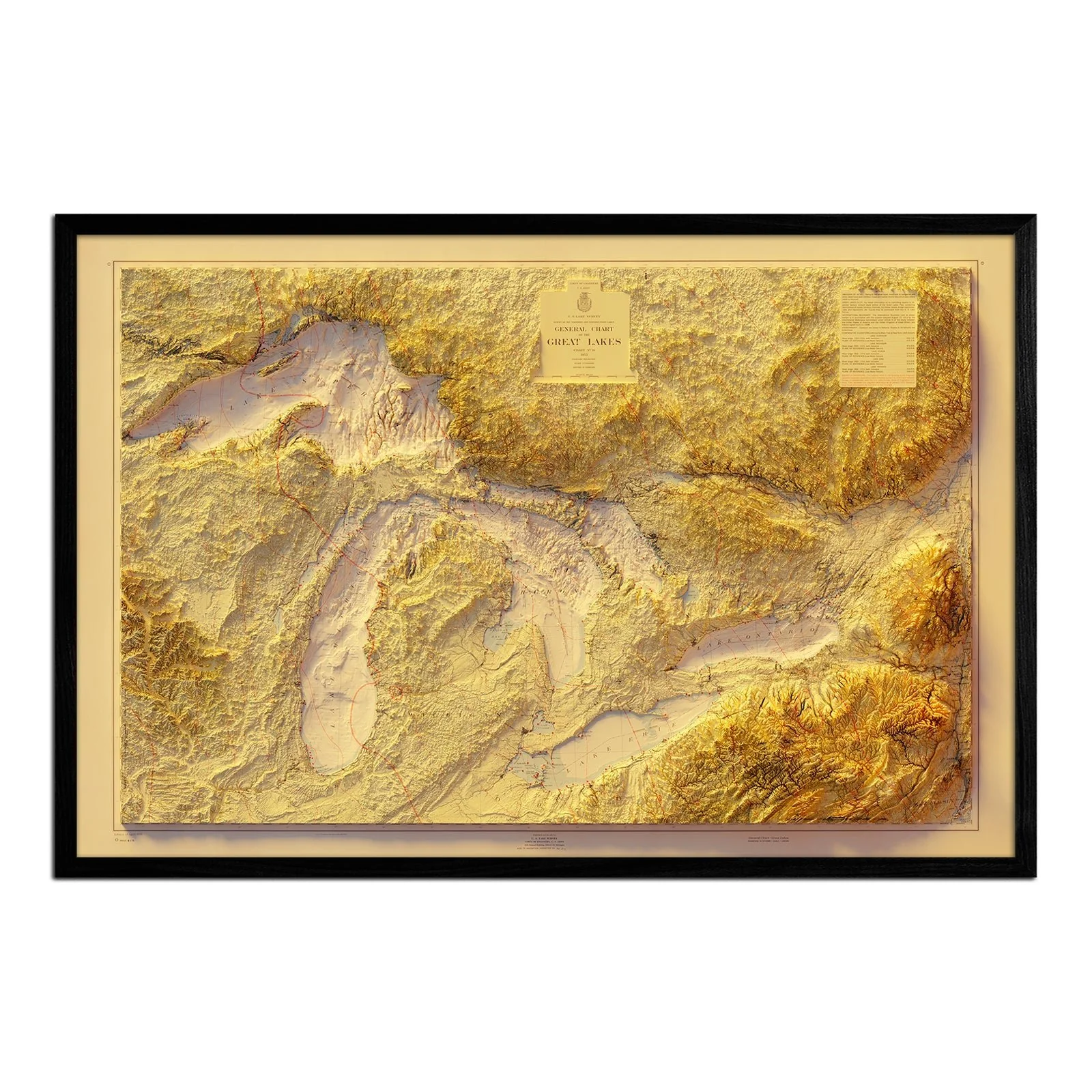
Water is literally the lifeblood of any country. If you’re drawn to water, you know that how and where it flows tells the story of a place.
The USA Hydrological Map shows every river, stream, and lake, including non-perennial waterways, in fascinating detail. Our map of these water bodies displays the USA’s (Lower-48, Hawaii, and Alaska) rivers and streams using the Strahler Stream Order method. This method displays them graphically by rank, mapping how they interconnect in their intricate watersheds. The flow of water also has a dendritic, aesthetic elegance that our map captures beautifully.
Our map of the USA depicts every watercourse in the country in detail, from large rivers to intermittent streams, and every body of water with a diameter greater than 6 miles. For an extra aesthetic touch, we apply the Strahler Stream Order method to show the hierarchy of streams as they flow from their source. Lines representing rivers thicken as they acquire the flow of tributaries and gain relative importance. This allows us to legibly map a dry gulch in Nevada alongside the mighty Mississippi-Missouri River system, and enhances a sense of the interconnectedness of our waterways.
In our Hydrology Series, you’ll not only find your favorite rivers and lakes, but you’ll also be able to trace their origins and outflow and appreciate the beauty of their connections.
Original: $622.00
-70%$622.00
$186.60Product Information
Product Information
Shipping & Returns
Shipping & Returns
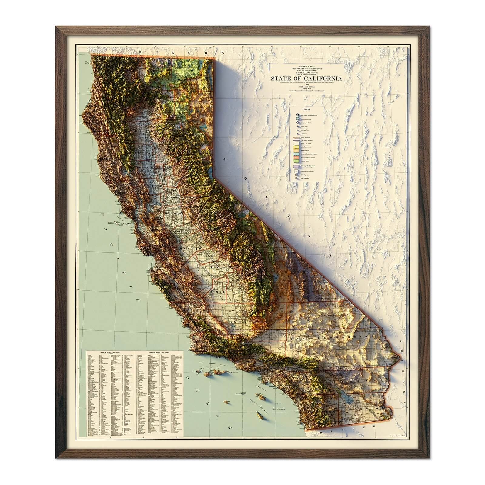
Description
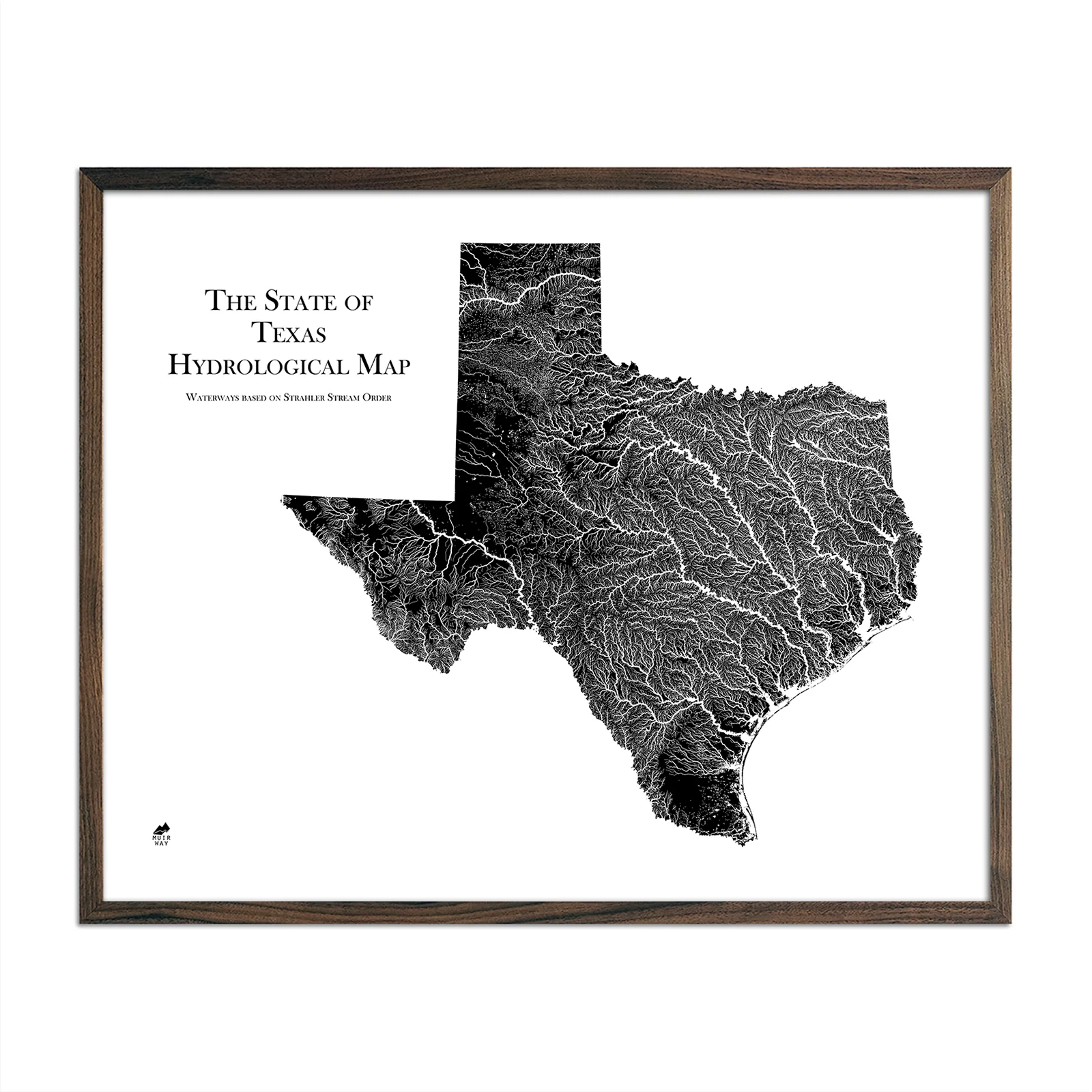
Water is literally the lifeblood of any country. If you’re drawn to water, you know that how and where it flows tells the story of a place.
The USA Hydrological Map shows every river, stream, and lake, including non-perennial waterways, in fascinating detail. Our map of these water bodies displays the USA’s (Lower-48, Hawaii, and Alaska) rivers and streams using the Strahler Stream Order method. This method displays them graphically by rank, mapping how they interconnect in their intricate watersheds. The flow of water also has a dendritic, aesthetic elegance that our map captures beautifully.
Our map of the USA depicts every watercourse in the country in detail, from large rivers to intermittent streams, and every body of water with a diameter greater than 6 miles. For an extra aesthetic touch, we apply the Strahler Stream Order method to show the hierarchy of streams as they flow from their source. Lines representing rivers thicken as they acquire the flow of tributaries and gain relative importance. This allows us to legibly map a dry gulch in Nevada alongside the mighty Mississippi-Missouri River system, and enhances a sense of the interconnectedness of our waterways.
In our Hydrology Series, you’ll not only find your favorite rivers and lakes, but you’ll also be able to trace their origins and outflow and appreciate the beauty of their connections.